Pinara Ancient City: A Lycian City and Episcopal Center in Türkiye

Site at a Glance
- Rating
- 4.6
- Popularity
- Low
- Country
- Turkey
- Primary era
- Classical
- Eras represented
- Classical
- Civilizations
- Lycian, Roman
- Site type
- City
On this page10 sections
History
Pinara Ancient City is an ancient Lycian city in Türkiye, located near the western bank of the Eşen River at the foot of Mount Cragus, now called Mount Babadağ. It stood on and around a rounded rocky mass and became one of Lycia’s largest cities, with a history extending from the period of the Lycian city-states through Roman and Byzantine rule.
Foundation and Lycian identity
The city’s Lycian name was Pilleñni, probably meaning “round” or “round hill,” a reference to the rounded rock above the settlement. It was also known by the earlier name Artymnesos, or Artymnesus. Menecrates of Ephesus, an ancient writer on Lycian history quoted by Stephanus of Byzantium, described Pinara as a colony of Xanthos. Another tradition tells that elderly inhabitants left overcrowded Xanthos and established a new settlement on the rounded hill below Mount Cragus. The poet Panyassis attributed the foundation to Pinarus, son of Tremiles or Termilus, although that account has limited support.
Pinara held an important position in Lycia and possessed three votes in the Lycian League, the political federation of Lycian cities. Its political standing is also reflected in its association with Pixodarus, the ruler of neighboring Caria. An inscription indicates that Pinara was subject to Pixodarus between 340 and 334 BCE, and the city assisted him together with several other Lycian communities. Pinara also maintained a cult of Pandarus, the Lycian hero associated with the Trojan War. This religious connection encouraged the tradition that Pandarus was a native of the city.
The settlement was a major port city for part of its history. Its harbor later silted up and became reed-filled wetlands, weakening the maritime position that had supported its importance. Strabo, the Greek geographer and historian, counted Pinara among the largest cities of Lycia, while the scale of its surviving remains reflects its extensive urban development.
Macedonian conquest and Roman rule
Alexander the Great, the fourth-century BCE king of Macedon who conquered the Persian Empire, attacked Pinara in 334 BCE. The city surrendered soon afterward. After Alexander’s death, Pinara came under the Kingdom of Pergamum. In 133 BCE, the bequest of the Pergamene kingdom by Attalus III, its last king, transferred the territory to the Roman Republic, and Pinara became a Roman city.
Pinara experienced a long period of prosperity under Roman rule. Severe earthquakes damaged the city in 141 and 240 CE. Following the earthquake of 141, Opramoas of Rhodiapolis supplied financial assistance for the repair of public buildings. These disasters formed part of the later history of a city whose civic buildings and religious monuments continued to be used and altered over successive periods.
Christianity and abandonment
Christianity reached Pinara at an early date, and the city became an episcopal center. A bishop was a senior Christian cleric responsible for an ecclesiastical territory. Five bishops connected with Pinara are recorded. Eustathius signed the formula of Acacius of Caesarea at the Council of Seleucia in 359. Heliodorus signed a letter from the Lycian bishops to Emperor Leo I in 458. Zenas attended the Council in Trullo at Constantinople in 692, Theodore attended the Second Council of Nicaea in 787, and Athanasius attended the council that reinstated Patriarch Photios I of Constantinople in 879.
Pinara is identified as the birthplace of Nicholas of Myra. Repeated pressure from invading forces caused the city to lose its inhabitants, and it was abandoned in the ninth century. Its importance had already declined completely after the eighth century. The former bishopric remains listed by the Catholic Church as a titular see, a designation that preserves the name of a former bishopric without a resident bishop.
Rediscovery
The ruins were first identified and described by Sir Charles Fellows, a nineteenth-century British explorer and antiquarian whose work helped identify ancient sites in Lycia. Pinara’s surviving buildings, tombs, inscriptions, and urban spaces have preserved evidence of its Lycian, Hellenistic, Roman, and Christian phases.
Remains
Pinara extends across terrain that slopes from west to east and is generally arranged along a north-south axis. A valley at approximately 360 metres above sea level contains the agora, odeon, and basilica before ending in a level open area to the south. A rocky hill about 30 metres high bounds the eastern side of the valley. It contains a church, residences, a square, and the lower fortress. Farther east, where the ground falls to approximately 300 metres, the bath and theatre occupy the lower terrain. A rounded crag rises among the ruins, while the necropolis spreads across the rocky slopes surrounding the city.
Rock-cut tombs and acropolises
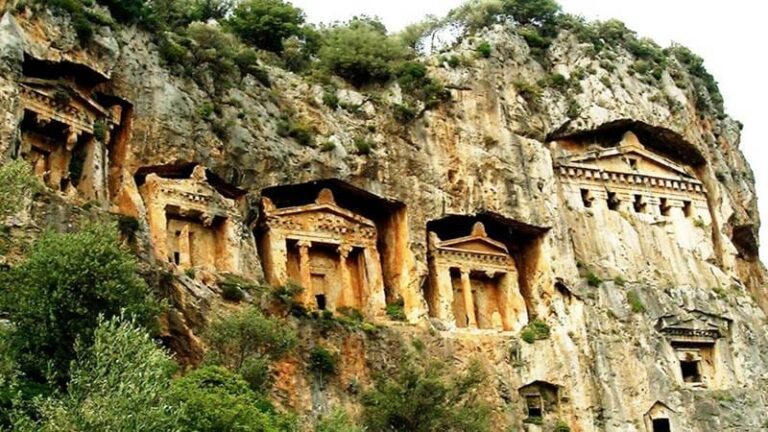
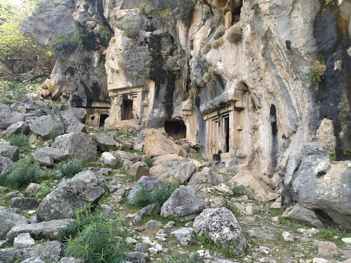
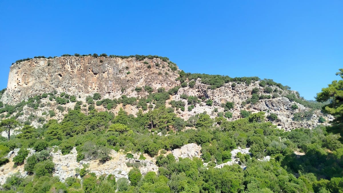
Rectangular rock-cut tombs are placed on the steep eastern face of the rocky mass near the approach to the city. Pinara contains the principal Lycian tomb types in unusually large numbers, including a tomb known as the royal tomb. Several tombs have finely executed, richly carved reliefs. Their inscriptions use Lycian characters, and Greek inscriptions also occur frequently on the same tombs. Together, the tombs form a major part of the city’s remains and occupy the slopes around its urban core.
The site includes both an upper acropolis and a lower acropolis. The lower fortress stands within the rocky hill on the eastern side of the valley, alongside residences, a church, and a square. The surrounding slopes and elevated rocky areas preserve the close relationship between the city’s defensive, residential, and funerary spaces.
Fortifications and civic spaces
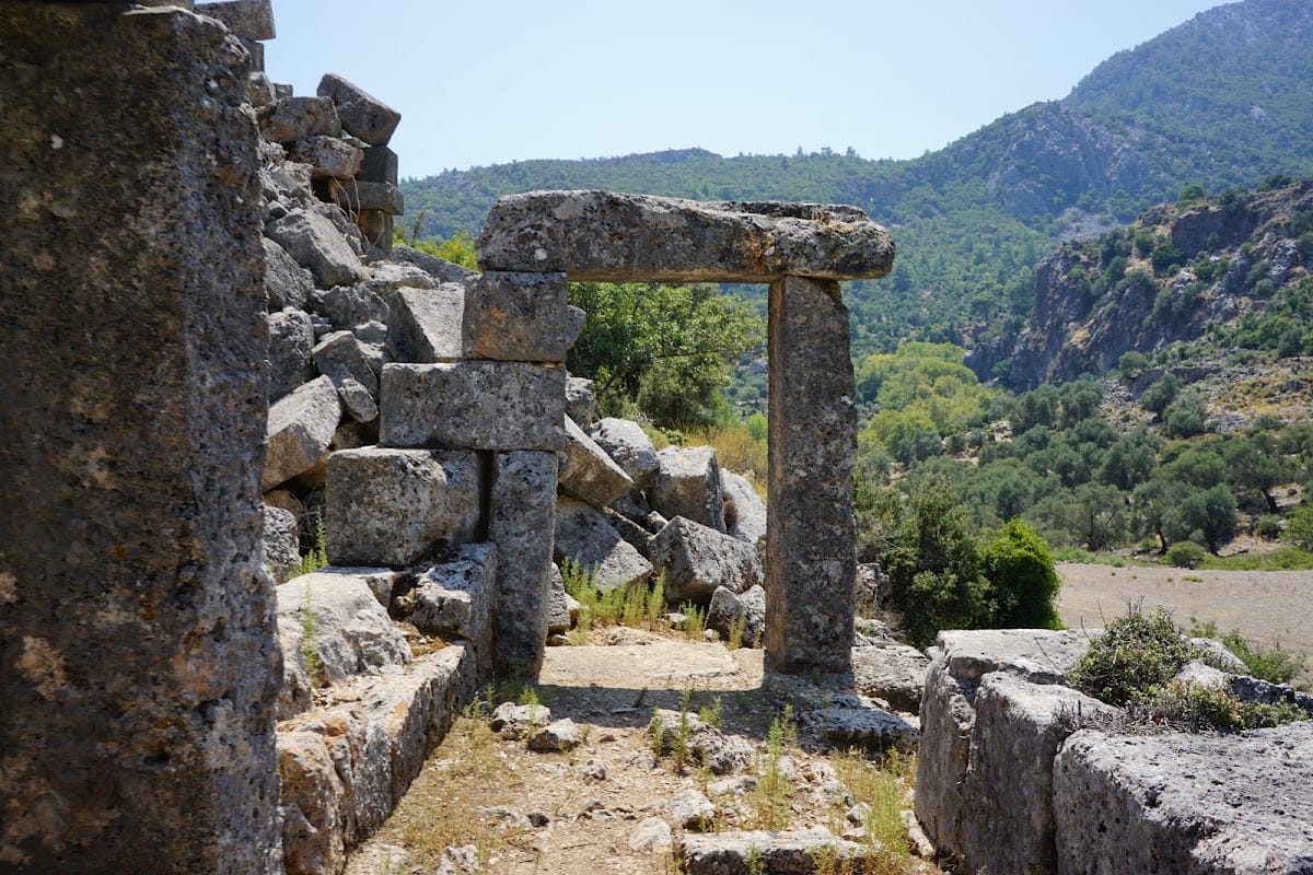
The city walls and several buildings use Cyclopean masonry, a construction method employing very large, roughly fitted stone blocks. Monumental gateways are formed from three massive stone blocks. At the southern end of the valley, the ground falls steeply for approximately 35 metres toward a streambed. A central street, about 4.2 metres wide, extends south from the area containing the agora and odeon. Buildings west of the street may have served as shops and public buildings.
The street reaches a broad area paved with stone blocks approximately 56 metres to the south. Its southern side was left open and may have formed a viewing terrace. A Roman tomb stands on the western edge of this paved space, while the city basilica lies 9.5 metres west of the tomb.
Theatre and odeon
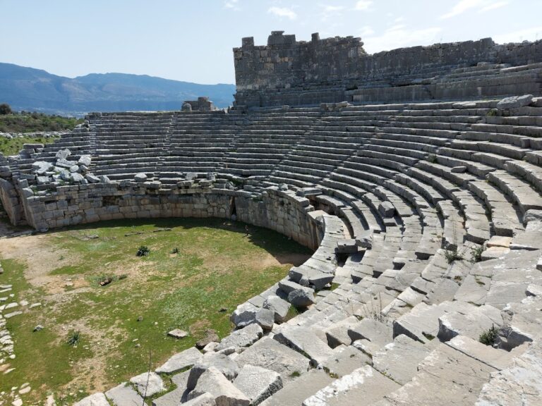
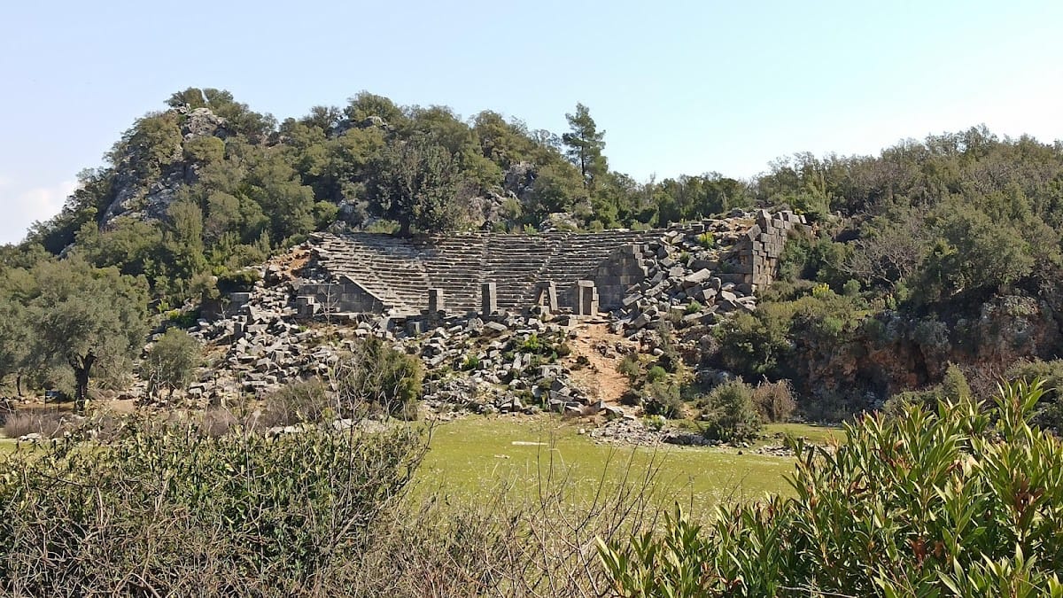
Pinara’s theatre is unusually well preserved. All of its seating rows remain, and the side sections slope toward the proskenion, the front platform or architectural zone of the ancient stage building. Several entrances can still be recognized. The theatre occupies the lower eastern part of the city, near the bath and the point where the terrain descends toward approximately 300 metres above sea level.
The odeon lies in the valley near the agora. An odeon was a building intended mainly for musical performances or smaller assemblies. Its position within the civic area places it alongside the principal public spaces of the settlement.
Basilica and other buildings
The city basilica has a rectangular east-west plan divided into three aisles. It measures 19.35 by 14.40 metres overall. The length to the beginning of the semicircular apse, the rounded end of the building, is 16.65 metres, increasing to 19.35 metres when the apse is included. Dense vegetation covers the basilica’s area, and parts of the structure are interwoven with soil and vegetation, while some sections remain buried.
Other surviving features include several temples, a church, a bath, houses, and cisterns. The columns are described as heart-shaped rather than round. These remains occupy the valley, rocky hills, and lower eastern ground, forming the physical record of Pinara’s civic, residential, religious, defensive, and funerary development.