Olympos Ancient City: A Lycian and Roman City in Türkiye
Site at a Glance
- Rating
- 4.6
- Popularity
- High
- Country
- Turkey
- Primary era
- Classical
- External website
- Open
- Eras represented
- Classical, Medieval
- Civilizations
- Ancient Greek, Byzantine, Genoese, Lycian, Roman
- Site type
- City
On this page22 sections
History
Olympos Ancient City in Türkiye was a Lycian city founded as a Hellenistic hill settlement, probably around 300 BC, above the harbor of Korykos on Mount Musa Dağı. The Hellenistic period followed the conquests of Alexander the Great and brought broad Greek political and cultural influence to the eastern Mediterranean. Olympos later became an important member of the Lycian League, a federation of Lycian cities whose members held votes in a federal assembly, before passing through Roman, Byzantine, medieval, and Ottoman phases.
Hellenistic foundation and conflict with Rome
The earliest settlement remains and the city’s coinage point to a foundation during the Hellenistic period. By the second half of the 2nd century BC, Olympos held three votes in the Lycian League, indicating its prominent position within the federation. Its earliest surviving written reference appears in Strabo’s Geographica, which cites the geographer Artemidorus of Ephesus.
During the 1st century BC, Olympos became associated with piracy after Zeniketes, probably a local ruler, seized power and opposed Rome. The Lycian League expelled the city, and Zeniketes was declared a pirate. In 77 BC, Roman forces under Publius Servilius Vatia defeated him and besieged his fortress on Olympos. Zeniketes refused to surrender, setting fire to the fortress and dying with his family. Settlements connected with his revolt were subdued, their supporters were punished, and their lands were confiscated as ager publicus, Roman public land taken from defeated communities or rebels.
Olympos was not readmitted to the Lycian League until the 1st century AD. More than 50 inscriptions from the city and its territory provide evidence for its inhabitants and lands, while only one known inscription mentions Korykos, the harbor settlement to the south.
Roman prosperity and the name Hadrianopolis
Olympos had again become an elite member of the Lycian League by the 2nd century AD. Inscriptions on the tomb of Marcus Aurelius Archepolis identify him as Lyciarch, the league’s senior administrative official. The city was also renowned for its cult of Hephaistos, the Greek god of fire and metalworking, which was closely associated with the natural flames of nearby Chimaira.
From about AD 130, the hill settlement was also called Hadrianopolis. The name apparently reflected a change in the city’s balance: activity in the hill settlement had stagnated while the harbor prospered during the peace of the Roman Imperial period, the era of Roman rule under emperors that conventionally began with Augustus in 27 BC. Strong earthquakes struck Olympos and other regional cities in AD 141 and 240. Further earthquakes began in AD 542 and recurred irregularly until the 8th century.
Christian and Byzantine Olympos
Christianity reached Olympos by the 3rd century AD, when the city was mentioned as a bishopric. It became a diocese, an ecclesiastical district governed by a bishop, within the Metropolitanate of Myra, an ecclesiastical province headed by a metropolitan bishop. Methodius of Olympus, probably martyred in AD 312, was the first known bishop of Lycia and Olympos. His writings responded to anti-Christian works and contributed to early efforts to establish recognition for Christianity.
Several later bishops are associated with Olympos. Aristocritus attended the Council of Ephesus in AD 431, a major Christian council. Anatolius appears in a letter from the administration of the Myra metropolitanate to Leo I dated AD 458, while Ioannes attended the Constantinople synods of AD 518 and 520. A lead seal from the late 6th or early 7th century records another bishop whose name is read as Anania, Anianus, or Ioannes. The bishops Theophiletus and Nikolaos are named on architectural elements from the Episcopal Church.
Olympos appears in episcopal lists from the 5th through the 7th centuries, and its name was last recorded in the 9th century, when it remained affiliated with the Metropolitanate of Myra. Settlement later declined, with periods of poverty and reduced occupation, and the city was eventually abandoned during or after the Arab raids.
Medieval capture and later use
During the Crusades of the 11th and 12th centuries, Venice, Genoa, and Rhodes captured Olympos. The acropolis and a Genoese castle on the eastern side of the city were probably used or strengthened for defense during these occupations. Plague epidemics affected Olympos and other regional cities in 1346 and 1347, in some places killing up to half the population.
Permanent settlement at the ancient city ceased after the Ottoman conquest in the 15th century. Yörüken nomads used the area as a winter quarter during the 18th and 19th centuries and at the beginning of the 20th century. Francis Beaufort reached Olympos in 1811–1812 aboard the Frederikssteen and published observations of the site and coast in Karamania in 1817. He described Olympos and Çıralı as parts of a settlement that could not clearly be separated.
Local tradition places the construction of a watermill on the southern harbor road around 1850. A man named Kıbrıslı Hacı Hasan is said to have built it with material taken from ancient buildings. The limited modern settlement helped preserve large areas of the ancient building fabric. Systematic epigraphic and historical-geographical research, together with excavation campaigns between 2000 and 2006, exposed damaged sarcophagi and other remains.
Protection and recent history
Olympos and its ruins lie within Olympos Beydağları National Park and are administered as an archaeological site under the Antalya Museum Directorate. The surrounding coast is also protected as a nesting and conservation area for loggerhead sea turtles. Fires in 2007 and 2008 destroyed nearby accommodation and large areas of surrounding land, but did not reach the ancient remains. Severe flooding in 2009 carried vehicles, agricultural machinery, and several modern buildings through the river and open-air museum. A forest fire in 2016 led to evacuation and closure while it was contained before reaching the excavation area.
Archaeologist Sinan Sertel, assistant head of the excavation team, was fatally stabbed near Çıralı on 19 May 2019 after a dispute involving alleged illegal tree felling. Reconstruction work in 2024 moved the museum entrance back from its former position. Until that work, two households comprising about ten people still lived within the open-air museum in the northern necropolis area.
Remains
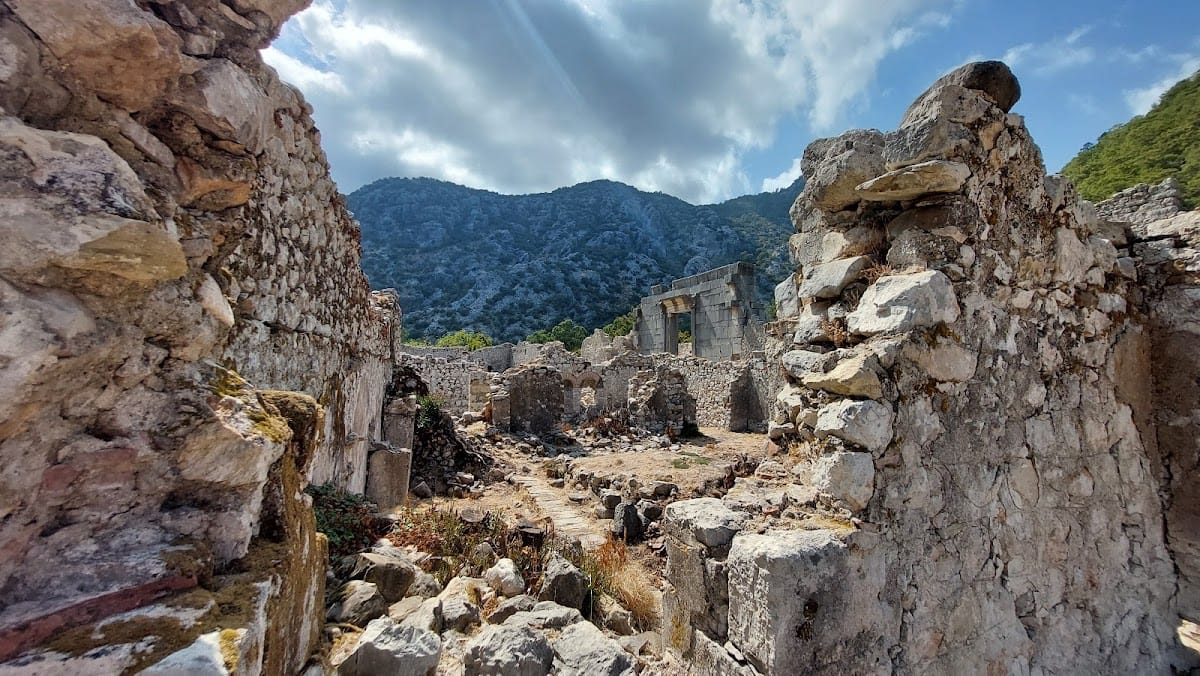
Olympos occupies a deep valley where the Akçay, also called Olympos Çayı, reaches the Mediterranean. The ruins extend along both riverbanks, while a beach lies north of the river mouth and a gorge continues westward for about 3 kilometers before opening out. The river is heavily silted and flows weakly in summer, although it can rise sharply in winter. A surviving bridge remains marks the former connection between the northern and southern urban sectors.
Urban plan and defenses
Olympos and its necropolises spread along both sides of the valley from at least the 1st century AD. The Roman-period plan was broadly hippodamic, with streets and alleys crossing at right angles. Northern Harbor Street formed the main east–west route. Necropolis Street ran parallel to it from the western necropolis toward the temple area, while north–south Bridge Street crossed Northern Harbor Street and continued to a large square in the southern city before reaching Harbor Street.
Fortification walls
The earliest identified architectural remains are polygonal fortification walls enclosing the area conventionally called the South City. Excavation where these walls meet the Roman bridge, together with evidence from Bridge Street, showed that a gate was partly destroyed when the street was built. The walls therefore predate the Roman Imperial period, although their construction was no earlier than 76 BC.
Bridge and streets
A triple-arched bridge connected the two sides of Olympos. Archaeological investigation of the bridge and Bridge Street indicates that the street was laid out during the Roman Imperial period. The urban framework continued to guide later construction, although roads and streets were widened or narrowed in places.
Medieval defenses
The acropolis and a probable Genoese castle stood on the eastern bank. Both were used or strengthened during the medieval captures of Olympos by Italian and Rhodian powers. Their defensive role belongs to a later phase than the polygonal walls surrounding the South City.
Public and commercial buildings
Northern entrance complex
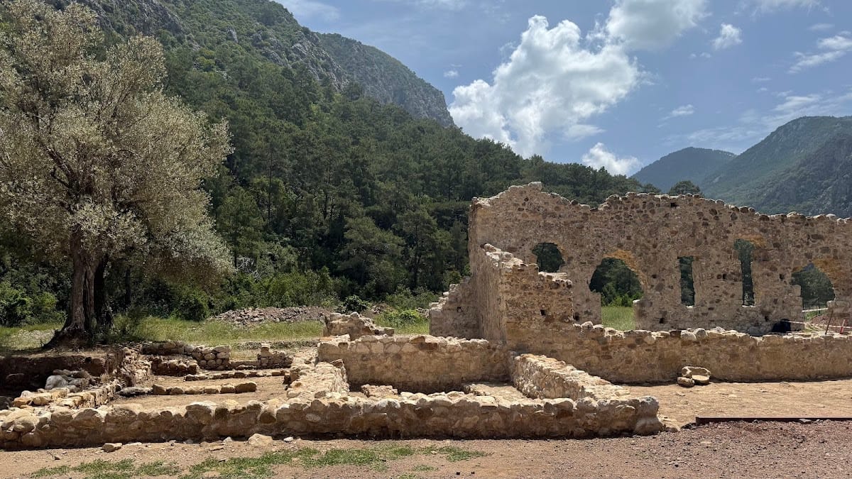
The northern entrance complex lies shortly beyond the present open-air museum entrance. It contains 11 rooms and probably had a second storey with another 11 rooms. Arcaded corridors ran along its northern and southern sides and were entered through five round arches. These covered approaches led to the rooms, while the southern corridor probably looked over the river. Architectural evidence and finds indicate that the complex was used in the 5th and 6th centuries for residence, food production, and food commerce. Its enlargement followed changing needs rather than a single original plan.
Roman theater and temple area
A small Roman theater survives in a severely deteriorated and overgrown condition. In the area of the former lake, which has become marshy, are the remains of a temple dating from the 2nd century AD. Roman public buildings, including baths, were concentrated in the southern part of the city, while temples and tombs were concentrated in the north.
Northern temple
The northern temple was identified through its monumental entrance and distinctive architectural features. An inscription connected with a statue dates the building and records the erection of the statue in honor of the emperor Marcus Aurelius. The surviving gate is 4.88 meters high. It carries acanthus ornament and an unfinished bead pattern along the sides of its lintel, while its exposed masonry resembles construction found in several Lycian cities.
Necropolises and tombs
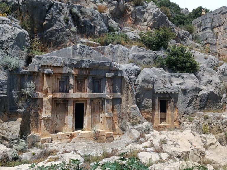
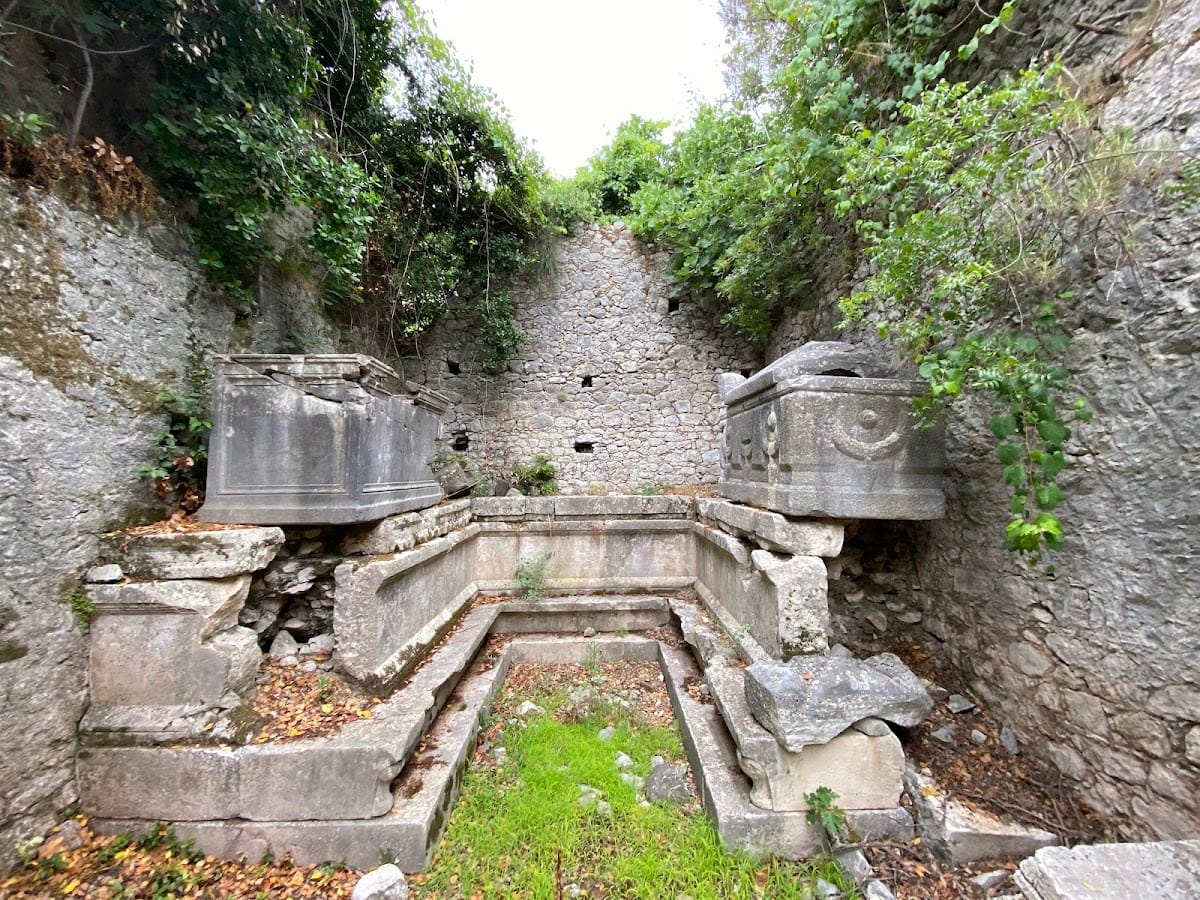
The northern and southern necropolises contain distinct groups of burials. The northern necropolis has 113 identified graves, with separate tomb buildings rather than connected structures. Burials there took place from the 1st century to the middle of the 3rd century AD. From the 4th century onward, houses with large courtyards were increasingly built beside the road through the necropolis. Some stood close to tombs, while others reused ancient building material, and the area acquired its present form from the 5th century onward.
Alkestis Sarcophagus
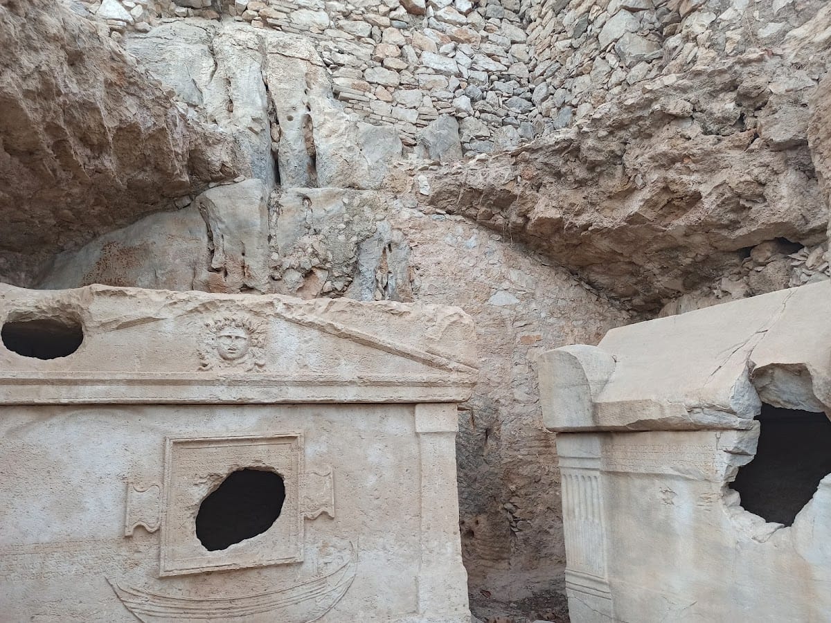
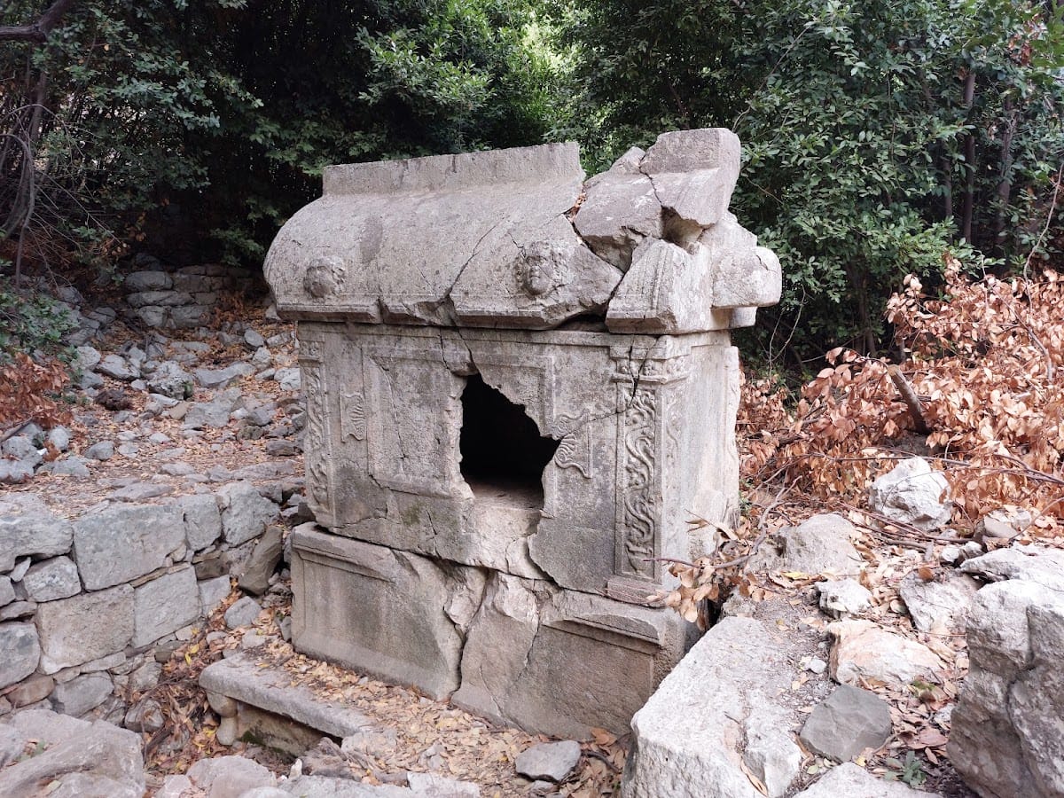
The southern necropolis contains the richly decorated Alkestis Sarcophagus of Aurelius Artemias and his family. Made from local limestone, it has a lid shaped like a house roof and its upper structure. Reliefs show Eros, Nike, and the head of Medusa. Greek inscriptions naming the owners appear on a tabula ansata, an inscription panel with projecting ends. A man and woman clasping hands represent marriage, while another side shows a female figure in a chiton and himation, Herakles, and a winged male figure. The sarcophagus dates from approximately AD 180–200.
Zosimos and Eudemos tombs
Two late 2nd-century AD tomb chambers in the northern part of the city belonged to Zosimos and his uncle Eudemos. Inscriptions on their sarcophagi identify the occupants. Other graves and inscriptions occur within the necropolis, whose inscriptions do not display Lycian characteristics.
Residential terraces and churches
The southern hillside settlement was built on terraces supported by retaining walls. East–west passages ran between the terraces, and stairways connected the different levels. During the early Byzantine period, the settlement expanded southeast toward the slopes of Sepet Ridge. Residential and civic buildings continued to follow the Roman parcel layout, although some church plans were distorted by earlier structures.
Early Byzantine churches
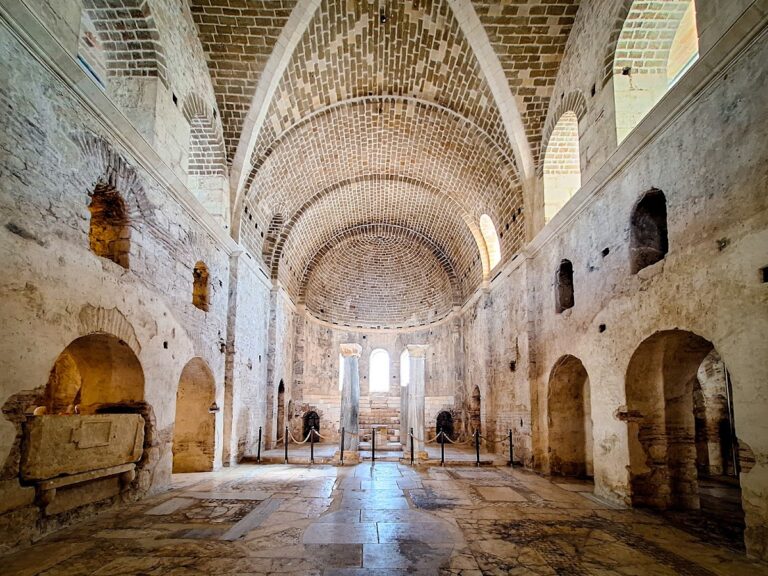
Nine early Byzantine churches stood in the city center. All had three-aisled basilica plans, and two included transepts, crosswise sections intersecting the main axis. Their floors were decorated with opus tesselatum, a mosaic technique using small regular pieces to create geometric or figurative designs, and their interiors had rich decorative programs.
Four churches had atriums, open or partly enclosed forecourts. Church 8 had its atrium on the north side, while those of Churches 1, 3, and 6 lay to the west. Churches with atriums lacked western narthexes, or entrance halls, while the other churches had narthexes. Limited building land prevented the two arrangements from being combined. Beam sockets and buttresses show that wooden floors helped resolve changes in level within the main worship spaces of churches built on the terraces.
Episcopal Church
The Episcopal Church yielded a chancel-screen slab and a door lintel bearing the names of the bishops Theophiletus and Nikolaos. A cistern contains a drawing in red pigment of a ship, or ship graffiti, associated with activity in the Byzantine harbor. In the northern city, civic buildings stood along Necropolis Street, and Roman tombs were converted into living spaces, showing how the early Byzantine settlement adapted the older urban framework.
Harbor landscape and route
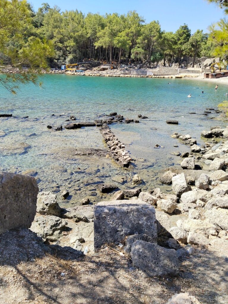
At the beach, a natural rock passage called Deliktaş, or “Perforated Rock,” forms a feature of the coastal landscape. It is currently about 2 meters high and can be bypassed along the beach. Francis Beaufort described it as the only route into the adjacent valley. Roof tiles embedded above the passage indicate that it once had a larger covering. Silt has placed it about 20 meters from the water, although winter storms can bring the shoreline back to the rock, and the original passage may lie substantially deeper beneath modern sediment.
The ancient Lycian route between Fethiye and Antalya crosses the open-air museum between the northern beach and the southern necropolis. It was marked and reopened for walking in 1999. The ruins are heavily overgrown with subtropical vegetation, especially bay trees, and the valley contains many endemic plant species. The Olympos–Çıralı beach remains a protected nesting and conservation area for loggerhead sea turtles.