Burg Müneck: An Abandoned Hilltop Castle in Germany

Site at a Glance
- Rating
- 4.1
- Popularity
- Very Low
- Country
- Germany
- Primary era
- Medieval
- Eras represented
- Medieval
- Civilizations
- Holy Roman Empire
- Site type
- Military
- Remains
- Castle
On this page7 sections
History
Burg Müneck is an abandoned hilltop castle in Germany, above Breitenholz in present-day Ammerbuch. Built around 1100 by the Lords of Müneck during the eleventh or twelfth century, it served as a defensive stronghold on an elevated summit. The Münecks were a collateral line of the Lords of Hailfingen and followed the Counts Palatine of Tübingen, powerful counts whose authority was originally connected with a ruler’s palace or court.
The Lords of Müneck
The castle and its family first enter the written record in 1259. In that year, the knight Hugo von Müneck sold a farm to Kirchberg Abbey and described himself as a ministerial of Count Rudolf von Tübingen. A ministerial was a dependent noble who served a lord in administrative, military, or courtly duties, and Count Rudolf issued the document. Hugo appeared again as the count’s witness in 1270, alongside Arnold von Müneck.
Hugo was mentioned again in 1291 and 1292. Heinrich von Müneck, first recorded in 1286, was probably his son. The family’s seals from 1301, 1307, and 1330 show a shield with three or four points directed either to the right or left. The castle’s name appears in several medieval forms, including Muginekke, Mugenecke, Mönegge, Münecke, Muegenegge, Mueienecge, Miunegge, and Muineck. The element “Mugin-” has no established explanation, while “-eck” refers to the site’s location.
Disposal of the estate
During the next generation, the Münecks began selling their possessions. In 1330, the sisters Gere, Gute, and Adelheid von Müneck sold a serf woman from Entringen to Bebenhausen Abbey for 10 pounds in Haller currency, with their brother Heinrich acting as guarantor. That same year, Heinrich and Renhard von Altingen sold estates in Entringen and Breitenholz to the Lords of Hailfingen. Those properties later passed to Bebenhausen Abbey between 1338 and 1340.
In 1336, Heinrich, who called himself an edelknecht, sold income from his Breitenholz estates to Kirchberg Abbey for 19 pounds in Haller currency. An edelknecht was a lower-ranking nobleman or noble retainer. His son, also named Heinrich, took part in the transaction. In 1337, Heinrich and his wife, Sophie von Neuneck, sold their Breitenholz and Entringen estates to the Herter family of Dußlingen for 320 pounds. The Count of Tübingen confirmed the sale in 1338.
The remaining Müneck property probably passed to Heinz von Hailfingen. In 1364, he sold his share in Breitenholz and Müneck to the Herter family. Albrecht, probably the last recorded member of the family, appears in 1373 and 1383 as a canon of Sindelfingen and parish priest of Altingen. A canon was a cleric attached to a collegiate church, while a parish priest held responsibility for a parish.
Abandonment and investigation
The castle apparently went out of use after the Müneck property was sold. It gradually deteriorated and was later used as a quarry. The surrounding land became temporarily state-owned in the nineteenth century before the municipality bought it from the state in 1823. Castle researcher Konrad Albert Koch excavated the ruin in 1924 and published the results in 1925. Since 2000, the former castle grounds have formed part of the 459-hectare Schönbuch-Westhang/Ammerbuch nature reserve.
Remains
Summit setting and earthworks
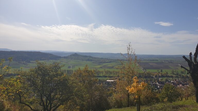
Burg Müneck occupied a summit 543.1 metres above sea level on the southern edge of the Schönbuch. The terrain falls steeply south toward the Ammertal and west toward the Käsbach, a northern tributary of the Ammer. To the northeast, the ground descends more gradually toward the Großer Goldersbach, the right-hand headwater stream of the Goldersbach. This elevated position provided broad views south and west and allowed visual contact with neighbouring castles.
The surviving layout is defined by an enclosing ditch and rampart system surrounding a central plateau. The plateau indicates the approximate size of the former inner bailey, the principal enclosed area of the castle. The ditch is more than 10 metres deep and reaches its greatest depth on the north and east, where the summit slopes relatively gently. On the south and west, an outer rampart strengthens the defenses where the ground falls more sharply.
Surviving structural evidence
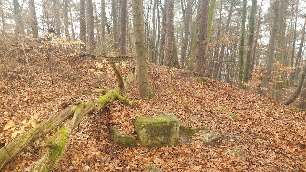
No defensive walls or castle buildings remain above ground, and the original building plans can no longer be reconstructed. The approximate foundations of one wall can still be discerned, while individual worked stones lie across the former castle grounds. Together with the enclosing earthworks and central plateau, these fragments define the physical remains of the abandoned stronghold.
Nearby sites