Castle of Guevara-Gebara: A Medieval Fortress and Carlist Stronghold in Spain
Site at a Glance
- Rating
- 4.5
- Popularity
- Very Low
- Country
- Spain
- Primary era
- Medieval
- External website
- Open
- Eras represented
- Medieval
- Civilizations
- Crown of Castile
- Site type
- Military
- Remains
- Castle
On this page11 sections
History
The Castle of Guevara-Gebara was a privately held fortress near Guevara in Barrundia, Álava, Spain, rebuilt in the fifteenth century as an ancestral residence and strategic stronghold of the Guevara family. It later served as a residence of the Marquesses of Guevara and the Counts of Oñate. Standing above the Álava plain, it controlled routes towards Gipuzkoa, the former County of Oñate, the Castilian plateau, the Cantabrian coast, and the Royal Post Road leading to the Kingdom of France.
Early references and the Guevara lineage
References to a fortress at Guevara appear by the eleventh century. The surviving castle was built in the fifteenth century, possibly over an earlier settlement or castle dating from the tenth century. A documentary reference indicates that the fortress had been sold by the fourteenth century, although it remained closely connected with the Guevara lineage and its political influence.
The family became especially prominent from the thirteenth century through its association with the Counts of Oñate. Pedro Ladrón de Guevara led the Gamboino faction during the first half of that century and fought at Elorrio and Salvatierra. He held the title of Count of Álava in 1123, while his grandson Diego López held the same title in 1181.
The banderizo wars
The Guevaras belonged to the Gamboino faction in the late-medieval banderizo wars, conflicts between rival noble groupings in the Basque region. The Gamboino side was associated with the Gamboa and Guevara families, while the opposing Oñaz grouping included the Oñaz and Mendoza lineages. Guevara Castle was an important stronghold during these struggles, using its elevated position to oversee movement across the surrounding routes.
The castle is believed to have been abandoned after the banderizo wars, either at the end of the fifteenth century or during the sixteenth century. In 1672, the French cartographer and royal officer Albert Jouvin de Rochefort described it as apparently uninhabited and linked it to a local tale about a malign goblin. In 1679, Marie Catherine Le Jumel de Barneville, Countess d’Aulnoy, also recorded the belief that a goblin lived in the deserted castle. She entered the building and described unfurnished rooms containing tapestries depicting the loves of Peter the Cruel, the fourteenth-century king of Castile, and María de Padilla, his prominent companion and political associate.
Carlist occupation and destruction
The fortress deteriorated further during the Peninsular War. During the First Carlist War, a nineteenth-century conflict between supporters of the Carlist dynastic and traditionalist cause and forces loyal to the liberal monarchy, it became a Carlist bastion, archive, and storehouse. Liberal forces under General Luis Fernández de Córdova captured it from Carlist troops commanded by Nazario Eguía in 1835, but the Carlists later recovered the position.
In retaliation for local support of the Carlists, the liberal government army under General Martín Zurbano burned the village of Guevara on 19 September 1838. After the Carlists were besieged and defeated in 1839, the castle’s defenders continued to resist for eighteen days. Following the Embrace of Vergara, the settlement that ended the First Carlist War and was symbolized by a meeting between opposing commanders, they became the last Carlists to surrender.
Victorious liberal forces demolished the castle at about two o’clock in the afternoon on 30 November 1839. They used 288 arrobas of gunpowder, more than 2,500 kilograms, intending to prevent the Carlists from using the fortress again. Pedro Ruiz de Eguino later recorded an attempt to reconstruct the castle during the Second Carlist War of 1872 to 1876. More than 10,000 cartloads of stone were reportedly carried from the walls of Salvatierra to Guevara for that purpose.
The ruins now form part of the Inland Route of the Way of Saint James through the Basque Country, an inland branch of the Christian pilgrimage network leading to Santiago de Compostela. The site is recognized by the Basque Government as a cultural-heritage site and is protected as an Asset of Cultural Interest, a formal Spanish designation for protected cultural property.
Remains
Hilltop setting and outer defenses
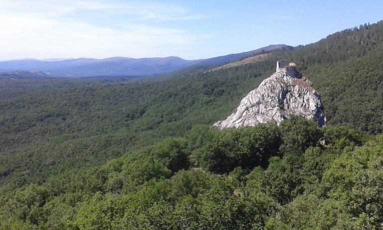
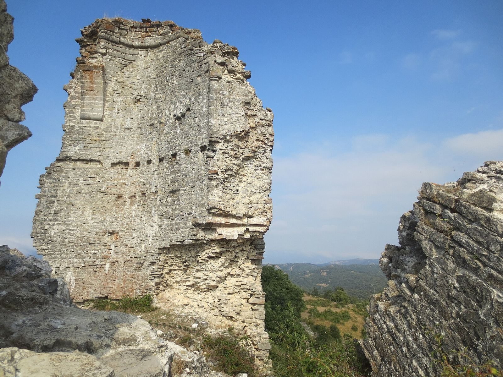
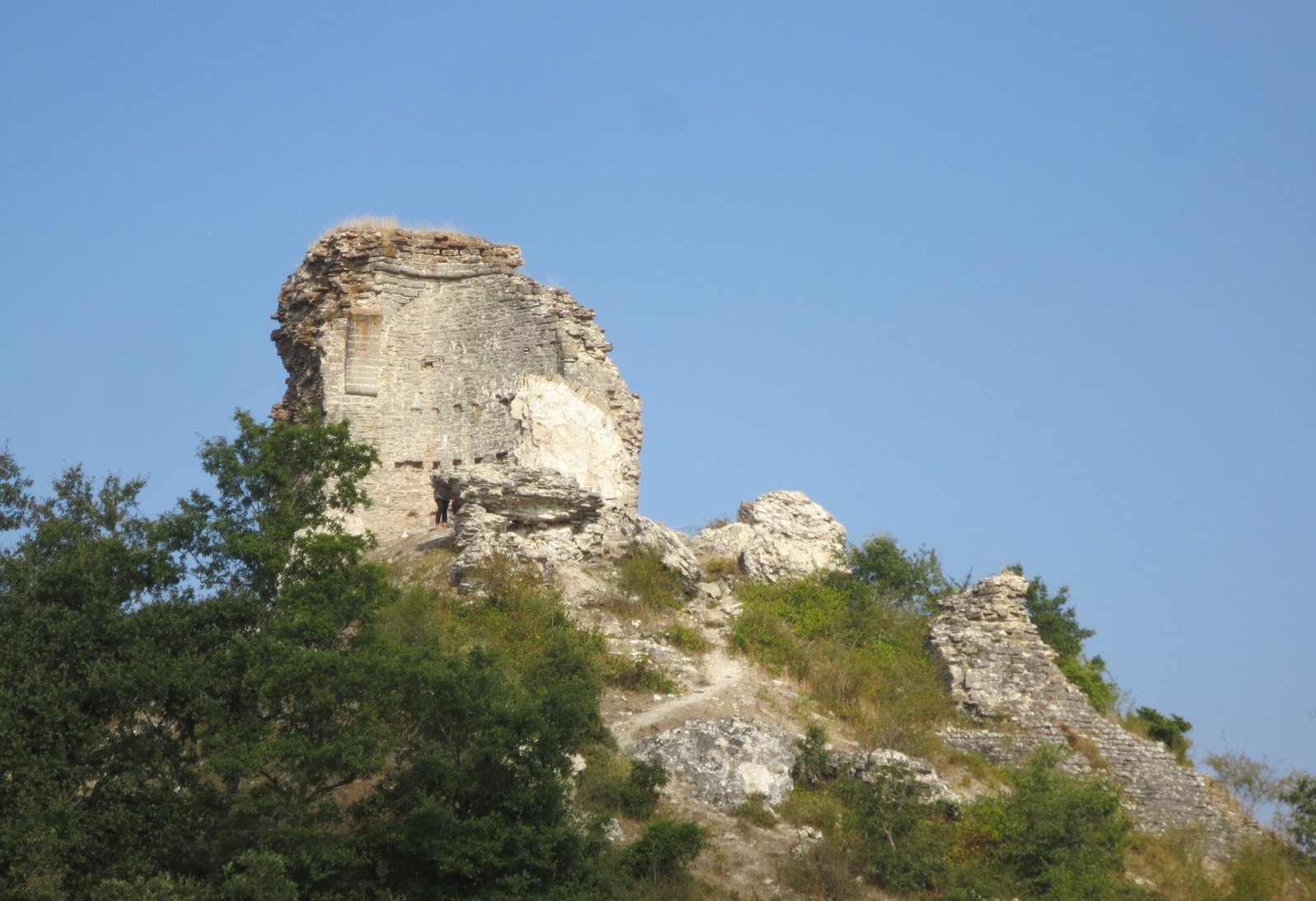
The ruins occupy a hilltop beside the Zadorra River, within the Aldaia range between the Barrundia and Zadorra river basins and facing the Elguea range. The fortress elevation is given as approximately 660 to 661 metres, while another description places it on the summit of Askaña hill at 659.67 metres. Mount Guevara is described as 727 metres high. This elevated position gave the castle command over the Álava plain and the routes crossing the surrounding landscape. The fortified Guevara Palace stood on the southern slope, beside and below the village.
Walls, towers, and entrances
The castle was a large, simple rectangular fortress built with rubble masonry and dressed stone. Its walls were approximately 1.5 metres thick and pierced by numerous arrow slits, narrow openings used to shoot arrows or similar projectiles. The fifteenth-century design was reportedly modelled on the Castel Sant’Angelo in Rome, a monument that began as the mausoleum of the emperor Hadrian before later serving military and papal purposes.
An outer defensive enclosure surrounded the interior complex with walls, towers, and entrances on the southern side. The surviving fabric includes sections of the enclosing walls, traces of the towers that defended them, and the southern access points. One southern façade bears a Malferit coat of arms. Together, these remains outline the fortress’s principal defensive boundary and preserve parts of its approach from the hill.
Vaulted defensive galleries
The southern and eastern wall sections contain vaulted galleries, passages covered by curved masonry vaults, along the lower parts of the defenses. Four strategic gun ports remain open in these galleries. These narrow openings were adapted for firearms and served the later defensive use of the fortress. Part of another vaulted gallery survives in the upper body of the walls, adding to the evidence for a multilevel defensive arrangement.
Interior fortress and main tower
Parade courtyard
Inside the walls was a rectangular parade courtyard, an enclosed space used by the garrison, measuring approximately 50 metres by 18 metres. The courtyard formed the central open area of the castle, with the principal tower positioned along its western side. Its surviving dimensions help define the organization of the interior behind the outer defenses.
Principal keep
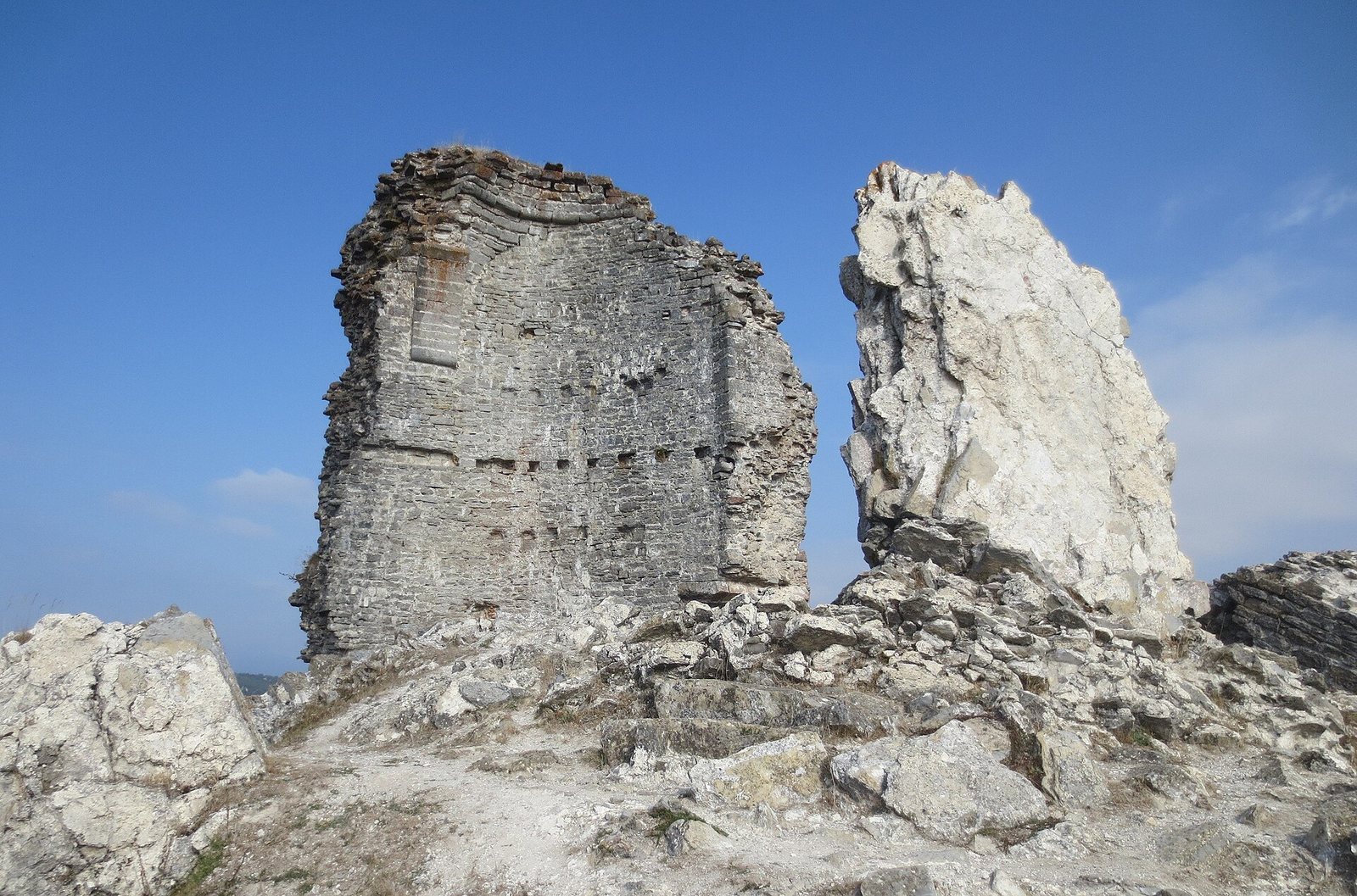
The main tower was an imposing keep approximately 10 metres in diameter and about 40 metres high. It had a single entrance, with an opening roughly 4.5 metres above the interior floor. Access to this elevated opening was provided by a retractable wooden ladder, making the entrance part of the tower’s defensive design.
From the elevated opening, a comfortable spiral staircase led to the upper levels. The tower’s vaulted rooms included spaces identified as a guardroom, a kitchen, and the chief’s chamber. The surviving keep, wall fragments, defensive galleries, and access structures now form a ruin, while historical engravings preserve an image of the fortress before its destruction in 1839.