Burg Hohenwaldeck: A Medieval Hilltop Castle in Germany


Site at a Glance
- Rating
- 4.5
- Popularity
- Low
- Country
- Germany
- Primary era
- Medieval
- Eras represented
- Medieval
- Civilizations
- Holy Roman Empire
- Site type
- Military
- Remains
- Castle
On this page11 sections
History
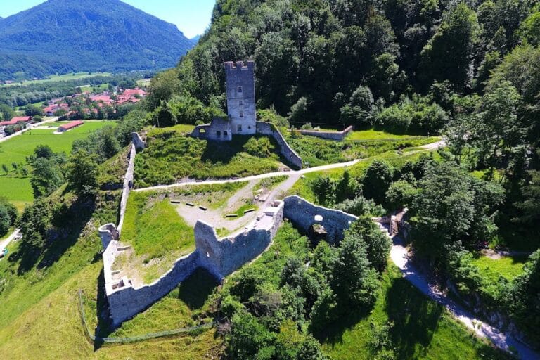
Burg Hohenwaldeck is a medieval hilltop castle ruin in Germany above Schliersee, built by the Lords of Waldeck toward the end of the thirteenth century. The castle formed part of the family’s attempt to establish a largely independent lordship around Schliersee while remaining connected to the political world of the Bishopric of Freising.
The Waldecks and Freising
The Waldecks appear from the mid-eleventh century as ministeriales, or dependent service nobles, of Freising. These officials performed military, administrative, and court duties for the bishop while building hereditary power of their own. By the thirteenth century, the family had become the cathedral chapter’s most influential vassals, and its members held the bishopric’s highest secular offices while expanding their territorial possessions.
Hohenwaldeck belonged to this effort to strengthen Waldeck authority. The castle was both a practical defensive and representative structure and a visible expression of the family’s ambitions toward the Freising archbishopric and the Duchy of Bavaria. Its military usefulness was constrained by the steep, difficult terrain, and a prolonged attack would probably have relied on blockade and starvation rather than direct assault.
Conflict and political independence
The relationship with Freising broke down openly in the early fourteenth century. In 1312, Arnold von Waldeck destroyed the episcopal castle at Miesbach. Peace negotiations that followed forced Freising to surrender its overlordship over the Waldeck possessions.
The lordship was divided among members of the family during the next two centuries. In 1454, Georg von Waldeck gained imperial immediacy, meaning that his lordship was held directly from the Holy Roman Emperor rather than from an intermediate ruler such as the Bishop of Freising or the Duke of Bavaria. This ended the remaining formal ties to Freising. The elevation probably reflected a Habsburg effort to prevent the Wittelsbach dukes of Bavaria from occupying a territory close to the beginning of Habsburg possessions in Tyrol.
Decline of the castle and transfer of the lordship
Hohenwaldeck had ceased to serve as a residence by this period. Georg von Waldeck, who died in 1380, was probably the last knightly occupant. After his death, the administrative seat of the lordship moved to Schliersee. The castle was probably not occupied throughout the year, with winter residence maintained at Miesbach and Wallenburg.
A rockfall destroyed the castle buildings in 1480, and another major collapse around the same period probably made the fortress permanently uninhabitable. In 1497, the abandoned castle and lordship passed through Waldeck’s daughter Ehrentraut and her husband, Hieronymus von Seyboltsdorf, to the Lords of Seiboldsdorf. Wolfgang von Maxlrain acquired the shares of the co-heirs in 1516. The Maxlrains, one of Upper Bavaria’s wealthiest noble families, administered the lordship from residences near Aibling and at Wallenburg on the Schlierach. Wolfgang’s son, Wolf Dietrich von Maxlrain, openly supported Martin Luther.
The Counts of Waldeck died out in 1483. The Bavarian dukes then pursued a legal dispute lasting several decades with the heirs in an effort to acquire the lordship, while the imperial court supported the heirs against Duke Albrecht the Wise. After the Maxlrain family became extinct, the lordship passed to the Electorate of Bavaria in 1734. The county was dissolved in 1803 and converted into a regional court district.
Early interpretations and modern conservation
By 1568, Philipp Apian described Hohenwaldeck as the ruin of an ancient castle, with enormous trees growing inside its walls. In 1585, Wiguläus Hundt suggested, incorrectly, that the remains belonged to a pagan structure from before the medieval period.
Since the late twentieth century, interpretations of medieval castles as expressions of power and status have increasingly been questioned. Hohenwaldeck is best understood as serving several purposes at once, including defence, representation, and the display of Waldeck authority. Its position also offered limited control over the road to Bayrischzell, although the elevation and mountain conditions restricted its effectiveness as an offensive base.
The ruin was closed to the public in summer 2020 after deteriorating masonry created a safety risk. Conservation suited to its status as a protected monument began in summer 2023 and ended in autumn 2024. The Bavarian State Office for Monument Protection identifies Hohenwaldeck as an archaeological monument containing buried high- and late-medieval remains, including late-Gothic stray finds. It is also protected as an architectural heritage monument in Bavaria.
Remains
Hohenwaldeck stands at 986 metres above sea level on a rocky spur above the Schliersee, about 470 metres east of the lake’s southern end and near Neuhaus. The site rises approximately 209 metres above the lake and lies in front of the western flank of the Leitnerberg. The castle occupies a ridge that falls steeply on three sides, while a shallow depression on the eastern side forms a ditch-like approach or natural protection.
Entrance and front tower
Bossed-ashlar tower
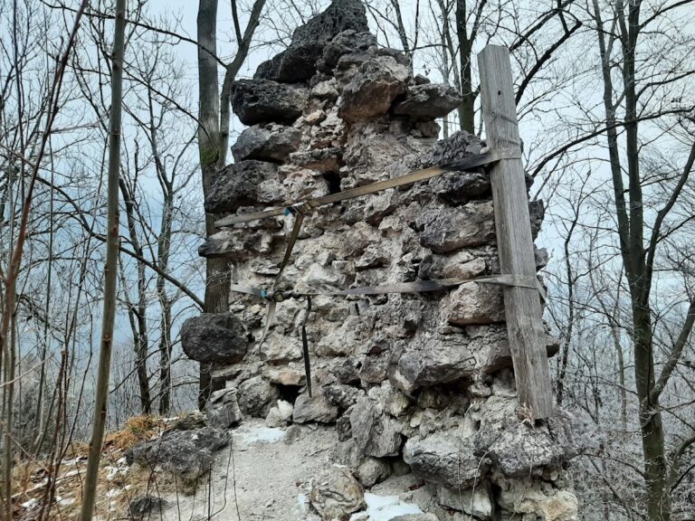
Behind the eastern depression, a rock outcrop carries the remains of a structure interpreted as either a keep or a residential tower. The front tower has large bossed ashlar blocks at its corners. This masonry consists of rectangular stones whose exposed faces project outward or remain roughly finished, a technique used for strong and imposing medieval fortifications. The corner treatment points to a date in the late thirteenth or early fourteenth century, although the technique continued into the Late Middle Ages and early modern period.
The tower survives to about 6 metres high on its southern and eastern sides. Traces of a raised entrance may remain on the southern side, while the northern and western walls have disappeared. A wooden footbridge passes the well-preserved southern side and leads into the castle interior.
Enclosure and castle plateau
Enclosure walls
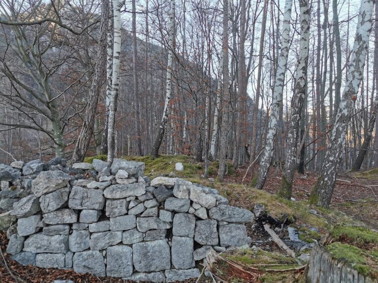
Large sections of the enclosure wall survive around the castle plateau. The walls use limestone ashlar blocks of varying sizes together with rubble stone, and their outer facing was carefully laid in courses. Some surviving sections reach 8 metres in height. Their lines form an irregular quadrilateral that narrows to an acute point toward the north. The walls may have served as a curtain wall, or they may represent the outer walls of buildings.
The high rocky ridge within the castle probably resulted partly from the late-medieval rockfall. The western part of the castle has slipped into the valley. A plan made by Adolph von Schaden in 1832 showed that further wall sections may once have secured the edges of the slope, although the terrain had already collapsed when the plan was prepared.
Mountain setting and physical function
The narrow northern spur provides views across the Schliersee. The strongly built front tower and the height of the enclosure wall contributed to the site’s defensive character, but the surrounding terrain imposed severe practical limits. The approach from Schliersee is about 3 kilometres long and climbs to roughly 1,000 metres. Direct descents are steep and could have been used only by lightly loaded pack animals.
Winter snow could reach several metres in depth, while falling rocks and landslides created continuing hazards. Water was probably obtained from cisterns and melted snow. No substantial repairs to the remains appear to have taken place since the Late Middle Ages, although the surviving wall lines were not considered to be in immediate danger before the conservation campaign of 2023 and 2024. That work also corrected earlier information at the site that had wrongly assigned large bossed-ashlar towers to the Roman period.
Nearby sites