Castello di Lipari: The Fortified Citadel of Lipari, Italy


Site at a Glance
- Rating
- 4.5
- Popularity
- Medium
- Country
- Italy
- Primary era
- Early Modern
- Eras represented
- Stone Age, Bronze Age, Iron Age, Classical, Medieval, Early Modern
- Civilizations
- Ancient Greek, Byzantine, Crown of Aragon, Norman, Roman, Spanish
- Site type
- Military
- Remains
- Citadel
On this page11 sections
History
Castello di Lipari is a fortified citadel in Italy that developed on the island’s ancient acropolis through successive Greek, Roman, Byzantine, Arab, Norman, Swabian, Aragonese, and Spanish phases. The site has been inhabited for approximately 6,000 years, while the present castle complex derives principally from sixteenth-century defenses ordered by Charles V after repeated Ottoman attacks.
Prehistoric and Greek settlement
The earliest confirmed occupation belongs to the Neolithic period. A prehistoric settlement and necropolis remained in use from approximately 4000 BC until the eighth century BC, followed by a Greek settlement dating from the eighth to the seventh century BC. Between 2300 and 1500 BC, the acropolis formed part of the Capo Graziano cultural horizon, which originated on Filicudi. Thapsos–Milazzese occupation followed between 1500 and 1300 BC.
Near the end of the thirteenth century BC, the acropolis and the other islands were abandoned and their villages destroyed. A population identified as Ausonio I then arrived from peninsular Italy. Another destruction separated this phase from Ausonio II occupation around 1200 BC, and a further destruction brought Ausonio II to an end around 900 BC.
Greek colonization began around 580–576 BC, when settlers from Cnidus and Rhodes established their first settlement on the acropolis. Cnidus and Rhodes were ancient Greek centers in the eastern Aegean. Later dominations altered the site extensively, although a fourth-century BC tower survives from the Greek phase.
Roman and Byzantine occupation
The Roman settlement or castrum, a fortified settlement or military encampment, formed part of a long phase extending from the seventh century BC to the fifth century AD. The Roman remains date from the second or first century BC and continue into the imperial period. They include evidence of an organized street system and access to the acropolis.
A Byzantine castrum occupied the site from the fifth to the ninth century. In 829–837, Muslim attacks transformed the political situation in the Aeolian Islands. In 836–837, a fleet led by al-Fadl ibn Yaqub attacked the archipelago. He was replaced in September by the Aghlabid prince Abu l-Aghlab Ibrahim ibn Abd Allah ibn al-Aghlab, cousin of Emir Ziyadat Allah. The fleet devastated the islands and captured several fortresses on Sicily’s northern coast. Arab occupation at Lipari lasted from 829 to 1062.
Norman, Swabian, and Aragonese rule
Norman fortification followed in the eleventh or twelfth century. The Normans were a medieval ruling and military elite whose conquests established Norman rule in southern Italy and Sicily. In 1085, Roger I of Sicily and Robert Guiscard founded the Monastery of Saint Bartholomew, which received its first documentary attestation three years later. The site’s monument chronology also places the Benedictine-Cluniac monastery and the co-cathedral of Saint Bartholomew in 1082–1083.
In 1094, Roger I confirmed earlier donations to Abbot Ambrose and added grants from his barons. The Cathedral of Saint Bartholomew was founded in this context. Queen Adelasia del Vasto, who became queen of Sicily through her marriage to Roger I, granted several Jewish people to the Abbey of Saint Bartholomew in 1109.
The religious institution changed status during the twelfth century. In 1131, Antipope Anacletus II, whose claim to the papacy was opposed by Innocent II, elevated the joined monasteries of Patti and Lipari to an episcopal see, meaning an institution under a bishop. The bishopric reverted to an abbey in 1139, episcopal functions were restored in 1159, and the abbot was definitively consecrated bishop in 1166. A 1134 confirmation diploma of Roger II, the first king of Sicily, mentions a viscount, a castle guard, and a stratigote, a Byzantine-derived administrative or military official, at Lipari.
Idrisi described Lipari in 1150 as a hisn, or fortified place. He noted that the locality was inhabited only during parts of the year and had a small harbor. The site later passed through Swabian and Aragonese phases. Swabian fortification belongs to the thirteenth century, while Aragonese works date from the fourteenth. In 1356, King Frederick IV of Aragon appointed Vinciguerra of Aragon captain of war and castellan of Lipari. In 1396, the bishopric of Lipari and Patti was granted to John I of Aragon.
Spanish reconstruction and archaeological study
The present defensive complex took shape chiefly during the sixteenth century. Charles V, the Habsburg emperor and ruler of the Spanish crowns, ordered new works after the Ottoman admiral and corsair Khayr al-Din Barbarossa repeatedly attacked the island. Barbarossa and his brother Aruj raided Sicilian coastal settlements between 1502 and 1504. Elias and the Barbarossa brothers carried out further systematic attacks on Lipari and Tindari in 1510, 1512, and 1514.
In July 1544, a fleet commanded by Khayr al-Din Barbarossa and the Ottoman naval commander Rais Dragut devastated Lipari, captured the settlement, and overcame its fortifications. The campaign also included the sack of the fortified church at Tindari, the destruction of Patti’s settlement and citadel, the burning of Lipari Cathedral, the siege of the settlement protected by the Castle of Santa Lucia del Mela, and a threatened assault on Milazzo’s citadel. The attacks formed part of the wider Ottoman and Spanish struggle for control of the Mediterranean, between the Spanish conquest of Tunis in 1535 and the Ottoman defeat at the naval Battle of Lepanto in 1571.
Spanish fortification between 1529 and 1575 produced the main form of the current castle complex, incorporating parts of earlier defenses. Until the eighteenth century, Lipari’s citizens lived within the citadel’s walls. The fortified settlement later retained several churches and monuments, while archaeological investigation provided evidence for the long sequence of earlier occupation. Excavations begun in 1950, particularly those directed by Luigi Bernabò Brea from the 1950s onward, exposed more than 10 metres of cultural deposits. Volcanic ash from Stromboli and Vulcano helped preserve the layers and their archaeological material.
Several buildings within the castle now accommodate the Regional Aeolian Archaeological Museum, including parts of the former episcopal seat. The museum contains much of the material recovered through excavations begun after the Second World War. Castello di Lipari is designated Italian national heritage.
Remains
Acropolis and prehistoric layers
The citadel occupies a volcanic rock rising approximately 50 metres above the Tyrrhenian Sea. Its steep sides provided a natural defense against attacks from the sea. The fortified complex includes the castle, buildings spread across the volcanic acropolis, and a strong circuit of walls. The necropolis and the areas occupied by settlements and castra lie on the flatter parts of the Civita, the fortified upper area.
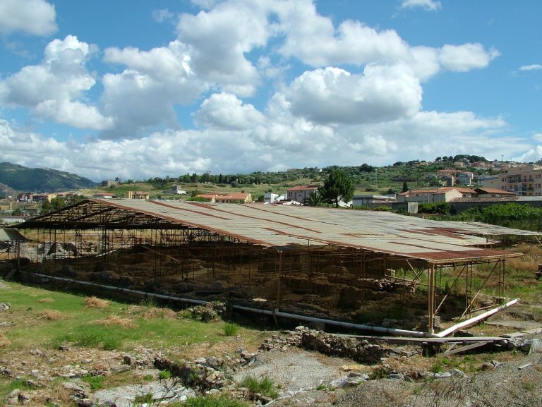
The earliest settlement consisted of superimposed oval huts. These small structures reached a maximum width of approximately 5 metres and had dry-laid stone walls, roofs made from broom branches, and floors covered with unfired clay. Later Ausonio I and Ausonio II huts expanded to approximately 15 by 7 metres, with pitched roofs supported by vertical posts. Their remains form part of the archaeological sequence preserved beneath the later citadel.
Greek and Roman remains
The Greek phase includes a fourth-century BC tower positioned between the Spanish and Norman fortifications. The structure is thought to have been reused during the Norman period in the twelfth century. The settlement also included the so-called Bothros of Aeolus, a votive pit, meaning a ritual deposit or shrine-related installation. A lava-stone slab closed the pit, and a reclining lion above it represented the settlers’ homeland of Cnidus.
Roman remains reveal an organized division into cardines and decumani, the principal north–south and east–west streets of a Roman town. A road led toward the acropolis, providing access between the planned settlement and the elevated fortified area. The Roman material belongs to the second or first century BC and continues into the imperial period.
Medieval and Spanish defenses
The walls form a powerful circuit around the elevated citadel and the lower sottocastello quarter. They separate Marina Lunga to the north from Marina Corta to the south and divide both marinas and the lower town from the fortified area above. Access through the walls is provided by a carriage gate. The ancient borough represents an enlargement of the earlier fortified town.
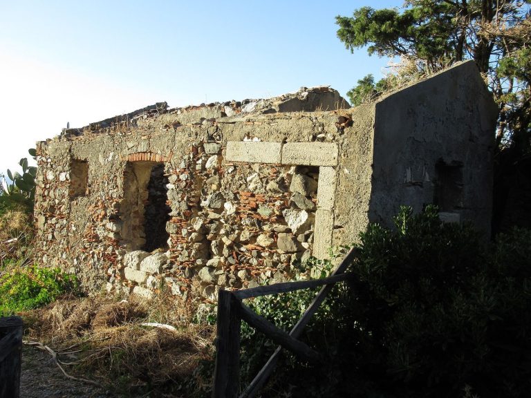
The Norman fortification included a mastio, or principal fortified tower, with features characteristic of Norman military architecture. Other Norman towers are thought to survive within the masonry of the later Spanish defenses. The sixteenth-century castle incorporated parts of these twelfth-century towers, and one fortified gate was later converted into the castle entrance. The Spanish defensive system and its associated fortifications belong to the sixteenth-century reconstruction.
Cathedral, monastery, and later churches
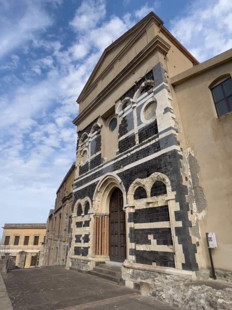
The Cathedral of Saint Bartholomew stands at the center of the hill among the archaeological remains. The Normans built it around the twelfth century, and the Spanish rebuilt it after the destruction of 1544. Its present facade dates from 1861. Beside the cathedral, the cloister of the former monastery incorporates material reused from earlier Roman and medieval buildings.
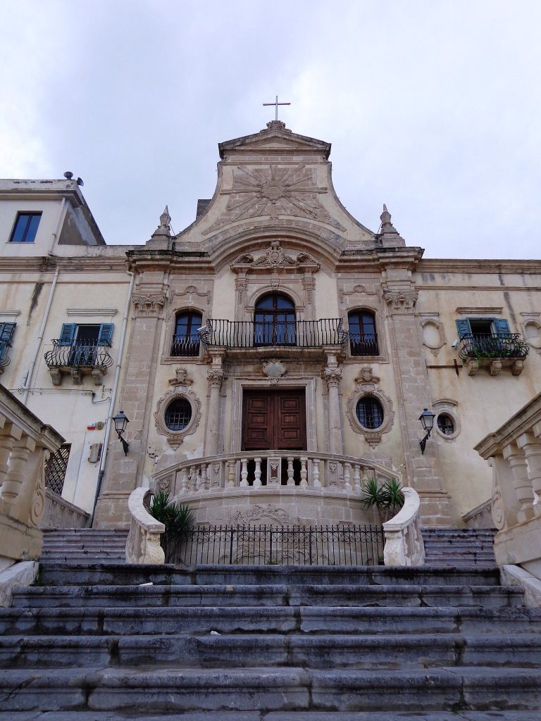
The complex also contains the Church of Saint Catherine of Alexandria, which dates from the sixteenth century. The churches of Maria Santissima Addolorata and Maria Santissima Immacolata belong to the seventeenth and eighteenth centuries respectively, while the Church of Maria Santissima delle Grazie dates from the eighteenth century. Cloisters, the former Benedictine-Cluniac monastery, the co-cathedral, and parts of the former episcopal seat remain within the fortified precinct.
Archaeological museum and preserved deposits
Some castle wings and the former episcopal seat house the Regional Aeolian Archaeological Museum. The museum’s collections include material recovered from excavations across the acropolis and the fortified settlement. More than 10 metres of cultural stratigraphy preserve successive prehistoric, Greek, Roman, medieval, and later phases, with volcanic ash from Stromboli and Vulcano contributing to the survival of the archaeological evidence.