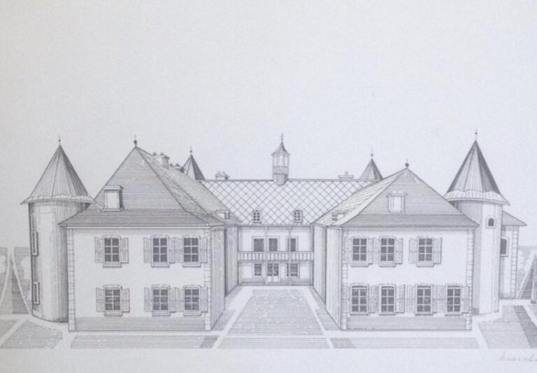
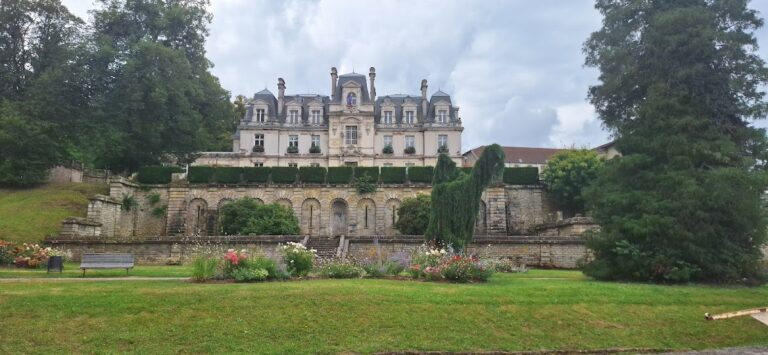
Château d’Épinal: A Medieval Fortress and Historic Park


Site at a Glance
- Rating
- 4.4
- Popularity
- Medium
- Country
- France
- Primary era
- Medieval
- External website
- Open
- Eras represented
- Medieval, Early Modern, Modern
- Civilizations
- Duchy of Lorraine, Holy Roman Empire
- Site type
- Military
- Remains
- Castle
On this page17 sections
History
Château d’Épinal is a medieval fortress and historic park in Épinal, France. Its origins lie in a fortress established around 980 by Thierry I of Hamelant, bishop of Metz, to protect church lands and their inhabitants from Burgundian incursions. The present castle was developed on the same rocky ridge during the thirteenth century as part of Épinal’s fortifications and its struggle for political independence.
The episcopal fortress
The first stronghold at Spinal probably consisted of a wooden tower, later associated with the Tour du Voué or Tour de la Vouerie, surrounded by a wooden palisade. Built at the tip of the sandstone spur, it watched the Moselle and the Ambrail and Saint-Michel valleys. The site served as the residence of the bishop’s provost, or advocate, an official who administered and defended episcopal property. It later housed the duke’s bailiff.
The upper castle replaced this earlier installation. Work on the rocky ridge may have started during the episcopate of Conrad de Scharfeneck between 1213 and 1224, but construction was certainly continued by Jacques de Lorraine, bishop of Metz, in the middle of the thirteenth century. The resulting complex formed a major part of the town’s defensive system.
Artillery and late medieval change
Between 1464 and 1500, the castle and town were adapted to the use of artillery. In 1465, after Louis XI, king of France from 1461 to 1483, ceded Épinal to Thiébaut de Neufchâtel, the inhabitants refused to surrender. A siege from the Justice plateau severely damaged the castle’s northern front and the residential building beside it. In 1473, the bishop of Metz, allied with Burgundy, attacked the castle while attempting to recover Épinal.
The sixteenth century brought further changes to the defenses, bridges, entrances, and internal buildings. In 1533, Duke Antoine of Lorraine ordered a small timber-and-clay watchtower to be placed above the donjon after its raised roof blocked the watchman’s view toward the town. The castle’s roofs and timber structures were already in poor condition by 1601 and 1602, when the Tour de Lespinoux was also threatened with collapse.
Sieges and the end of the stronghold
During the seventeenth-century conflicts between Lorraine and France, Épinal and its castle repeatedly changed hands. Duke Charles IV of Lorraine retook them in 1637, including through a surprise operation, after the castle had housed a French garrison. Between 1637 and 1640, the suburbs were demolished and new earthworks were constructed in preparation for further fighting.
The town capitulated to France on 23 August 1641, but the castle continued to resist. French forces opened a breach in the northern curtain wall through sapping and mining, and the defenders withdrew into the donjon before surrendering to Marshal François du Hallier. A further French siege in 1649 was abandoned after a vigorous defense by Lorraine colonels. French occupation resumed in 1653 and continued until the Treaty of Vincennes in February 1661, following an earlier period of neutrality.
In September 1670, Marshal de Créqui captured Épinal after an eighteen-day siege, and the castle capitulated on 28 September. The town was ordered to pay 30,000 barrois francs and to destroy its fortifications and castle. Épinal consequently ceased to serve as a strategic stronghold. It remained under the dukes of Lorraine until Lorraine was annexed to France in 1766.
Ruins, garden, and archaeological recovery
From the eighteenth century, the ruins were dismantled and reused as a source of building stone. In 1724, Duke Leopold authorized the town to take stone from the castle for walls along a branch of the Moselle. The Saint-Éloi barracks, built from castle stone in 1740, remained in use until a fire destroyed it in 1923.
The castle domain became a national asset in 1791. Christophe Doublat acquired the ruins in 1804 and gradually purchased the whole site by 1827, creating a landscape garden of more than twenty hectares in the pre-Romantic style. After his bankruptcy and suicide in 1840, the property passed to Paul Brocart, who bequeathed it to the town at his death in 1857. Épinal took possession after Brocart’s widow died in 1890 and opened the garden to the public.
During the twentieth century, vegetation covered much of the garden and ruins, turning the landscaped estate into a park. At the request of Mayor Philippe Séguin, Michel Bur directed the first archaeological excavation campaign in 1984. Excavations continued until 1992 and revealed remains that clarified the castle’s organization and military operation. In 1993, Thierry Algrin proposed presenting the complex as a Romantic-style ruin, including a raised donjon, an excavation store, and an open-air theater. Only the donjon was raised, reaching thirteen metres.
In 1992, the castle remains between the Tour de la Vouerie and the works of the Tour de Lespinoux, along with the nineteenth-century Chinese pavilion, chalet, garden structures, dairy, and the façades and roofs of the farm, were classified as historic monuments. The park received historic-monument registration at the same time. The town of Épinal owns the site. The Chinese Tower was restored between 2009 and 2011, while the park was reorganized from 2011 to 2013.
Remains
Ridge and fortified enclosures
The castle and its surviving ruins occupy a rocky sandstone ridge 387 metres above sea level, overlooking Épinal and the Moselle valley. The medieval complex was organized as a polygonal enclosure with a substantial residential donjon and a large cistern fitted with a filtering structure. The whole spur extended about 380 metres from the Tour de Lespinoux to the western end of the châtelet and was approximately 100 to 120 metres wide.
Three elongated enclosures followed the ridge from west to east. A châtelet stood at the western end, followed by a dry moat, the main castle, and an eastern ditch. Part of the eastern ditch probably resulted from quarrying stone for the castle and its walls. The châtelet may have included stables and workspaces for craftspeople. A strong fortified wall and ditches connected the site with the town.
Walls and towers
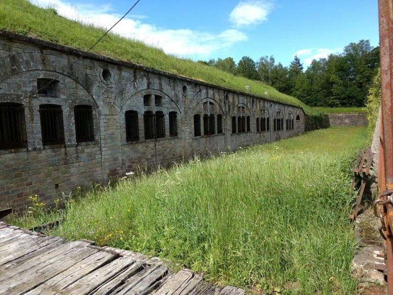
The enclosures were flanked by towers that were generally open at the rear, roofless, and without enclosed rooms. Contemporary accounts often called them false towers. The walls and curtain walls consisted of two faces of cut stone around a core of irregular rubble. Where the parapet walk survived, the walls reached about 10 metres in height. Their thickness varied from roughly 1 to 2 metres according to their position and exposure.
Tour de Lespinoux
The Tour de Lespinoux, also called the bridge tower, formed part of the eastern approach. It may have been rebuilt during the major works of 1519 and 1520, although a false tower stood behind the castle as early as 1472 and may have preceded it. The bridge tower was still recorded in 1577, but had become ruinous by 1601 and 1602.
Residential and service buildings
The donjon
The square donjon combined a residential purpose with the defensive role associated with a high medieval keep. It belonged to a tradition of polygonal enclosures and high keeps found widely in the former Lotharingian and imperial territories. Its roof was raised in 1533, obstructing the watchman’s view toward the town, so a small timber-framed watchtower with wattle-and-daub walls was added above it. In 1534 and 1535, the great tower roof was covered with 5,000 lead-glazed tiles in three colors.
The donjon roof was removed in 1641 to create a platform, and its northern wall was damaged across approximately 20 metres. The later rehabilitation raised the surviving structure to a height of 13 metres.
Seigneurial lodging
The principal residential building was a timber-framed seigneurial lodging attached to the northern curtain. It probably had one upper floor, rested on a stone base, and carried a roof of rounded tiles. The building stood 1.90 metres from the donjon on its northern side and 2.40 metres away on its southern side. It was demolished after 1495. Excavations begun in 1984 exposed its remains.
Cistern and later hall
The large cistern formed part of the medieval castle’s water system and retained its filtering structure. An arsenal appears to have been built over it before 1475. The new hall was constructed in 1481 in the angle between the southern and western curtain walls. Its northern part was removed when a ramp to the western curtain platform was probably built in 1524 and 1525. The cistern was repaired and its upper surface paved in 1652.
Other excavated buildings include the captain’s lodging, an oven, a chapel, and the arsenal. In 1631 and 1632, the oven, bakehouse, and guardhouse were placed beneath one roof between the northern curtain and the donjon. An earth ramp piled inside the courtyard between 1649 and 1656 buried the ruins of the new hall, the ramp, remains of a palisade, an earlier embankment, and the guardhouse.
Artillery defenses and entrances
The artillery alterations of 1464 to 1500 introduced low gunports near the ditches for close-range fire, while upper arrow slits continued the earlier defensive arrangement. The openings accommodated hook arquebuses, bombards, or culverins, an early type of gun. Their horizontal embrasures were narrow enough to allow only a cannonball to pass through.
A shield-shaped buttress may have been added to the northern face of the donjon toward the Justice plateau. The eastern defenses received gunports in 1512 and 1513. A large covered wooden bridge stood behind the castle. Wooden steps along the eastern flank were removed in 1515, and a drawbridge was built in 1515 and 1516 before the projection formed by the gunport-equipped boulevard. Three stone piers constructed in 1519 and 1520 supported a replacement wooden bridge. The eastern entrance probably also gained a chevaux-de-frise, an obstacle of projecting stakes, and a barbican, an advanced defensive work protecting the entrance.
The western curtain included a platform overlooking the town. A quadrangular western bastion was probably added in the second third of the seventeenth century because artillery from this position threatened inhabitants loyal to Charles IV of Lorraine. A staircase was probably built in the captain’s lodging during the same period, together with a wall protecting the posterns in the southern curtain.
The northern curtain was breached during the siege of 1641. Wooden palisades were installed across the breach in 1645, and the internal earth ramp was later raised to about 4 metres. A covered, paved stone gallery once crossed the eastern curtain between the Tour Saint-Georges and the donjon. The fixed bridge was rebuilt in 1629 and 1630.
The landscaped estate
Chinese Tower and garden buildings
The nineteenth-century garden incorporated the medieval ruins into a larger landscaped estate. Doublat’s property included a Chinese-style stair tower built in 1804, a greenhouse, a reception pavilion, an icehouse for storing ice, garden structures, and a dairy. The stair tower contained an access stair of 80 steps. The dairy retained a circular imitation-marble salon decorated with high-quality grisaille cartouches, painted ornaments in shades of gray designed to imitate relief sculpture.
Henri Joseph Hogard built the Chinese Tower in 1809. The western ditch was filled with water between 1827 and 1834. Nineteenth-century views by Charles Pensée show an enclosure formed partly by the western châtelet, with a single entrance through the treasury and Chinese Tower. The tower was restored between 2009 and 2011.
Archaeological park
Excavations from 1984 onward cleared the overgrown ruins and exposed the relationships between the donjon, lodging, arsenal, captain’s lodging, oven, chapel, cistern, and defensive works. The surviving medieval structures now occupy a park that still incorporates the nineteenth-century garden buildings and landscape features. Park reorganization between 2011 and 2013 included rebuilding the animal enclosures, improving children’s play equipment, and adding new planting.