Rumkale: A Byzantine and Armenian Fortress-City on the Euphrates
Site at a Glance
- Rating
- 4.6
- Popularity
- Medium
- Country
- Turkey
- Primary era
- Medieval
- Eras represented
- Medieval, Early Modern
- Civilizations
- Byzantine, County of Edessa, Crusader, Kingdom of Cilicia, Mamluk, Ottoman
- Site type
- Military
- Remains
- Citadel
On this page17 sections
History
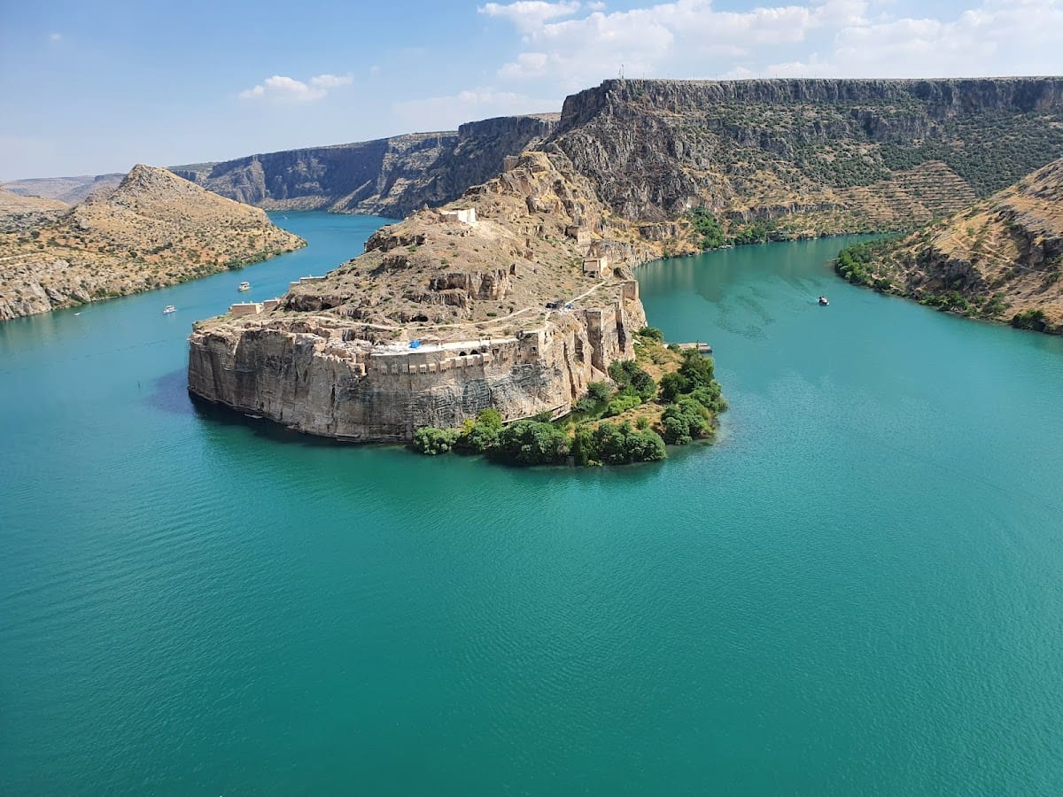
Rumkale is a ruined fortress-city in Türkiye, on a rocky promontory where the Merzimen River meets the Euphrates in present-day Gaziantep Province. Its earliest surviving foundations belong to Byzantine rule, although the site’s origins remain uncertain. Rumkale occupied a strategic frontier position from the medieval period onward and later became the administrative and burial centre of the Armenian catholicosate, the institution governed by the senior bishop of the Armenian Apostolic Church.
Early origins and Byzantine rule
Several traditions place Rumkale’s beginnings in the distant past. One attributes its foundation to the Proto-Hittites in 1230 BC, while another identifies it with Shitamrat, said to have been captured by the Assyrian king Shalmaneser III in 855 BC. Roman or Hellenistic occupation has also been proposed, but no remains earlier than about AD 1000 have been identified. The name appears in several forms, including Rumkale, Rum Kalesi, Hromkla, Hromgla, Ranculat, Qal’at al-Rum, and Qal’at al-Muslimin. The element derived from Rhomaios means Roman or Byzantine, rather than referring to the modern city of Rome.
During the Byzantine period, the fortress guarded an exposed frontier and may have protected the Roman road along the Euphrates’ right bank. It also housed a Syriac Orthodox bishopric in the fifth and sixth centuries. Syriac Orthodox Christianity is an ancient Christian tradition using the Syriac liturgical language and rites. The site developed into a town in the eleventh century, partly through the arrival of Armenians displaced from northern territories.
Armenian and Crusader control
After the Byzantine defeat at Manzikert in 1071, the region entered a period of political upheaval. The Byzantine-Armenian general Philaretos Brachamios controlled the surrounding territory, and Rumkale later belonged to Kogh Vasil and his successor Vasil Dgha. In 1116, Baldwin II of Edessa forced Vasil Dgha to surrender his lands, including Rumkale, to the Crusader states. The fortress then formed part of the County of Edessa or of lordships associated with it.
Between about 1148 and 1150, Gregory III Pahlavuni, catholicos of the Armenian Apostolic Church, purchased Rumkale from Beatrice of Turbessel. He moved the catholicosal headquarters there from Tzovk. From approximately 1150 until 1292, Rumkale served as the residence, administrative centre, and burial place of the Armenian catholicoi. The seat was later transferred to Sis, the principal political and ecclesiastical centre of the Armenian Kingdom of Cilicia.
Rumkale became part of the Armenian Kingdom of Cilicia while continuing to accommodate Syriac Orthodox and Catholic representatives. Nerses IV Schnorhali, the brother of Gregory III, was elected catholicos at Rumkale in 1166 and was buried there. The fortress hosted theological conferences in 1170 and 1172 concerning a possible union between the Armenian and Byzantine churches. In 1179, a major Armenian synod brought together Armenian bishops, the catholicos of Caucasian Albania, and bishops from eastern Armenia. The meeting reached a compromise and sent a profession of faith to the Byzantine emperor Manuel I Komnenos.
Manuscripts and Syriac Orthodox activity
Rumkale developed into an important centre of Armenian manuscript production. The school of Hromkla reached a high point under Catholicos Constantine I, while the illuminator Toros Roslin directed its scriptorium from about 1256 to 1268. A scriptorium was a workshop where handwritten books were copied and decorated. Religious manuscripts were produced there, and the earliest surviving manuscript attributed to the school is dated to 1166.
Syriac Orthodox activity continued alongside the Armenian institutions. The Syriac patriarch Ignatius II David transferred the library of the nearby Barsauma Monastery to the fortress, including manuscripts associated with Patriarch Michael I. Ignatius David spent several years at Rumkale, died there, and was buried at the site. Between about 1147 and 1150, the fortress also served as a prison for Basil bar Shumna, the Syriac Orthodox metropolitan of Edessa, a senior bishop responsible for several dioceses.
Mamluk conquest and frontier stronghold
By 1268, Rumkale had become isolated from the other territories of the Armenian Kingdom of Cilicia. Mamluk forces attacked and destroyed the town but did not capture the citadel. On 19 May 1280, a Mamluk army attacked the fortress for five days, plundering and destroying parts of the Armenian town while again failing to take the citadel.
The decisive assault began on 26 May 1292. After a siege lasting until 29 June and involving 33 catapults, the Mamluk army of Sultan al-Ashraf captured Rumkale. The town was heavily destroyed. Catholicos Stephan IV, bishops, priests, and other Christians were taken prisoner or enslaved, and the church treasury was plundered. Stephan IV was taken to Egypt and died after about a year in captivity. Al-Ashraf rebuilt the fortress and renamed it Qal’at al-Muslimin, while the Armenian catholicosal seat moved to Sis.
Under the Mamluk Sultanate, the Islamic state centred in Egypt and Syria from the thirteenth to the early sixteenth century, Rumkale became an important frontier stronghold facing the Ilkhanate, the Mongol successor state based in Iran and neighbouring regions. It served as a base for raids and intelligence operations. The former catholicosal cathedral was converted into a mosque, and a bazaar was established. The fortress also sheltered rebels, including the Mamluk commanders Çekem, Nevruz, Devadar Özbek, and Demürtaş. Timur’s forces damaged Rumkale in 1400–1401, after which the Mamluks repaired it. In 1466, the Dulkadirid ruler Shah Suwar briefly seized the fortress before Mamluk control was restored.
Ottoman administration and decline
Rumkale surrendered to the Ottoman army in 1516 after the Ottoman victory over the Mamluks at the Battle of Marj Dabiq, without undergoing a siege. It became the centre of a namesake sanjak in 1517. A sanjak was a large Ottoman administrative division. The settlement was soon reduced to a kaza of the Sanjak of Birecik, probably between 1518 and 1520. A kaza was a smaller Ottoman administrative district. Sixteenth-century records list a Muslim population, while Armenians later returned and were permitted on some occasions to use the former catholicosal church.
Ottoman records describe Rumkale as a district with associated subdistricts and villages. In the nineteenth century, these included Merzuman, Ank, Araban, Reşi, and Baziki. The administrative centre had shifted to Halfeti, on the opposite bank of the Euphrates. Evliya Çelebi described the seventeenth-century fortress as containing a mosque, caravanserai, bathhouse, open-air bazaar, gardens, and abundant fruit.
Rumkale’s isolated position also led to its use as a state prison and place of exile. Most recorded exiles came from the Aleppo region. In 1859, Artin, son of Aboş, an Armenian resident of Aintab, was detained and sent to Rumkale for arrogance and abusive conduct. In 1860, Ibrahim bin El-Kudri and Ahmet bin El-Kudri were sent there for six months after a dispute in Aleppo Province. In 1861, Hafız Hasan Efendi, an employee of the Urfa Commercial Court, received a three-month sentence at Rumkale for spreading false information that obstructed debt collection.
In 1831, Bekirzade Mehmed Bey, the voivode of Rumkale, led a revolt in alliance with the Rişvan tribe and destroyed villages in Birecik, Rumkale, and Besni. A voivode was an Ottoman provincial official who could also exercise military authority. Ottoman forces suppressed the rebellion and ordered the town depopulated, with its houses destroyed to prevent the fortress from sheltering further rebels. In 1832, Ibrahim Pasha bombarded Rumkale during the Egyptian-Ottoman War, causing extensive damage. Residents moved to Kasaba, Halfeti, or Aintab. By 1838, about forty ruined houses remained, and later nineteenth-century observers recorded only six huts.
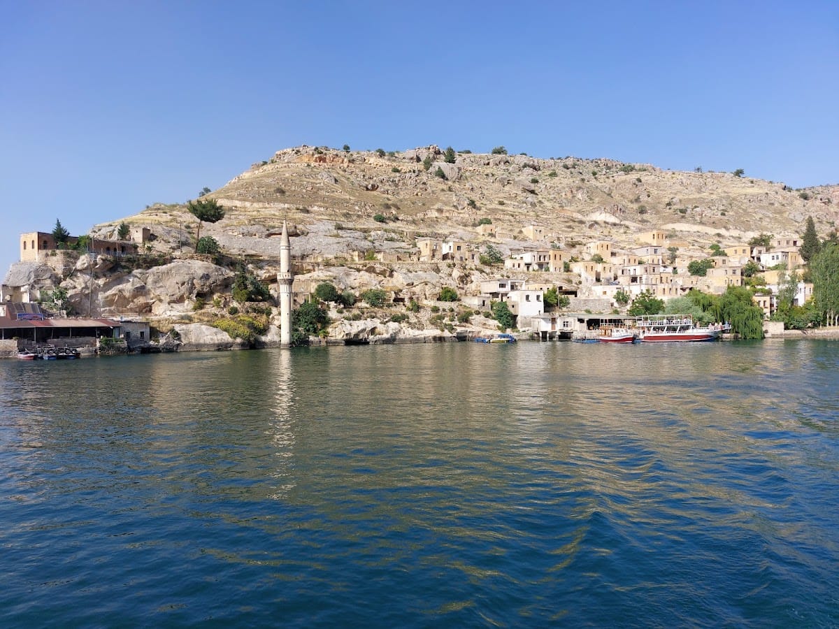
The settlement continued to decline during the twentieth century. In 1926, the Rumkale district was subordinated to Birecik and reduced from district status to a municipality. District status was restored in 1954 under Urfa Province. Construction of the Birecik Dam in 2000 submerged lower parts of Rumkale and the eastern part of nearby Halfeti, leaving portions of the fortress flooded. Archaeological protection and conservation measures were later undertaken at historic Eski Halfeti, whose buildings had been formally registered and protected.
Remains
Rocky peninsula and defensive works
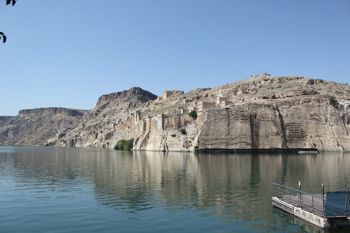
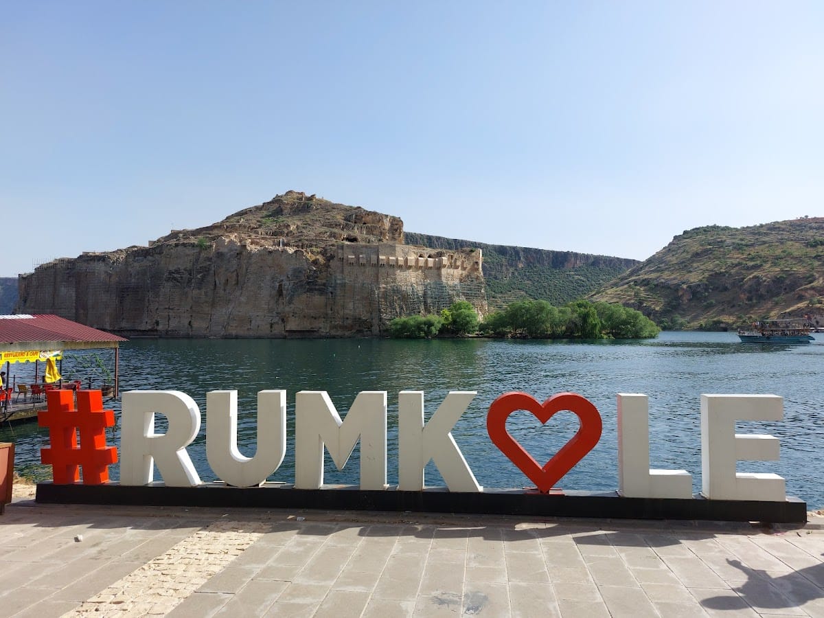
Rumkale occupies a high, isolated, spur-like rocky plateau between the Euphrates and the Merzimen valley. The plateau rises about 50 metres above the water and forms a narrow peninsula with steep rock faces. The lower areas were partly submerged by the Birecik Reservoir. A substantial defensive wall encloses the fortress, using the same pale rock as the surrounding cliffs. Nineteenth-century descriptions give the walls a height of about 60 feet and mention battlements, towers, and machicolations, projecting openings in a parapet floor through which defenders could drop objects or liquids onto attackers.
Rock faces on three sides were cut vertically to heights of roughly 40 to 100 feet. On the southern approach, a major ditch cut into the rock separated the fortress from the adjoining plateau. It was described as about 80 feet deep and 40 feet wide. A proposal to deepen the ditch and divert water from the Merzimen to make the fortress an island was recorded, but no completed water connection survives.
Entrances and internal routes
The western approach followed a winding route through six successive gates. Some passages had barrel vaults, while others had cross-vaults. The route crossed four terraces cut into the rock, with paths and steps linking the different levels. An entrance stairway approached from the east. From the west, a road crossed a bridge described as Roman and passed several guardhouses before reaching the fortress.
Rock-cut terraces and stairways, vaulted gateways, cisterns, wells, and channels connected with the Euphrates formed part of the settlement’s internal infrastructure. The extensive cutting of the rock made it difficult for nineteenth-century observers to distinguish natural cliff faces from human workmanship. Cultivated areas within the fortress or its immediate settlement included olive, fig, pistachio, watermelon, melon, and pumpkin plants. The surrounding district was also associated with vineyards, olives, pistachios, and figs.
Religious and monastic buildings
St. Nerses Church and the catholicosal complex
The largest surviving building is a church generally dated to the mid-twelfth century. It was converted into a mosque in the thirteenth century and collapsed in the mid-eighteenth century. The former catholicosal complex included three Armenian churches, identified as St. Gregory the Illuminator, Saint Mary, and the Holy Savior. The complex therefore preserves the material setting of the Armenian ecclesiastical centre that occupied Rumkale between approximately 1150 and 1292.
Syriac Orthodox churches
Later descriptions also mention at least two Syriac Orthodox churches. One was probably a small church in the town dating from the late twelfth century. Another, larger church stood in the lower quarter. These remains belonged to the Syriac Orthodox community that continued to use Rumkale alongside the Armenian institutions.
Summit mosque and church remains
A mosque stood on the summit within a large paved courtyard. Older vaulted structures beneath it were thought to belong to the Armenian monastic complex. Nearby columns with richly carved capitals apparently came from an Armenian church. A church substructure described in 1883 was about 30 feet high and had a profiled frame containing two shields decorated with foliage and vine reliefs in Byzantine style. The upper parts of the shields had once contained crosses, most of which had been chiselled away.
Richard Pococke described two churches during his visit in 1737. The lower church appeared older and had three aisles, a square western gable, and a half-gable on one side. The upper church was smaller but richly built, with a largely square plan and two chapels beside the high altar. Its entrance stair had eight steps on each side of a landing, and two large octagonal pillars carried Gothic capitals. Neighbouring Christians still visited it on certain days, and it was associated with a former monastery.
Water systems, residences, and cemetery
The Armenian well
A large Armenian well was described as approximately 200 feet deep and wide enough to contain a spiral stairway cut into the rock. The stair descended towards the Euphrates, allowing pack animals to carry water up to the fortress. By 1883, the well was partly blocked and dry. Traces of its water channel and several routes descending towards the river were still visible.
Palace and dwellings
The northern side contains the remains of an Ottoman-period palace that replaced an earlier church, together with dwellings on the northern slope. Other residential spaces were cut directly into the rock, with partitions left standing between rooms. Nineteenth-century observers recorded additional secular buildings, ruins, and about forty houses before further deterioration reduced the built settlement.
Cemetery and lower settlement
The site includes a historic cemetery, other church and building ruins, cisterns, and wells. Lower parts of the settlement were submerged when the Birecik Reservoir formed, and portions of the fortress now lie beneath the water. The surviving remains combine the defensive walls and rock-cut approaches with religious, residential, and water-supply structures from successive Byzantine, Armenian, Mamluk, and Ottoman phases.