Steinburg: A Medieval Castle and Administrative Center in Germany
Site at a Glance
- Popularity
- Medium
- Country
- Germany
- Primary era
- Medieval
- Eras represented
- Medieval
- Civilizations
- Holy Roman Empire
- Site type
- Military
- Remains
- Castle
On this page11 sections
History
Steinburg was a lowland castle near Süderau in Germany, probably built shortly after 1300 to administer the Kremper Marsh. It was a motte castle, with a defensible residence raised on a mound, and stood beside an important road and river crossing.
Foundation in the marsh
The Kremper Marsh had been diked and settled from the early thirteenth century. Its free-farming settlers owed dues to the counts of Schauenburg and Holstein and were subject to their authority in legal, military, and political affairs. In 1238, a bailiff of Count Adolph IV, based at Itzehoe Castle, had responsibilities in both the Wilster and Kremper marshes. Bailiff positions were initially hereditary, but after conflicts with the counts, territorial rulers began appointing their holders in the second half of the fourteenth century.
After the Kremper Marsh was assigned to the Kiel branch of the ruling family, Count Johann II of Holstein-Kiel had a bailiff named Nicolaus in 1293. Johann II may have ordered the construction of Steinburg. The castle first appears in a document in 1307, which lists Hohenfelde, Horst, Neuenbrook, Krempe, Neuenkirchen, Borsfleth, Süderau, Heiligenstedten, and Bole within its bailiff’s jurisdiction. An Elbe flood destroyed Bole in 1412 or 1413.
Steinburg stood where the old Hamburg–Itzehoe road crossed the then-navigable Kremper Au, close to the boundary between higher ground and marsh. A barrier known as the Rönnebaum closed the road on the Grevenkop side of the river, and a toll may have been charged there. The castle could block the route during conflict, serve as a military base for the territorial ruler, and shelter local people.
Royal rule and rebuilding
Duke Adolph VIII of Schauenburg died without an heir in 1459, and Steinburg passed to his nephew, King Christian I of Denmark. Under the Treaty of Ribe in 1460, Christian assumed territorial rule. The district administered from the castle became the Amt Steinburg, an administrative district overseen by a royal appointee. Its duties included local government, policing, roads and dikes, justice, taxation, and military affairs.
In 1469, the Hamburg pledge-holders received royal permission to repair the castle at Christian I’s expense. Once the scale of its deterioration became clear, the king ordered it dismantled and rebuilt the following year, allocating 4,000 marks for the work. Duke Frederick ordered new fortifications in 1508. Farmers from the Kremper and Wilster marshes supplied labor and transport, while Krempe, Itzehoe, and Wilster contributed money voluntarily.
By 1555 the castle was in poor condition. That year, when Jürgen von Ahlefeldt of Stellau became the district administrator, he was given a residence in Krempe. The district took its name from that town, and Steinburg continued as an estate farm. In 1576, administrator Josias von Qualen was ordered to rebuild the castle on its earlier foundations. The new building included rooms for the king and queen.
Wartime occupation and demolition
During the Thirty Years’ War (1618–1648), a major European conflict, administrator Detlev Rantzau issued orders from Steinburg until January 1626, when the district’s seat moved to Gut Drage. On 11 September 1627, imperial commander Wallenstein took the castle without difficulty. Imperial troops then fortified and held it for the rest of the war. An effort by forces from Krempe to relieve the castle on 29 March 1628 failed.
After the peace, Steinburg was again unoccupied but apparently still fit to use. In 1630, King Christian IV sent timber there for the royal court. District correspondence came from both Steinburg and Drage, and administrative clerk Jacob Steinmann still worked at Steinburg in 1639. In 1640, Christian IV gave the castle’s stone to his administrator at Rendsburg, Christian Rantzau, for a residence at Glückstadt. Long known as the “new Steinburg,” that residence later became a house of correction and a mental asylum. The castle was dismantled around 1641–1643, and the district was administered first from Glückstadt and later from Itzehoe.
Fortification and later history
After the castle’s removal, the defenses were developed into an earthwork fortification. Together with Glückstadt and Krempe, it formed part of a defensive triangle. Some service buildings and the estate farm remained. In the Danish-Swedish conflicts of 1644 and 1658, control of Steinburg mattered because of its position on the Hamburg–Itzehoe road. Danish troops occupied it; in 1644 it turned back two Swedish advances, while during the later conflict it endured several raids.
In 1742, King Christian VI commissioned proposals to modernize the fortification, but neither plan was carried out. Demolition was ordered in 1763, and the land associated with the fort was leased. The estate’s farmland had been leased roughly a century earlier and was sold in 1677.
Following the wars of 1864 and 1866, Schleswig and Holstein were annexed and became a Prussian province in 1867. The Amt Steinburg, the towns of Itzehoe, Wilster, Krempe, and Glückstadt, and other localities were combined into the district of Steinburg, replacing the old district administrator’s office with a Prussian district administration. The district retained its 1867 boundaries until a 1970 reform added 17 municipalities from the former district of Rendsburg. Its administrative seat is in Itzehoe.
In 1884, the owner recovered the castle’s stone foundations and sold them for road construction. The mound and moat were restored in 1984, and the surviving ensemble is protected as a monument.
Remains
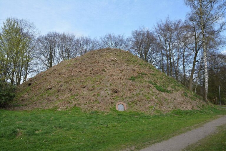
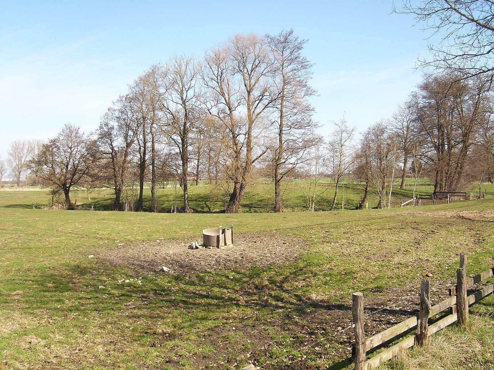
Steinburg was arranged as a motte castle, with a fortified residence on a raised mound, enclosed by ditches and earth defenses. The castle buildings have disappeared; the mound and its surrounding moat survive, bordered by alder trees north of the L112 in the Steinburg locality of Süderau.
The mound and residence
The mound measured 60 metres across and carried a two-storey brick residence. Its square stone foundation measured 40 metres along each outer wall and was built of boulders bonded with Segeberg lime mortar. A central east–west division made from similar stone indicates two adjoining houses joined together, with their gable ends facing the Kremper Au. The foundation may have given Steinburg its name. The residence’s ground floor held a gatekeeper’s home, an archive, an office, a prison, servants’ rooms, and storage; the bailiff lived upstairs. The 1576 rebuilding reused the earlier foundations and added an octagonal stair tower at the northwest corner. This was the only tower rising from ground level. Later references to three towers may refer to two additional roof turrets.
Defenses and associated estate
Ditches and entrances
A four-metre-wide ditch encircled the mound, with a bridge giving access from the south. Beyond it stood an earth rampart and another ditch. The rampart gate and a wooden bridge were on its western side, on the narrow strip between the Kremper Au and the ditch. Together, these defenses enclosed the residence and controlled its approaches.
Working estate
The associated estate covered about 250 hectares and was intended to support the garrison. The wider complex included an inn, a mill, and a place on the Kremper Au where ships could turn. Farmers had to work on the castle and maintain its defenses and ditches.
The later earthwork fortification
Plans drawn in 1742 show the fortification’s layout, including a rounded-square enclosure of about 70 to 75 metres across that contained the former castle area. An inner ditch, 8.5 to 16 metres wide, surrounded it; a powder tower stood within the enclosure, and a bridge crossed the ditch on the south. The outer rampart had four bastions, projecting platforms for defensive fire: two half-bastions to the south and two pointed bastions to the north. A broad ditch, 7.5 to 20 metres wide, surrounded this rampart, with a ravelin, an outwork in front of the defenses, on the east. A drawbridge crossed the ditch beside the southwest bastion, at the narrow bank between the fort and the Kremper Au. A long channel on the east controlled the flow of river water into the ditches. Some service buildings and the estate farm remained within the converted fortification.