Pyrgi: Etruscan Port and Sanctuary of Caere
Site at a Glance
- Popularity
- High
- Country
- Italy
- Primary era
- Iron Age
- Eras represented
- Iron Age, Classical
- Civilizations
- Etruscan, Roman
- Site type
- Settlement
- Remains
- Town
On this page21 sections
History
Pyrgi was the principal Etruscan port of Caere on Italy’s Tyrrhenian coast, northwest of the city. The Etruscans, an ancient people of central Italy whose civilization preceded Roman rule there, established the settlement at the end of the seventh century BC through Caere’s direct intervention. Its name comes from Greek and means towers. This foundation date is distinct from earlier coastal activity, which may have included salt production from the late eighth through the seventh century BC. An ancient tradition preserved by Strabo instead attributed the sanctuary’s founding to the Pelasgi, a people featured in Greek stories of the distant past.
Port of Caere
Pyrgi was one of three ports belonging to Caere, alongside Punicum and Alsium, and became the city’s main harbor and naval base. Its sheltered inlets supported trade and contact with merchants from abroad, connections reflected in imported goods dedicated at the sanctuary. The harbor likely served both commercial and military purposes. It may also have been where the fleet involved in the Battle of the Sardinian Sea was equipped and launched.
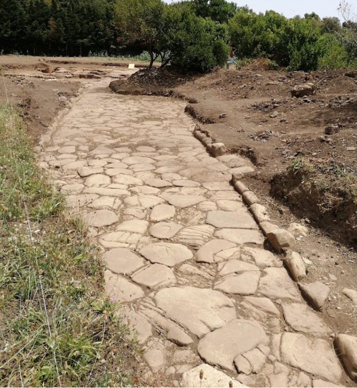
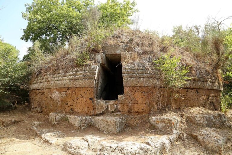
A substantial road linked the port to Caere, incorporating an older overland route. Tumuli, or burial mounds, from the Orientalizing period, an early phase of Etruscan history marked by strong eastern Mediterranean influences, stood along its course. The route tied the coastal settlement to its parent city and later became part of the sanctuary’s sacred landscape.
Sanctuaries and Caere’s authority
The northern sanctuary included worship of Uni, an Etruscan goddess identified there with the Phoenician Astarte and associated with the Greek goddess Ilithyia. Temple B was commissioned by Thefarie Velianas, ruler of Caere. Inscriptions at Pyrgi record his dedication in the third year of his rule. A common interpretation is that he dedicated the temple and related buildings to Uni and Astarte. Another reading places the dedication in a shrine, perhaps containing a statue, within a temple that may have already stood there.
Caere sponsored a second temple and expanded the sanctuary after Etruscan military defeats at Himera in 480 BC and Cumae in 474 BC. The enlarged precinct and the treatment of the road from Caere as a sacred route asserted the city’s authority. A relief associated with the new temple has been interpreted as political messaging from Caere’s ruling group, condemning tyrannical arrogance and presenting divine justice as victorious.
The southern sanctuary served Cavatha and Sur, also called Suri. Cavatha was associated with Kore-Persephone, the Greek goddess connected with spring and the underworld; Sur or Suri was interpreted as an underworld and oracular form of Apollo. The sanctuary is regarded as the oldest and most elaborate center of worship associated with Demeter known in Etruria.
Raid, Roman colony and later town
In 384 BC, Dionysius I, ruler of the Greek city of Syracuse in Sicily, attacked Pyrgi at night and plundered its sanctuary. The captured wealth was estimated at 1,000 talents. After the raid, worship shifted away from the southern precinct toward the northern one, and the southern sanctuary was ritually sealed.
During Rome’s conquest of Caere and seizure of coastal territory in the third century BC, the Romans established a maritime colony at Pyrgi, probably around 273 BC. The colony was intended to counter Etruscan piracy and the possibility of Punic, or Carthaginian, invasion. Its sacred buildings were dismantled, although open-air worship continued intermittently until at least the second century BC. Use of the sanctuary continued into the first half of the third century BC. In 191 BC, colonists sought exemption from military service.
In later Roman times, Pyrgi supplied fish to Rome, served as a station on the Via Aurelia, a major road along Italy’s western coast, and became a summer resort for wealthy patricians. Imperial-period worship included Aesculapius, the Greco-Roman god of healing, the Sun and Pater Pyrgensis, meaning Father of Pyrgi. Large villas stood along the coast. The port had declined by the early second century AD, and by 416 AD a large villa was the only occupation noted at the site.
Rediscovery and excavation
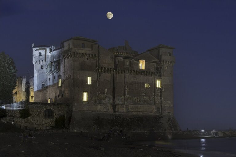
Filippo Cluverio established Pyrgi’s identification with Santa Severa after recognizing polygonal walls incorporated into the medieval castle. Aerial photography and fieldwork clarified the connection between the coastal settlement and its sanctuary in 1957, the year systematic excavation began under Massimo Pallottino. Giovanni Colonna directed excavations from 1981 to 2008 with Francesca Melis and Maria Paola Baglione; Baglione continued the work afterward.
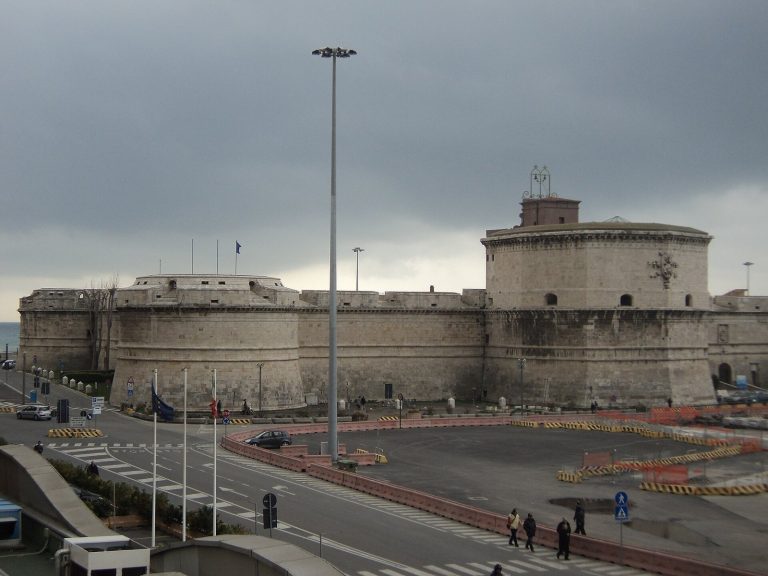
Underwater investigation began in 1999. Excavations within the castle from 2003 uncovered imperial-period walls over later Etruscan houses, and a group of ceremonial buildings was found north of Temple A in 2009. A local antiquarium opened in 1972 and is now housed in Santa Severa Castle.
Remains
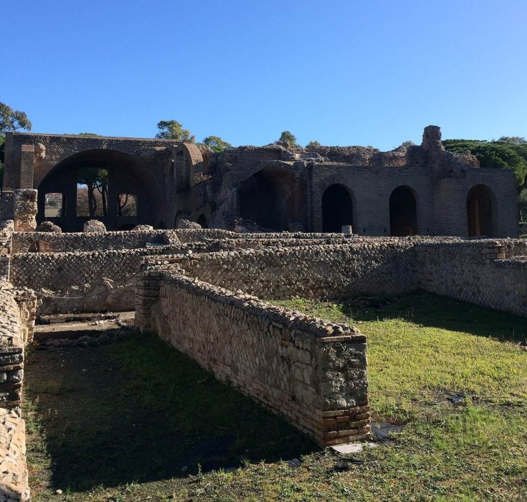
The Etruscan settlement covered about 10 hectares, extending from a rocky promontory south toward the sanctuary. Its two districts and harbor works followed the shape of the coast and its inlets. An inland spring still flows near the site, while the ancient shoreline lay farther seaward than the modern one; two former headlands are now submerged.
Town, harbor and defenses
Harbor and coastal layout
Underwater exploration identified an artificial channel cut into bedrock in front of the castle. By about 600 BC, the harbor had two basins linked by channels. Deposits that partly filled the channel contain ceramics spanning the sixth century BC through the medieval period. The Grand Ribaud F shipwreck, found off Provence, indicates that Pyrgi had facilities suited to large cargo vessels during the Archaic period.
The settlement extended along the shore in two districts, each facing one of the two ports and divided by a pebbled road. The northern district occupied the promontory; the southern one contained buildings and may have included an agora, or public gathering place. Another broad pebbled road marked the southern edge of the southern district, with the sanctuary beyond it.
Streets and houses
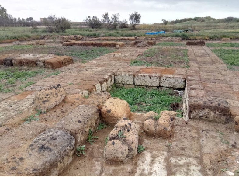
Secondary earth roads, averaging about two metres wide, formed a street network that was not laid out on a regular grid. Blocks opened in a fan-shaped pattern, mainly northeast to southwest, following the inlets. Narrow passages between blocks served movement and drainage, while wells point to adjoining homes and courtyards. Tiles linked to roof openings and tuff column bases indicate that houses with a central hall, often open to the sky, were adopted toward the end of the sixth century BC. Blocks were rebuilt repeatedly, with as many as five successive house levels between the late seventh and third centuries BC.
Warehouse and House of Amphorae
A stone stele found in 1968, dated to the third or fourth quarter of the sixth century BC, appears to have marked the boundary of a warehouse belonging to a foreigner with a Latin name. The House of Amphorae, exposed by a storm in 1982, dates to the second quarter of the fifth century BC. It was a room with a floor covered by mostly imported amphorae, interpreted as serving both commercial and residential purposes.
Road to Caere
The paved road to Caere had curbs and drainage and was wide enough for carts to pass in both directions. Near the coast it curved broadly. During construction of Temple A, this section was made into an open area with a monumental entrance.
Etruscan walls
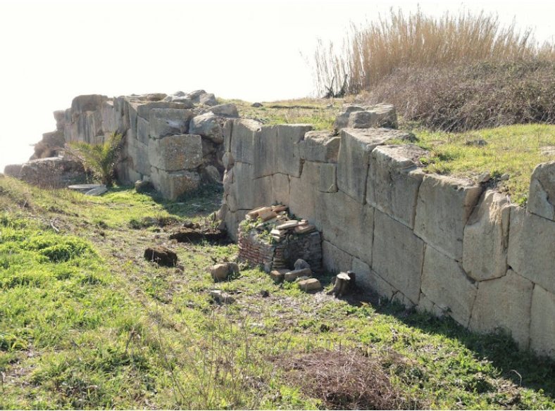
Carefully fitted blocks of polygonal limestone and sandstone formed defensive walls around an area about 200 metres by at least 220 metres. The sea has destroyed the settlement’s southwestern end and eroded other coastal sections.
Roman colony walls
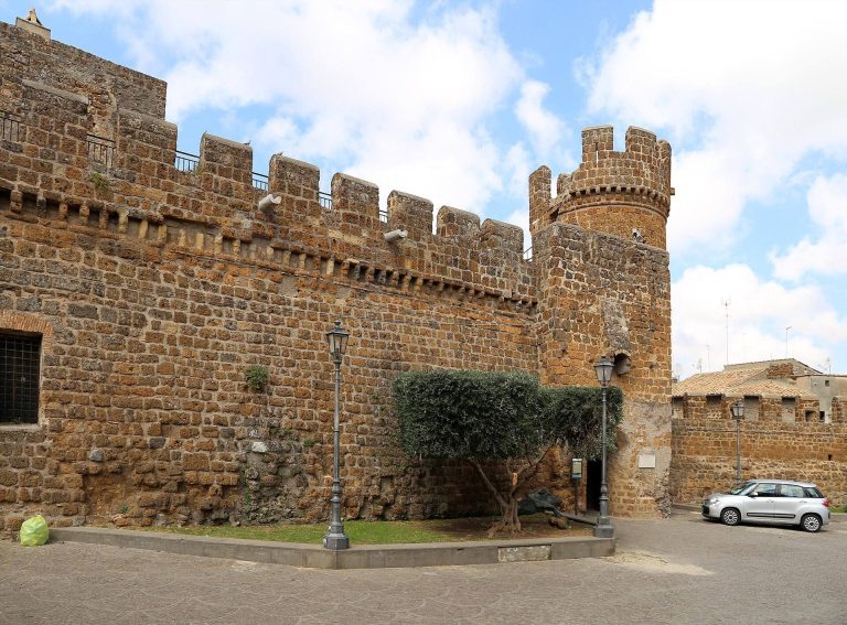
The Roman colony’s polygonal wall enclosed the promontory alone. Its circuit followed the southern limit of an earlier Etruscan road, measured about 220 by 250 metres and had three gates. The stone blocks probably came from a rocky headland at Grottini, about two kilometres north, which has since been eroded by the sea.
Northern sanctuary
Temple B
Temple B, built around 510 BC, measured 18.64 by 28.41 metres. It had one enclosed central chamber and columns around the building, with four columns in two rows at the front and six along each long side. Its design drew on Greek models, possibly transmitted through Campania, while its construction used wood and terracotta rather than stone. Relief panels showed episodes from the story of Heracles, and a pair of roof sculptures depicted the hero with Uni.
More than twenty small rooms ran along the temple’s southern side. Their purpose remains disputed: they may have housed priestesses involved in sacred prostitution, a practice possibly introduced from Phoenicia through Eryx, or provided lodging for sanctuary visitors. Floral-patterned plaques from the temple’s door frames are among the recovered objects; a miniature representation of the building is held at the Sapienza University museum in Rome.
Temple A
Temple A stood about 20 metres north of, and parallel to, Temple B. It measured 25.75 by 21.90 metres and had a plan with three enclosed chambers. Its construction is dated to about 480–460 BC. A bronze tablet from before the building’s construction supports its probable dedication to Thesan, an Etruscan dawn goddess.
A polychrome terracotta relief more than 1.5 metres across formed part of the rear roof ridge and faced the sanctuary entrance. Nails secured it to the building, where it also helped protect the structure from weather. The overlapping scenes show Zeus striking down Capaneus; the dying Tydeus taking hold of the dying Melanippus and preparing to devour his skull; and Athena recoiling with a life-giving potion intended for Tydeus. The Theban Polyphontes also appears, held down by a god. The relief’s style combines a late Archaic influence with intricate treatment of hair, beards and drapery. It is held, with the gold tablets from the sanctuary, at the National Etruscan Museum at Villa Giulia in Rome, where a reconstruction of Temple A is also displayed. Other Temple A finds at the Pyrgi Antiquarium include a roof-edge ornament with a Silenus head and fragments of a warrior’s legs.
Open-air precinct and ritual features
Area C was an open-air sacred space adjoining Temple B on its north side. It contained three inscribed gold tablets and a bronze tablet. A small enclosure nearby included a cylindrical altar and a pit linked to an underworld cult of Tinia, the Etruscan counterpart of Jupiter. A bronze inscription from the enclosure names Tinia alongside Uni.
The northern sanctuary was enclosed by a sacred precinct wall. Its original area was about 6,000 square metres, later increased by a further 6,000. After the 384 BC raid, a new square was laid out in this precinct, with the quadrangular Alpha building at one end and the small shrine Pi at the other. Pi was originally decorated with votive statues, objects dedicated to a deity. Earlier structures within the monumental precinct were covered by extensive fills containing offerings, sacrificial remains and equipment used in worship.
Southern sanctuary
Precinct and artificial mound
The southern sanctuary covered about 2,000 square metres. Unlike the monumental northern precinct, it consisted of altars and small shrines built with materials and methods similar to local houses. Its low position near sea level made it prone to waterlogging, leading to repeated drainage work and earlier land reclamation. In the second half of the sixth century BC, a fill of yellow clay raised an artificial hill.
Between the first and second quarters of the fifth century BC, the precinct expanded and a monumental wall bounded the hilltop. Excavators have reconstructed a four-sided enclosure from the negative trace left by the wall. Its sides may have measured about 60 feet, with corners aligned to the cardinal directions. It has been interpreted as a sacred plan marked out on the ground that organized the surrounding sanctuary.
Buildings and deposits
The sanctuary included three buildings known as Alpha, Beta and Gamma. The Archaic Beta building had two chambers of unequal width and a portico on its eastern side. Female-headed roof ornaments, possibly representing nymphs, and roof sculptures shaped as Achelous, a Greek river deity, decorated it. A pair of gold earrings and an oil flask in the Ionian style had been placed in the bedding beneath its floor.
Around 500 BC, a circular pit about 50 centimetres deep received at least 44 imported vessels, arranged in three levels by shape. A central amphora held a silver set. A sandstone disk altar about 120 centimetres in diameter marked the deposit.
Cult objects and pottery
Inscriptions from the sanctuary name Cavatha, who appears in at least seventeen inscriptions, and her divine partner Sur or Suri. The precinct also yielded a notable range of Attic pottery. A red-figure phiale, a shallow vessel used for pouring liquid, measures 41.7 centimetres across. Its exterior shows the killing of Penelope’s suitors, while the interior depicts a symposium, or drinking gathering. The exterior scene may be the earliest surviving depiction of that subject.