Tenam Puente: A Maya Highland Settlement in Chiapas, Mexico
Site at a Glance
- Popularity
- Medium
- Country
- Mexico
- Primary era
- Medieval
- Eras represented
- Classical, Medieval
- Civilizations
- Maya
- Site type
- Settlement
- Remains
- Town
On this page15 sections
History
Tenam Puente is a Maya settlement in the Balum Canan valley, in La Trinitaria municipality, Chiapas, Mexico. It originated during the Classic period, around AD 300–600, and its principal occupation is placed in the Early Postclassic, approximately AD 900–1200. The site is regarded as an example of the transition between these periods, a comparatively little-studied phase in Chiapas archaeology. A date of about AD 874 is the latest specific date associated with the site, while its principal occupation is assigned to the later period.
Classic and Early Postclassic occupation
Tenam Puente stood on a route connecting the Chiapas and Guatemalan highlands with the Central Depression of Chiapas. Its position gave its inhabitants access to the route and control over its passage. Ceramics from the site indicate exchanges with distant regions, including the Gulf of Mexico. Finds also place Tenam Puente within the later phase of Classic Maya culture and the transition to the Early Postclassic, when metalworking became more prominent and alabaster objects appeared.
The settlement developed through a period of change across the Maya region. The ninth-century Maya collapse was the decline and abandonment of many cities, rather than the disappearance of the Maya people. Lowland centers such as Palenque and Yaxchilán were more severely affected than smaller highland communities. Highland cities that survived the initial decline may have gained from the weakening of their lowland competitors. Tenam Puente and nearby Chinkultic were modest powers on the western edge of the Maya highlands, and both appear to have endured until about AD 1200. Tenam Puente was then abandoned for reasons that remain unclear. Its principal occupation was contemporary with the height of Toltec culture at Chichén Itzá.
Recognition and continuing use
The name Tenam derives from the Nahuatl word tenamitl, meaning “wall” or “fortress.” Puente refers to a farm that stood there in the early twentieth century; the former farm land now forms the Francisco Sarabia ejido, a form of communal landholding in Mexico. The site was first mentioned in Tribes and Temples, edited by Frans Blom and Oliver La Farge and published in 1928. Ballcourt 1 was the first court explored, after it and its side structures had been used for cultivation. Residents of the ejido continue to make a pilgrimage to the Acropolis’s highest point in August, on a movable date, honoring the Virgin Mary as “Heart of Mary.”
Remains
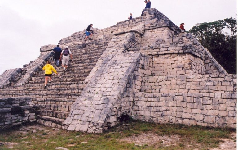
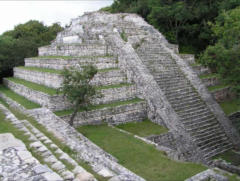
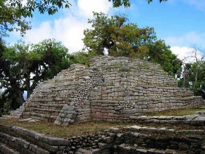
Tenam Puente occupies a mountain among limestone hills at about 1,600–1,700 metres above sea level, overlooking the Comitán plain toward the Montebello Lakes. Its core covers about 30 hectares and contains slightly more than 60 structures. Platforms and substantial retaining walls form five levels of open and enclosed plazas, with access becoming more restricted higher up. Limestone blocks were fitted without mortar or lime. Stucco survives on some walls, floors, and stairways, and some floors are paved with stone slabs. A number of buildings have stone ramps that function as supports.
Settlement groups
The Acropolis
The northern group, known as the Acropolis, contains most of the settlement’s principal buildings. Structures 4 and 7 occupy its highest point. Long terraces level the slopes and diminish in height and extent toward the summit; the upper terraces rise to 20 metres and include stepped sections. Buildings are arranged around courts and plazas.
The southern group
A separate group to the south contains temples and residences associated with the upper classes. They are arranged around enclosed and small plazas, shrines, and courts. Some platforms carry spacious rooms. Remains of the settlement also extend beyond these groups, although agricultural activity has substantially altered them.
Ballcourts
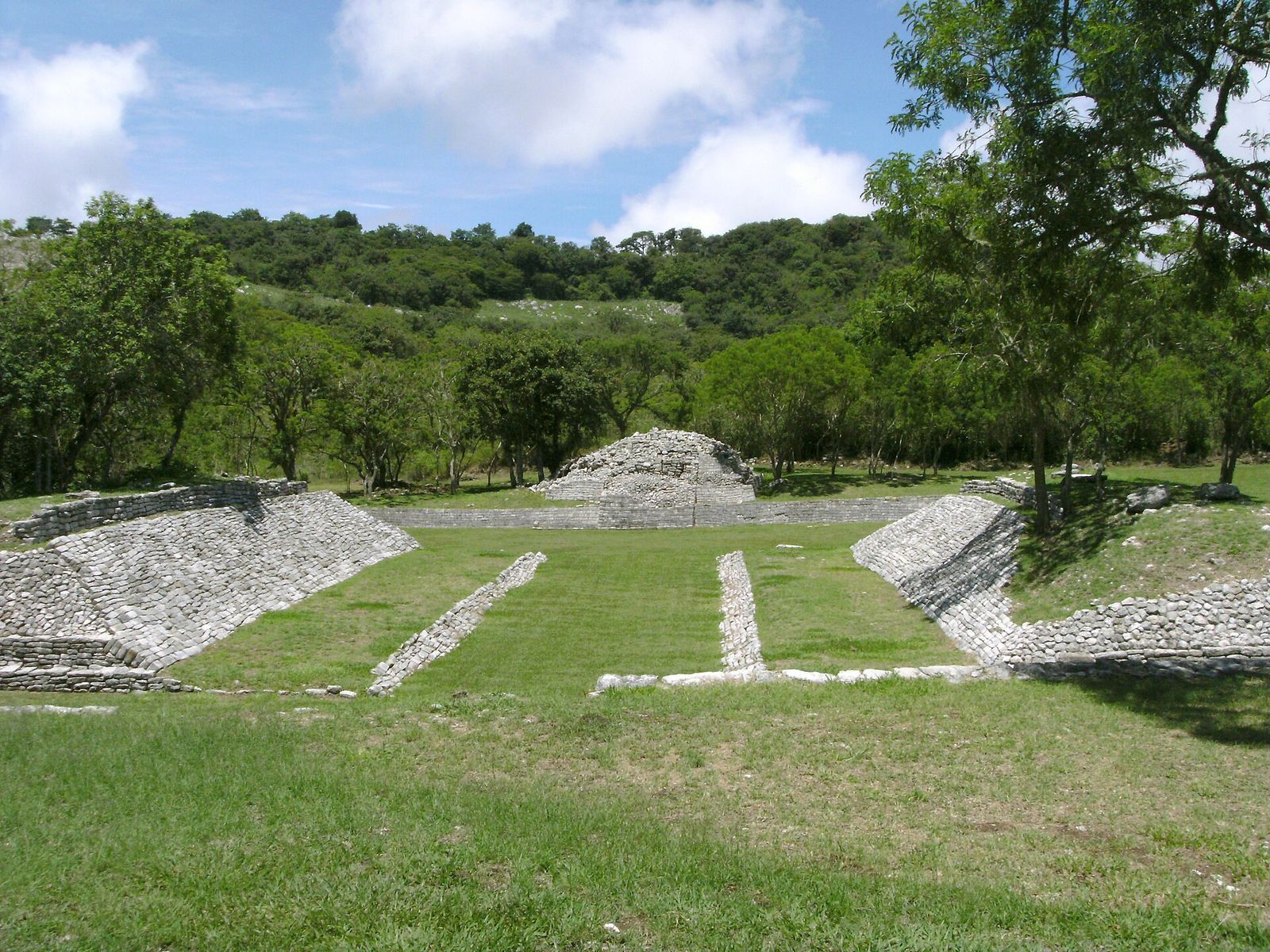
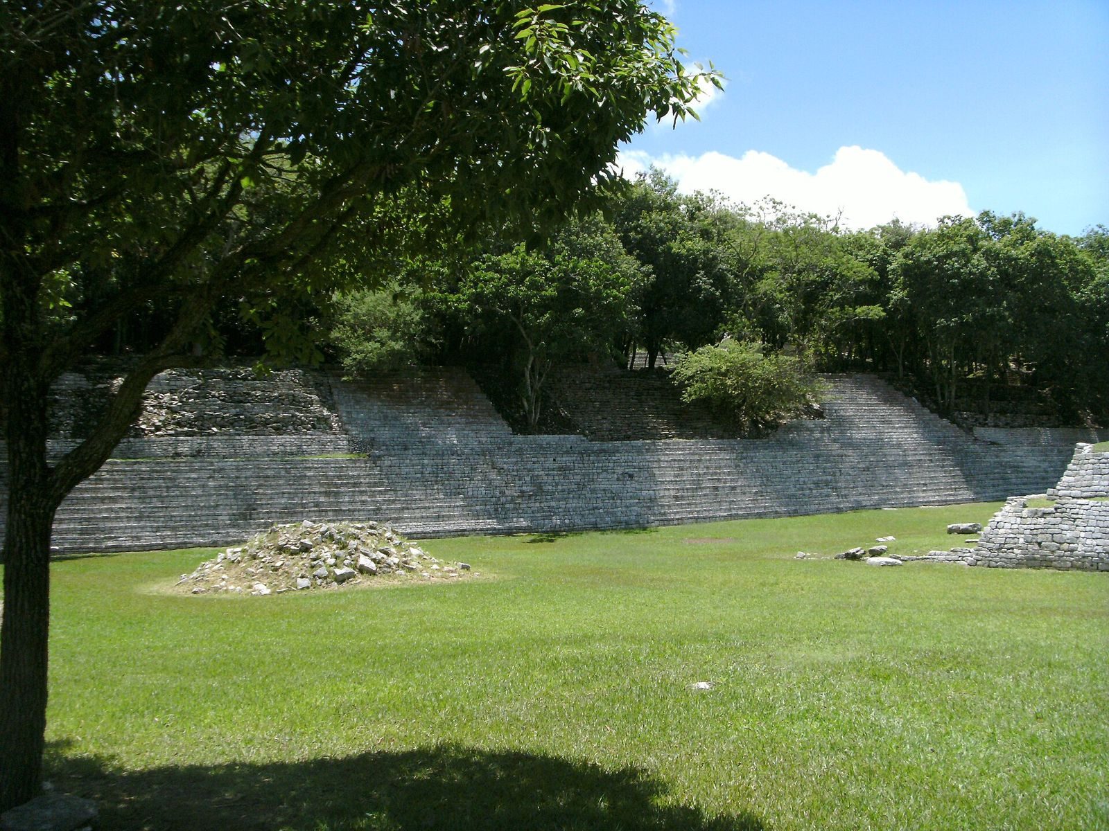
The Acropolis contains three ballcourts, built spaces for the Mesoamerican ballgame. They occupy different levels, with Court 1 serving as an approach to the precinct and Courts 2 and 3 positioned higher up. Their double-T plans have a central playing space and transverse end zones. The courts vary in size, orientation, and arrangement.
Court 1
The largest court stands before the first major platform, at the edge of a broad open plaza and almost opposite the sole access to the higher levels of the Acropolis. It measures about 50 metres long and averages 29 metres across its end areas. Its orientation is 28 degrees east of north, nearly perpendicular to the other buildings. The sunken playing area has low side benches and flanking structures topped by projecting stone edges. Stairs descend from the plaza at both ends, with the southern end slightly larger.
A southern annex at plaza level has stairs leading down into the court and sits out of alignment with the central playing area. The court was built from partly shaped stones and cut blocks. Partly shaped stones appear in the side structures and early parts of the annex, while cut blocks were also used in stairways and small additions beside the side structures. Cut stone predominates in the annex. At the court’s north end, a roughly carved, semi-rectangular block resembles a plain stela, an upright stone monument; its intended position is uncertain. A similar block lies in the plaza west of the court. Behind the annex, low attached walls, traces of stone-slab flooring, and a channel may represent the foundations of a steam bath.
Court 2
Court 2 is a closed, slightly sunken court about 40 metres long and 25–27 metres across its ends, oriented 50 degrees west of north. Its broad central playing space is flanked by walls forming side structures with very low projecting upper edges. At the southeastern end, an annex is set asymmetrically to the playing area. Two low platforms stand above the opposite terminal structure. One platform contained internal additions and numerous small, flat stones on its surface. Traces of channels survive in poor condition in the stucco floor. One circular marker was recovered at the southeastern corner of the court’s southeastern end.
Court 3
Court 3 adjoins Court 2, parallel to it on the next level. It measures 33 metres long and 18–20 metres across its ends, and is oriented 60 degrees west of north. Its narrow playing space has benches and flanking structures. A small, low platform stands above the eastern end. A later low wall closed part of that end, damaging a corner of its stairway and covering the first steps. Further low walls made from stone slabs formed small rooms with stucco floors nearby, and two small drainage channels were added. Two plain circular markers, each about 45 centimetres across, were found in place at the ends of the playing surface. A plain rectangular block stands before the western stairs. Similar regional blocks have been identified as plain stelae. Sculptures are also associated with Court 3 and Plaza B immediately to its north.
Access and symbolic alignments
Architectural barriers and sculptures of captives at Courts 2 and 3 suggest more restricted access than at Court 1. One interpretation holds that the upper courts represented warfare and offered a way to settle conflicts among Maya cities, or between Maya communities and their neighbours. A symbolic alignment links the highest part of the sacred precinct with the main Acropolis entrance and Court 1. It runs from Structure 17, east of Plaza B, through Structures 21 and 20 to Structure 37, then follows the entrance and descends toward Court 1. The alignment has been associated with the sun’s daily course. At sunset, the sun appears to descend through the court toward the underworld, a realm connected in Maya religious thought with the dead and supernatural forces.
Burials and stone monuments
Burial offerings
Burials contained vessels, jade objects, shell ornaments, and stingray spines. The assemblages indicate that prominent individuals received numerous offerings.
Stela
A stela from the site bears a date of AD 790 and is now held at the Archaeological Museum of Tuxtla Gutiérrez.