Chinkultic: A Maya City and Ceremonial Center in Chiapas, Mexico
Site at a Glance
- Rating
- 4.7
- Popularity
- Low
- Country
- Mexico
- Primary era
- Medieval
- External website
- Open
- Eras represented
- Classical, Medieval
- Civilizations
- Maya
- Site type
- City
On this page16 sections
History
Chinkultic is a pre-Columbian Maya archaeological site in Chiapas, Mexico, within Lagunas de Montebello National Park. First occupied around 50 BC, it developed into a city by the early fourth century AD, with its principal political and architectural growth taking place during the Late Classic period, approximately AD 600 to 900.
From Early Settlement to Maya Kingdom
Chinkultic remained occupied from the Late Preclassic or Protoclassic period through the Classic and Early Postclassic periods. During its florescence, it appears to have been the center of a small independent kingdom and became a regional power. The name of that kingdom and the history of its ruling dynasty remain unknown because the site’s emblem glyph has not been identified.
The surrounding water system supported both everyday life and religious practice. Local merchants are associated with trade in animal skins, indigo, amber, vanilla, and trogon feathers. Toward the end of the Classic period, the city experienced a temporary decline, followed by a gradual recovery during the Early Postclassic. Occupation continued until about AD 1200, and the city was probably abandoned permanently around AD 1250.
Inscriptions, Ritual, and Political Authority
Ceramics and hieroglyphic monuments help establish Chinkultic’s chronology. Sculptures and inscriptions are especially numerous from the last three centuries of the Classic period, with texts dated from AD 591 to 897. One stela bears a date of AD 810, possibly the earliest known Classic-period date in the region. Earlier stela fragments, dating from approximately 50 BC to AD 350, have designs associated with the Izapan style. Other architectural and material features reflect contacts with regional traditions and with the Maya Lowlands.
The cenote and lakes around Chinkultic supplied water and formed the focus of offerings and other religious practices. The Agua Azul cenote produced human bones and evidence interpreted as human sacrifice, together with broken pottery, copal, greenstone beads, axes, and obsidian blades. Offerings from the Acropolis included ceramic vessels, shell plaques, bird bones, obsidian blades, grinding stones, and figurines. Objects were thrown into the cenote from the edge of the Acropolis or placed in underwater niches. Chac, the Maya rain deity associated with rainfall, storms, and agricultural fertility, appears most frequently among the recovered religious representations.
Solar worship is reflected in urn and censer fragments with solar imagery, funerary urns showing figures with solar attributes, and stela scenes combining solar and underworld symbolism. The Mesoamerican ballgame, a formal athletic and religious practice linked to rulership, sacrifice, conflict, and cosmic order, also held deep religious importance at Chinkultic. The possible sacrifice of one or more players, perhaps the losers, remains uncertain.
Rediscovery and Archaeological Work
Eduardo Seler published the first account of Chinkultic after visiting the site in the late nineteenth century. In the 1920s, Frans Blom and Oliver LaFarge reached the ballcourt and found Stela 8, while Enrique Juan Palacios produced a detailed description in 1926. Morley and Thompson found Stela 10 during a 1944 visit, and Gareth W. Love, director of excavations for the New World Archaeological Foundation, visited the ruins in 1958.
The first archaeological investigations took place in 1966 under Stephan F. de Borhegyi of the Public Museum of Milwaukee. Guillermo Bonfil, director of Mexico’s National Institute of Anthropology and History, explored the site in 1969. From 1970, Mexican government archaeologists excavated and consolidated several buildings, including structures in the Acropolis, and partially explored the Agua Azul cenote. Chinkultic is administered by the National Institute of Anthropology and History and lies within the protected area of Lagunas de Montebello National Park.
Remains
Chinkultic occupies limestone hills overlooking a lake district and the broad Comitán plains, at an elevation of approximately 1,450 to 1,500 metres above sea level. Its builders adapted the city to the terrain with terraces, leveled areas, stone fill, retaining walls, and ceremonial centers attached to hillsides. About 200 large and small mounds and approximately 300 buildings are arranged around six principal groups, including Groups A, B, C, and D, the Acropolis, the Great Platform, and several plazas.
Water System and Group A
Three natural water deposits help organize the site. The Agua Azul cenote lies north of the central groups, Lake Chanujabab lies to the northeast, and Lake Tepancuapan lies to the northwest. The Yubnaranjo stream separates Group A from the other groups and connects Chanujabab with Tepancuapan. Low open spaces, elevated platforms, and hilltop settings formed a varied settlement pattern, while small residential clusters occupied lower areas around the principal architectural groups.
Group A, also called El Mirador, occupies the highest and northwestern part of Chinkultic. Its position provides views toward both Chanujabab and Tepancuapan and across much of the archaeological complex. The group has three nuclei. The eastern nucleus includes a stepped pyramidal platform, the central nucleus has three basal platforms, and the third is the hilltop Acropolis, reached by a large stairway. The Acropolis buildings and this stairway belong to two distinct construction phases.
Acropolis Structure 1
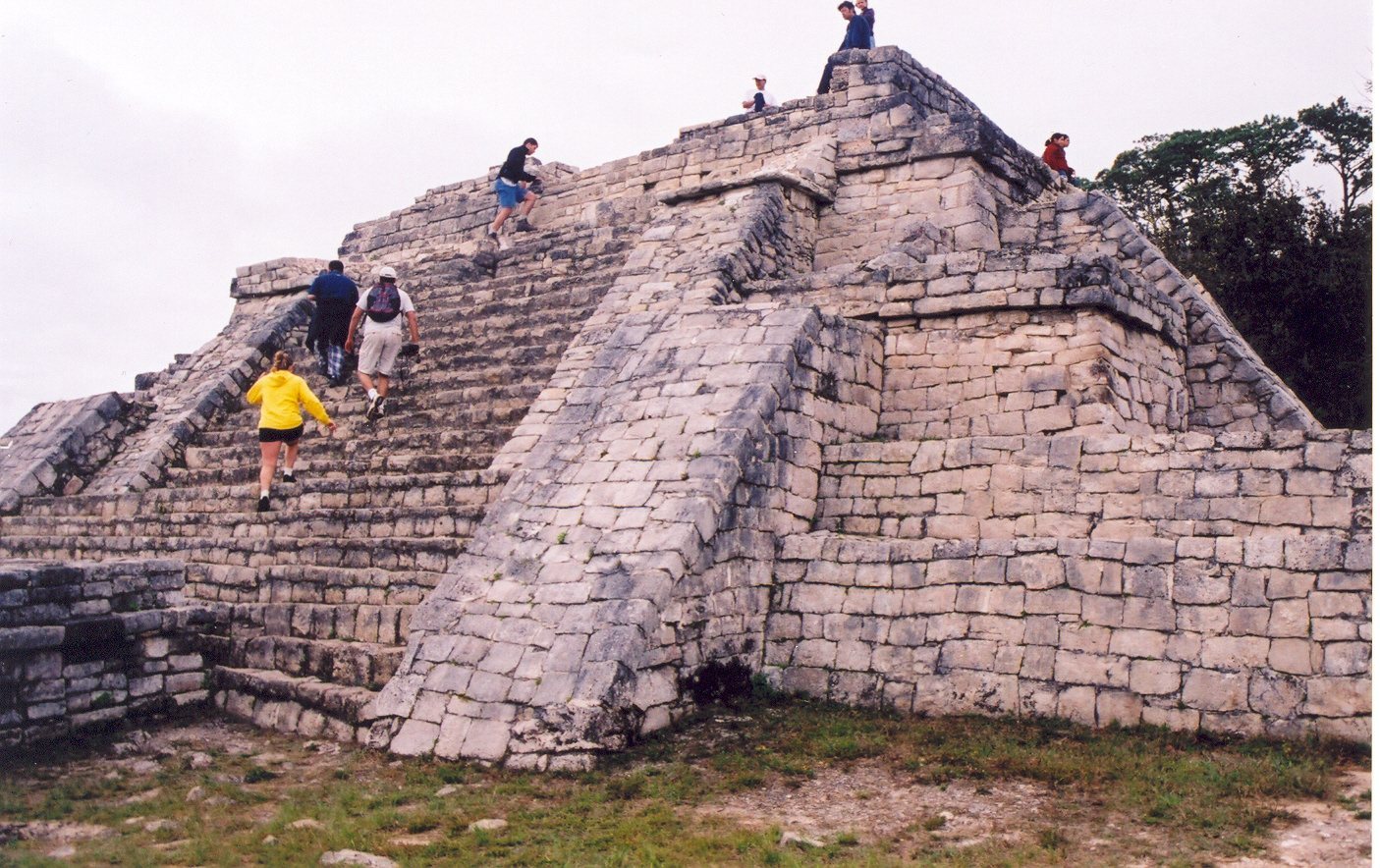
Structure 1 is the principal pyramidal platform of the Acropolis. Five superimposed stepped bodies rise with sloping walls, while the three upper bodies have broad cornices. A central stairway with balustrades ascends the southeast facade, and an attached altar covers part of the lower steps. The summit preserves a temple with two rectangular rooms and a tomb with a circular-plan vaulted roof. Three smaller shrines with southern stairways stand in front of the structure.
Agua Azul Cenote Platforms
A platform of at least two bodies stands east of the Acropolis along the upper edge of the Agua Azul cenote, approximately 50 metres below and beside the ceremonial center. Two plazas occupy terraces formed from piled stones at the cenote edge. Four altars are distributed between the lower plaza and the smaller upper plaza. This area provided the point from which offerings were cast into the water, while other offerings were deposited in underwater niches.
Group B and the Great Plaza
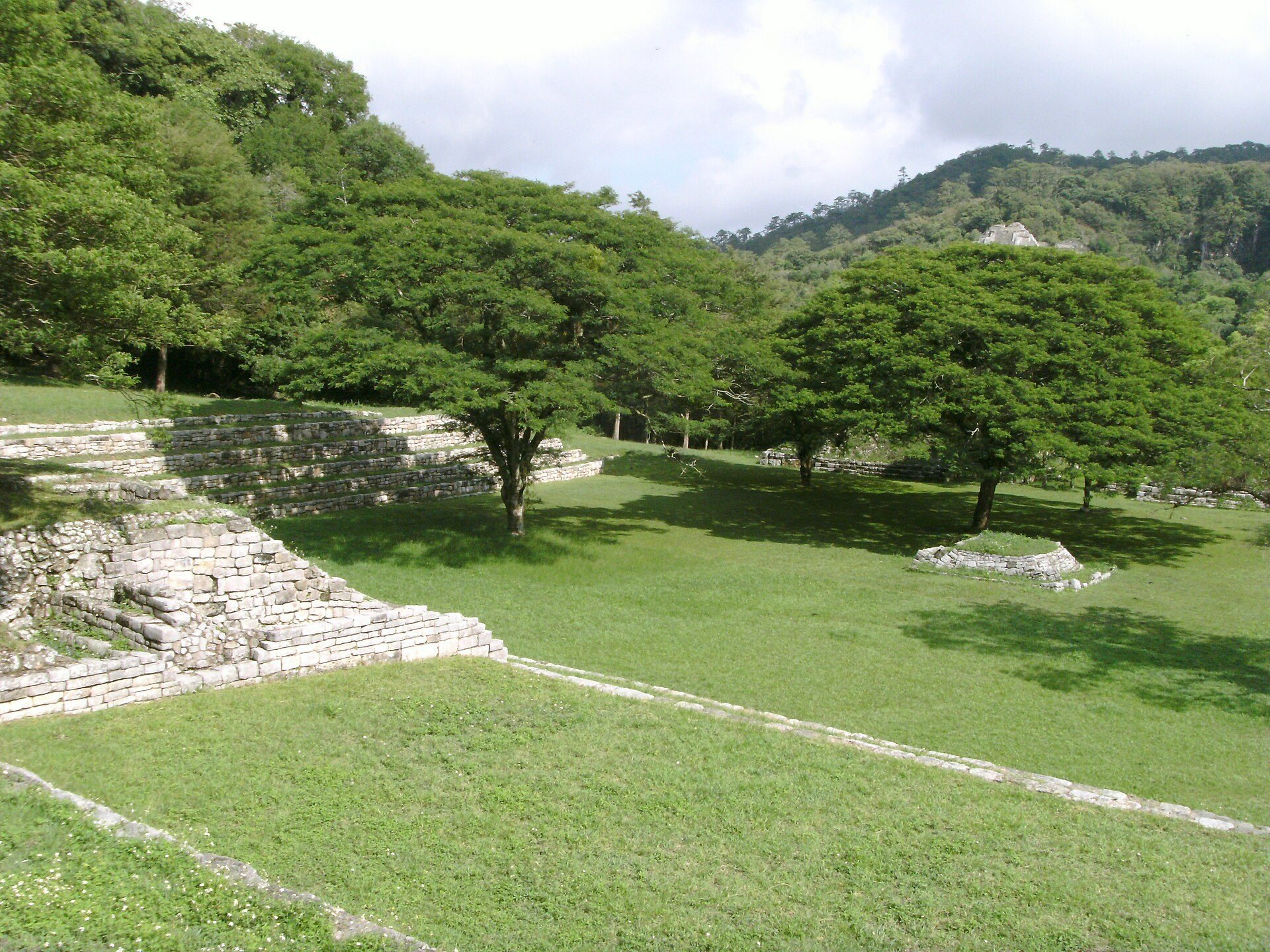
Group B occupies a low hill in the central part of the site. Its principal feature is the Great Plaza, also known as the Sunken Plaza, which measures approximately 58 metres from north to south and 54.22 metres from east to west. Stepped seating encloses three sides, creating an amphitheater-like arrangement, while a rectangular platform or quadrangle occupies the eastern end. Terraces and low platforms modified the hilltop, and the plaza may have served as a performance space.
Structure 17
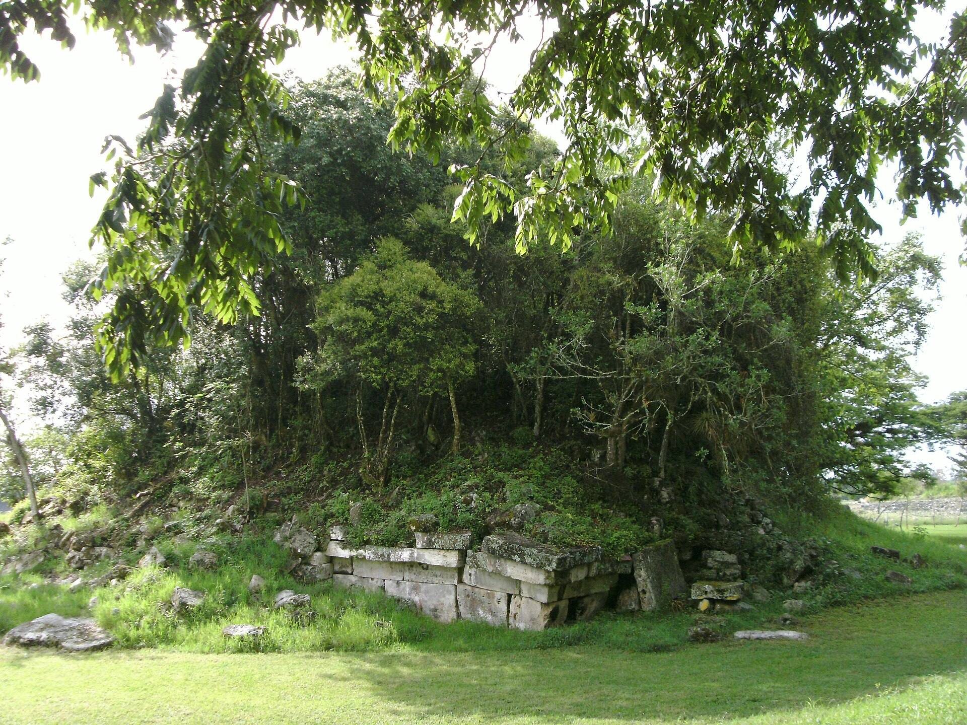
Structure 17 stands at the center of the Great Plaza. The platform measures approximately 5.50 metres square and rises about 1 metre, making it visible from throughout the plaza. It was enlarged at least twice and may originally have consisted of five stepped bodies.
Seating Terraces
Structures 16, 16A, and 16B form three irregular seating terraces built in sections. Their steps vary in size, possibly reflecting differences in the social rank of spectators or in the activities held during public ceremonies and performances. The southern side reaches a maximum height of 5.10 metres, and the structures measure approximately 51 metres, 52.30 metres, and 45 metres in length. Structures 13, 14, and 15 enclose the northern side of the plaza. Their stepped platforms average about 6.50 metres in height and complete the horseshoe-shaped seating arrangement.
Structures 18 and 19
Structure 18 stands beside the quadrangle and has direct access to its interior, indicating an important role in ceremonial ballgame activities. Part of its body survives, with the facade collapsed inward into the plaza. Structure 19 is separated from it by a small plaza. Its final construction phase is severely damaged, but its plan measures approximately 18.80 metres in length by 12.86 metres along the sides. A small landing contains a central seat or throne, flanked by two cylindrical columns. The columns are about 0.37 metres in diameter and just over 12 centimetres high, stand 1.13 metres apart, and align with two small monolithic altars on lower levels.
Group C and the Ballcourt
Group C lies at the southern end of the site, where buildings use the slopes of a hill modified with terraces and platforms. The group is especially known for relief-carved stelae showing richly dressed figures accompanied by hieroglyphic inscriptions. Most of these monuments stand in the eastern part of the group and date to the Late Classic.
Ballcourt
The ballcourt lies west of Group C against a terraced, stone-faced hillside. It is a closed court formed by two T-shaped areas joined at their bases, with the northern end wider than the southern end. Sloping and vertical walls define the court, while markers were placed on the playing surface and sometimes on the inner slopes. A small plaza, platforms, tribunes, balustrades, and stela bases complete the complex.
Modeled stucco, carefully dressed exterior facing stones, and later architectural elements combining a coffin-like form with a thick molding survive in the ballcourt. The Chinkultic Disk was found here. This limestone bas-relief measures approximately 56 centimetres in diameter and 13 centimetres thick. Probably used as a ballgame marker, it shows a player striking the ball with his hip while wearing a thick belt, leg, forearm, and knee protection, together with an animal hide extending from the hips to the ground. An inscription around the disk gives 21 May AD 591 as the date of the court’s inauguration and the disk’s installation. The disk is now held by the National Museum of Anthropology in Mexico City.
Great Platform
The Great Platform stands on the summit of the Group C hill and is surrounded by buildings. Its stonework is notable for the precision of its cutting. A group of stelae stood beside it, with many of the monuments associated with solar and water worship.
Group D and Monumental Sculpture
Group D lies southeast of Group B on the southern slope. Its visible remains include terraces, platforms, and a large pyramidal base. Structure 20, known as the Platform of the Slabs, is built from exceptionally large rectangular blocks measuring approximately 1.60 to 2.26 metres long and 0.38 to 0.47 metres wide.
Chinkultic’s stelae combine political imagery with ritual and military themes. Monuments 4 and 8 glorify the royal dynasty through accompanying hieroglyphic texts, while Monuments 3, 7, and 18 depict scenes of submission or subordination. Other stelae present rulers as warriors and express political authority through hierarchies between rulers and subordinate figures. Stela 3 shows two secondary figures, one possibly a hunchback, burning a skull at the feet of a dignitary. The monuments also include imagery connected with warfare, solar and water cults, and ritual acts.
Stela 8 is the largest stela at Chinkultic, measuring approximately 3.81 metres long, 0.81 metres wide, and 0.28 metres thick. It was found in the ballcourt area during the investigations of the 1920s. Together with the other carved monuments, it forms part of an inscriptional tradition dated from AD 591 to 897, while earlier fragments extend the site’s monumental history back to approximately 50 BC.