Floriana Lines: Malta’s Outer Fortifications of Valletta
Site at a Glance
- Popularity
- Medium
- Country
- Malta
- Primary era
- Early Modern
- Eras represented
- Early Modern, Modern
- Civilizations
- British, Crusader, Knights Hospitaller
- Site type
- Military
- Remains
- Wall
On this page17 sections
History
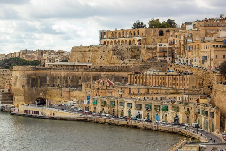
The Floriana Lines are limestone fortifications at Floriana, Malta, built by the Order of Saint John, a religious and military order that governed the island, as an outer defense for Valletta. Construction began in 1636, and the lines remained in military use from 1640 into the twentieth century. They are regarded as among Malta’s most complex and elaborate Hospitaller fortifications.
Proposal and construction
Valletta, founded by Grand Master Jean de Valette on 28 March 1566, occupied part of the Sciberras Peninsula between Grand Harbour and Marsamxett Harbour. Its landward defenses included four bastions, two raised defensive platforms, and a deep ditch. By the early seventeenth century, advances in artillery had weakened their ability to withstand a major assault.
Fears of an Ottoman attack in 1634 led Grand Master Antoine de Paule to seek Pope Urban VIII’s help in strengthening Malta’s defenses. The pope sent the Italian military engineer Pietro Paolo Floriani to inspect them. In 1635 Floriani proposed a second defensive line around Valletta’s landward front, the side facing an approach over land.
Some members of the Order and military engineers opposed the proposal, warning that the garrison needed for the new defenses would be too costly. De Paule approved the plan, believing it improper to reject the pope’s engineer’s recommendation. Bailiff Gattinara, a senior Order official, resigned from the Commission of Fortifications in protest. Work began in 1636, but the dispute was so contentious that the foundation stone was laid without a ceremony.
Construction costs prompted the next Grand Master, Giovanni Paolo Lascaris, to impose a tax on immovable property, creating a dispute between the Order and the clergy. Some priests urged people to join a national protest, but the plan became known to the authorities and its leaders were arrested. The fortifications took their name from their designer. By June 1640 they were considered partly defensible, although work remained unfinished.
Seventeenth- and eighteenth-century changes
The Ottoman capture of Candia, the Venetian name for Heraklion on Crete, in 1669 renewed fears of an attack on Malta. Grand Master Nicolas Cotoner brought in military engineer Antonio Maurizio Valperga to strengthen the incomplete defenses. He identified the sharp angles of the demi-bastions at the ends of the landward front as weaknesses, altered San Salvatore Bastion, and added a lower defensive wall along the front and an advanced fortification near its eastern end. The Flemish engineer Carlos de Grunenbergh made further, smaller changes in the 1680s.
Valperga’s work advanced slowly. In the early eighteenth century, the outer works, sloping earthworks, and defenses facing Marsamxett Harbour remained unfinished. Construction continued under other engineers, including Charles François de Mondion, and a further defensive line was added behind the Marsamxett circuit in the 1730s.
Floriana was founded in 1724 between the new lines and Valletta’s landward defenses. It was named Borgo Vilhena for Grand Master António Manoel de Vilhena, although Floriana became its common name. The settlement later became a town in its own right.
French and British military use
French forces invaded Malta in June 1798, and the Order surrendered within days. By September the French controlled the island. After a Maltese revolt, foreign assistance helped blockade French forces in the harbour area. The French continued to hold the Floriana Lines during the blockade, while Maltese forces built batteries at Tas-Samra and Corradino to bombard the defenses.
After the British took control of Malta in 1800, the lines continued in military use and underwent further changes. Sections of the covered way and sloping earthworks were demolished in the 1970s to make room for large storage tanks. The fortifications entered Malta’s Antiquities List in 1925 and are included in the National Inventory of the Cultural Property of the Maltese Islands. Since 1998, they have also been on UNESCO’s Tentative List as part of the Knights’ Fortifications around the Harbours of Malta.
Remains
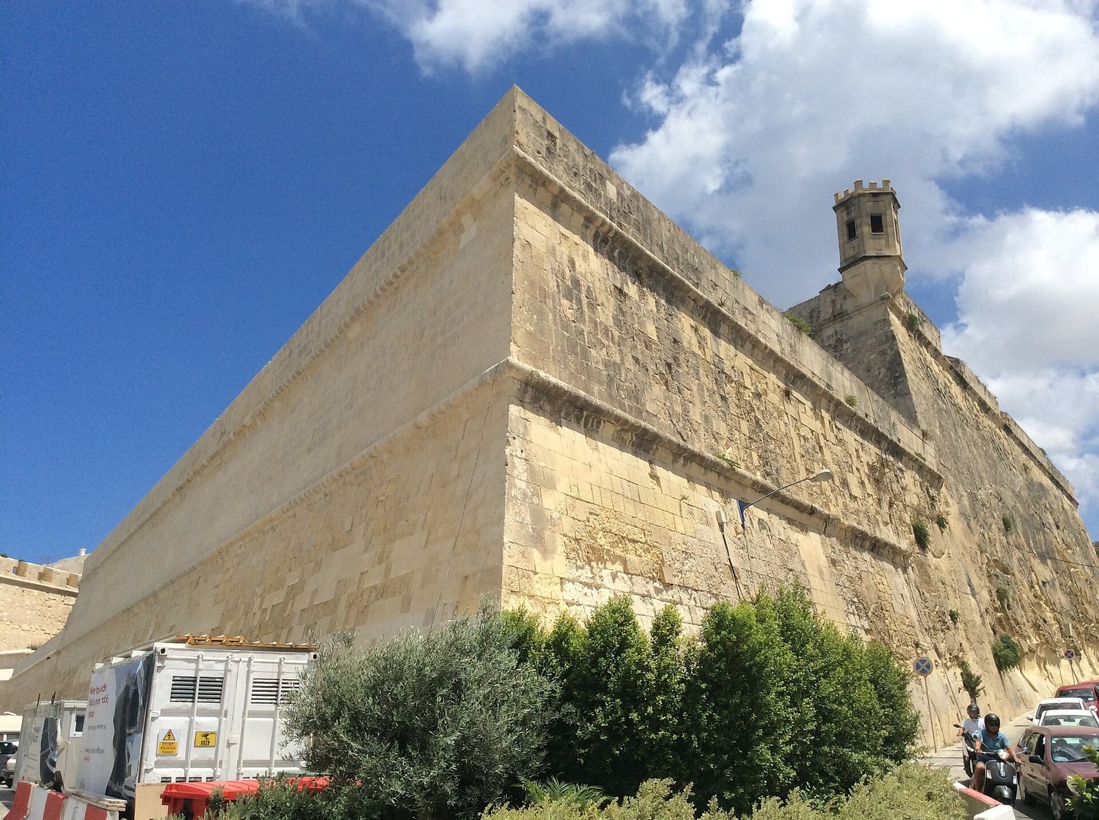
The Floriana Lines are an extensive limestone system around Valletta’s defenses. Its main components are the landward front, circuits facing Marsamxett and Grand Harbour, and associated outer works. The landward circuit’s bastions, projecting defensive works, are arranged around a ditch, while the two harbour-facing circuits extend from its ends.
Land Front
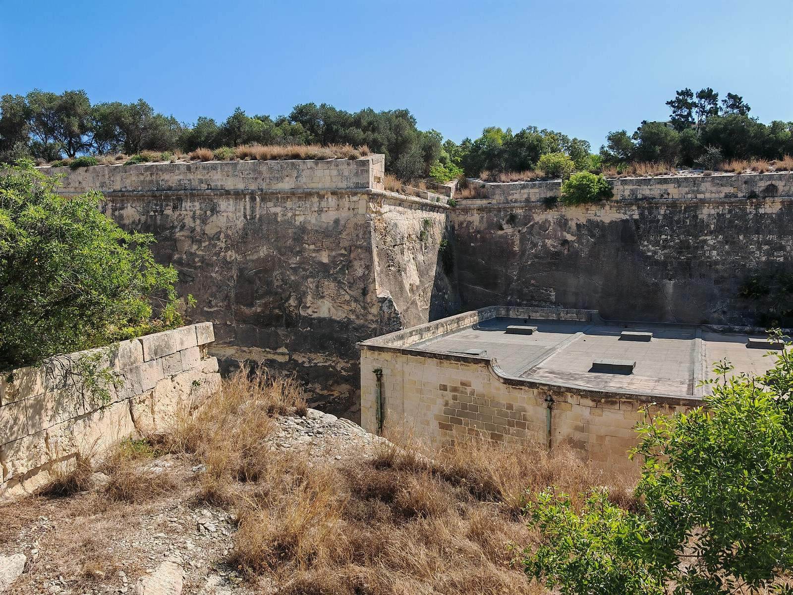
The Land Front is the large bastioned circuit defending Floriana’s landward approach. A ditch surrounds its principal works, with further defenses set beyond the main rampart.
Main rampart
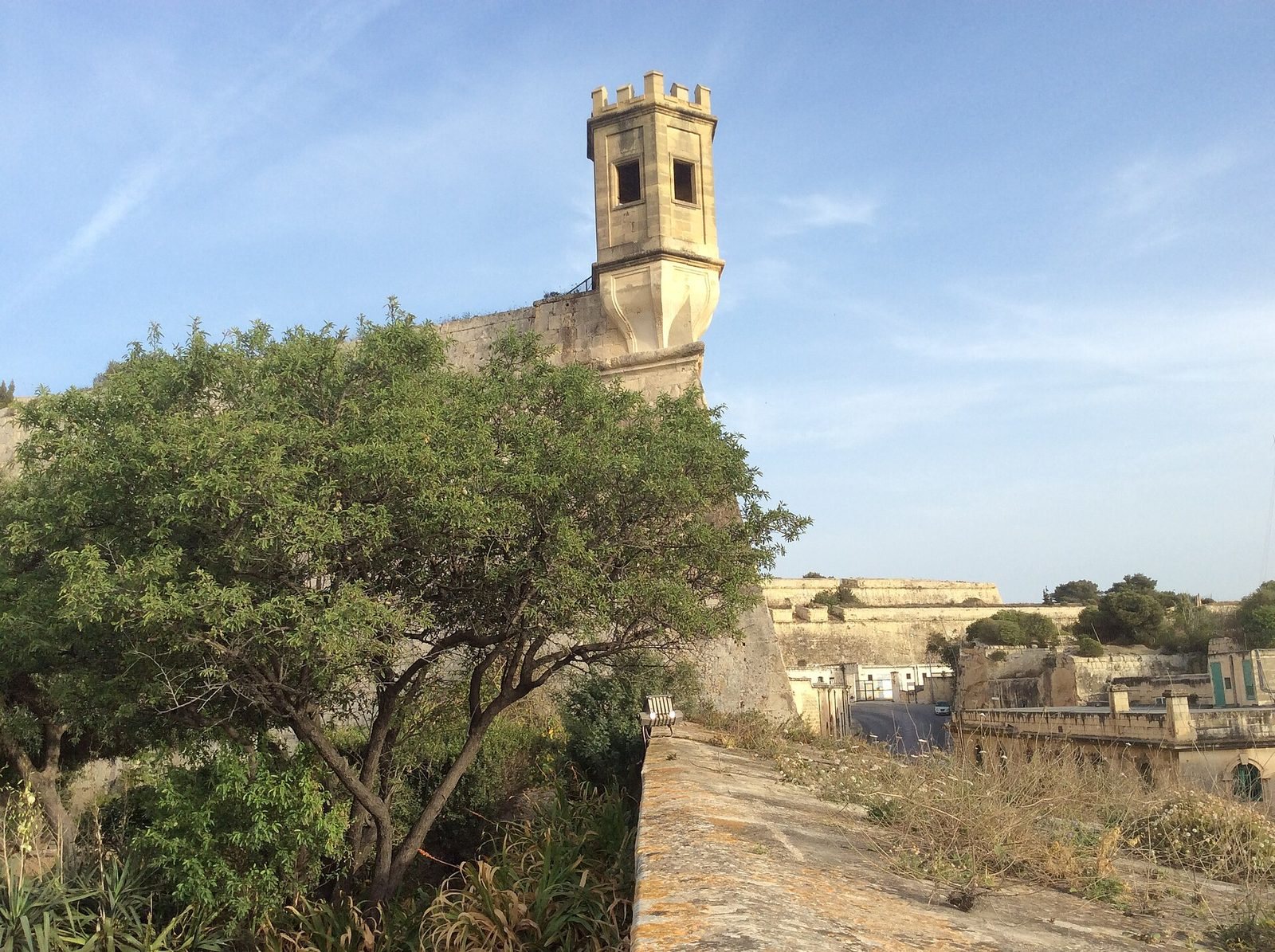
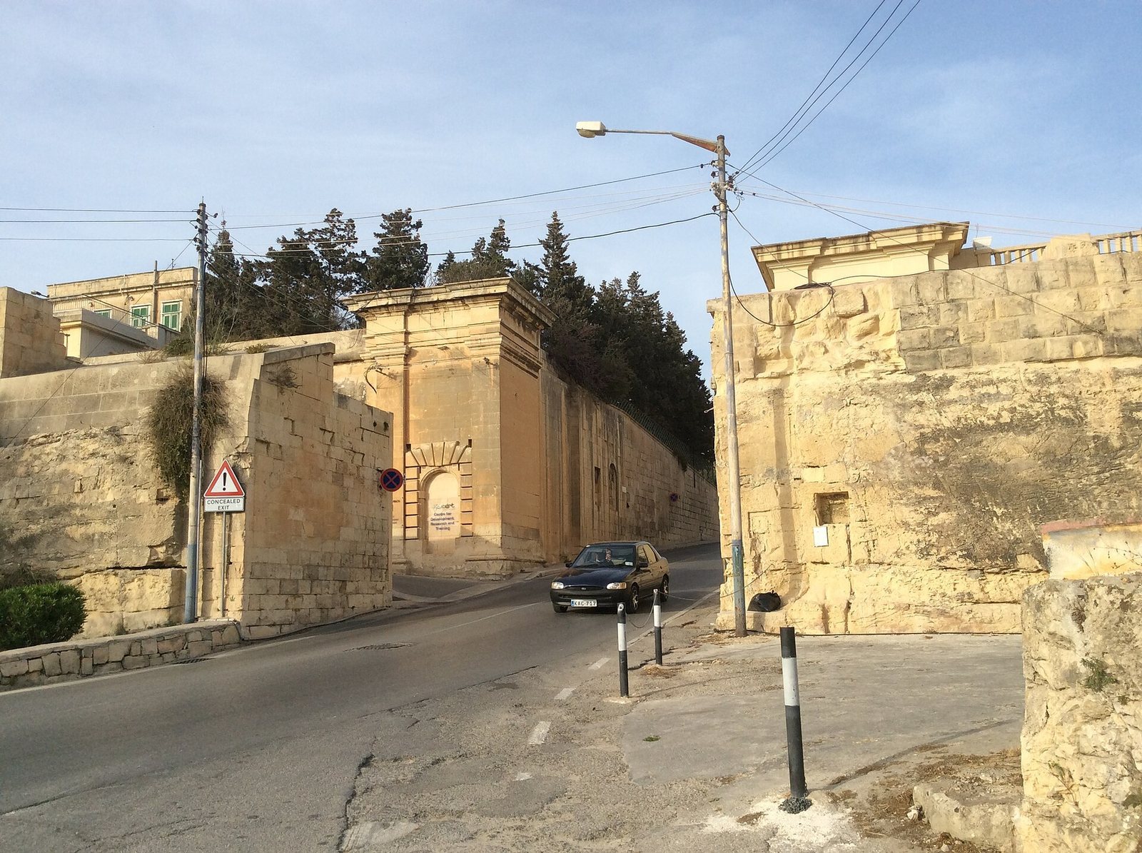
At the western end stands the Bastion of Provence, also known as San Salvatore or Sa Maison Bastion. It is a demi-bastion, with one full face and one flank, set behind an additional defensive work, and was substantially altered during the seventeenth and eighteenth centuries. Notre Dame Curtain, the wall connecting defensive works, links it to St. Philip Bastion. Notre Dame Gate, built into the curtain, was partly demolished in the 1920s to make room for traffic.
St. Philip Bastion occupies the center of the Land Front and has a wide, obtuse angle. Additional defenses stand behind it at St. James and St. Luke Bastions. St. Anne Curtain connects St. Philip to St. Francis Bastion. Its gate was replaced by a larger one in 1859, and that replacement was demolished in 1897 to improve traffic flow. St. Francis is a large demi-bastion, joined to Polverista Bastion in the Grand Harbour circuit and backed by St. Mark Bastion.
Outworks in the ditch
San Salvatore Counterguard, a forward work protecting a main defense, lies near San Salvatore Bastion. Pietà Lunette, a pentagonal detached outwork, stands between that bastion and Notre Dame Ravelin, facing Pietà Creek. It was damaged by aerial bombing during the Second World War. The pentagonal Notre Dame Ravelin, also called the Lower Ravelin, lies near Notre Dame Curtain between San Salvatore and St. Philip Bastions; government buildings occupy its open interior. A second pentagonal lunette between the ravelin and St. Philip Bastion was also damaged by wartime bombing, then repaired.
Porte des Bombes Lunette once stood between St. Philip Bastion and St. Francis Ravelin. It was demolished in the early twentieth century to make way for the modern road to Valletta. St. Francis Ravelin, or the Upper Ravelin, is a pentagonal outwork near St. Anne Curtain, between St. Philip and St. Francis Bastions. Its open interior contains offices of the Malta Environment and Planning Authority.
Outer defenses
A lower defensive wall, an advanced ditch, a protected passage along the ditch, and a sloping earthwork surround the Land Front’s outer works. Porte des Bombes was first built into the lower wall in the 1720s as the Gate of the Cannons. The British enlarged it, and it was later separated from the wall to improve traffic flow. It now has the form of a triumphal arch.
Near St. Francis Ravelin is a crowned hornwork, an advanced defense combining two demi-bastions with a larger outer work. Its inner hornwork has two demi-bastions; the outer crownwork has one full bastion flanked by two demi-bastions. The defenses also included a musketry gallery overlooking Marsa and two lunettes, one near the crownwork’s landward front and the other near its flank.
Marsamxett circuit
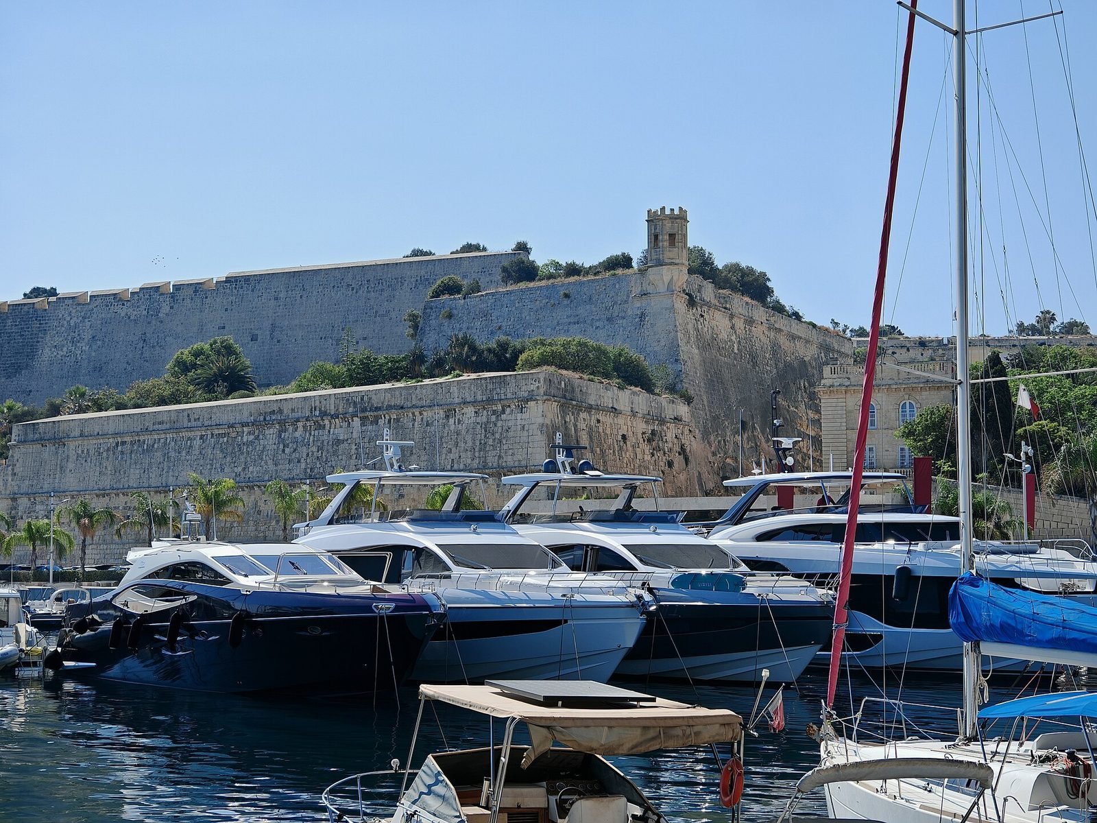
The Marsamxett defensive circuit begins at San Salvatore Bastion. It originally extended to St. Michael’s Counterguard in Valletta’s Land Front, and a second defensive line runs behind its full length.
La Vittoria and Polverista
La Vittoria Bastion is a small enclosed, vaulted defensive work attached to the Bastion of Provence. Polverista Curtain, a long enclosed wall, connects La Vittoria and Msida Bastions and overlooks the Armed Forces of Malta base at Hay Wharf.
Msida and Quarantine Bastions
Msida Bastion has an asymmetrical polygonal plan and an additional defensive work behind its main wall. A cemetery was established on its upper part in the nineteenth century; the area is now Msida Bastion Historic Garden. An unnamed curtain links Msida Bastion to Quarantine Bastion, another asymmetrical polygonal work with a defensive retrenchment. A modern road cuts through Quarantine Bastion.
North Entrenchment
The North Entrenchment is a bastioned defensive line behind the entire Marsamxett circuit. It provided a secondary line of defense.
Grand Harbour circuit
The Grand Harbour circuit runs from St. Francis Bastion to St. Peter and St. Paul Counterguard in Valletta’s Land Front. Its walls and bastions include later military installations.
Capuchin Bastion
Capuchin Bastion, also called Dhoccara, Magazine Bastion, or Polverista Bastion, is a demi-bastion connected to St. Francis Bastion. It contains a gunpowder magazine dating to the eighteenth century. A curtain wall links it to a flat-faced platform or bastion near Crucifix Curtain.
Crucifix defenses
Crucifix Curtain connects the platform to Crucifix Bastion, a large asymmetrical work containing a nineteenth-century gunpowder magazine. A concrete position for a nine-inch breech-loading gun, loaded from the rear of its barrel, was also installed there but has since been removed. Kalkara Curtain connects Crucifix Bastion to Kalkara Bastion and is cut through by a modern road.
Kalkara Bastion
Kalkara Bastion is an extended bastioned defensive complex connected to St. Peter and St. Paul Counterguard in Valletta’s Land Front. The fortifications as a whole remain largely intact, although some sections are dilapidated and require restoration.