Kafirkala: A Fortified City in Tajikistan’s Vakhsh Valley
Site at a Glance
- Popularity
- Medium
- Country
- Tajikistan
- Primary era
- Medieval
- Eras represented
- Classical, Medieval
- Civilizations
- Kushan
- Site type
- Settlement
- Remains
- City
On this page27 sections
History
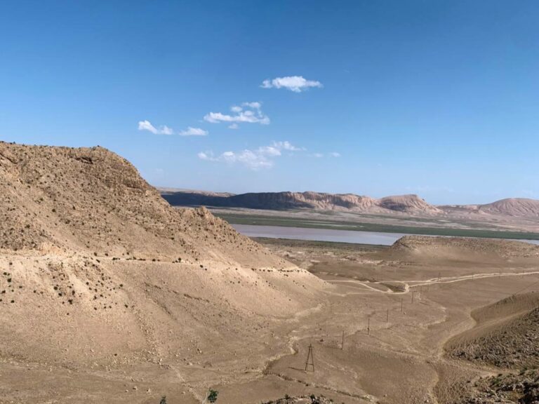
Kafirkala was a fortified city in the lower Vakhsh Valley of southern Central Asia, in present-day Tajikistan. It was the valley’s largest settlement and is identified as the capital of the small Vakhsh polity. The city lay in Bactria, an ancient Central Asian region, within the broader area later called Tokharistan. Its name is rendered as Fortress of the nonbelievers.
Kushan and Hephthalite periods
The earliest identified occupation belongs to the late Kushan period, around the third century. The Kushans were a Central Asian dynasty whose empire included Bactria and northern India, and their political sphere extended into the Vakhsh region until the third century. A route of the Silk Road passed through the valley from Khotan south to Balkh and onward toward Mesopotamia.
From the early fifth century until about 560, the Hephthalites, a power that dominated much of Central Asia, controlled the region. Turkic peoples took over former Hephthalite territory around 570. The small successor principalities, including Vakhsh, then faced pressure from both Turkic rulers and Sasanian Persia, whose ruling dynasty governed a major regional empire.
The Vakhsh capital and the Arab conquest
The Buddhist pilgrim Xuanzang, who travelled through Central Asia and India in the seventh century, described the principal city of the Vakhsh polity. Kafirkala is identified with that city, although Xuanzang’s stated perimeter for it appears implausibly large. He described the Vakhsh realm as about 200 kilometres long and 120 kilometres wide.
The Umayyads, the first major Islamic caliphate dynasty, began advancing north of the Amu Darya in the mid-seventh century. Their forces reached Sogdia in 654 and soon conquered the lower Vakhsh region. Kafirkala was destroyed during this conquest. Its latest principal occupation layer dates from the late seventh to the mid-eighth century, and parts of the site may have remained occupied into the ninth. Isolated pottery indicates human presence as late as the sixteenth or seventeenth century.
Three principal occupation layers distinguish the city’s sequence. The earliest, KF III, has sparse finds and late-Kushan material from around the third century. KF II dates from about the mid-sixth century to the first half of the seventh, while KF I belongs to the late seventh through the mid-eighth century. Kafirkala was probably known as Chelawerd in the early medieval period.
Later names, traditions, and investigation
A separate fortified city called Chelawerd, later known as Lagman, flourished about 12 kilometres northwest of Kafirkala in the tenth to twelfth centuries. It was a different settlement. The later city may have taken the name Chelawerd from Kafirkala, which had been the lower Vakhsh’s largest city before its destruction. A local tradition recorded in 1956 connected Kafirkala with the Iranian epic figures Zal and Rostam. It placed Zal’s daughter in the city and told that Zal was imprisoned in the citadel until Rostam freed him.
Regional surveys and investigations began in 1947 and continued at Kafirkala in 1954. Tamara Zeimal excavated part of the residential city in 1956–57 and identified its three occupation layers. Construction damage to the northern enclosure wall and citadel in 1965 exposed the citadel’s northeast tower, prompting wider excavation there in 1968. Boris Litvinsky directed further work, usually annually from 1969 to 1981, with breaks in 1972 and 1979. By 1975, two-thirds of the citadel had been excavated. In 2025, Kafirkala was included in the UNESCO World Heritage listing for the Cultural Heritage Sites of Ancient Khuttal.
Remains
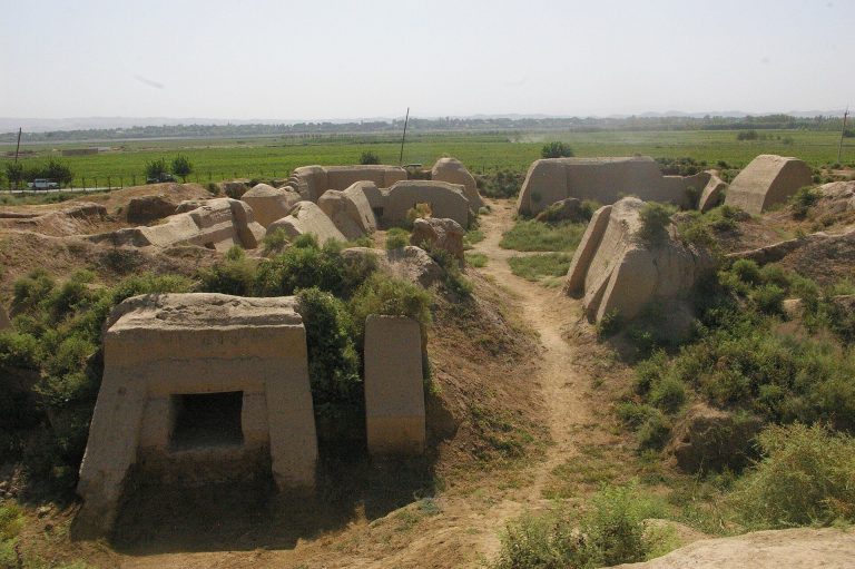
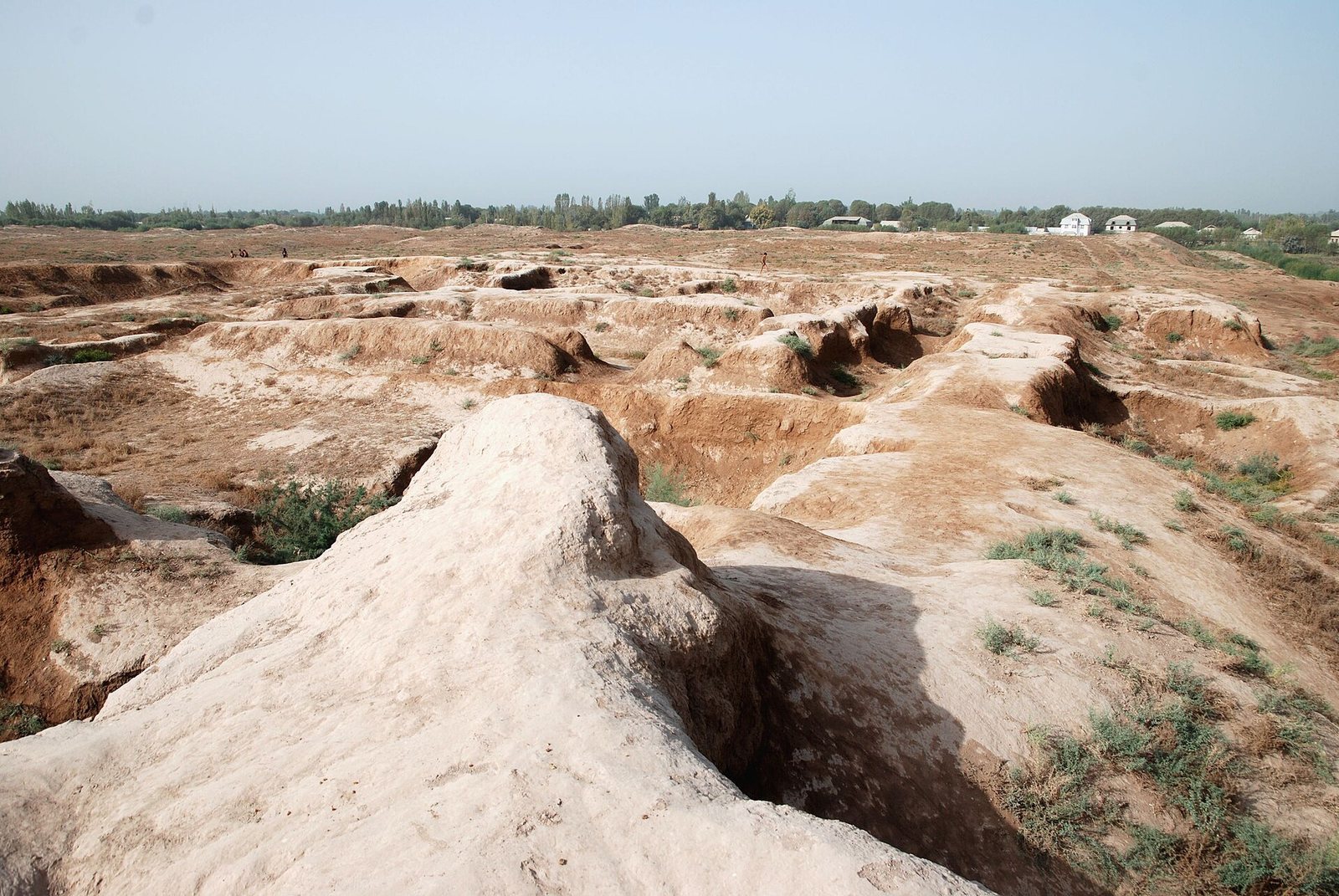
The site has three parts: a citadel, a walled residential city, and a suburb. The citadel and city were laid out together as a square aligned with the cardinal directions, measuring about 360 metres on each side, with the citadel at the northeast corner. The settlement’s main construction materials were compacted earth and mudbrick, and the remains preserve evidence of defensive works, streets, houses, and palace buildings.
Urban plan and defenses
Outer defenses
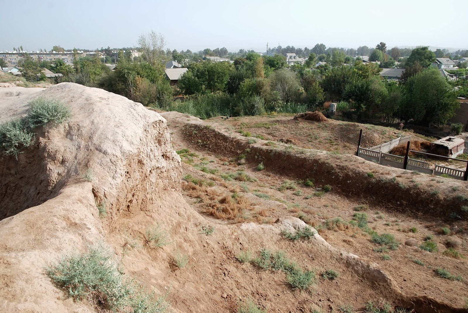
A broad ditch and enclosing rampart protected the city and citadel. The ancient ditch was about 50–60 metres wide and 5 metres deep, and could be flooded during an attack. Its enclosing rampart measured about 5–10 metres across. The settlement mound is now surrounded by a water-filled ditch, with a bridge on its eastern side.
Additional defensive walls stood between the ditch and the main walls. At the citadel, these forward walls ran just under 3 metres in front of the main wall and rested on earthen ramps. A surviving section is 1 metre thick and 3.8 metres high; ramps in this area measured 11–14 metres long and 4.5–6 metres high. Along the city wall, the forward defenses stood about 2 metres from the towers and 4.8 metres in front of the main wall, reaching about 2.5 metres in height. The narrow space between the walls may have been intended to trap attackers on foot, though the forward walls would not have resisted battering engines.
City walls and towers
Six towers reinforced each city wall, spaced about 50–60 metres apart. One excavated tower measured 10.7 by 3.2 metres at its base and included mock arrow slits. A spiral stair rose to a platform protected by an outer parapet. Slight rises in the rampart still indicate some tower positions.
Residential city and suburb
Street and residential districts
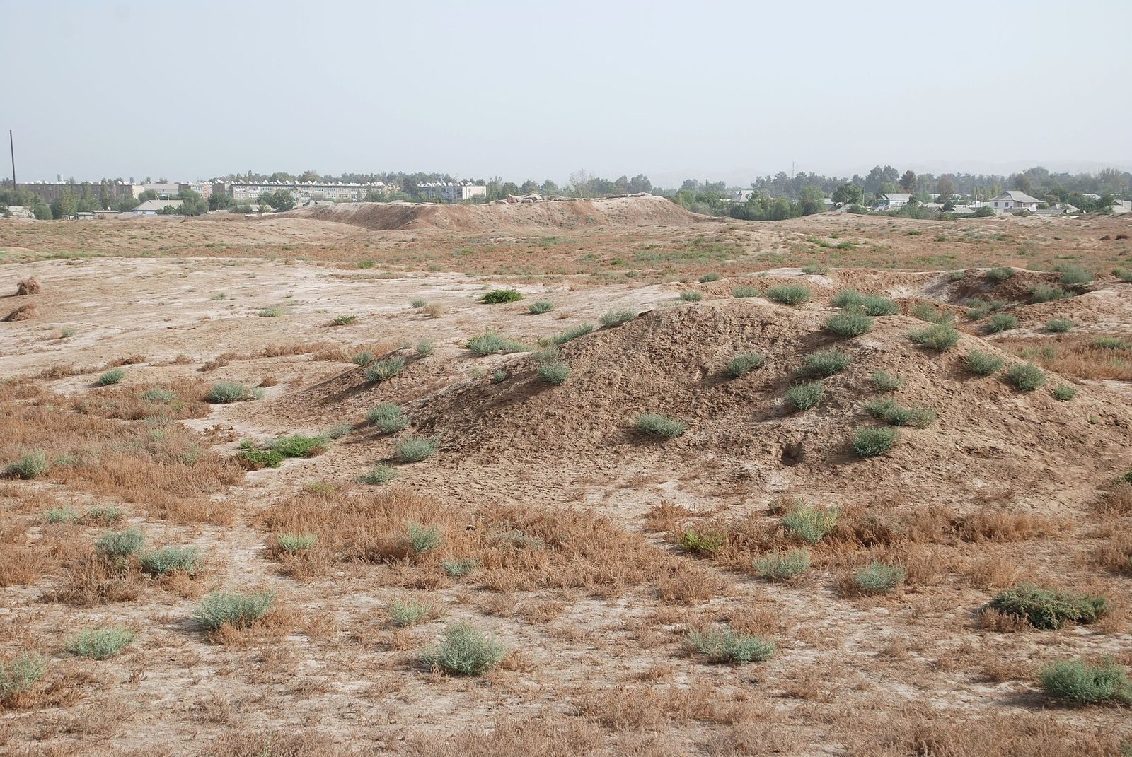
A straight street ran between gates in the eastern and western walls, dividing the residential area into roughly equal northern and southern parts. Smaller lanes led from it into housing areas. Settlement mounds cover about 12 hectares and rise as much as 8 metres above the plain. Another residential area lay inside the eastern wall, between the main street and the ditch separating the city from the citadel. The northern district was roughly rectangular, measuring 110 metres east to west, 70 metres along its western side, and 60 metres along its eastern side.
Houses and building materials
Residential walls rose directly from the ground and were built from compacted-earth blocks, generally about 1 metre wide, together with mudbrick. Most bricks measured 50–52 by 25–26 by 8–10 centimetres. Builders used fired bricks for some floors and for low wall-side benches. These raised benches were usually made of mudbrick, plastered, about 1–1.45 metres wide and 0.4–0.5 metres high.
Larger houses had a central hall surrounded by service rooms; simpler buildings consisted of a few small rooms. One hall from the KF II occupation measured 17 by 7 metres. Its walls combined compacted earth and mudbrick, finished with straw-reinforced mud plaster. A second floor lay 10–15 centimetres above the first. The first building phase included a niche at the western end, raised 50 centimetres above the floor, with the entrance opposite on the east. Fragments of a round mudbrick column base near the entrance suggest that the columns themselves were probably wooden.
Service rooms and finds
Smaller service rooms adjoined the hall to the south. The largest excavated room had plastered, whitewashed compacted-earth walls that survived to 2 metres. Finds from it included pottery vessels up to 1 metre high, double-cone-shaped hand-spindle whorls, a lamp, and an iron knife. A layer 0.8–1.3 metres thick lay above the KF II buildings and contained pierced bronze coins and other small objects.
Suburb and cemetery
A mudbrick farmstead survives about 100 metres south of the fortified city, beneath an earth mound roughly 27 metres in diameter and 2 metres high. A cemetery lay east of the suburb; modern housing now covers it.
Citadel and palace buildings
Citadel defenses
The citadel measured 70 by 70 metres and rose about 12 metres above the residential city. A deep ditch separated the two areas. A projection at the ditch’s southwest corner suggests that a bridge once connected them. The citadel’s walls rested on a 4-metre-thick base of compacted earth. Builders used blocks of compacted earth about 0.8 by 0.8 by 1.6 metres, with some mudbrick and intervening mudbrick courses.
The corner towers were rectangular. The southeast tower projected 3.4 metres beyond the wall, while the larger northwest tower projected 7 metres. Half-round projections on the north and east walls extended 0.6 metres and were 1.9 metres wide. Tall recesses with mock arrow slits stood between the towers and rounded projections. Narrow slits, about 1.5–1.6 metres high and 12 centimetres wide, also appeared across the wall faces. They served as decoration and as expansion joints that helped prevent cracking. A brick parapet about half a metre thick topped the walls and may have carried crenellations.
Room III and the northeast tower
The KF II palace occupied the citadel. Its central hall, Room III, covered about 200 square metres and adjoined smaller rooms. A doorway 1.2 metres wide connected it to a long corridor running parallel to the northern enclosure wall. The corridor ended a few metres short of the northeast tower. That tower stood 5 metres high and contained a 3.6-by-3.5-metre room with a domed ceiling, found almost intact. Its entrance had been blocked soon after the room was built.
Room II
Immediately south of the northeast tower, Room II connected the inner courtyard to the space between the main and forward walls. Its outer doorway had been blocked. Three projecting courses of mudbrick supported its barrel-vaulted ceiling. A hearth blackened the plaster with soot, and finds included pottery, bones, charcoal, and a Kushan coin.
Rooms IV and V
A brick-vaulted opening in Room III’s western wall led to Room IV, an 8.2-by-8.2-metre space, and then to Room V. Both entrances were blocked in a later alteration. Benches along Room IV’s eastern wall were first 1.1 metres wide and 16 centimetres high, then enlarged to 1.4 metres wide and 46 centimetres high.
Room V was square on the outside, with sides 10 metres long, and circular within, with an 8-metre diameter. Its walls survived to 2.4 metres and in places exceeded 3 metres. The dome’s springing and inner wall were 90 centimetres thick; its collapse left a metre-deep layer of mudbrick on the floor. A single 1-metre-wide entrance opened to the east. A continuous bench, 35 centimetres high, left only a small rectangular floor area exposed. Two layers of green plaster covered the room’s walls. Its purpose is uncertain: it may have served for worship or as a throne room, an interpretation supported by its exterior plaster and a foundation separate from nearby buildings.
Later palace plan
In the later palace arrangement, the main hall measured 19 by 10 metres, and its compacted-earth walls survived to 1.5 metres. Plastered mudbrick platforms projected into the room from the middle of its long walls, alongside benches that ran around the room. A hearth stood on the eastern platform. The flat roof used timber beams, branches, and a covering of mud and straw. Rooms 4 and 14 formed a passage around the hall’s south and west sides.
Room 13, west of the hall, measured 15.2 by 6.3 metres and had plastered mudbrick walls surviving to about 2 metres. A 4-metre passage connected its northwest corner to Room 11, which measured 7.4 by 8.2 metres and had benches along every wall. The unusually thick, 4-metre wall between the rooms reflects repeated changes to the building. Room 5, to the south, measured 14.5 by 11.2 metres and had wall benches and a platform 2.4 metres wide and 60 centimetres high in front of its northern wall. Other rooms were smaller.
Changes to the citadel included demolishing or reducing some buildings and supporting unstable walls with buttresses. The northern and eastern corridors beside the enclosure wall were divided into rooms with opposing pillars, used for living and food storage. Room V and the Buddhist temple remained substantially unchanged, while the courtyard west of the temple stayed open.
Buddhist temple and artistic remains
Temple plan
A small Buddhist temple occupied the citadel’s southeast corner. Its central room, Room X, measured 3.4 by 3.4 metres and was surrounded by a passage. The western entrance led through an open-sided vaulted space to a courtyard; an earlier entrance stood on the north. The plan draws on ancient Iranian temple architecture. Mudbrick walls, built with bricks measuring 50 by 25 by 10 centimetres, survived to 1.8 metres. Benches ran along the south and east walls.
Paintings
Wall paintings came from the temple, Room 24 of the citadel, and the residential-city hall. Fragments from the hall carry light-red designs on a white-green ground. The temple paintings include a Buddha head with a pink halo outlined in black, a well-preserved left eye, and a red mark on the forehead. Another fragment shows seated Buddhas in orange robes, each with a yellow halo edged in red. Other pieces depict a schematic lotus on blue, two human hands, and part of an animal. A Hephthalite inscription appeared on a painted wall. The works have been associated with the regional artistic tradition known as the Tokharistan school.
Buddhist manuscript
Fifty tiny fragments of a Buddhist manuscript were written in black ink on birch bark, with the writing surviving as impressions in clay. They represent two or three horizontal leaves in Brahmi, an ancient South Asian writing system, and were probably written by a professional scribe in the seventh or eighth century. Birch bark was unusual in the region, so the manuscript may have come from northern India or the Himalayas. The fragments may indicate that Buddhist monks lived in the citadel.
Pottery, coins, and other finds
Pottery
The pottery includes quickly wheel-made tableware and larger, hand-built vessels for storing food. Some tableware has a brown or black surface coating. From the mid-seventh century, potters also used ochre or splashed water onto vessels before firing, leaving a whitish deposit. KF I pottery is generally poorer in quality than KF II pottery, and some was made at home rather than in professional workshops. The types resemble contemporary pottery from Old Panjikent and Kalai-Kafirnigan.
Coins
About 80 coins came from the residential city and citadel, in addition to a substantial single find from a suburban manor. Among the early finds are Kushan coins. One copper coin from the palace, attributed to King Kanishka, shows the four-armed Vishnu on its reverse; two other Kushan coins also came from the palace. A coin from a city house dates to the reign of Vima Takto. A Hephthalite coin from a dwelling supports the dating of the KF II occupation.
KF I included local bronze coins with a raised square around a central hole and curved marks at two corners. The design represents a ruling emblem of Tokharistan and circulated locally on the Vakhsh’s left bank from the late seventh to the first half of the eighth century. Eight local bronze coins carry Sogdian writing on the front and four illegible Chinese characters on the reverse; they circulated from about the 730s into the first half of the eighth century. Four coins of the Munchak-Tepe type have a raised ring around the central opening and a Hephthalite inscription.
A nearby hoard contained 245 cast copper coins with central holes and script-like decoration, probably imitations of Chinese bronze coins from the late seventh or early eighth century. Other coins from Kafirkala, Ajina-Tepe, and sites in the Kubodiyon oasis bear cursive Bactrian writing.
Other objects and paintings
Other finds include local and imported glass vessels, beads, ornaments of bronze and semiprecious stone, iron tools, and arrowheads. Seventh-century paintings identified as a ruler with a child and musician, a Buddha head, and hunting scenes are held by the National Museum of Antiquities of Tajikistan.