Falkner’s Circle: A Prehistoric Stone Circle near Avebury
Site at a Glance
- Popularity
- Medium
- Country
- United Kingdom
- Primary era
- Bronze Age
- Eras represented
- Bronze Age, Iron Age
- Civilizations
- Unclassified
- Site type
- Civic
- Remains
- Megalithic Monument
On this page12 sections
History
Prehistoric activity and construction
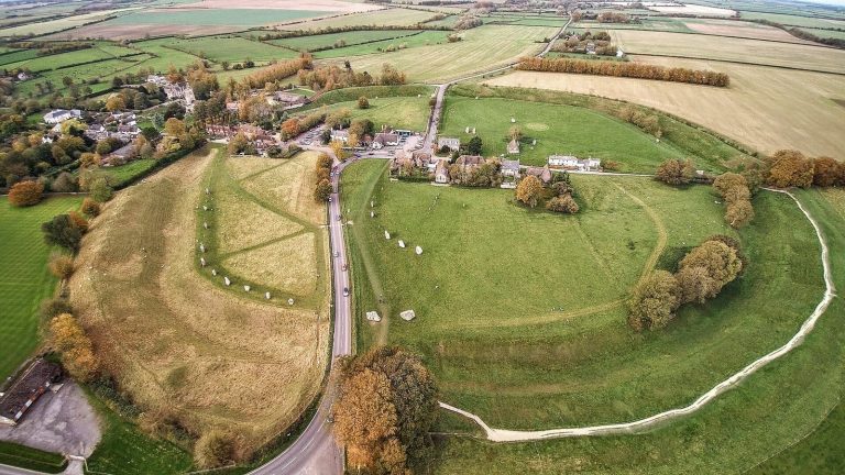
Falkner’s Circle is a prehistoric stone circle about 750 metres southeast of Avebury in the United Kingdom. It was probably erected in the late third or early second millennium BCE, during a stone-building tradition that extended across Britain, Ireland, and Brittany from about 3300 to 900 BCE. Human activity at the location began earlier, in the Mesolithic, or Middle Stone Age. Unusually early flint finds have prompted the suggestion that the place carried historical or mythological meaning before the circle was built.
People made flint tools here during the Late Neolithic, the later Stone Age, or the Early Bronze Age, but the circle’s purpose is uncertain. It may have served as a shrine for a family or kin group, marked a sacred place, or commemorated an important event or myth. Another interpretation proposes that the builders treated the site as a threshold between different states and made a monument focused on stones themselves. Its scale was modest beside Avebury henge, Silbury Hill, and West Kennet Avenue, and its importance to local people may have been brief.
In the Middle Iron Age, the period following the Bronze Age, a pit at the site was probably used as a hearth. Radiocarbon dating places it either in 410–340 BCE or in 310–200 BCE, with a 95.4 percent probability.
Damage and early records
Some stones were toppled and damaged by burning during the post-medieval period, which followed the Middle Ages. By the seventeenth century most were already down. This may explain why the English antiquaries John Aubrey and William Stukeley, early investigators of ancient remains, did not record the circle during their work in the area.
The earliest known account dates to 1840, when Mr Falkner of Devizes encountered the circle while riding. His description, later published by Wiltshire antiquarian William Long in 1858, noted one upright stone, two lying stones, and nine hollows. Falkner argued that a burial mound had not occupied the centre, which he described as level.
In the late 1870s, the Reverend A. C. Smith investigated the site with Long’s help. Smith included the circle on an archaeological map published in 1884, showing that it still existed then. Agricultural intensification later led to the removal of stones lying on the ground and the destruction of the circle. This happened at some point in the late nineteenth or twentieth century.
Investigation and protection
In August and September 2002, Mark Gillings, Joshua Pollard, David Wheatley, and Rick Peterson led a four-week investigation combining excavation with a geophysical survey, which uses measurements of the ground to locate buried remains. They judged that the evidence supported the existence of a stone circle, while allowing that other interpretations remained possible.
Falkner’s Circle is part of the Stonehenge, Avebury and Associated Sites UNESCO World Heritage Site, a designation for places considered to have Outstanding Universal Value. Its remaining standing stone is also protected as a scheduled monument under the Ancient Monuments and Archaeological Areas Act 1979.
Remains
Setting and surviving stone
Landscape and circle
The circle stood at the southern end of a field scattered with naturally occurring sarsen, a hard sandstone found in parts of southern England. The field lies at the bottom of a dry valley running from Avebury toward West Kennett. The circle was about 36.6 metres across and formed from grey sarsen stones, like those used at Avebury stone circle and along the West Kennet and Beckhampton avenues. It may have been built close to where the stones occurred naturally. The site is near Avebury stone circle and West Kennet Avenue, a prehistoric route marked by rows of stones, though its precise connection to those monuments is unclear. It can be seen from a substantial stretch of the avenue, but does not join it. Avebury’s henge, a prehistoric earthwork enclosure, and stone circles are hidden from the site by gently rising ground to the north.
Standing stone
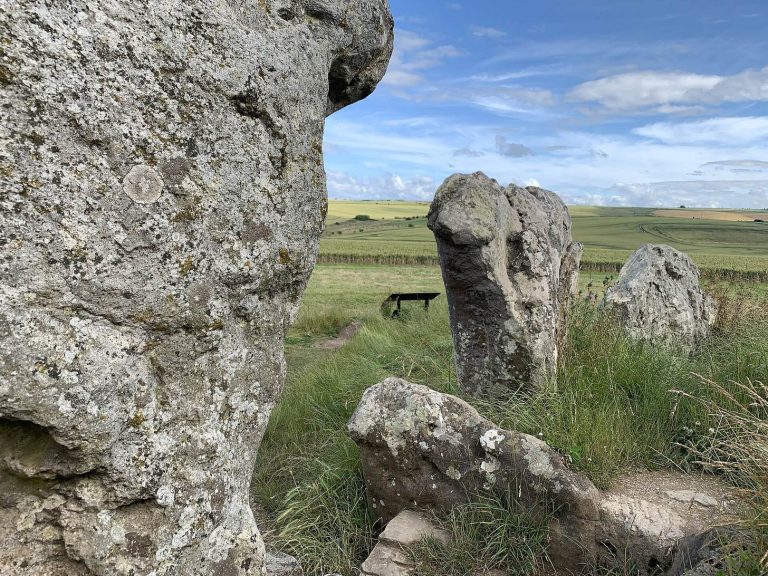
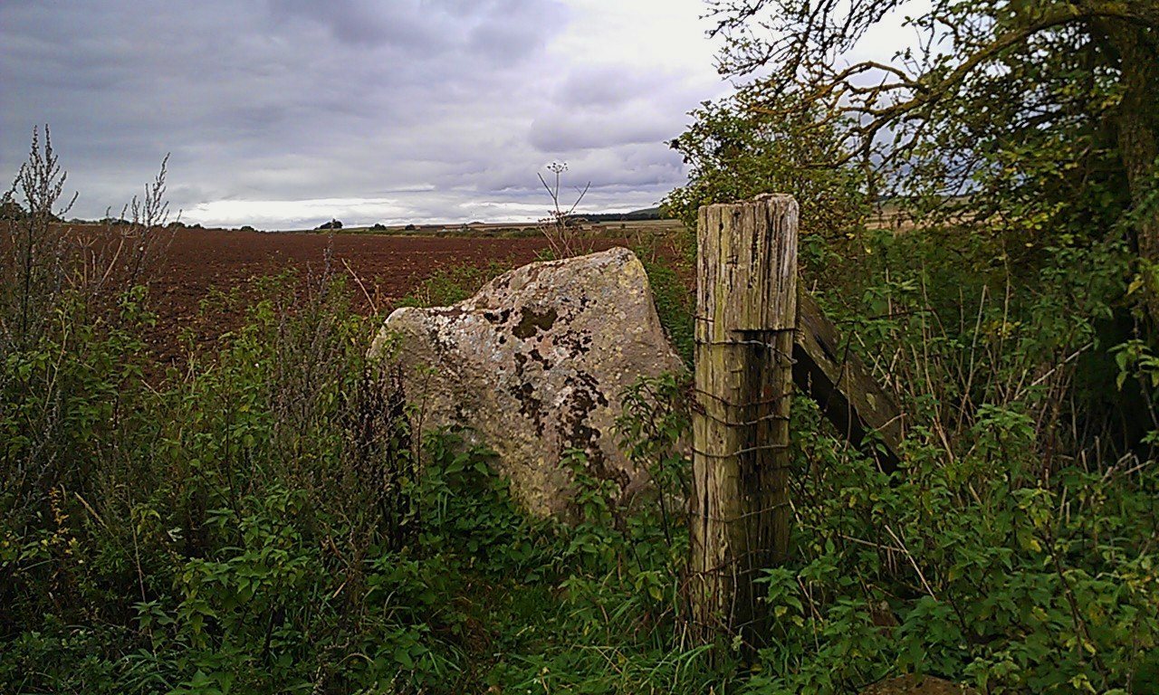
One circle stone remains upright, incorporated into a hedge line about 250 metres east of West Kennet Avenue. It rises 1.28 metres above ground and is up to 2.10 metres wide at its base. It probably continues at least another half-metre underground, giving it an estimated total length of about two metres. Its long axis runs east to west. Lichen covers much of the stone, whose upper surface has several natural depressions.
Archaeological evidence
Stone settings and fragments
Excavation in 2002 uncovered five pits cut into chalky gravel and arranged along an arc about 44 metres across. The pits were spaced 13 to 17 metres apart, and each was associated with fragments of burnt sarsen. If the arc is projected as an evenly spaced circle, it suggests a setting of ten stones. A total of twelve is also possible, since stone circles do not always have regular spacing. In an earlier investigation, Smith found 22 small sarsen stones that he considered fragments of the circle. He described the scatter as defining its northern, southern, and eastern parts, while the western part was poorly represented. Stukeley had recorded naturally scattered sarsen in the eighteenth century; farmers later removed those stones.
Worked flint and pottery
The 2002 excavation recovered several worked flints of Mesolithic type, including a microlith, a small flaked-stone tool, and a broken tranchet axe, a type of stone axe. It also produced 1,074 worked flints, most from the topsoil. Much of this material consists of waste flakes from stone-tool making and belongs to the Late Neolithic or Early Bronze Age, evidence for tool production at the site. Three sherds of Grooved Ware, prehistoric pottery decorated with grooves, were found; two came from the same vessel.
Evidence of burning
A spread of clay reddened by heat and charcoal measured about 10 by 4 metres. It was interpreted as evidence of post-medieval burning associated with the damage and destruction of stones.