Solarium Augusti: Augustus’s Solar Monument in Rome
Site at a Glance
- Popularity
- High
- Country
- Italy
- Primary era
- Classical
- Eras represented
- Iron Age, Classical
- Civilizations
- Egyptian, Roman
- Site type
- Civic
- Remains
- Obelisk
On this page7 sections
History
Augustus’s commission
The Solarium Augusti was a solar monument commissioned by Augustus in Rome, Italy, and erected in 10 BCE in the Campus Martius, the city’s Field of Mars. It was Rome’s first dedication to the Sun. The obelisk had originally stood at Heliopolis in Egypt, where Pharaoh Psamtik II of the Twenty-Sixth Dynasty had erected it. After Egypt came under Roman rule, Augustus brought the monument to Rome. Its dedication presented it as a gift to the Sun, while its inscription listed Augustus’s titles, including Pontifex Maximus, the chief priest of Roman state religion, an office connected with the public calendar.
The monument formed part of a group of Augustan buildings that included the Ara Pacis, or Altar of Augustan Peace, and the Mausoleum of Augustus. Their placement and alignment have been interpreted as associating Augustus’s rule with peace and imperial authority.
Purpose and interpretation
The monument’s precise purpose remains uncertain. Pliny the Elder, a first-century Roman writer, described the obelisk as casting a shadow that indicated the changing lengths of day and night. He also said it had stopped working accurately decades before he wrote, and suggested that solar irregularities, earthquakes, or flooding might explain the problem.
For a long time, scholars reconstructed the installation as a very large sundial. That interpretation has largely given way to the view that it served as a meridian instrument, using the Sun’s position at noon to track its yearly movement, or as a calendar of the solar year. It is not known whether this timekeeping role was part of the original installation or was introduced later. One further proposal is that the instrument helped correct an error in the Julian calendar, the Roman system introduced under Julius Caesar with a leap day intended every fourth year. This proposed use has not been established.
German archaeologist Edmund Buchner argued that the obelisk’s shadow at the autumn equinox reached the center of the Ara Pacis, linking the arrangement to Augustus’s birthday on 23 September. Both the proposed alignment and its interpretation as a deliberate celebration of Augustus have been challenged. The evidence does not settle the question.
Burial, recovery, and relocation
The monument’s original setting had given way to housing by late antiquity, although the obelisk remained standing into the eighth century. It later fell, broke, and became covered by sediment. People rediscovered it in 1512, but excavation did not begin then. In 1748, canon Angelo Maria Bandini excavated the obelisk and its original base. Architect and archaeologist James Stuart made wash drawings of the finds, which later helped scholars reconstruct the installation; Bandini also consulted mathematician Leonhard Euler.
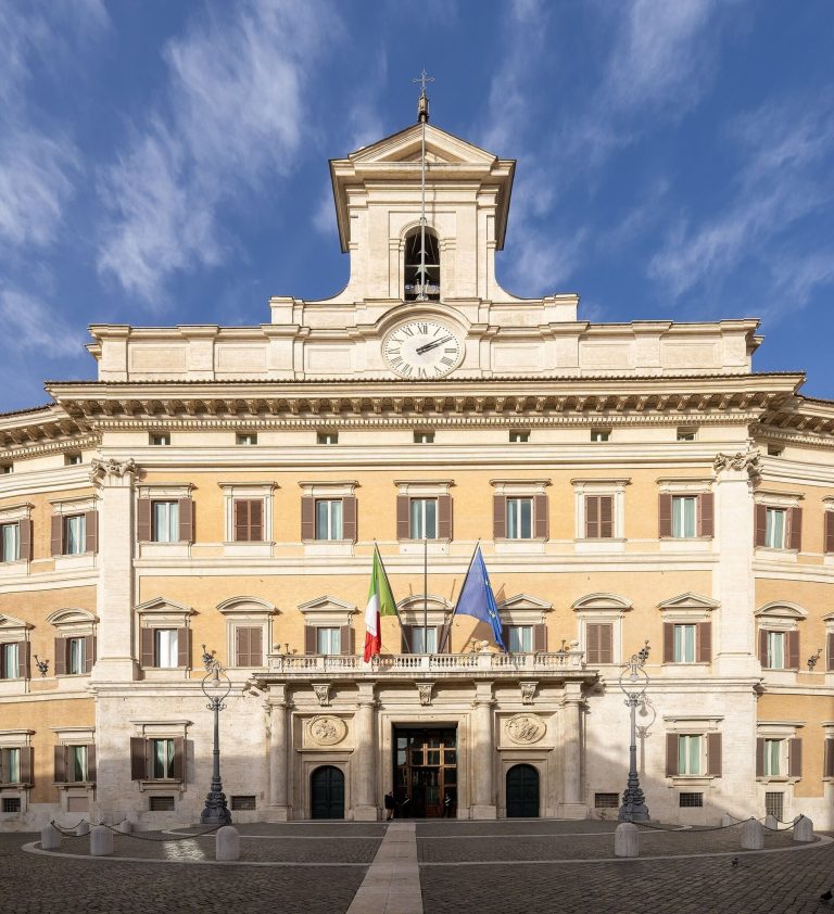
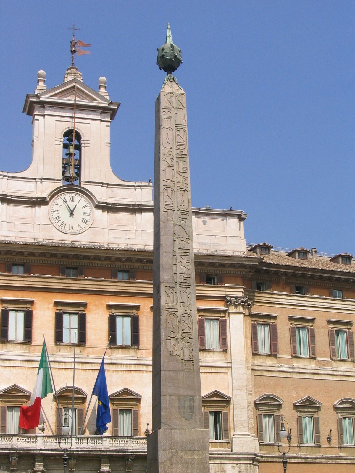
In 1792, Pope Pius VI had the reassembled obelisk, fitted with a new sphere, and its base moved to Piazza di Montecitorio, about 200 metres from the ancient site. It is now known as the Obelisk of Montecitorio. The German Archaeological Institute investigated the ancient location from 1970 to 1981, and the discovery of part of the inscribed pavement in 1979 renewed discussion of the instrument’s purpose. In 1990, physicist Michael Schütz challenged key elements of Buchner’s reconstruction. The evidence is now generally considered more consistent with a meridian instrument, though aspects of its function remain unresolved.
Remains
The ancient installation occupied a marble-paved area in the northern Campus Martius, between the Tiber and the Via Flaminia. The Ara Pacis stood to its east, and the two monuments were aligned. The paved area measured roughly 160 by 75 metres and had a shape compared to a horse saddle, with the obelisk positioned in its southern hollow. The surviving remains are now divided between the relocated obelisk and a section of inscribed pavement below modern street level.
Pavement and meridian line
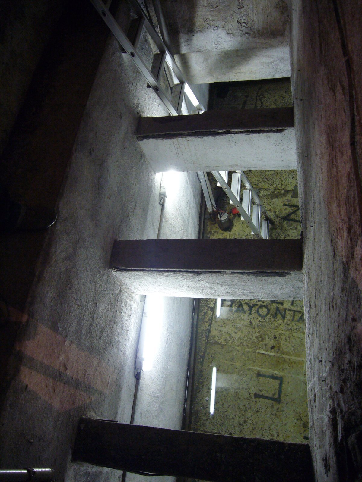
The surviving pavement dates to the Flavian period, the reigns of Vespasian, Titus, and Domitian, rather than Augustus’s rule. It carried a meridian line, a noon marker used to follow the Sun’s annual movement. Bronze markings, gilded to catch sunlight, extended an estimated 55 metres between the solstice points. A surviving section about 6.6 metres long lies in a cellar beneath Via del Campo Marzio. It was found roughly 1.6 metres above the Augustan ground level and about 8 metres below the modern surface.
The surviving stretch has 27 short cross-marks for degree divisions and a longer mark between zodiac signs, the constellations along the Sun’s apparent yearly path. The marks grow farther apart from south to north, from about 19 to 30 centimetres. Inscriptions identify degrees on both sides: the western sequence runs from 19 degrees Aries to 16 degrees Taurus, while the eastern one runs from 14 degrees Leo to 11 degrees Virgo. At the Leo-Virgo division, an inscription says that the Etesian winds, seasonal winds of the Aegean, cease. Another, at 15 degrees Taurus, states that summer begins.
Obelisk
Quarried from red granite at Aswan, the obelisk is about 22 metres long. Its pedestal was nearly 5 metres tall, and the complete installation, including the crowning sphere, reached roughly 30 metres. Pliny reported that the bronze sphere at the top helped make the end of the obelisk’s shadow easier to locate.