Dainzú: A Zapotec City in Oaxaca
Site at a Glance
- Popularity
- Medium
- Country
- Mexico
- Primary era
- Classical
- Eras represented
- Iron Age, Classical
- Civilizations
- Zapotec
- Site type
- Settlement
- Remains
- City
On this page13 sections
History
Dainzú was a Zapotec city in the Tlacolula Valley of Oaxaca, Mexico, occupied from about 750 BCE to around 1200 CE. Its foundation date is uncertain, but pottery associated with the Rosario Phase, an early period in Oaxaca’s Central Valleys identified in part through pottery, indicates that people lived there by about 750 BCE. Dainzú developed before Monte Albán and was contemporary with that Zapotec centre and with Mitla.
Early settlement and Monte Albán
In its early history, Dainzú was one of the principal villages of the Tlacolula Valley and was contemporary with settlements such as San José Mogote in the Etla Valley. Like other communities in the region, it probably contributed to the founding of Monte Albán. Some centuries later, Dainzú came under Monte Albán’s authority. The construction of Monte Albán accompanied a decline in the populations of valley settlements, and Dainzú had contracted by about the second century BCE.
The settlement’s original name is unknown. When archaeologist Ignacio Bernal asked local Zapotec residents about it, they used the name Dannizhú, meaning “Hill of the Organ Cactus.” Another recorded name, Quiebelagayo, means “Five Flowers,” the same meaning as Macuilxóchitl, the Nahuatl name of a nearby settlement.
Urban development and decline
Dainzú retained local importance after its earlier contraction and became one of the region’s important cities during the Mesoamerican Classic, a broad period in the area’s pre-Columbian history. Its period of greatest prominence is associated with about 600 BCE to 200 CE, while its principal urban phase is placed at the II–IIIa transition, around 250–350 CE. II–IIIa is a chronological phase in the Monte Albán sequence. During its urban phase, Dainzú held a secondary position in economic, political, and religious importance.
The later decline of Monte Albán changed relationships among the valley settlements and contributed to Dainzú’s decline. Ignacio Bernal conducted the site’s first formal archaeological excavations in 1965.
Remains
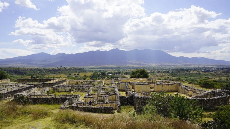
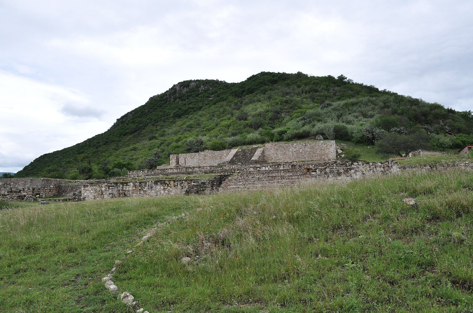
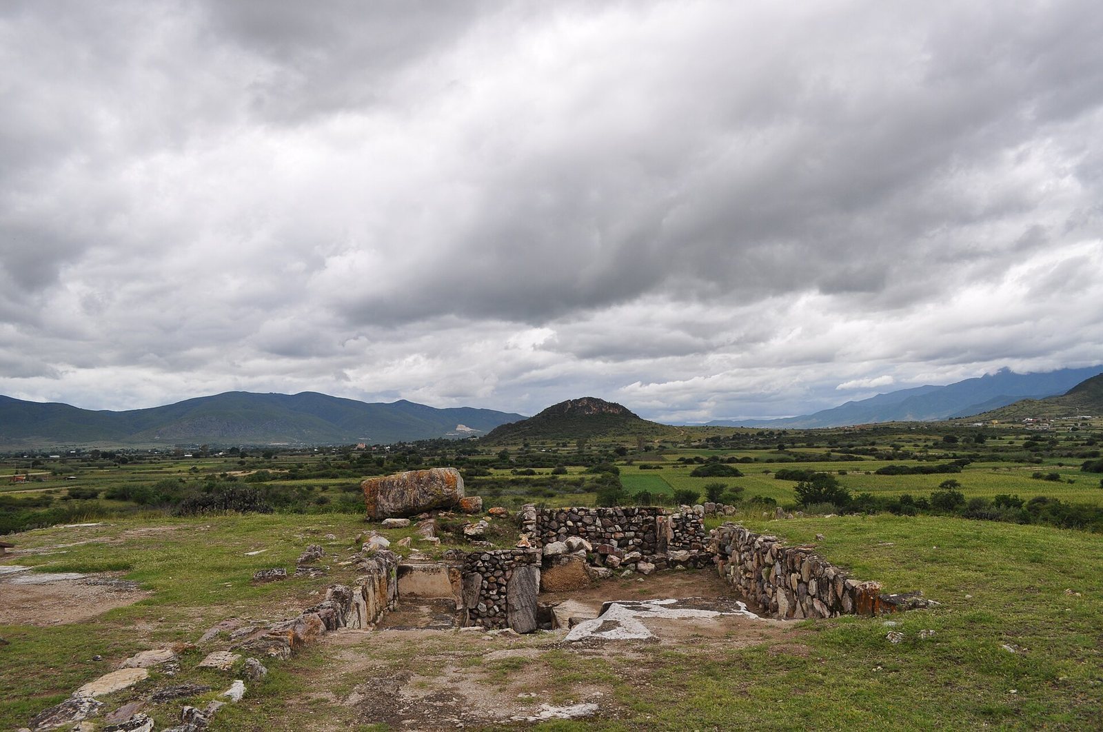
Dainzú stands beside a tributary of the Salado River, with its buildings adapted to the local terrain and built against a hill. River cobbles, including basalt, were the principal construction material. The original entrance was apparently at the western, river-facing end, perhaps chosen for aesthetic reasons. Buildings A and B and the small terrace of Building C have been explored. Building C joins Building B and extends south toward Building D.
Buildings and carved features
Building A terraces and rooms
Building A occupies the site’s highest area and may have served religious purposes. It is a stepped stone-and-clay structure arranged in three terraces against the hill’s western slope. North- and south-facing sides frame a large central stairway. The upper terrace has rounded corners and an almost vertical wall more than five metres high. A roofed, stepped passage leads to four rooms, whose roofs used large stones laid at an angle, a method also found in some Monte Albán tombs.
The central terrace has a vertical wall 1.25 metres high and is reached by recessed stairs at its southwest corner. The lower terrace has a three-metre vertical wall, a central stairway with side parapets, and a relief on its northern side that differs from the other carvings. Later work added rooms, stairways, and parapets to repair damage and adapt the building to changing uses. Building A is considered Dainzú’s oldest terrace, and its construction has similarities to Building J at Monte Albán.
Building A reliefs
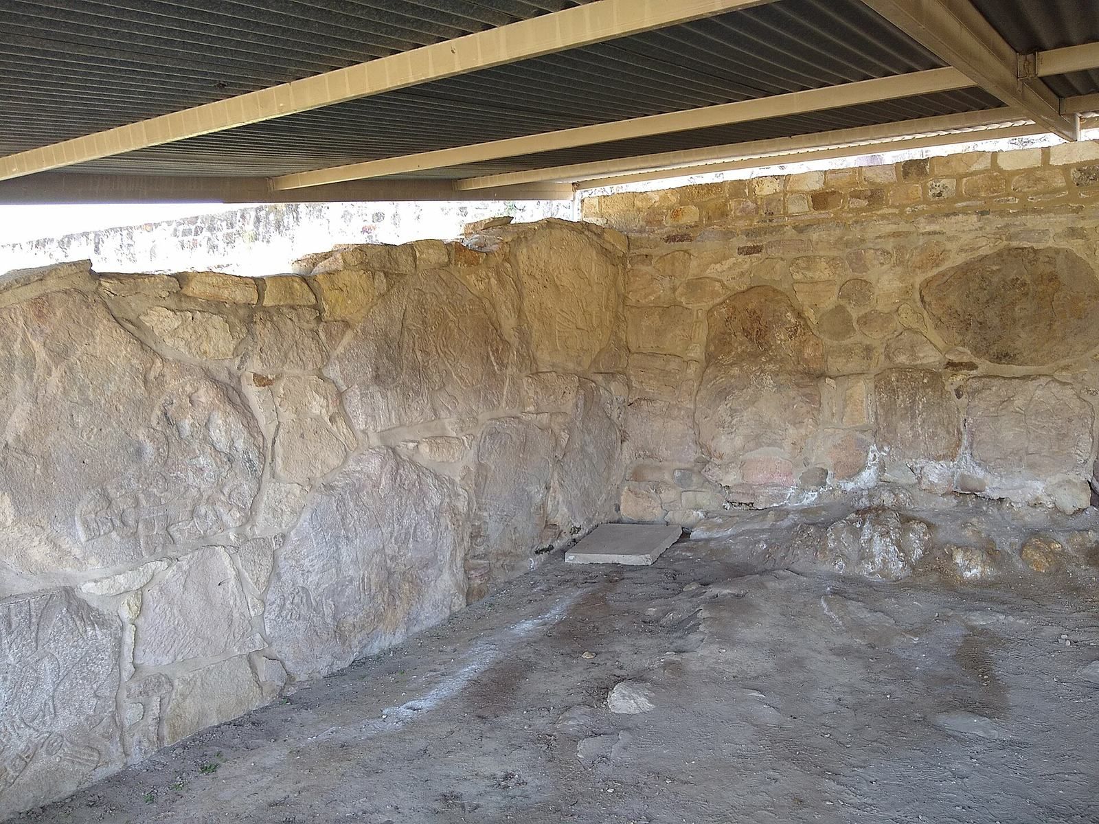
A gallery of carved reliefs runs along the southern side of Building A’s lower wall. Most figures are identified as ballplayers, and four represent deities associated with the ballgame. Other carvings show priests making offerings and include calendrical dates that may refer to particular ballgame rituals. The players appear in varied poses; some hold small spheres and wear protective gear such as helmets, knee pads, and gloves.
Bernal proposed that the reliefs were added during a later rebuilding of the platform, which may account for their irregular arrangement. Most interpretations identify the figures as players, although some read them as combatants, perhaps throwing stones. Heather Orr interprets the carvings as a procession showing stages of a ritual that ended in human sacrifice. Rocks protruding from the vegetation at the hilltop have also been interpreted as severed heads, probably connected with the ballplayers. The reliefs are regarded as distinctive within Mesoamerica, with some figures compared to carvings in Monte Albán’s central plaza and at other Preclassic sites in the valleys.
Building B
West of Building A, Building B is a large complex of rooms, walls, stairways, and courtyards shaped by six successive construction phases, each built over earlier work. Its open courts may have accommodated civic or other public activities. Entry from the lower part of a terrace or plaza led up a stairway beside a wall and through a roofed passage covered with large single-piece stone slabs. The complex began as two separate terraces, which were later joined by the Yellow Temple. Rectangular underground channels drained rainwater from several parts of the complex.
Four burial chambers and several simpler tombs were found within Building B’s terraces. The most important chamber, Tomb 7, was a private burial place reached by a stairway.
Tomb 7
Tomb 7 lies in the central part of Building B and dates to the II–IIIa phase, given here as 200–600 CE. Its walls and niches use dressed stone, and large single-piece stones form its roof. A jaguar carved in the stone at the entrance frames the doorway: its head appears on the lintel, while its forepaws flank the opening. The tomb was probably looted in pre-Hispanic times and is partly destroyed.
The Yellow Temple
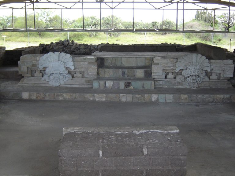
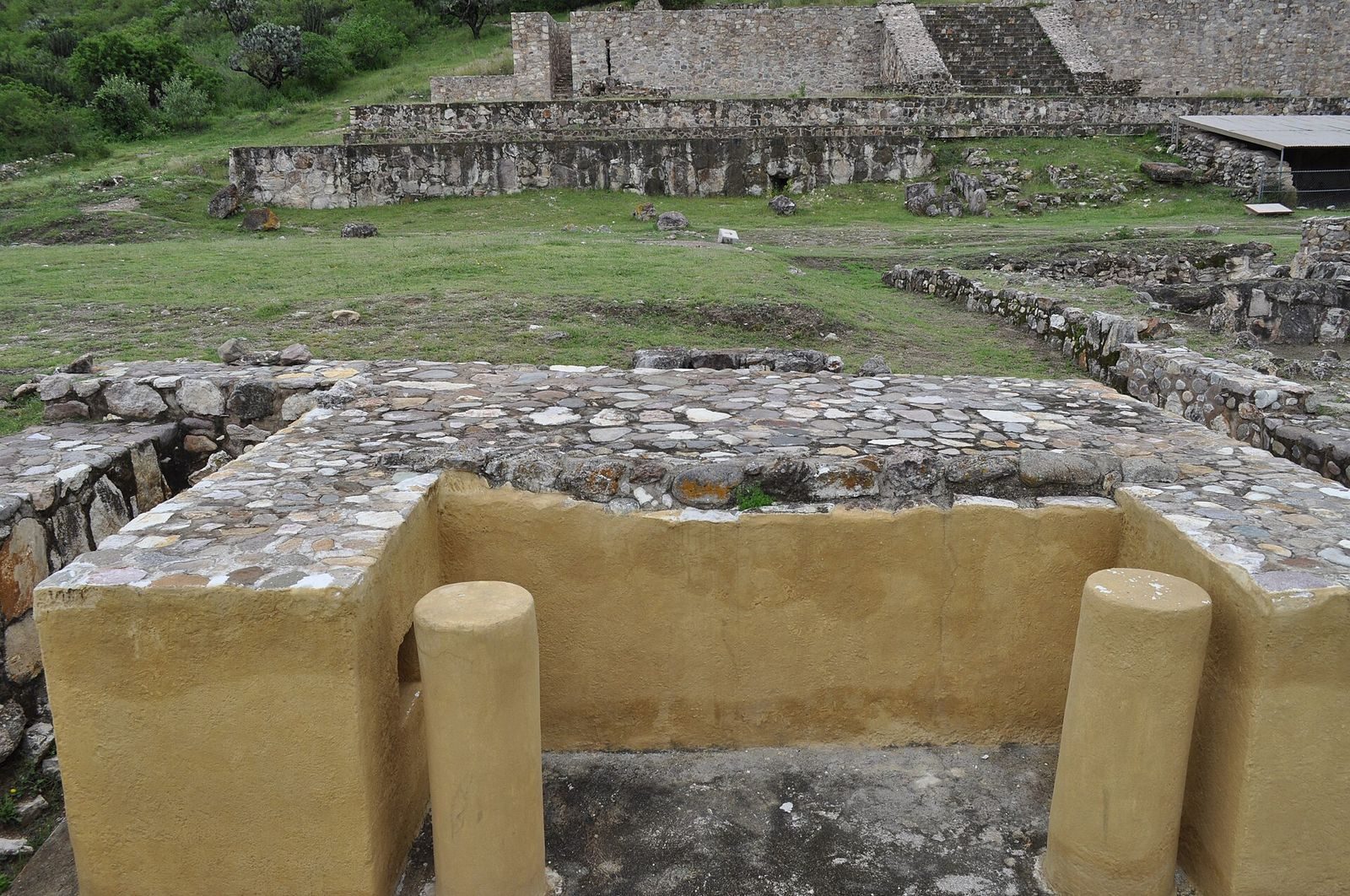
The Yellow Temple is a small shrine-like structure of adobe, or sun-dried earth, and stone, built on a stuccoed platform. Its front faces a small patio, and the building is oriented east to west. Two large single-piece stone columns stand in its portico, and a rectangular niche was found on the right side. The structure was painted ochre yellow; its color and orientation may have had religious significance.
Building C
Building C is a small terrace at the same level as Building B. It connects with that complex and continues south toward Building D.
The ball court
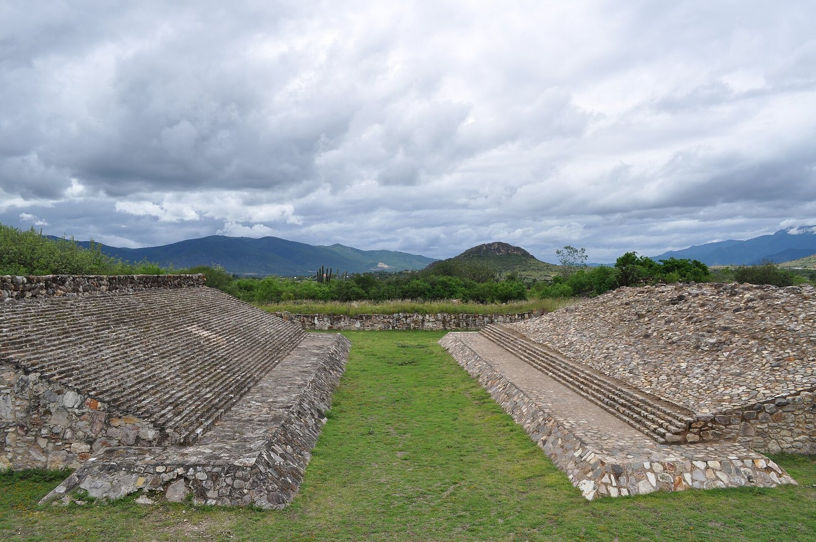
The ball court stands in the centre of a large plaza. Its plan forms a Latin capital I, and it runs east to west. Small stone blocks resembling steps were coated with stucco to create sloping surfaces. Irregular carved stones, bound with clay mortar and small stones or pottery fragments, formed the structure; a thin stucco layer covered the surface. Excavated and restored work covers half the court, where anthropomorphic reliefs of ballplayers were found.
The reliefs depict two forms of the ballgame. In the earlier form, players used gloves to catch, strike, or throw the ball. In the later form, associated with I-shaped courts, players propelled the ball with their hips; this form is called olomaliztli. Depicted players wear short trousers, knee pads, feline masks or helmets, and bands.
Hilltop features
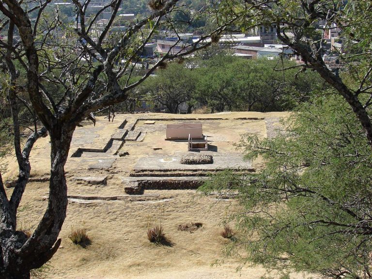
Terraces and petroglyphs, images carved into rock, occur on a nearby hill. At its summit, steps and chambers cut into the rock may have belonged to a shrine.