Bourne Castle: A Medieval Castle Site in the United Kingdom
Site at a Glance
- Popularity
- Medium
- Country
- United Kingdom
- Primary era
- Medieval
- Eras represented
- Medieval
- Civilizations
- Norman
- Site type
- Military
- Remains
- Castle
On this page11 sections
History
Possible Norman origins and early lordship
Bourne Castle is a medieval castle site in Bourne, United Kingdom. It may have been established soon after 1071 by Oger the Breton as a ringwork, a defended enclosure formed by an earth bank and ditch. Its foundation may have followed the suppression of a rebellion against Norman rule led by Hereward the Wake, which was believed to have received support from Earl Morcar. The castle may have occupied the site of an earlier Saxon manor or stood close by. Oger was Bourne’s largest recorded landholder in 1086.
The manor passed from Oger to his son Ralph, then to William and Richard Du Rullos around 1114. A motte, a raised earth mound, may have been added by Baldwin FitzGilbert, son of Gilbert FitzRichard of the De Clare family. He was a different person from Baldwin the Sheriff, who built Okehampton Castle. The castle later entered the Wac, or Wake, family through Hugh Wac’s marriage to Emma FitzBaldwin, around 1141. This transfer is also linked to Baldwin FitzGilbert’s death in 1154.
Wake lordship and medieval use
Under the Wakes, the timber castle developed into a more substantial stone stronghold and reached its greatest extent. By about 1200, it was held by Baldwin Wake. Its first known written reference is in the Pipe Roll for 1179–80, a record of royal financial accounts. Later notices appear in Inquisitions Post Mortem, inquiries into the estates of deceased landholders, and the Close Rolls, records of royal orders and correspondence.
In 1349, the castle was granted as dower, property assigned to a widow from her husband’s estate, to Blanche of Lancaster, wife of Thomas Wake. A 1380 inventory from Blanche Wake’s tenure lists 413 houses and 2,295 inhabitants in Bourne, as well as about 200 people serving at the castle. In 1356, a couple from Irnham, Luttrell and Despenser, married in the chapel within the castle grounds.
Later ownership and changing fortunes
The castle passed to the Holland family. By 1443, more than 140 messuages, dwellings with associated land, in Bourne were described as waste and ruinous, but the condition of the castle itself at that time is unclear. In the middle of the fifteenth century, Margaret Beaufort lived there with her husband, Henry Stafford, for five years. The castle later came into the possession of Henry FitzRoy, the illegitimate son of Henry VIII, who held it until his death in 1536. By the middle of the sixteenth century, William Cecil, treasurer to Elizabeth I, held the manor of Bourne.
The antiquarian John Leland described the site in terms of its hills and ditches, and also remarked on the castle’s servants and the substantial service carried out there. His description does not establish that the castle was already in ruins. Another antiquarian, named Peaks, referred to the principal keep and may have seen the castle earlier in the sixteenth century.
The castle is traditionally said to have been destroyed in 1645 after its use by Oliver Cromwell’s troops during the English Civil War, fought between Parliament’s forces and the king’s supporters. The date and circumstances of its destruction remain uncertain. A farm was later built on the site. An archaeological watching brief in 2002, which monitored groundworks to record remains, placed activity there from the late eleventh or early twelfth century to the middle of the seventeenth century.
Remains
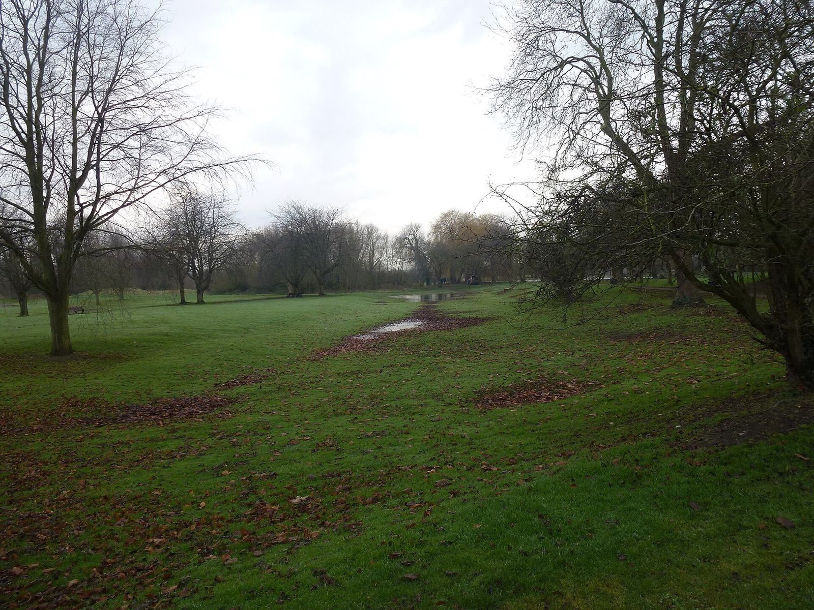
The castle’s medieval layout was unusually concentric and included two baileys, or enclosed courtyards. Its grounds are now within Wellhead Park, which is owned by Bourne United Charities. The surviving earthworks and survey results help outline the castle’s arrangement.
Earthworks and defenses
Mound, keep, and enclosing wall
Traces of the enclosed mound remain. When a stone keep, the castle’s principal stronghold, was built, the earlier motte was reduced. A semi-oval curtain wall, an enclosing defensive wall, surrounded the keep and may have been joined to it.
Baileys and moats
The eastern bailey and an outer enclosure to its east formed parts of the castle layout. Inner and outer moats also survive as traces in the ground. Both were connected with the Bourne Eau: the river was diverted to feed the castle’s ditches, and part of the outer moat followed the watercourse.
Survey evidence and reused stone
Buried footprint
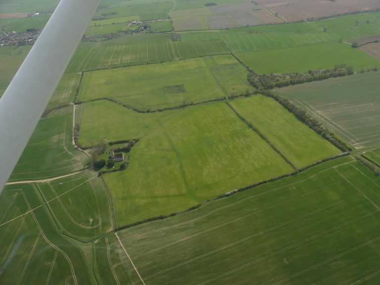
Resistivity surveys, which map buried features by measuring electrical resistance in the ground, have revealed the castle’s footprint. Charles Hobbit carried out a survey in 2006, followed by a larger survey in 2021 initiated by local historian Steven Giullari. The footprint may also become visible during extended hot weather.
Possible reused masonry
A barn north of Well Head Cottage is thought to incorporate stone from the castle. Its arrow-slit windows have been associated with this possible reuse.