Wareham Castle within the Anglo-Saxon Town Defenses
Site at a Glance
- Popularity
- Medium
- Country
- United Kingdom
- Primary era
- Medieval
- Eras represented
- Medieval, Early Modern
- Civilizations
- Anglo-Saxon, English
- Site type
- Military
- Remains
- Wall
On this page12 sections
History
Wareham Castle is a motte-and-bailey castle, built around a raised mound and enclosed courtyards, in Wareham, United Kingdom. It occupies the southwest corner of the town’s Anglo-Saxon defenses, but its own construction date is uncertain. It may have been built after the Norman Conquest of 1066, when the Normans took control of England.
Early settlement and Anglo-Saxon defenses
People probably lived at Wareham before the Roman period, and a Roman settlement later grew beside the River Frome. Saxons took the site in the late sixth century. By the end of the ninth century, Wareham was among Dorset’s leading fortified settlements, known as burhs. Alfred the Great, king of Wessex, and his son Edward the Elder established burhs to protect Wessex’s borders, sometimes incorporating earlier defenses.
A tax system helped fund these fortified places. The Burghal Hidage, a record assigning land assessments to burh defenses, allotted Wareham 1,600 hides. A hide was a unit used to assess land, and this allocation was considered sufficient to maintain 2,200 yards of ramparts. The castle’s position may also have been connected with an earlier Anglo-Saxon royal residence.
The castle and the Anarchy
Robert Beaumont held the castle in 1118 and transferred it to Robert, Earl of Gloucester, who carried out work there in 1137. In the 1140s, Wareham stood between territory controlled by King Stephen and Empress Matilda during the Anarchy, the civil war over the English succession. The castle housed a regional mint, and control passed between Stephen and Robert, who supported Matilda. Stephen may also have burned the town. By the conflict’s end, Corfe Castle had become the region’s principal military stronghold.
Royal control and the town’s decline
After 1154, the Earls of Gloucester controlled the castle. King John seized it and ordered repairs in 1207, using it as a stopping place on journeys to Corfe Castle. After his reign it passed to the de Clare family, who paid it little attention.
Wareham’s economy stagnated in the late twelfth and thirteenth centuries. As silt built up in the River Frome, the port declined and trade shifted to Poole. By the fourteenth century, the town was in economic decline.
The Civil War and the Monmouth Rebellion
Wareham initially supported Parliament during the English Civil War. In 1642, £60 was spent improving the town’s walls. Royalist forces commanded by Ralph Hopton took the town in 1643. Parliament regained it in 1644, when soldiers led by Sir Ashley Cooper forced their way through the West Gate. The defenses were strengthened, possibly with circular platforms at key positions. Parliament’s advisers considered them useful and too substantial to dismantle deliberately.
In 1685, seven men were executed on the west bank of the defenses for their involvement in the Monmouth Rebellion, an uprising against the English monarchy. The stretch became known as Bloody Bank.
Later changes and investigation
The date when the castle was finally abandoned is unknown. By the eighteenth century, buildings extended along its eastern edge, while the rest of the site was open ground called Castle Green. Houses were built around the mound from the early nineteenth century, and it was enclosed later in that century. Building Castle Close villa on the mound in 1911 involved extensive reshaping. Around 1850, a road was cut through part of the western town wall. Further changes were made in 1940 to guard against possible enemy tank attacks. Town authorities took over management and conservation of the remaining walls in 1956.
Investigations of the Anglo-Saxon defenses took place in 1910, 1930, and 1951, followed by more extensive excavations from 1952 to 1954. The surviving castle and town defenses are protected in England as a Scheduled Monument, a legally protected archaeological site.
Remains
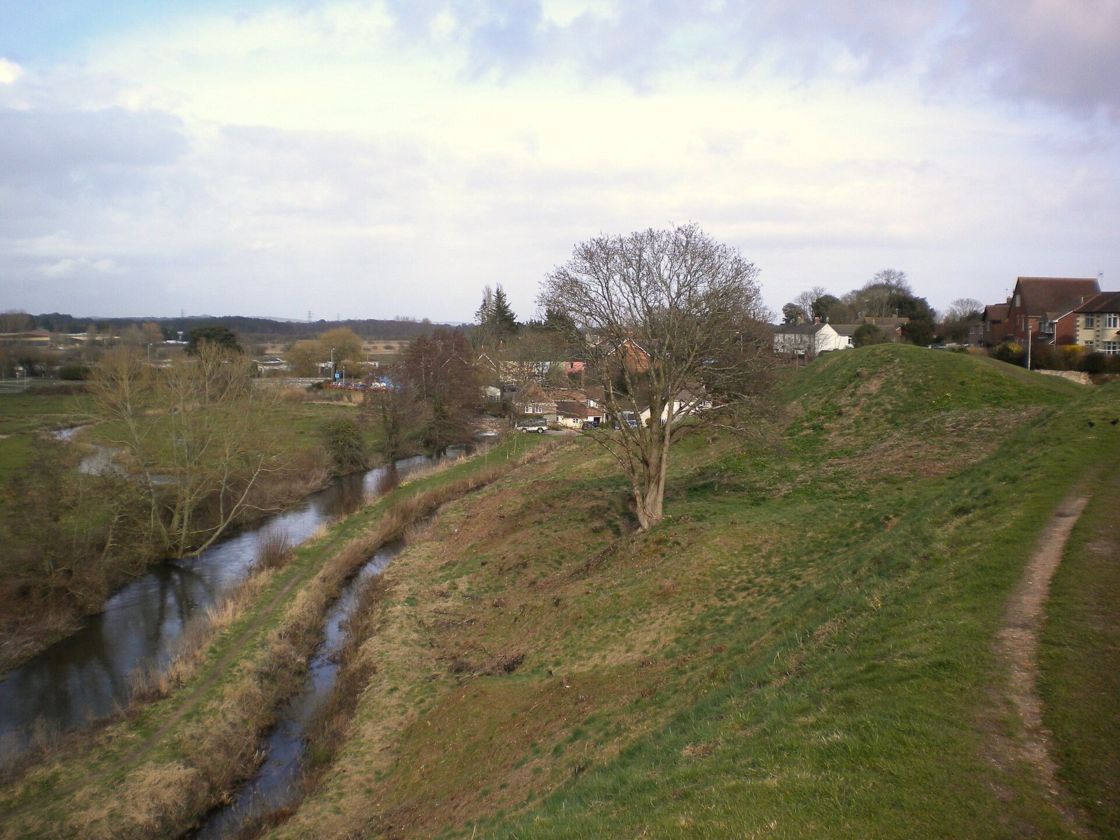
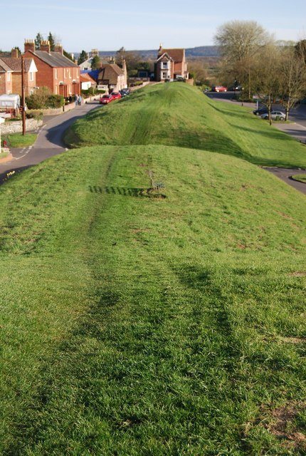
The site includes the castle earthworks and portions of the town defenses, built from earth, timber, and stone. The castle’s mound and enclosed courts occupy the southwest corner of the broader defensive circuit.
Castle
Motte and baileys
The castle’s raised mound, or motte, stood with inner and outer baileys, enclosed courtyards protected by timber defenses and a ditch. The original mound may have been about 55 to 60 feet across, though its initial size is uncertain. After substantial alteration, it now measures about 250 feet across at the base and 120 feet across at the top. Pound Lane and Trinity Lane trace the lines of the inner and outer baileys.
Keep
A small square keep of stone rubble stood on the mound, probably from the early twelfth century. It measured about 37 feet across and had shallow, projecting supports at its corners. Its foundations survive within the mound.
Bailey wall and ditch
A stone curtain wall, the defensive wall enclosing the castle court, protected the bailey and reached about 5 feet thick in places. The outer-bailey ditch was filled during the early thirteenth century. Elsewhere, surviving parts of the castle ditch measure about 70 feet across and 22 feet deep.
Anglo-Saxon town defenses
The defenses enclosed a roughly rectangular area of up to 90 acres (36 hectares), with an entrance on each side. An earth bank and protective ditch supported timber-faced ramparts. The west side measured about 585 yards (535 metres), the north about 670 yards (610 metres), and the east about 760 yards (690 metres). Timber facings were replaced with stone, probably in the late tenth or early eleventh century. In places, the surviving defenses reach about 55 feet (17 metres) across and 17 feet (5.2 metres) high.