Dunduff Castle: A Restored Scottish Residential Tower
Site at a Glance
- Popularity
- Medium
- Country
- United Kingdom
- Primary era
- Early Modern
- Eras represented
- Early Modern
- Civilizations
- Kingdom of Scotland
- Site type
- Domestic
- Remains
- Castle
On this page11 sections
History
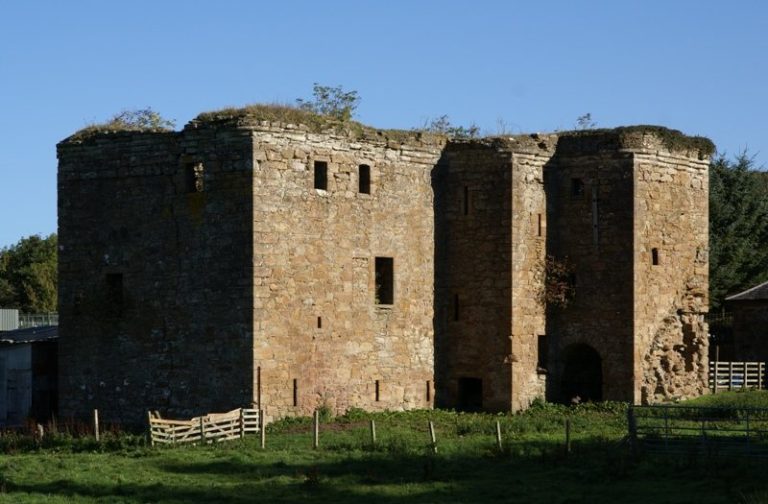
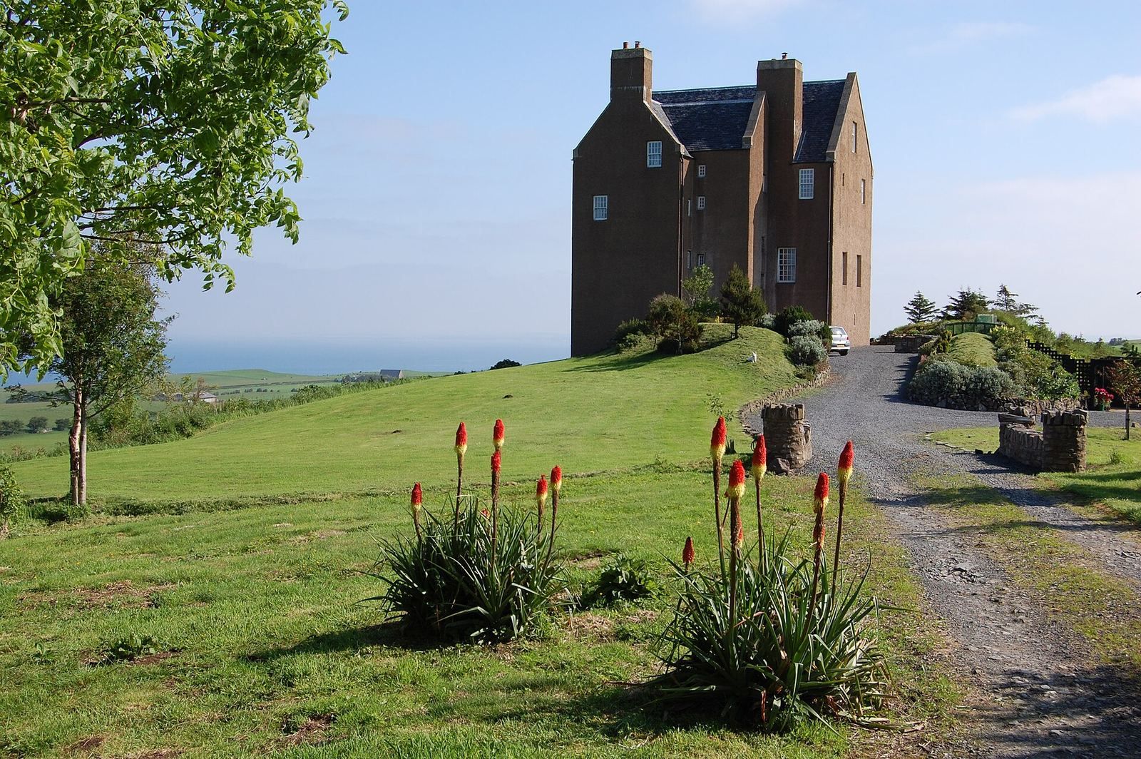
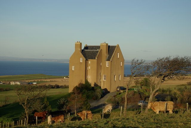
Dunduff Castle is a stone residential tower on a rocky knoll above Dunure in the United Kingdom. Its window and doorway details suggest that it was built in the late 16th or early 17th century, and its history is closely connected with Scottish landholding and political conflict.
Early references and local identity
The name Dunduff has several proposed meanings. It may combine Gaelic words for “hill” or “fort” and “stag”; alternatives include “Fort of Duff,” with Duff as a personal name, and “Black Hill Fort.” Glennie identified Dunduff with Dindywydd, a place in an Arthurian poem attributed to Aneirin, also called Neirin, an early Brythonic poet. The poem survives in the late-13th-century Book of Aneirin, a medieval manuscript preserving poetry attributed to him.
The earliest written reference to Dunduff dates to the reign of William the Lion, king of Scotland from 1165 to 1214. Walter Champenais de Karrig granted land there to the monks of Melrose. The grant identifies the place and its lands, but does not establish that a castle existed at the time. Sir John de Graham, a Scottish knight, was born on Dunduff lands in 1298. Smith later associated the castle with Clan Kennedy and related families, whose castles were found in the surrounding region.
The Stewart lairds and their lands
William Stewart, Dunduff’s first Stewart laird, was appointed Scottish ambassador to France by James V in 1528. He died in 1552. His father, Sir Andrew Stewart, was the second Lord Evondale and James IV’s first Lord of the Bedchamber. The family traced its descent directly to Robert II.
A second William Stewart was recorded as laird in 1558 and married Elizabeth Corry. The family surname appears to have been Stewart, although its members often used Dunduff as a surname. Paterson proposed that the family acquired the estate through marriage to an heiress named Dunduff. Matthew, the third laird, was born there in 1560, inherited the estate in 1580 and was styled “Dunduff of that Ilk.”
In 1581, Matthew Dunduff, also known as Stewart, took possession of Dunduff Mill. The associated estate included 12 merklands, land assessed by value rather than by a fixed acreage, as well as 10 merklands at Glentig with a grain mill, 5½ at Mekill Sallauchan and four at Little Sallauchan. Dunduff’s own grain mill formed part of the holdings.
The feud and the Ulster grant
In the 16th century, Matthew joined the Master of Cassilis and the Laird of Auchindraine in a plot to kill the Master’s brother, identified as the Earl of Culzean. A dispute between the earl and the Laird of Bargany over Newark lands drew Bargany into the conspiracy. On 1 January 1598, the four plotters and their servants waited in Maybole for the earl, who had been dining with Sir Thomas Nasmyth. They fired eight shots, but the earl escaped unharmed.
Matthew was briefly held at Edinburgh Castle and sentenced to banishment from Scotland, England, Ireland and the other British islands, as well as a fine of 1,000 merks, a Scottish unit of account. The sentence was apparently evaded or not enforced. After returning, Matthew resolved his dispute with the earl, and the two became friends. Matthew died in 1609. His brother George was murdered in 1601 by John Glendoning of Drumraschein. Thomas Kennedy of Bargany is also identified as an ancestor of the Dunduff lairds.
William Stewart, the fourth laird, was born around 1580 and inherited the estate from his father. He later became a baronet, a hereditary rank below baron, and sought land in Ulster during the Plantation of Ulster, an early-17th-century program of English and Scottish settlement. Under James VI, he received 1,000 acres in County Donegal: Coolaghy in the Barony of Raphoe, also called Fort Dunduff and later the Manor of Mount-Stewart. He could grant land tenures and appoint a court baron and a court leet, local manorial courts. Mount-Stewart later passed to the family of Alice Howard, first Countess of Wicklow.
Whiteford ownership and the castle’s changing condition
In 1668, John Stewart, the fifth and last Stewart laird, and his brother William were prevented from renewing their covenant, a formal pledge with political and religious force. They had opposed Oliver Cromwell, an English political and military leader whose regime opposed the Stuart monarchy, and supported the Crown. The estate was sold soon afterward and passed to the Whiteford family.
James Whiteford of Dunduff, who died in 1697, married Isabel Blair, daughter of Sir Bryce Blair. A further James Whiteford appears in charters of 1700 and 1714. Bryce Whiteford of Dunduff and Cloncaird, who died in 1726, married Elizabeth Cuninghame, daughter of Sir David Cuninghame. James Whiteford of Dunduff held lands at Drumfadd in 1757. Lady Dunduff, Bryce Whiteford’s widow before 1750, was living in Ayr in 1767 and died in 1775 at the age of 85.
The castle’s state of completion was described in differing ways. A record from 1696 called it nearly finished, while Smith and Abercrummie regarded it as unfinished; Abercrummie described it as a coastal house that had never been completed. Maps from Pont’s survey period, 1560 to 1614, and later maps made before 1775 depict the castle as whole. Armstrong’s 1775 map marks it as a ruin. Aiton’s 1808 map does not label it as ruined, while Groome described it as a ruin in 1903.
Kirkbride church was abandoned after its parish joined Maybole and was ruinous by 1696. Its cemetery continued in use as late as 1903. The area was also known as Larges, a secular name once applied to much of the old parish and preserved in Largs Farm. In 1655, Dunduff Creek was recorded as a small harbour between Dunure and the Heads of Ayr.
In the 1990s, the castle ruins were consolidated and the tower fully restored for use as a family residence.
Remains
The castle
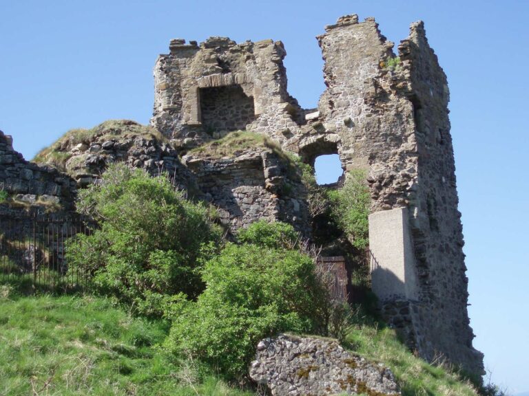
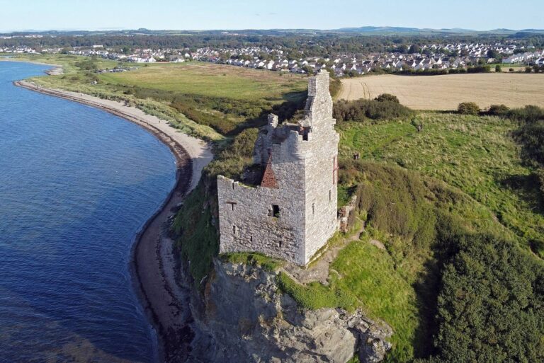
The castle stands on a rocky knoll east of Dunduff Farm, on the Brown Carrick Hills above the Drumbane Burn and overlooking the sea above Dunure. Its stone building has an L-shaped plan. A square, three-storey stair tower occupies the inward-facing corner on the south side of the main block.
Three ground-floor chambers have barrel-shaped vaulted ceilings and are reached from the tower lobby. A corridor running along the main block gave access to a private chamber on the first floor. A fireplace in the wing heated the hall, which has a deep window recess that widens toward the inside. Sockets in the walls show that an intermediate floor once divided part of the interior.
Nearby landscape and archaeological features
Dane’s Hill
Dane’s Hill lies about 170 metres west of the castle on a separate rocky knoll. It has been described either as an Iron Age fort or as a motte, a raised earthwork used as a fortified strongpoint. The remains include a ditch across the site and two ramparts. The slopes are steep and rocky except beside the rampart. Local tradition links the place with Danish fighting and also attributes the construction of a castle at Dunure to the Danes.
Dunduff Mill
A burn descending from Brown Carrick Hill powered Dunduff Mill. Its breastshot waterwheel, driven by water striking around the middle of the wheel, turned a single pair of millstones. Mill workers sifted and winnowed the grain by hand. The General Roy map, made between 1747 and 1755, shows the mill in association with the castle.
Kirkbride Church
Just west of the castle, beyond Dunduff Farm, stand the rectangular ruins of Kirkbride, a pre-Reformation church dedicated to St Brigid. In 2010, portions of the church ruin, the churchyard and gravestones remained. The church was associated with 52 acres of land and a salt pan, and a neighboring field is known as the “Priest’s Land.”
A cross carved on a slab with angled edges was found among the church rubble in 1928. Its center has an unusual diamond-shaped opening. The slab may have served as the chapel’s consecration stone and may date to the 12th century.