El Baúl: An Archaeological Center of the Maya and Cotzumalhuapa Traditions
Site at a Glance
- Popularity
- Medium
- Country
- Guatemala
- Primary era
- Medieval
- Eras represented
- Classical, Medieval
- Civilizations
- Maya
- Site type
- City
On this page16 sections
History
El Baúl is an archaeological center associated with Maya culture and the Cotzumalhuapa tradition, an archaeological tradition of Guatemala’s Pacific coast, about 4 km north of Santa Lucía Cotzumalguapa, Guatemala. Its earliest occupation is broadly dated to about 900–400 BCE, and it was founded around 600 BCE as a small settlement within the sphere of La Venta, a major Olmec center in what is now Mexico.
Early settlement and regional growth
Fertile volcanic soils supported the cultivation of manioc, maize, and beans. Trade involved pottery and obsidian, a naturally occurring volcanic glass used to make tools; exchanges with nearby cities also included volcanic ash. Around 400 BCE, El Baúl had become an important center in southern Guatemala. By about 300 BCE, it had developed into a city-state, an urban center with its own political organization, while remaining under the regional influence of Izapa. Izapa was a powerful pre-Columbian center in the Pacific coastal region of southern Mexico and Guatemala, and its influence shaped El Baúl’s political organization and culture.
A Classic-period regional center
During the Classic period, a broad era in Mesoamerican chronology, El Baúl, Bilbao, and El Castillo formed a regional center. Monumental construction and connecting routes developed as part of this network. El Baúl also served a defensive role in the northern Cotzumalhuapa region. Natural barriers and control of movement across bridges and constructed routes helped support that function.
Decline and archaeological study
After about AD 900, internal tensions, limited cultivable land, and climatic change contributed to El Baúl’s decline. Buildings fell into ruin, and volcanic ash covered some remains. The deposits made later discovery more difficult but also protected covered remains from erosion.
The site was discovered in 1862, and German researchers worked there during the 1860s and 1870s. Alfred Percival Maudslay made detailed descriptions, drawings, and photographs during an expedition to southwestern Guatemala in 1895–1899. His work appeared in Antiquities, part of Biologia Centrali-Americana, published between 1889 and 1902.
In the 1930s, John Eric Sidney Thompson carried out the first investigations of the site’s successive layers. He developed a pottery-based chronology and examined how the region’s principal centers related to one another. After the Second World War, researchers from Guatemala’s Institute of Anthropology and History studied the central complex, routes, and defenses. Further investigations followed in the 1970s and 1990s.
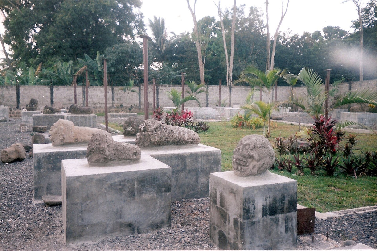
From 1997 to 2001, excavations led by Oswaldo Chinchilla Mazariegos examined the central complex and other parts of the settlement, clarifying its defenses and connections with Bilbao and El Castillo. Related findings appeared in the proceedings of Guatemala’s Eleventh Symposium on Archaeological Research, published in 1998. Urban development destroyed the southern complex in 1997. During the 1990s, artifacts previously kept in a makeshift metal enclosure on the estate were moved to a small walled open-air museum.
Remains
Setting and settlement plan
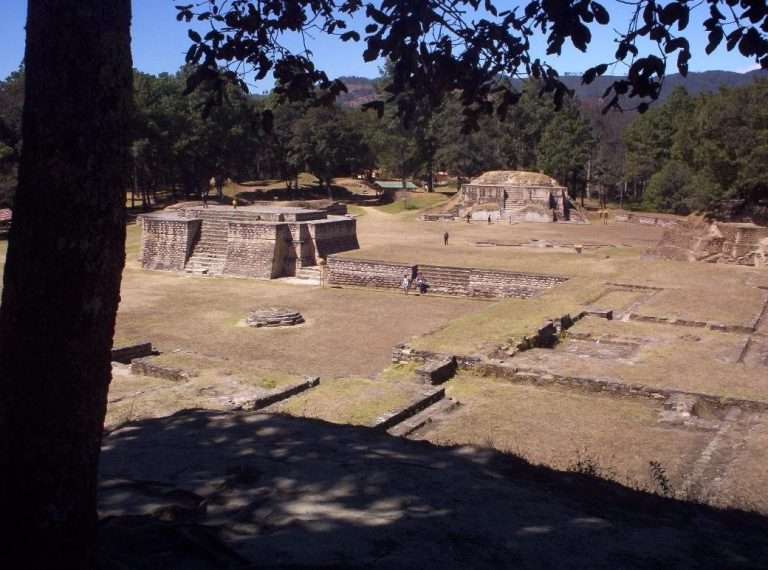
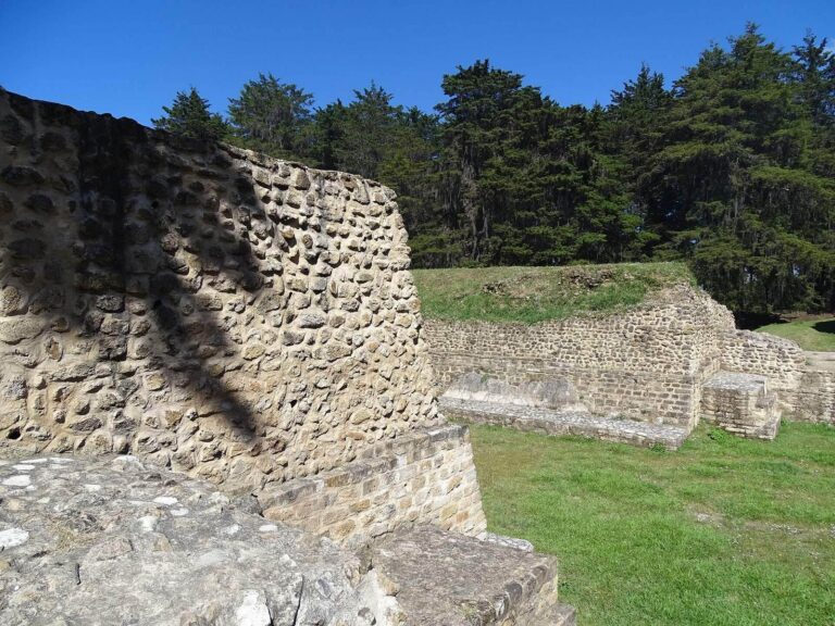
El Baúl occupies a volcanic landscape near Fuego volcano, at an elevation of about 550 m and roughly 50 km from the Pacific coast. Its principal groups are now covered by sugar-cane fields. The settlement’s layout centered on a monumental precinct of platforms and stepped pyramids, with residential groups between it and a ballcourt to the north. Stone monuments remain among the fields.
Central precinct and residential groups
The central monumental complex served ceremonial and administrative purposes. Its platforms and stepped pyramids formed the principal architectural group, while residential areas occupied the space toward the northern ballcourt.
Ballcourt and constructed routes
A ballcourt, a court for the Mesoamerican ballgame, was excavated about 500 m north of the central complex. Two causeways, constructed routes linking parts of an ancient settlement, connected areas of El Baúl; one linked residential groups near the center. The largest measured about 2.5 km long and 11–14 m wide, joining El Baúl’s central complex to that of Bilbao.
Santiago River crossing
A route between El Baúl and El Castillo crossed the gorge of the Santiago River on a bridge. The bridge probably had a wooden upper structure supported by stone foundations, portions of which remain visible in the river. Excavation west of the gorge identified two stages of causeway construction, both dating to the Late Classic period, generally the later centuries of the first millennium AD.
Water management and defenses
Drainage works and water reservoirs formed part of the settlement’s infrastructure. The central complex also included defensive terraces, among the features examined in modern excavations.
Workshops and deposits
Obsidian-working areas and associated refuse deposits have been identified, along with a probable sweatbath, a heated bathing structure. A test pit labeled P31 reached 3.78 m beneath the deposits and exposed layers of ash from Fuego. Obsidian debris beneath the ash indicates that the area had been used for a long time as a place to discard refuse.
Stone monuments and sculpture
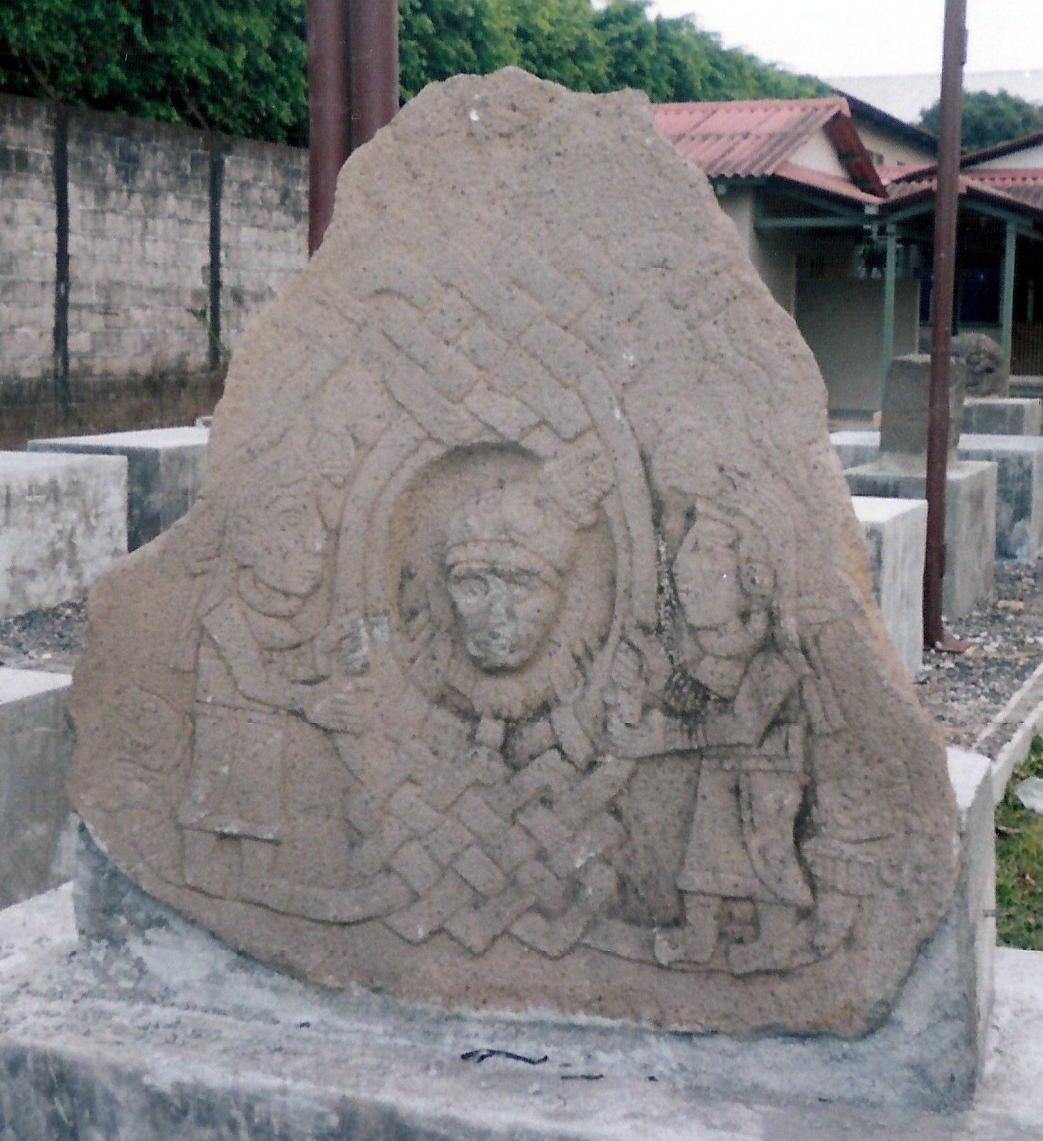
El Baúl’s carved art is known for lifelike figures, carefully rendered anatomy, balanced proportions, and expressive faces. Stone carvings show running warriors, dancers, combat, and ritual scenes. Some arrange a sequence of events in separate images on a single slab, an uncommon format in Maya art. This artistic style spread along Guatemala’s Pacific coast and highlands and reached western El Salvador. Monumental altars and sculptures include figures wearing masks or helmets. Many upright stone monuments, or stelae, have forms and subjects that differ from those of Maya stelae of the same period.
Stela 1
Stela 1 has a partly damaged Maya Long Count date, a calendar system that counts elapsed days from a fixed starting point. Some archaeologists interpret it as March 6, AD 37, a date they regard as among the earliest recorded in that calendar system. The carved image shows a priest-king in profile, wearing an elaborate headdress and holding a ceremonial knife in his right hand. Cloud ornament above the figure includes shapes resembling signs.
Stela 5
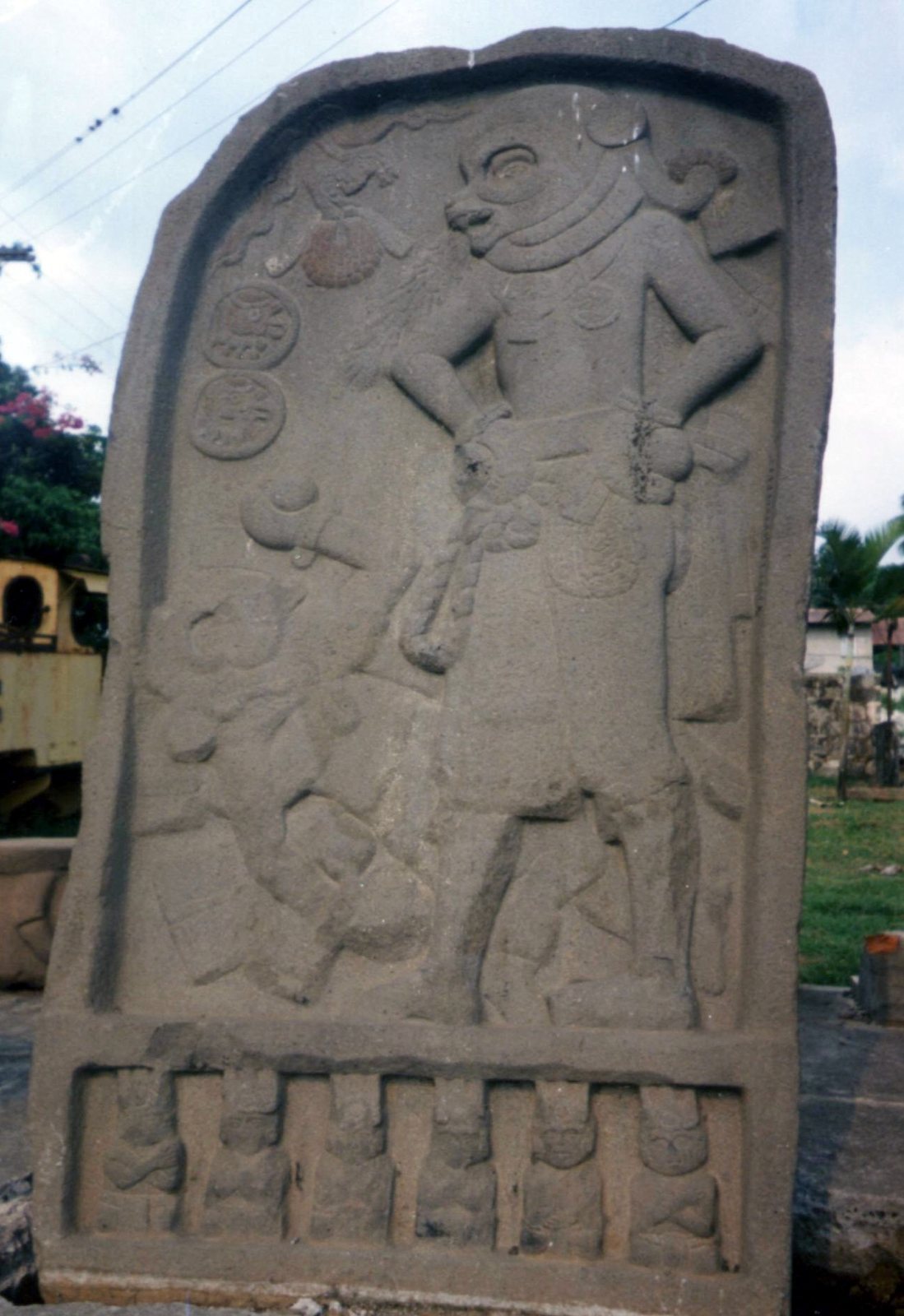
Stela 5 has a framed scene that probably represents two ballplayers. One stands wearing a coyote mask, while the other lies on his back; both hold balls in padded hands. The standing player wears a U-shaped ballgame yoke, a belt-like piece of equipment, secured with bands. Rounded signs appear to the left. A small divine figure emerging from a cloud serpent extends an object that appears to be a victory trophy. Six smaller figures sit cross-legged below the main scene, their arms crossed over their chests.
Other carved figures
Other stelae show rulers or ruler heads, hybrid beings, and skulls. One abstract, geometrically shaped head has rosette-like forms at its sides and may represent Tlaloc, a Mesoamerican rain and storm deity. A seated feline sculpture, perhaps a jaguar or a puma, has raised clawed forepaws and an open mouth and eyes. Jaguar figures with extended forelegs also appear on several stelae.
Monumental head and Monument 27
One monumental head among the fields depicts either an old man or a deity, with a wrinkled face and hooked nose. Indigenous people continued to venerate it. Monument 27 shows a helmeted figure with a human torso and animal head, breathing fire from its mouth. At the figure’s feet, a small crouching person appears to offer a jaguar a sacrifice.