Church of St. Mary of the Germans: A Crusader-Era Church and Hospital Complex in Jerusalem
Site at a Glance
- Popularity
- Medium
- Country
- Israel
- Primary era
- Medieval
- Eras represented
- Classical, Medieval
- Civilizations
- Crusader, Kingdom of Jerusalem
- Site type
- Religious
- Remains
- Church
On this page15 sections
History
Foundation and institutional development
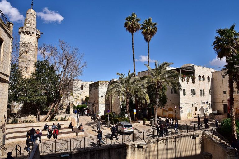
The Church of St. Mary of the Germans is a ruined Roman Catholic church in Jerusalem, Israel, built by German residents around 1127–28 in the Romanesque style, a medieval style marked by substantial masonry and rounded arches. It stood in the Crusader Kingdom of Jerusalem, a Latin Christian state established after the First Crusade. Tradition attributes the foundation of a hospital for poor and sick Germans to a German resident of Jerusalem and his wife, who then established a chapel beside it with the patriarch’s consent. A record dating to the 1380s gives 1127 as the foundation year; the church may have followed the hospital. Together, the church and hospital served German residents and pilgrims.
The institution retained a distinct German identity but did not become a separate religious order. In 1143, Pope Celestine II placed its prior and serving brothers under the Hospitaller master. The Hospitallers began as a religious hospital institution and later developed into a military religious order. The arrangement apparently aimed to limit competition for donations while leaving the German institution’s identity intact.
Visitors and benefactors connected the church with European pilgrims. In 1167, Welf VI, Duke of Spoleto, gave the German brothers money, land, and produce. Sophia, Countess of Bentheim, died on pilgrimage to Jerusalem and was buried in the church in 1176, probably near the apse of the north aisle. A charter issued by King Amalric in 1177 listed the German hospital’s estates and properties. Among its provisions, sugar cane from Nablus was used to prepare an electuary, a sweet, often syrupy medicinal preparation for patients.
Conquest and transfer of the institution’s properties
Jerusalem fell to Saladin, an Ayyubid sultan, in 1187, ending the institution’s original work there. The church may have been damaged during the conquest, but the extent of that damage is uncertain. The fate of its clergy and brothers is also unclear; they may have returned to Europe. On 6 February 1191, Pope Clement III placed the German brothers of the Jerusalem church under his protection.
A separate German hospital arose at Acre during the siege of 1189–91 and later developed into the Teutonic Order, a Catholic military order. Despite traditions linking it to the Jerusalem institution, the two had no shared personnel or property. After Jerusalem returned to Christian control in 1229, Emperor Frederick II granted the former hospital and its properties to the Teutonic Order. The Hospitallers contested the grant in 1229 and 1239, invoking the 1143 arrangement, but their appeals failed. Jerusalem came under Muslim rule again in 1244.
In 1219, al-Mu’azzam Isa, an Ayyubid ruler in Damascus, ordered the destruction of Jerusalem’s defenses and other buildings, an action that may have caused further harm to the church. Additional destruction may have followed the Mamluks’ rise to power. During the Mamluk period, the complex was renovated and used as a khanqah, a religious center for Sufi worship and communal life. Its remains later served as residences for an extended period.
Rediscovery, excavation, and preservation
A British survey recorded the site in 1867–69. In 1872, C. F. Tyrwhitt-Drake, T. Chaplin, and C. R. Ronder identified and described the remains as the German church. At that time, families lived among the better-preserved walls of the western wing.
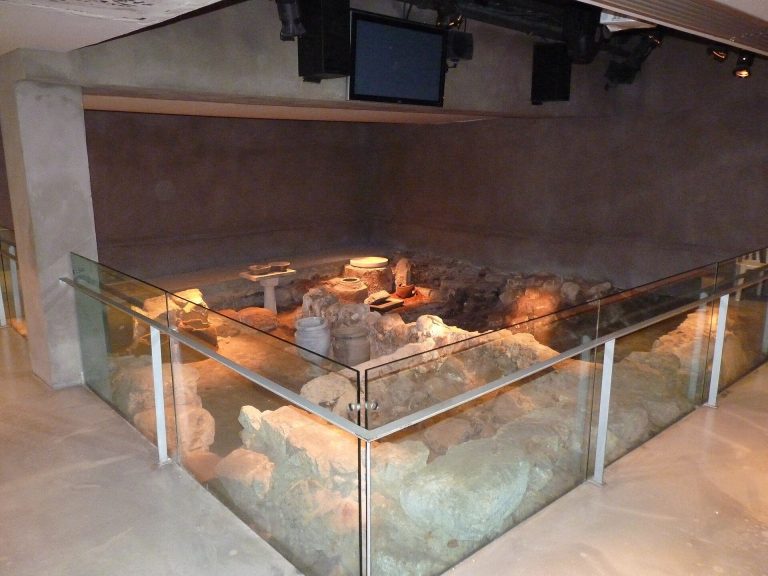
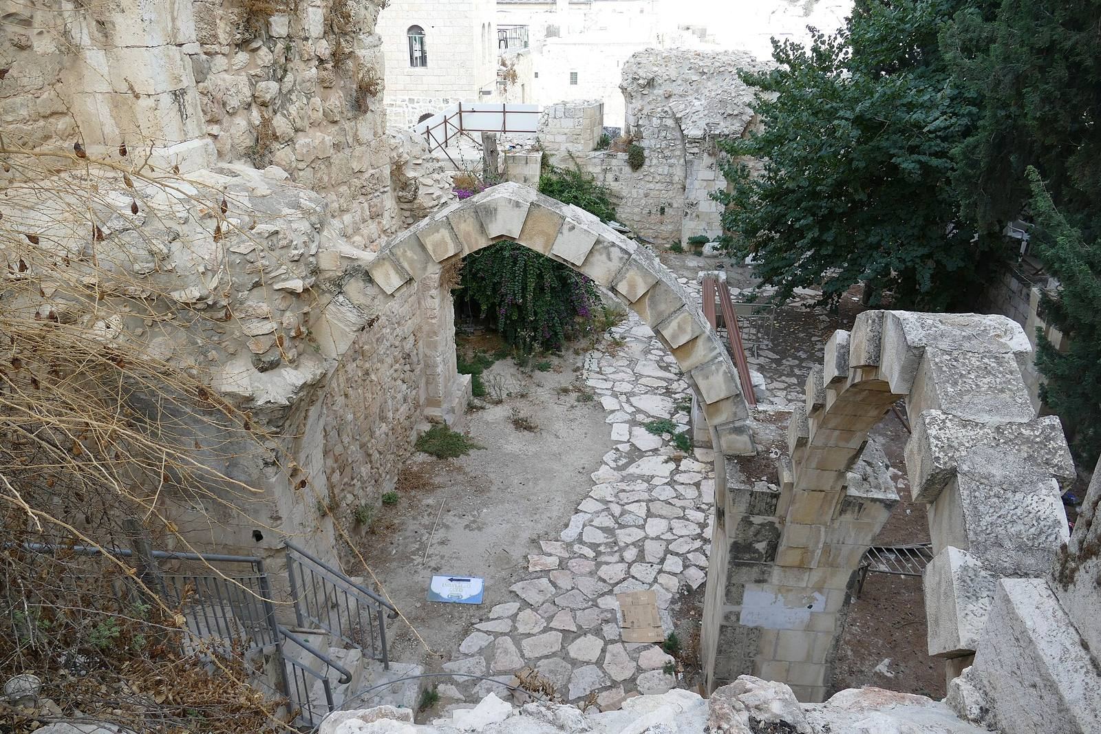
Work in Jerusalem’s Old City beginning in 1967 led to the church’s rediscovery in 1968. Excavations connected with clearing ruins from a planned road route to the Western Wall uncovered the church and southern hall. Asher Ovadiah and Ehud Netzer excavated those structures. Meir Ben-Dov later directed stabilization and partial reconstruction, strengthening unstable walls and removing additions made after the Crusader period. The site became an archaeological park, and conservation work in February–August 2009 focused especially on the former hospital.
The site is one of 20 monuments designated for preservation under the Old City’s planning scheme. In the 1990s, the Jewish Quarter Development Company sold it to the Aish HaTorah yeshiva, a Jewish religious school, under terms that permitted demolition for expansion. The Jerusalem Foundation petitioned Israel’s Supreme Court to stop the sale in 2000. In 2005, the company and the school agreed to preserve the property as an antiquities site for public access, conservation, and cultural and educational activities. The court dismissed the petition in 2009.
Remains
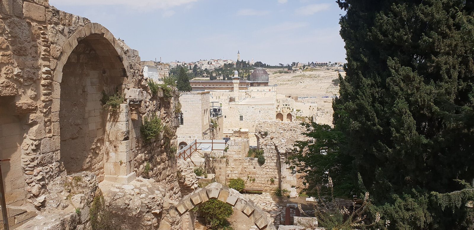
The church stood at the center of a larger complex on the eastern slope of Jerusalem’s Crusader-era German quarter, along a street leading toward the Temple Mount. A two-storey hall lay to its south, and a larger courtyard building stood to the north; excavated Crusader-period structures south and west may also have belonged to the complex. The church is an east-facing limestone basilica, meaning it has a central nave flanked by two aisles. Its plan and surviving masonry preserve evidence of the building’s layout and construction.
The church
Plan and supports
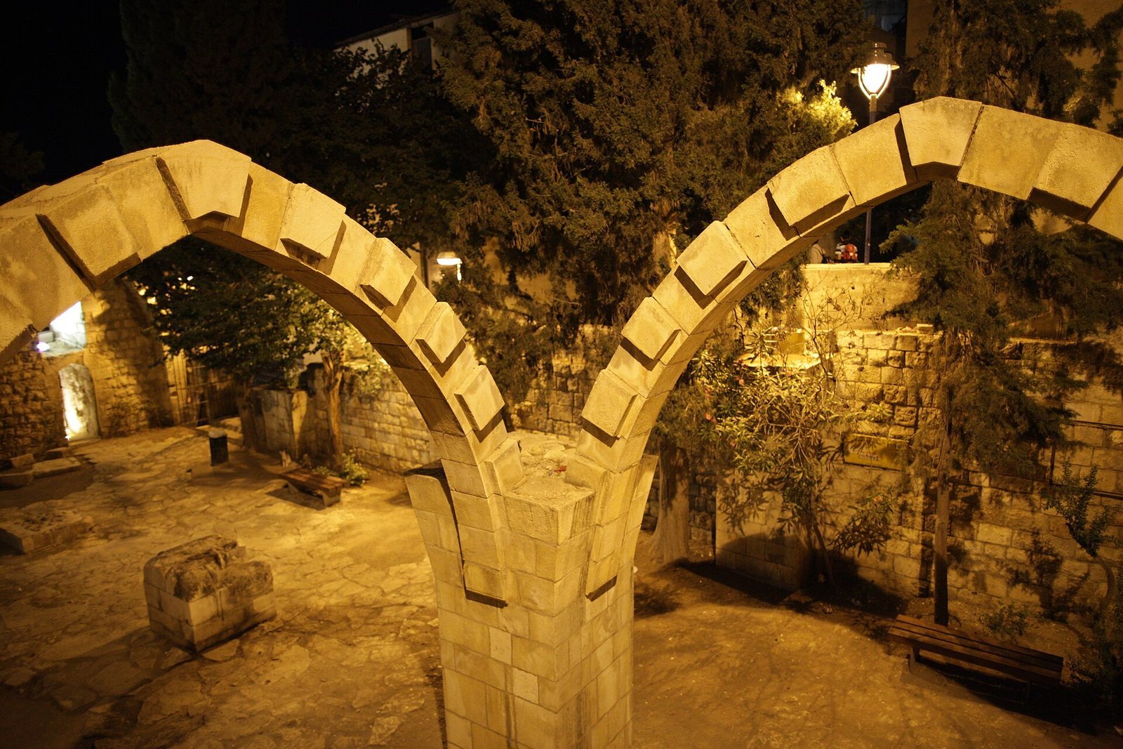
The church measures about 20 by 12 metres. Three semicircular apses, projecting spaces at a church’s end, terminate the nave and aisles. The nave is about 5 metres wide, while each side aisle measures roughly 3.5 metres. Three pairs of square piers, each around 1 metre across, divided the central space from the aisles. Bases of the pair nearest the sanctuary remain in their original positions, and two shallow pilasters survive on the west wall. Elbow-shaped supports with carved capitals indicate that the nave carried a barrel vault, a continuous arched ceiling. Leaf patterns decorate the capitals; an elbow column recovered from the church is held at the Israel Museum.
Apses and sanctuary
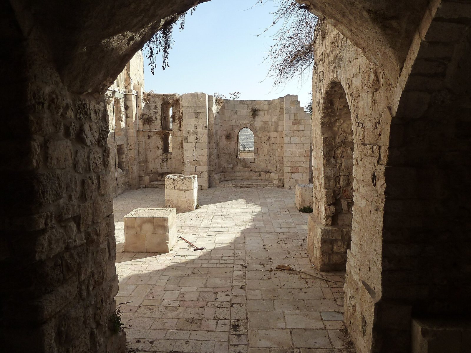
Each aisle ends in an apse. The central one has a broad, low window beneath a shallow pointed arch, much of which has been reconstructed. Each side apse has two tall, narrow windows arranged one above the other. Art historian Denys Pringle suggested that the central apse may also have had a pair of vertically arranged windows.
The sanctuary, the area around the altar, stood one step above the nave floors. A stone bench followed the curved apse walls. Beneath the sanctuary, a vaulted chamber about 5 metres high accommodated the sloping ground; later occupants used it as a water reservoir. The lower part of the north apse wall preserves traces of painting on white plaster, with dark-brown patterns. The paintings were made on wet plaster, but their style and date remain undetermined.
Walls, floors, and entrances
Cut limestone blocks form the church walls, which are 1.5–2 metres thick. The north apse wall is especially well preserved, rising 4.9 metres to a cornice, a projecting architectural molding, decorated with geometric patterns. The floor has a compacted-clay lower layer and an upper pavement of white stone slabs, each about 20 by 20 centimetres. The paving survives in the eastern and central parts of the church, and the two layers indicate construction in two phases.
Three entrances pierce the west wall. The central Romanesque doorway is the largest, measuring 2.9 by 1.15 metres; the two simpler side entrances are each 0.8 metres wide. A cistern, a reservoir for storing water, was cut 10 metres deep beneath the northern side entrance. Four doorways in the north wall connected the church with the adjoining building. On the south, a broad arched passage with three steps linked the church beneath its second vault to the upper floor of the hall.
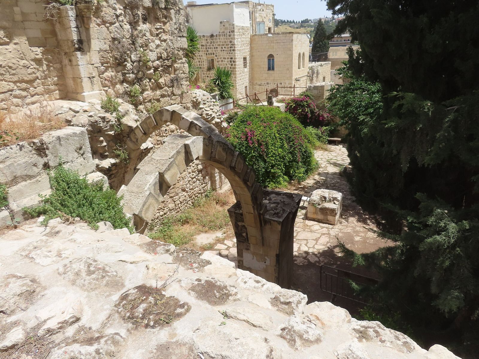
An arched niche in the exterior wall of the south apse measures 1.2 metres wide and 2.6 metres high. Two carved corbels, projecting blocks that support masonry above, frame it. Its first purpose is unknown; a later alteration cut a 1-metre-wide opening through the niche to create access into the apse.
The southern hall
Lower floor
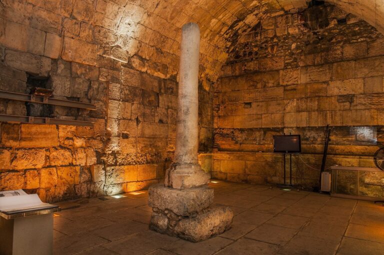
The two-storey hall extends farther than the church, though its west wall lies east of the church’s west wall. Its lower floor measures about 20 by 11 metres. Three main pillars divide it into two broad corridors, each with four bays covered by cross vaults, ceilings formed by intersecting vault sections. Three central columns and eight additional wall piers supported the vaulting. Each corridor had a window at its eastern end, and another window faced the street from the building’s southern corner. A stairway along the church’s south side led to the lower floor.
Upper floor and proposed functions
The upper floor follows a similar plan and width but reaches 27 metres in length. Its ribbed cross vaults use projecting ribs to articulate or support the intersecting vault sections. Square columns spaced about 3 metres apart support them; the columns have elbow-shaped supports and rounded bases. Hellenistic-period walls lie beneath the bases, and a plastered wall, probably built during the Mamluk period, stands over this earlier construction. Steps supported on an arch beside the church apses reached an entrance in the hall’s extended north wall.
The hall’s original role remains debated. Excavators interpreted it as the hospital, with the northern building serving as a hostel for pilgrims. Pringle instead proposed that the northern building contained the hospital and hostel, while the southern hall housed the brothers’ dormitory and dining room. Estimates for the hospital’s capacity range from 30–50 adults with more space between beds to 100–150 if beds were placed more closely together.
Northern building and earlier remains
Courtyard building
The northern structure is a rectangular courtyard building, approximately 21 by 36 metres, with an entrance facing the western street. Five cisterns beneath it collected rainwater. Pottery found in the cisterns dates mainly to the thirteenth century.
Archaeological evidence
Excavations in the area also uncovered mosaics. Ben-Dov proposed that the site had earlier held a Byzantine praetorium, an administrative or military headquarters, and a church associated with the trial of Jesus. He identified that church with Hagia Sophia, or Holy Wisdom, shown on the Madaba Map, a mosaic map of the Holy Land preserved in a church in Madaba, Jordan.