Durankulak Archaeological Complex: A Prehistoric Settlement and Cemetery in Bulgaria
Site at a Glance
- Popularity
- High
- Country
- Bulgaria
- Primary era
- Medieval
- Eras represented
- Stone Age, Bronze Age, Classical, Medieval, Modern
- Civilizations
- Ancient Greek, Bulgarian
- Site type
- City
On this page17 sections
History
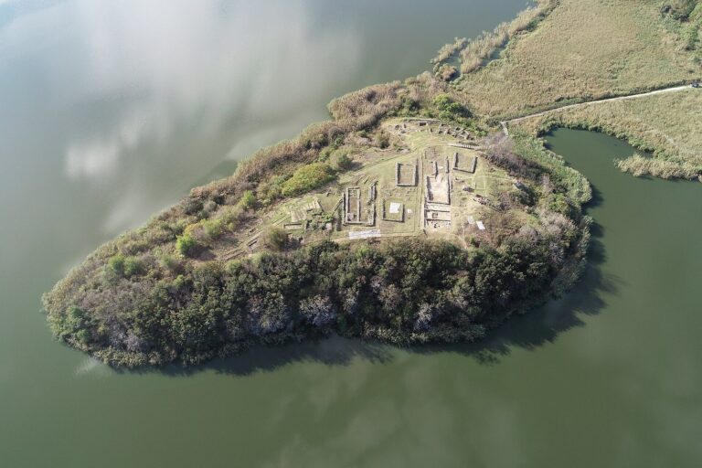
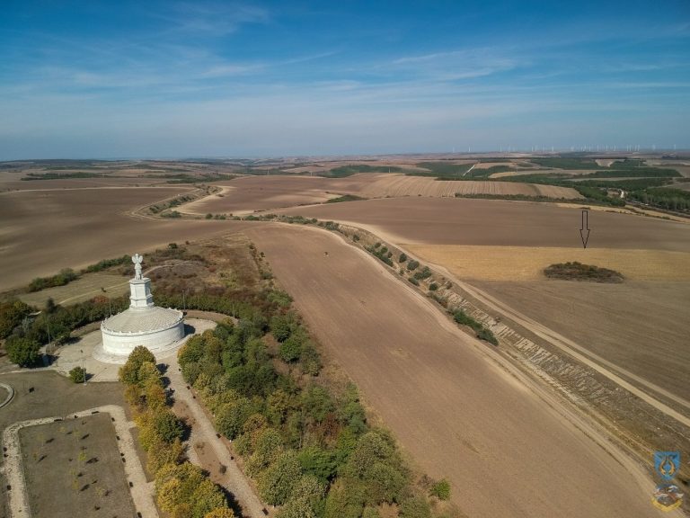
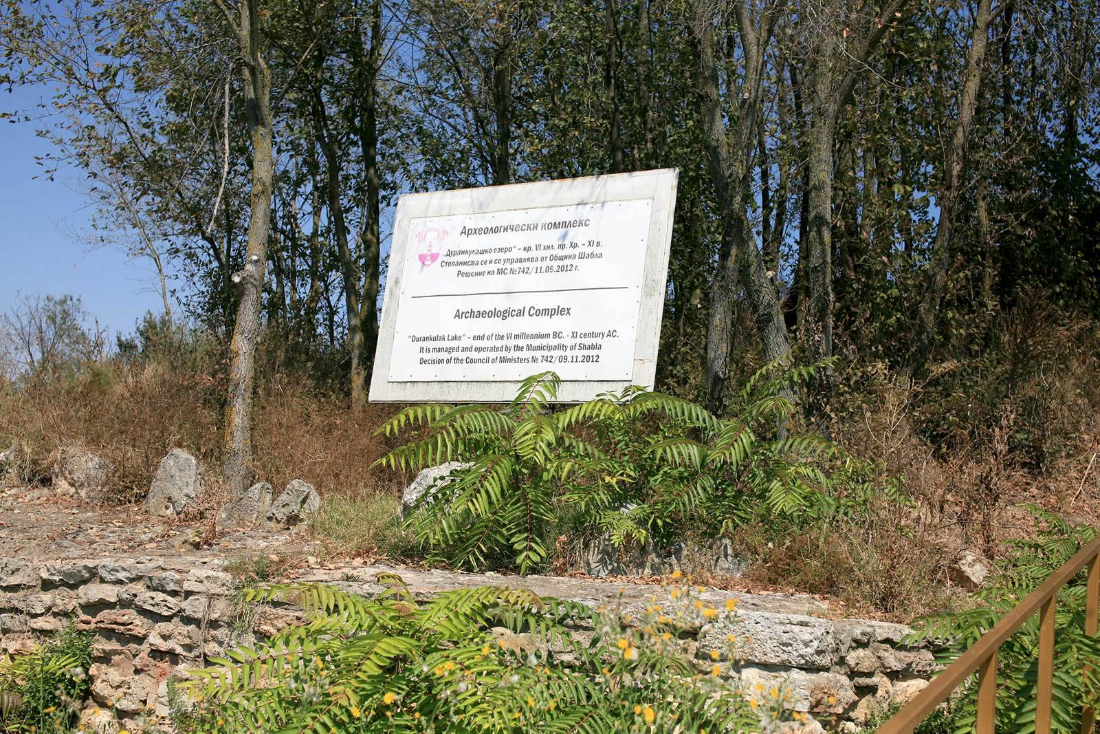
The Durankulak archaeological complex in Bulgaria includes a settlement mound on Big Island, a cemetery on the western shore of Durankulak Lake, and the Durankulak-Nivata area. Big Island was occupied from the early fifth millennium BCE until the early eleventh century CE, as successive communities established settlements and cult places in the same area. Its earliest settlement belonged to the Hamangia culture, a prehistoric culture of the western Black Sea region, in phases III–IV.
Prehistoric communities
The early settlement on Big Island has been interpreted as an administrative and political center. Its possible role in managing the exchange of valuable raw materials remains a hypothesis. During the early Eneolithic, or Copper Age, a destructive earthquake brought this phase to an end. The quake reached an estimated intensity of IX on the MSK-64 scale, which measures earthquakes by their observed effects. Initial tremors caused a major fire and drove residents away, although they salvaged many household goods. Later shocks destroyed the buildings, and the settlement was not rebuilt. The earthquake is thought to have resulted from activity along the Shabla-Kaliakra fault zone.
After a short interruption, a large late Eneolithic settlement associated with the Varna culture developed on Big Island. Its inhabitants reused stones and sometimes visible walls from earlier buildings. The settlement went through several rebuilding phases, possibly in response to local earthquakes or fires. Cult pits and a place of sacrifice on the island are associated with the Bronze Age Cernavoda I and III cultures. At the end of the twelfth century BCE, a fortified settlement linked to the Coslogeni culture occupied the island’s southern slope. Its origins may be connected with groups described as Proto-Thracian who moved northward.
The prehistoric cemetery provides evidence for changing social differences and community practices. In Hamangia IV, copper objects occur in 42.3 percent of graves and gold in 9.6 percent. Most grave goods were made of locally available bone, stone, and clay, while imported shells were uncommon. Wealth became concentrated in a smaller group of burials in Hamangia IV. In the Varna I phase, dated to about 4500–4400 BCE, inequality temporarily eased; during Varna II–III, about 4400–4150 BCE, valuable objects were concentrated in an estimated 3–5 percent of graves. Copper and gold occur in approximately 40 and 10 percent of Varna I graves respectively, with their occurrence falling markedly by Varna III.
Bones of the European wild ass, Equus hydruntinus, occur in about 15 percent of Hamangia I–II graves. Their association with burials may reflect an economy combining hunting and herding, as well as a possible ritual or status value for the animal’s meat. Burial practices also varied by age and sex: in Hamangia IV, children were placed in the shallowest pits and men in the deepest, a pattern that continued into the Varna period. Skeletal evidence, burial customs, and grave goods point to interaction between local communities and migrants from the Balkan interior during the late Eneolithic.
Greek sanctuary and later ancient occupation
Greek settlers from Callatis, an ancient colony at the site of modern Mangalia in Romania, created a cave sanctuary to Cybele on Big Island at the end of the fourth century BCE. Cybele was a major Anatolian mother goddess also worshipped in parts of the Greek world. The sanctuary was most intensively used in the first half of the third century BCE and remained in use into the first quarter of the second century BCE. An earthquake probably caused its abandonment when much of the cave vault collapsed.
The sanctuary’s importance appears to have grown after Lysimachus, one of Alexander the Great’s successors, besieged Callatis in 313/312 BCE and ordinary life resumed there. Soldiers in his army may have visited and made sacrifices at the sanctuary, although this remains uncertain. Stamps on transport amphorae from Greek cities, found at the sanctuary and nearby cemetery, indicate renewed trade between Callatis, the Aegean, and the Black Sea region.
A small community occupied the area beneath the surviving part of the sanctuary vault in the sixth century CE, during Late Antiquity, the transition from the ancient Roman world to the early Middle Ages. Its occupation ended after a destructive fire.
Early medieval settlement
A settlement of the Proto-Bulgars, a people who formed part of the early medieval Bulgarian state, was established on Big Island in the mid-ninth century and lasted until the beginning of the eleventh. Its inhabitants came from the northern Black Sea region. Their migration south may have been prompted by conflict with the advancing Khazars, while the settlement’s defenses indicate concern about external danger. Increasing pressure from Byzantium probably contributed to its decline.
Evidence from the settlement points to Christian customs, including burial practices, and offers few indications of pagan practice. Some residents may have converted before arriving, perhaps in their former homes around Crimea. The settlement’s development overlapped with the conversion of the Bulgars to Christianity, the end of Boris I’s rule, and the reigns of Simeon I and Peter I.
Archaeological research and conservation
Archaeological investigations began in 1974 under Henrieta Todorova, Kiril Botov, and Todor Dimov. Work in the necropolis continued from 1976 to 1990 under their direction. The early medieval settlement was fully excavated in 1976–1980, and the results were published in 1989. Conservation and presentation work on Big Island began in 1980–1984 but was only partly completed. Since 2015, research on the island has used updated recording and analysis methods, including digital documentation, photogrammetry, and revised study of archaeological layers. Excavations and geophysical surveys have also examined areas on the western shore and beneath the lake.
Remains
The complex is spread across Big Island and the lake’s western shore. Big Island’s settlement mound has occupation deposits 3.20–3.50 metres thick, divided into seven archaeological layers; six have been fully investigated. The cemetery lies on a gently east-sloping, well-drained terrace about 360 metres southwest of the island. Its prehistoric, ancient, and medieval burials occupy a landscape of loess and river-laid deposits formed during the Late Pleistocene and Holocene.
Big Island settlements
Before the first buildings were erected, the rocky surface of Big Island was levelled with finely crushed reddish stone and grey meadow-marsh clay. The island once stood on the western bank of a river that preceded the lake. Changing water levels later turned the river valley beside the island into a lagoon, and parts of the island and settlement may now lie beneath the lake. Geophysical surveys have identified traces of another settlement area beside a tributary on the western shore. The Shabla valley, a dry valley associated with a seasonal watercourse, and related depressions are thought to have influenced regional water conditions and prehistoric settlement.
Early Eneolithic buildings
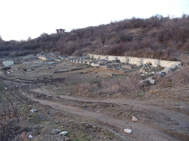
The early settlement had straight streets up to 1.50 metres wide, with representative buildings distinguished from economic ones. Most buildings were oriented north to south. Excavations identified six structures, numbered 5, 8, 12, 13, 24, and 25; five have been conserved in place with their original stone foundations.
Late Eneolithic houses and layout
Varna-culture houses were generally smaller than those of the earlier settlement. Most were rectangular, with their long sides running north to south. A typical house had a main room with a central hearth, an entrance room separated by a clay partition, and a roughly square oven against the east wall. Entrances were commonly on the south side. Oven floors were made from small stone slabs repeatedly coated with yellow clay.
The houses formed three parallel rows running east to west. Narrow lanes and larger open spaces separated them, and some were grouped into family or clan compounds. Larger buildings within these groups, including building 9/IV, may have served public or sacred purposes. Some rebuilt houses had a northeast-to-southwest orientation.
Late Bronze Age settlement
The Late Bronze Age settlement occupied terraces on Big Island’s southern and western slopes. Its upper terrace was made artificially, and a massive stone wall protected the settlement from the north. In both construction phases, A and B, small buildings had foundations of several courses of stone slabs and a curved end, or apse.
Cybele sanctuary
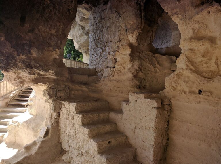
The sanctuary occupies the southern slope within a terraced landscape. Its upper terrace was formed artificially in the Late Bronze Age, while the lower terrace took shape naturally by the fourth millennium BCE. Water and erosion hollowed caves in the slope, and the largest was cut and shaped for use as a sanctuary; tool marks remain visible on its walls. The building extends 25 metres into the rock and measures 6.40–8.15 metres across. Its parts include an open cult area, a porch with a stone gabled roof, a rock-cut entrance corridor, and central halls divided by a wall.
The eastern hall has a curved recess, or apse, where the goddess’s throne stood. The western hall contains an altar and channels for sacrificial blood. A channel cut into the altar led to a deep collecting hollow. Orange clay-and-lime plaster coated the walls, and fragments were recovered during excavation. A dedicatory slab with a relief of Cybele was found in a nearby building wall and was probably taken from the temple ruins. Terracotta pieces and pottery fragments also support the identification of the sanctuary.
Well and water installations
A deep drinking-water well lies beside the temple below the island’s southern slope. Broken amphorae found in the well include vessels bearing stamps from Sinope, Thasos, and other Greek cities. The well belonged to an economic complex similar to one at the foot of the southwestern slope.
Early medieval settlement
The early medieval settlement comprised 240 buildings arranged in 15 quarters. A broad road reinforced with crushed stone divided its northern and southern areas and remained passable throughout the year. Most buildings were small, rectangular, and stone-walled, with floors set 50–80 centimetres below ground. Stone was also used for ovens and hearths. Circular and oval, yurt-like structures stood alongside these houses.
Several circular buildings, or rotundas, stood in the southern part of the settlement. Building 58 was converted into a church, and Christian graves were found around it. These graves had pits lined and covered with large stone slabs. A defensive wall crossed the former porch of the Cybele sanctuary and incorporated reused Hellenistic blocks of carefully dressed stone, as well as pieces of the temple’s pediment. The prehistoric stone foundations have been conserved with little alteration, while early medieval buildings have undergone more extensive rebuilding, including masonry set with cement mortar.
Durankulak necropolis
Prehistoric cemetery
Excavations in the prehistoric cemetery recorded about 1,200 burials, including 390 assigned to Hamangia III and 164 to Hamangia IV/Varna I. Hamangia IV gold objects predate the gold finds associated with the Varna culture and rank among Europe’s earliest worked gold. Across the cemetery, grave goods and burial construction include gold, copper, weapons, pottery, ornaments, and imported materials.
Individual finds include anthropomorphic clay figures placed beneath the head of a woman in grave 626 and a ceramic vessel with an anthropomorphic lid. Grave 644 contained large Spondylus shell bracelets. Finds from grave 49 include a necklace made from red deer vestigial upper canine teeth and a reconstructed belt with cylindrical Spondylus beads. Shell ornaments came from grave 609, where Dentalium shells may have indicated high status. A necklace from male grave 211 combines gold, carnelian, and agate beads.
Ancient graves
Investigations on the western shore recorded 41 ancient graves. One, grave 341, was a cremation; the others were inhumations. Four graves within the prehistoric cemetery were excavated in 1983, while the remaining 37 lay in the Durankulak-Nivata area. Most are considered Early Hellenistic. Some catacombs and graves with side niches may instead be associated with late Sarmatian groups, peoples of the Eurasian steppe.
The graves include stone-built rectangular chambers covered by large slabs, loess pits that were partly slab-covered, and uncovered pits with varied orientations. Other forms have a side niche closed with upright slabs, or a passage leading into a chamber cut into loess. These catacombs lie 1.00–1.20 metres deep. Grave orientations vary; the stone chambers generally held the dead facing west, while the three recorded catacombs had two bodies oriented east and one west. Some chambers were reused, with earlier bones moved aside, and displaced bones also occurred in other graves.
Amphora stamps
A total of 84 amphora stamps were found on vessel handles or necks, and 53 can be dated. They identify production centers including Thasos, Heraclea Pontica, Rhodes, Sinope, Kos, and Chersonesus, as well as centers that remain unidentified. Most dated stamps belong to the first half of the third century BCE; one is slightly earlier and four date to the second half of that century. Some sealed groups of pits contained stamps spanning as much as 50 years.