Jerusalem Archaeological Park: Archaeological Remains beside the Temple Mount
Site at a Glance
- Popularity
- Medium
- Country
- Israel
- Primary era
- Classical
- Eras represented
- Bronze Age, Iron Age, Classical, Medieval, Early Modern, Modern
- Civilizations
- Byzantine, Canaanite, Israelite, Ottoman, Roman, Umayyad
- Site type
- City
On this page23 sections
History
The Jerusalem Archaeological Park preserves remains from roughly 3,000 years of occupation in Jerusalem, Israel. Its most prominent remains belong to the Second Temple period, the era of the Temple rebuilt after the Babylonian exile and destroyed by Rome in AD 70. Archaeological layers in the area also represent the Bronze and Iron Ages, and Roman, Byzantine, early Islamic, and Ottoman periods.
Excavations and archaeological interpretation
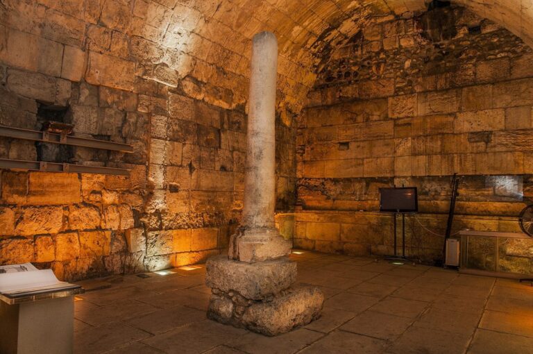
Charles Warren began archaeological investigations in the Ophel area in the 1860s. Because Ottoman authorities prohibited open excavation on or near the Temple Mount, a sacred place for Muslims, Warren worked through underground tunnels and shafts. His discoveries and records remained useful to later researchers. Kathleen Kenyon excavated in the area in the 1960s, while the Old City was under Jordanian control. Her principal advances came from work in the nearby City of David; she made no major discoveries in the Ophel itself.
In 1968, after 19 years of Jordanian rule, Israeli archaeologists were permitted to work in and around the Old City. Political and religious sensitivities ruled out excavation on the Temple Mount, so investigations focused on the surrounding land. Benjamin Mazar of the Hebrew University of Jerusalem was appointed chief archaeologist for the area south of the Mount, on land leased from a Muslim waqf, an Islamic charitable or religious endowment.
Mazar’s excavation ran from 1968 to 1978 and became one of Israel’s largest archaeological projects. Its publications called the work the Temple Mount Excavations, although the Temple Mount itself was not excavated. The project drew wide academic and public attention. Benjamin and Eilat Mazar published the first part of its report in 1989. Benjamin Mazar died in 1995, before further volumes appeared. A team led by Eilat Mazar continued preparing reports from excavation records and surviving finds, but the publication remained incomplete.
Excavations continued in subsequent decades. Eilat Mazar led work below the Huldah Gates in the eastern part of the site in 1988. From the mid-1990s to 2001, Ronny Reich, Yaakov Billig, and Yuval Baruch investigated areas around the Temple Mount’s southwestern corner, the Dung Gate plaza, the Huldah Gates, and the southeastern corner. Their work revealed further stretches of the Herodian Street and Roman cardo, a principal north-south street in a Roman-style city. It also examined an early Islamic palace and completed excavation of a Roman-Byzantine bathhouse in 2000.
The excavations exposed remains from many periods in ground occupied for millennia. To present selected periods separately, the area was divided into three archaeological zones. In the Second Temple zone, excavation reached that period and later remains were removed; plans to continue down to First Temple or earlier layers were abandoned. Features from other periods were retained in their respective zones when considered especially important.
Park, worship, and management
The site was formally established as an archaeological park in the late 1990s. The Davidson Center, which displays finds from the park and nearby areas, opened in 2001. It was established in part within the remains of an early Islamic building. A legal dispute between the East Jerusalem Development Company and the Company for the Reconstruction and Development of the Jewish Quarter ended with a court transferring ownership to the latter. An agreement allowed the Elad Foundation to operate the center in return for settling outstanding rent. Elad managed the park until 2021, when management passed to the Jewish Quarter development company.
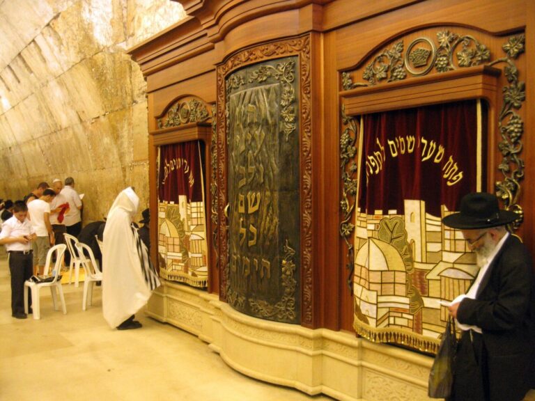
A compromise reached in the 1990s over Jewish prayer practices allowed Conservative and Reform congregations to hold mixed-gender services and ceremonies in the park beside the Western Wall. The main prayer plaza continued to serve Orthodox worship. The Second Temple-period paved street became a setting for services, bar mitzvahs, and other celebrations. Ezrat Israel, a prayer area for egalitarian worship at the Western Wall, was established there in 2013.
The Davidson Center was renovated and redesigned in 2023, with a new wing and interactive exhibition space. Its displays and models interpret archaeological finds and the changing appearance of the Temple Mount and its surroundings.
Remains
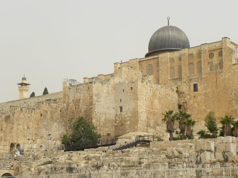
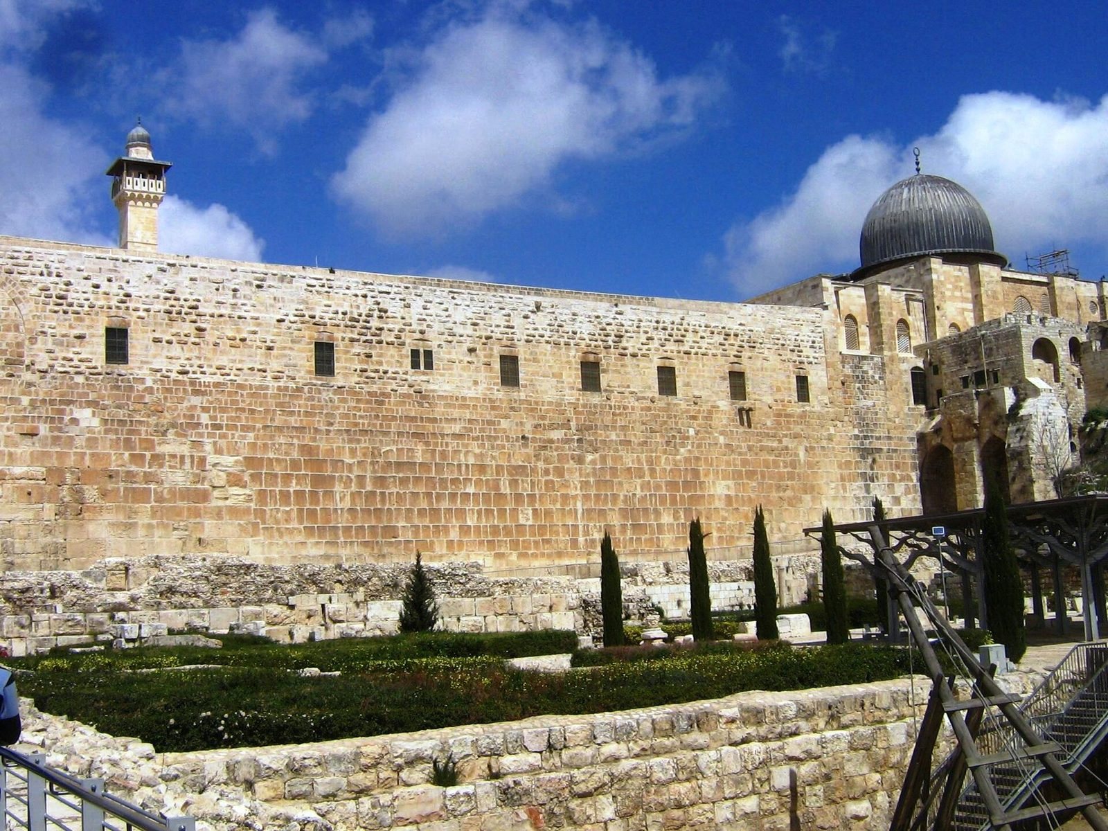
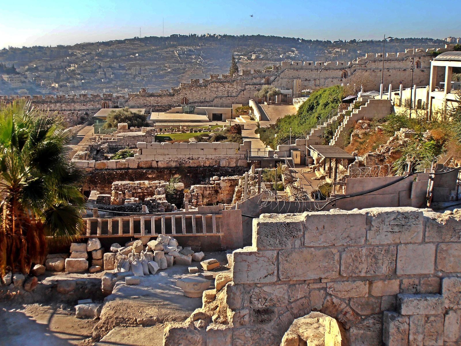
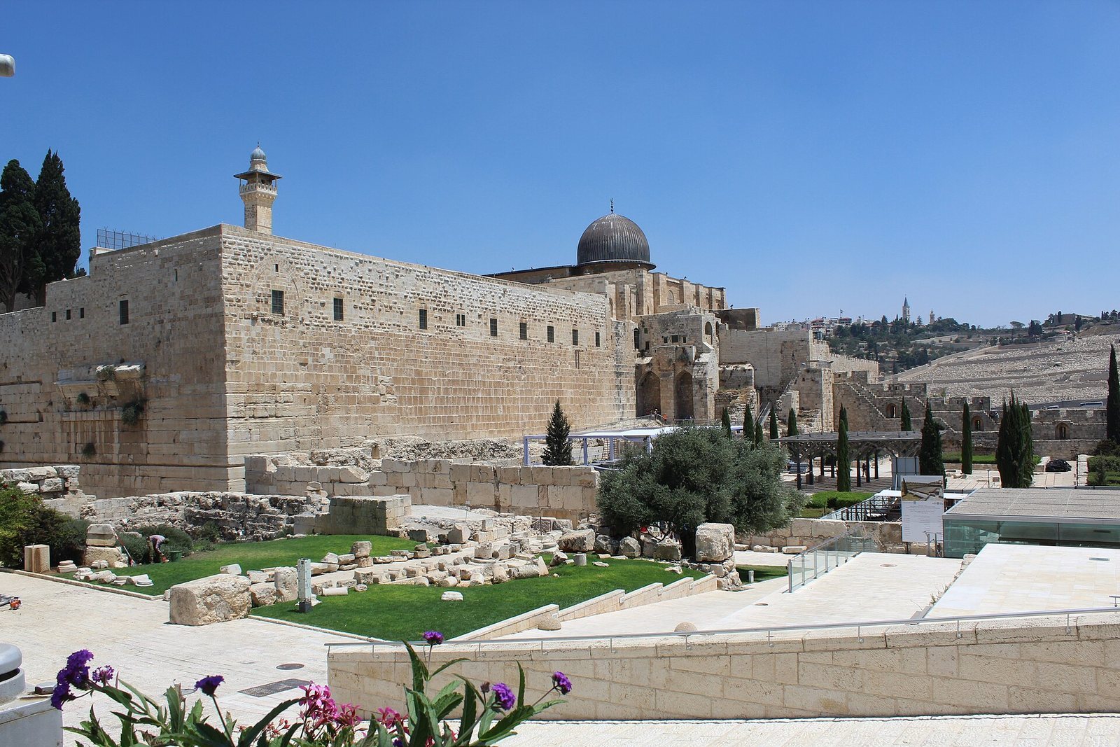
The park covers about 20 dunams, or 20,000 square metres, on the northern Ophel, the elevated area between the City of David and the Temple Mount. It lies below the Temple Mount’s Southern Wall and alongside part of its Western Wall. The park extends around the Southern Wall and part of the Western Wall; sections meet the Old City wall, while the stretch beside Ophel Road continues beyond it. An underpass beneath the road leading to the Western Wall provides access. The remains are arranged in three main zones: Second Temple-period features beside the Western Wall, Byzantine remains near the eastern half of the Southern Wall, and early Islamic remains beside its western half. Selected features from other periods are also retained within these zones.
Second Temple-period streets and structures
Paved street and shops
Beside the Western Wall, an exposed section of paved street measures about 75 metres long and eight metres wide. High stone curbs run along both sides. The street was part of the approach used by visitors and pilgrims to reach western entrances to the Temple Mount. A continuation found in 2007 on the slopes of the City of David, near the Second Temple-period Pool of Siloam, indicates a route linking the Mount with the southern city.
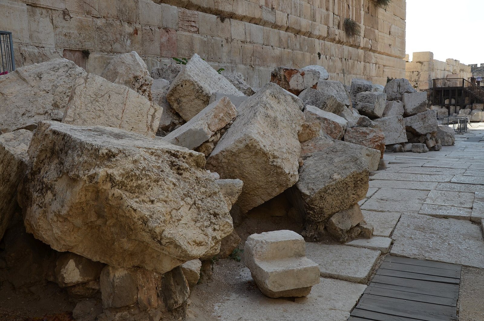
Shops stood beside the street along the wall and may have sold offerings, sacrifices, or other goods used in Temple worship. The shops were almost entirely destroyed, but ash from a fire remained visible on their walls. Warren and Benjamin Mazar exposed portions of the street, and Reich uncovered most of the surviving stretch. Many of the wall stones that once covered it were removed and relocated elsewhere in the park. Fifteen coins recovered from soil beneath the paving include one minted under Pontius Pilate, Roman prefect of Judaea from about AD 26 to 36. Its date establishes that the street was paved later; the paving stones’ unworn surfaces suggest that it saw limited use. Once attributed to Herod, the street is now generally dated to the time of his great-grandson Agrippa II, a client king of Rome in Judaea. Josephus, a first-century Jewish historian, links Jerusalem street paving under governor Albinus, in AD 62–64, to unemployment after the Temple Mount works had ended.
One paving stone remains in place as a cover for a connection to an underground drain. About half a metre square, it has two triangular recesses at its centre, apparently intended for an iron lifting ring. Its design has been compared with a passage in the Mishnah, an early compilation of Jewish oral law, describing a removable stone cover used to clean a Temple drainage system.
Huldah Steps
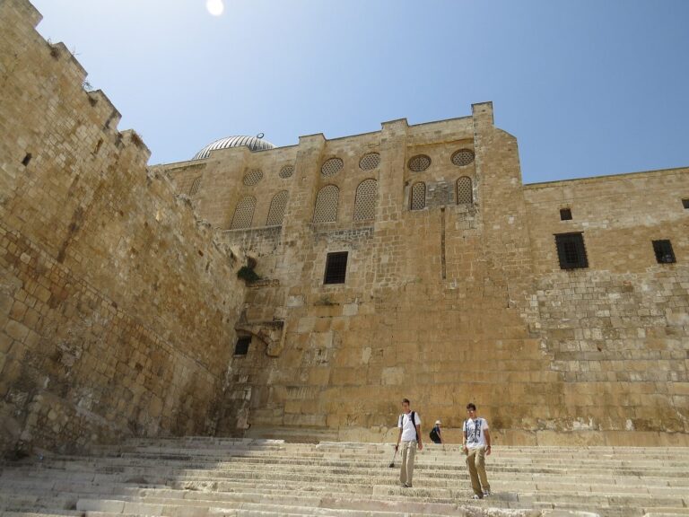
The Second Temple-period Huldah Steps extend across the Southern Wall and lead to the gates for which they are named. Their broad and narrow steps alternate, a pattern also found on other stairways of the period in the area. Reich suggested that this arrangement eased the climb. Benjamin Mazar exposed the steps, and some sections were reconstructed to make passage safer. A group of ritual baths, used for purification, stood midway along the steps.
Robinson’s Arch
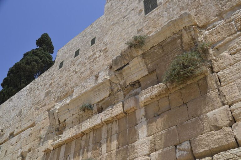
Robinson’s Arch formed part of a major entrance on the western side of the Temple Mount. A staircase rose over the massive arch, connecting the street with the elevated platform. The arch was more than 15 metres long, spanned about 12 metres, and rose roughly 17 metres above street level. The suspended section between the Western Wall and its supporting pier weighed about 1,600 tonnes. At the eastern end the arch was built into the wall; at the western end it rested on a large pier.
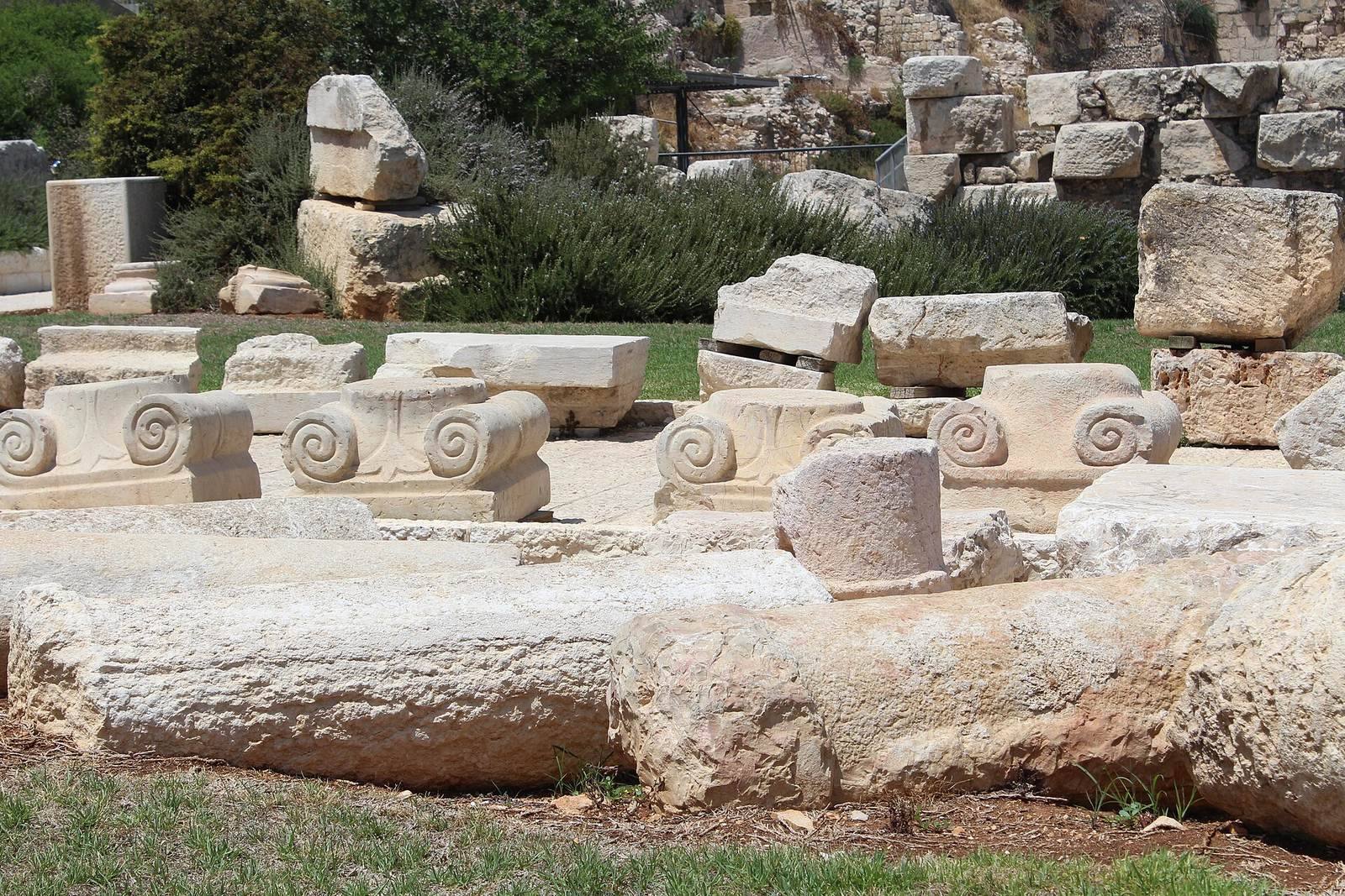
The arch was almost entirely destroyed after the Roman destruction of Jerusalem, then covered by soil and rubble. Archaeology has not established precisely when it was demolished. Its junction with the Western Wall remained visible above ground, and Edward Robinson identified it as part of an arch in 1838. Warren used the projecting curve to calculate the opposite pier’s position and located it by digging a vertical shaft. Four shops at the pier’s base were later exposed by Reich and Billig as part of the street complex. A surviving lintel fragment and other stones have helped reconstruct the entrance’s appearance.
Trumpeting inscription
A fallen corner stone near the Temple Mount’s southwestern corner bears a Hebrew inscription conventionally rendered as ‘To the place of trumpeting…’; the rest is illegible. The block is understood to have fallen from the upper corner of the Temple Mount walls during Roman dismantling. A niche survives on its inner face, while the original inscription is displayed at the Israel Museum. The surviving words have been understood as identifying a place where trumpets announced the start of the Sabbath or festivals, though proposed completions of the text differ.
Western Wall inscription
Below the base of Robinson’s Arch, a two-line Hebrew inscription is carved into the Western Wall’s third course. It quotes Isaiah: ‘You shall see, and your heart shall rejoice, and your bones shall flourish like grass.’ The wording differs slightly from the standard biblical text. The letter forms could belong to the fourth century, but are also compatible with the ninth to eleventh centuries, and analysis has not established a narrower date. Suggested explanations include a different textual version, a practice of abbreviating sacred verses, an intentional change to prevent the verse being read as referring to nearby non-Jewish graves, a Jewish tomb inscription, or mockery directed at those graves.
Purification complex
A large stone structure beneath the staircase linked to Robinson’s Arch served pilgrims as a purification complex and contained numerous ritual baths. The building was almost entirely dismantled, but rock-cut baths from its ground floor survive. Reich and Baruch distinguished baths built before and after Herod the Great’s expansion of the Temple Mount. A major bath was excavated beneath the threshold of the eastern Huldah Gate, also called the Triple Gate. Rock-cut channels and pipes supplied water that had not been drawn by hand, probably from nearby aqueducts.
Ophel, Hasmonean, and Roman remains
Fortifications and storage buildings
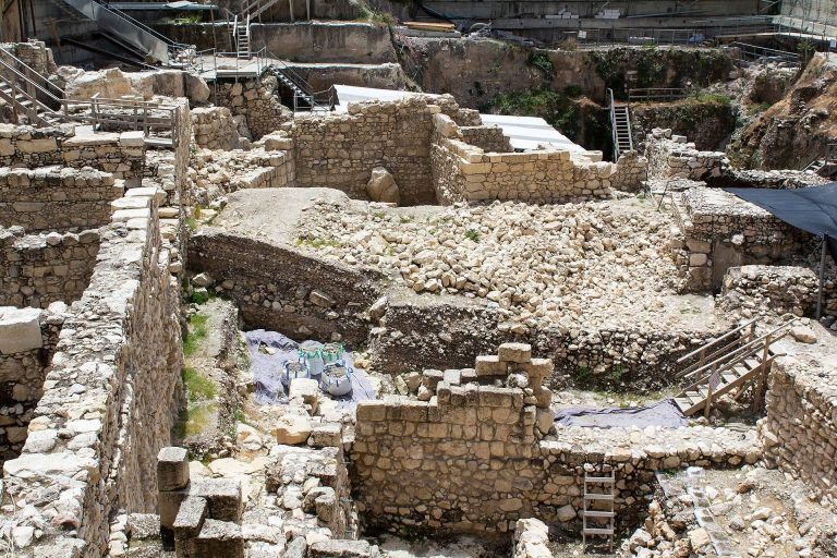
Along Ophel Road at the park’s lower edge, Eilat Mazar exposed fortifications that she dated to the tenth century BC, together with a gate and food-storage rooms containing large jars. One jar bears a partial inscription interpreted as ‘to the chief of the…’, perhaps referring to a chief baker or treasurer. Another has an engraved palm tree. Excavations also revealed a large public building and water cisterns attributed to the First Temple period, the earlier era associated with the Jerusalem Temple traditionally attributed to Solomon.
Hasmonean structures
Nearby remains include a large Hasmonean building with a pool at its centre. The Hasmoneans were a Jewish dynasty that ruled Judaea in the second and first centuries BC. A particularly large, square ritual bath with stepped sides also survives in the area and dates to the Second Temple period. Remains near the Huldah Gates may belong to the Acra fortress, which probably stood there during the Hasmonean revolt.
Roman building and bathhouse
A four-room building near the Temple Mount’s southwestern corner had an earlier Roman phase and a later Byzantine-period phase. Five circular ovens were found there, as well as brick and tile fragments stamped with the name of the Tenth Legion Fretensis, a Roman military unit. A Latin-inscribed clay stamp on the floor also contributed to the identification of the building as a place occupied by Roman soldiers. A military bread stamp found on the floor has a rectangular body, a trapezoidal section, and a partly missing ring with three ridges. Its face bears the letters PRIM, possibly the baker’s name, Primus, or a label for first-quality bread, panis primus, perhaps intended for senior legionaries.
A bathhouse in the same area was excavated by Benjamin Mazar and its excavation was completed by Yuval Baruch in 2000. Reich and Baruch interpreted it as a Byzantine bathhouse built over a Roman one, and proposed that it continued westward to the cardo. They considered the street to have originated in the Roman period and remained in use until the eighth century.
Byzantine neighborhood
Christian buildings and the hoard
In the eastern Ophel, a densely built Christian neighborhood developed late in the fourth century over the remains of a Jewish neighborhood from the Second Temple period. It included churches, a monastery, a hostel, workshops, shops, and houses. Some surviving floors carry mosaics with geometric patterns. The neighborhood was probably destroyed during the Persian-Sasanian conquest of Jerusalem in 614. The Sasanians ruled a Persian empire of late antiquity, and the neighborhood was not rebuilt.
A hoard uncovered in 2013 had been hidden in the wall of a Byzantine building. It contained silver and gold objects and 36 Byzantine coins dating from the mid-fourth to the early seventh century. The largest and most notable object is a gold medallion with a seven-branched menorah, a shofar, or ritual horn, and a third image. Eilat Mazar identified that image as a Torah scroll; other scholars have interpreted it as a lulav, the palm branch used at Sukkot, with myrtle and willow branches. The medallion is now in the Israel Museum. Mazar proposed that the hoard belonged to Jews who came to Jerusalem with the Sasanian conquest in 614, amid messianic expectations and promises to Jews, and in connection with Jewish recruitment into the Sasanian army under Nehemiah ben Hushiel. This proposed ownership has not been securely established.
Early Islamic palaces and later reuse
Palace complex and Palace 2
Benjamin Mazar attributed four large palaces in the early Islamic zone to the Umayyad caliph al-Walid I, whose reign lasted from 705 to 715. The Umayyads were the first hereditary Muslim caliphal dynasty. Together, the palaces covered the park and the Western Wall prayer plaza and formed a ruling complex. Each was arranged around an open courtyard. Only Palace 2 is displayed in this zone. Its many rooms surrounded a courtyard that probably had a colonnade, while the building itself may have risen two or three storeys. Slender cypress trees now mark the positions of the columns. A small bridge may have linked the palace roof with al-Aqsa Mosque. Some palace walls reused stones from the Temple Mount enclosure.
The date and construction history of the palaces remain disputed. The conventional interpretation holds that they were Umayyad buildings, destroyed by an earthquake in the mid-eighth century, then abandoned and later quarried for stone used in Fatimid fortifications. Yuval Baruch instead argued that construction was left unfinished after political change and the Umayyads’ defeat by the Abbasids, who succeeded them. Radiocarbon dating has also suggested that the buildings began in the Byzantine period and were adapted under early Muslim rule rather than originally built by the Umayyads.
Ottoman wall and Roman latrine
The sixteenth-century Ottoman city wall incorporated the outer line of Palace 2. At the palace’s corner, the wall turns north at a right angle and joins the Temple Mount wall partway along its Southern Wall. In the 1970s, excavators made an opening through the Ottoman wall where a former palace gate had stood, connecting sections of the park. The opening is known as the Gate of the Excavators or Gate of the Archaeologists. A Roman public latrine occupies the western edge of Palace 2. Some of its seats and its drainage channel survive in place among the early Islamic remains.
Early Islamic-period synagogue
West of the palace are remains interpreted as an early Islamic-period synagogue, regarded as the earliest synagogue discovered in Jerusalem. It probably had two storeys and an open courtyard. The identification rests in part on red menorah paintings on the walls, another menorah painted on a stone recovered from a collapsed room, and recesses beside doorways interpreted as places for mezuzot. Two further menorahs were painted on a doorway lintel, with a cross between them concealed beneath plaster. The building may first have served Christians in the Byzantine period, then been converted for Jewish use after the Arab conquest. It served as a synagogue for about 60 years before an Umayyad palace was built over it.
Davidson Center and archaeological displays
Building, models, and collections
The Davidson Center occupies part of the remains of Umayyad Palace 3 at the southwestern end of the park. Its displays bring together finds from the park and surrounding area in a sequence extending from the Second Temple period to the end of the early Islamic period. The center has presented a virtual reconstruction of the Second Temple-period Temple Mount, including the southern Royal Stoa, a monumental columned hall in the Temple complex, and a second model of the Temple Mount and its surroundings under the Umayyads. Ronny Reich developed the archaeological content of the Second Temple model, which Lisa Snyder built; Yuval Baruch created the Umayyad-period model. A metal scale model depicts modern Jerusalem.
Among the exhibited finds are stone weights, ossuaries used to hold bones after burial, fragments of decorative stonework from the Herodian Temple Mount, the Magdala Stone, a plastered wall from Jason’s Tomb, a coin of Agrippas, and an ossuary engraved with the word Jerusalem. The collection also includes a rare coin minted by Antigonus II Mattathias, the last Hasmonean king. It bears what is described as the earliest known artistic depiction of the Temple menorah, made 107 years before the Temple’s destruction. The center’s 2023 redesign added interactive galleries on inscriptions, the Foundation Stone, a sacred rock revered in Jewish tradition, the Jerusalem calendar, artistic memory of the Temple, Jerusalem poetry, the Western Wall’s history, and Warren’s excavations.