Château de Dreistein: A Ruined Medieval Castle in France



Site at a Glance
- Rating
- 4.5
- Popularity
- Low
- Country
- France
- Primary era
- Medieval
- External website
- Open
- Eras represented
- Medieval
- Civilizations
- Holy Roman Empire
- Site type
- Military
- Remains
- Castle
On this page11 sections
History
Château de Dreistein is a ruined medieval castle in Ottrott, France, probably founded in the thirteenth century on the Mont Sainte-Odile massif. It forms part of a group of nine castles around the Odilienberg and overlooks the Ehn valley with the castles of Ottrott and Hagelschloss. Its documented history is fragmentary, but its position suggests an important connection with Hohenburg Abbey, the major religious establishment on Mont Sainte-Odile.
Origins and division of the castle
The precise date of construction is uncertain. Dreistein may have been established to protect Hohenburg Abbey and may first have served as the residence of a ministerial, a medieval administrative or military servant of a powerful lord or institution. The western complex was probably later divided into two castles, perhaps when a family separated into two lines. The available evidence does not establish whether the Middle Castle and West Castle were built at the same time or in succession.
The castle was first mentioned in 1432 as “the castle of the three stones.” The name refers to the three rocky castle sections, while stein could also mean a castle built on a rock in medieval German. By that time, Dreistein belonged to the Rathsamhausen family. In 1435, Emperor Frederick III granted it to the family as an imperial fief, meaning a stronghold or estate granted by the Holy Roman Emperor in return for service or allegiance. Emperor Charles V confirmed the grant to the Rathsamhausen-Ehenweyer branch in 1550.
Abandonment and later ownership
The eastern section may have been abandoned around 1400. By about 1670, Dreistein was described as destroyed, although the circumstances of its destruction are unknown. The Rathsamhausen family retained ownership until the French Revolution, when the property was confiscated and sold as national property to a man named Rohmer. It later passed through a man named Fuchs to the family of the industrialist Schäfer of Oberehnheim.
Consolidation work was undertaken on the ruins in 1866. An architectural surround reconstructed during that work still bears a date from that year. Château de Dreistein has been protected as an inscribed French historic monument since 1990, a legal heritage status below the highest classification of a classified historic monument.
Remains
Setting and overall layout
The ruins stand at approximately 628 metres above sea level on a rocky spur projecting westward from the middle Vosges. Two trenches, each reaching depths of up to 20 metres, divide the spur into two rocky sections. These sections contain the eastern complex, known as Klein-Dreistein or the East Castle, and the western complex, known as Grand-Dreistein.
Grand-Dreistein consists of the West Castle and the Middle Castle, while the East Castle occupies the separate rocky section about 30 metres away. Dreistein therefore comprises three independent castles, each formerly equipped with its own entrance. The buildings were constructed mainly from Vosges sandstone. Some stone came from the enlarged trenches and from a nearby section of the Pagan Wall, an ancient defensive or boundary enclosure associated with Mont Sainte-Odile.
Western complex
West Castle
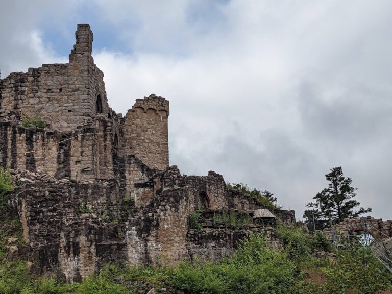
The West Castle retains parts of the lower castle’s curtain wall and a residential building that once had at least three storeys. Its eastern wall, facing the Middle Castle, served as a solid shield wall, a particularly strong defensive wall placed on the side most exposed to attack. A group of windows measuring 5.10 metres across survives on the southern side of the first upper floor. The vaulted niche beneath the window seats contains numerous masons’ marks, symbols cut into masonry by individual stoneworkers or building teams.
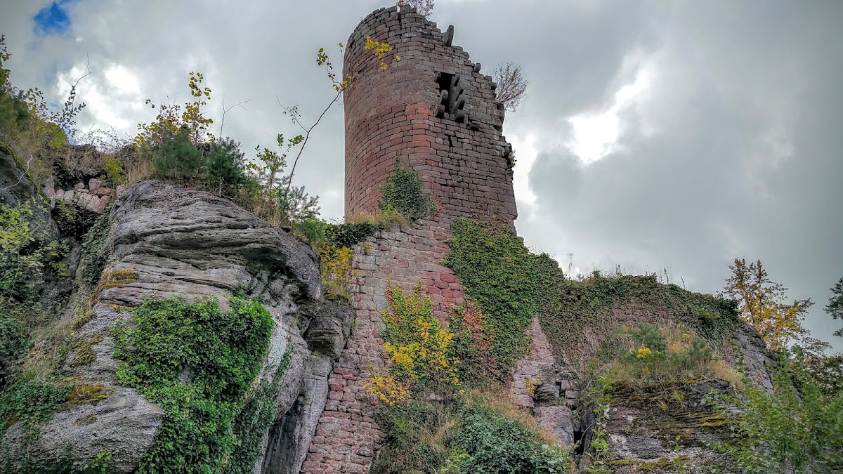
A round tower occupies the northeast corner. It was formerly reached from the second upper floor of the residential building, which has largely disappeared. The tower contained a projecting wooden oriel, a projecting enclosed window structure, and a projecting garderobe, or castle latrine. An internal spiral staircase led to the highest floor, which had a domed vault. The shield wall and tower survive to approximately 12 metres high. The castle was entered from the west through a gate that is now destroyed.
Middle Castle
The Middle Castle adjoins the West Castle immediately to the east, across a small courtyard. Limited and nonspecific stylistic evidence places its construction broadly in the thirteenth century, and it was probably built together with the West Castle. Its eastern side was defended by a shield wall faced with bossaged ashlar, carefully laid blocks whose outer surfaces retain projecting, roughly dressed faces. The wall survives to six metres high and bears numerous masons’ marks.
The Middle Castle had two ground levels. A residential building stood on the higher northern level, where only a few wall remains survive. A second building occupied the lower southern level. Part of its southern wall remains to a height of eight metres and included a projecting garderobe or throwing bay, an enclosed projection from which material could be discharged beyond the wall.
East Castle
Residential building
The East Castle stands on its own rocky section, approximately 30 metres from the Middle Castle. Its principal surviving structure is the western part of a three-storey residential building measuring 26 metres in length. The building was unusually narrow, with an internal width of only 3 to 6 metres, and its western wall, facing the Middle Castle, was reinforced to a thickness of up to 2 metres.
A transverse wall divided the ground floor into two rooms. The larger room could be heated by a fireplace. A second fireplace occupied the first upper floor, whose northern wall also contained a garderobe. On the second upper floor, pointed-arch niches preserve the position of a former double window with trefoil decoration. These niches probably indicate the location of the castle hall.
Defences and entrance works
The residential building was protected on its eastern side, where the ground was more vulnerable, by a keep that was at least partly round in plan. The tower may have been blown up at an unknown date, and its foundation is now the surviving element.
Access to the East Castle was from the south through a lower ward, represented by a few remaining wall sections. In front of the upper-castle gate are the remains of a round cistern. Its surviving draw shaft reaches 6.68 metres and was probably originally deeper than 7.50 metres.