Burgus Contra Florentiam: A Late Roman River-Landing Fort in Hungary
Site at a Glance
- Popularity
- Very Low
- Country
- Hungary
- Primary era
- Classical
- Eras represented
- Classical
- Civilizations
- Roman
- Site type
- Military
- Remains
- Fort
On this page13 sections
History
Burgus Contra Florentiam was a late Roman river-landing fortification at Dunafalva, Hungary, built on the Danube’s eastern bank to guard a crossing. The Roman term burgus means a small fortification; a river-landing burgus also defended a landing place. Recent dating places Hungary’s river-landing forts in AD 364–375, during the reign of Valentinian I, although the date proposed for this fort has been disputed.
Crossing and frontier
A river crossing at Dunafalva was in use by the mid-Roman period. It served a route through Sarmatian territory and along the Maros toward Dacia, a Roman province from AD 106 to 271. The crossing and its port helped protect this route while Dacia remained under Roman rule. A dedication by a Roman customs officer, found at ancient Partiscum near modern Szeged, has been cited as evidence for the route.
The fort stood beyond the imperial border, in territory inhabited by the Sarmatian Iazyges, opposite the Roman fort of Florentia on the western bank. Its garrison guarded the crossing and maintained close contact with troops at the opposing fort. The Danube formed the Roman frontier along much of this stretch. The Iazyges were Roman allies, though they also rebelled periodically.
Late Roman construction and disputed identity
The fort’s construction date remains unsettled. Recent archaeological dating places the Hungarian river-landing forts in the Valentinianic period, AD 364–375. Earlier proposals for this site include the reigns of Diocletian or Constantine the Great, and that of Constantius II, who ruled from AD 337 to 361. Archaeologist András Mócsy favored a date under Diocletian or Constantine, while Sándor Soproni proposed Constantius II’s reign. Zsolt Visy considered either a Diocletianic or Constantius II date possible.
The fort was conventionally identified with a burgus described as opposite Florentia in the Notitia Dignitatum, a late Roman administrative register of military commands and units. Robert Fröhlich identified the Dunafalva ruins with this installation in 1888, although the identification had been proposed earlier without archaeological confirmation. It relied in part on the view that the Roman fort opposite, known as Lugio in the mid-imperial period, was called Florentia in late antiquity. Visy disputed the equation, arguing that the register referred to another, unidentified fort nearby, since it does not generally list river-landing forts.
The garrison’s identity is also uncertain. The register associates the fort with Equites sagittarii, or mounted archers. Another proposal names Equites Dalmatae, a cavalry unit, and classis Histriae, a Danube river fleet. Soproni suggested that the mounted soldiers had been transferred from Altinum, the southernmost fort in Valeria, the later province in eastern Pannonia.
Abandonment, legends, and investigation
The fort remained in use into the early fifth century, perhaps as late as the 430s. It fell into decay after Pannonia, the Roman province along the middle Danube, ceased to be a Roman province, and was described as abandoned during the fifth century.
For a long time, people mistook the ruins for a medieval church known traditionally as the Church of the Angels. Local legend held that Louis II, the 20-year-old king of Hungary and Bohemia, was killed there after the Hungarian defeat at the Battle of Mohács in 1526. Another tradition said angels had carried a church sanctuary to the site, prompting the suggestion that the ruins were its remains.
Stones had been removed from the ruins around 1800 to build a Catholic parish church in a neighboring settlement. Following 19th-century regulation of the Danube, changes to the river’s water regime exposed much of the fort from beneath silt; Mór Wosinsky found it in notably good condition in 1894. Further masonry was taken in 1927 for a community building.
Antal Horvath, a lawyer and art collector, first studied and recorded the Roman masonry in 1885. Fröhlich made his identification three years later. Ancient historian Alfred von Domaszewski also excavated at the site, and Wosinsky surveyed the ruins and described them in a work published in 1896. In 1950, Ferenc Halász, director of the Dunaszekcső elementary school, presented an extensive account of the fort.
Severe floods in spring 1956 led local residents to take more masonry for rebuilding houses. Pál Lakatos, sent by the Pécs museum, assessed the damage and sought to prevent further destruction. Mócsy investigated the remains in 1958 and reconstructed the ground plan from earlier records, though previous damage prevented a complete survey. Zsolt Mráv led the first scientific excavation in 2008. Under Hungary’s 2001 heritage law, the fort is protected as nationally valuable archaeological property, and its archaeological finds belong to the state.
Remains
The fort occupied the low-lying island of Mohács, an area cut by branches of the Danube, described as marshy and subject to annual floods. Its reconstructed plan centers on a rectangular residential and watchtower building measuring 16 by 22 metres. Stone and brick formed the core of the fort, while the arrangement of its river-facing enclosure remains uncertain.
Central building and flanking towers
The central building’s foundations were about 3.5 metres thick. Two square bases reconstructed inside it would have supported several storeys and a heavy tiled roof. The building’s long northwest side followed the river. From each short side, a wall about 1.5 metres thick extended toward the northeast or southwest and ended at a square tower with walls of similar thickness. From each tower, another wall ran at a right angle toward the river. These walls may have carried crenellations and may have terminated in further towers.
River frontage and surviving fabric
Foundations and erosion
The fort’s western, river-facing section projected into the bank and was eventually undermined and destroyed by erosion. Halász described its foundation as a raft of oak timbers, with horizontal beams and others driven vertically into the ground. Mócsy also noted horizontal and vertical bundles of rods within the Roman foundations, used to stabilize the masonry above ground.
Enclosure facing the river
The layout at the water’s edge is unresolved. Mócsy interpreted timber traces as evidence for walls extending from the riverside towers and turning to enclose an approximately rectangular courtyard; Mráv supported this reconstruction. Another proposal is that a masonry wall closed the enclosure toward the river, perhaps with a gate or wide opening for hauling boats ashore. Alternatively, the timbers may belong to a continuous quay or riverbank structure. Halász recorded river-facing walls 1.90 metres thick and southeastern walls 1.45 metres thick, though he could not inspect the southeastern section himself.
Buried and visible remains
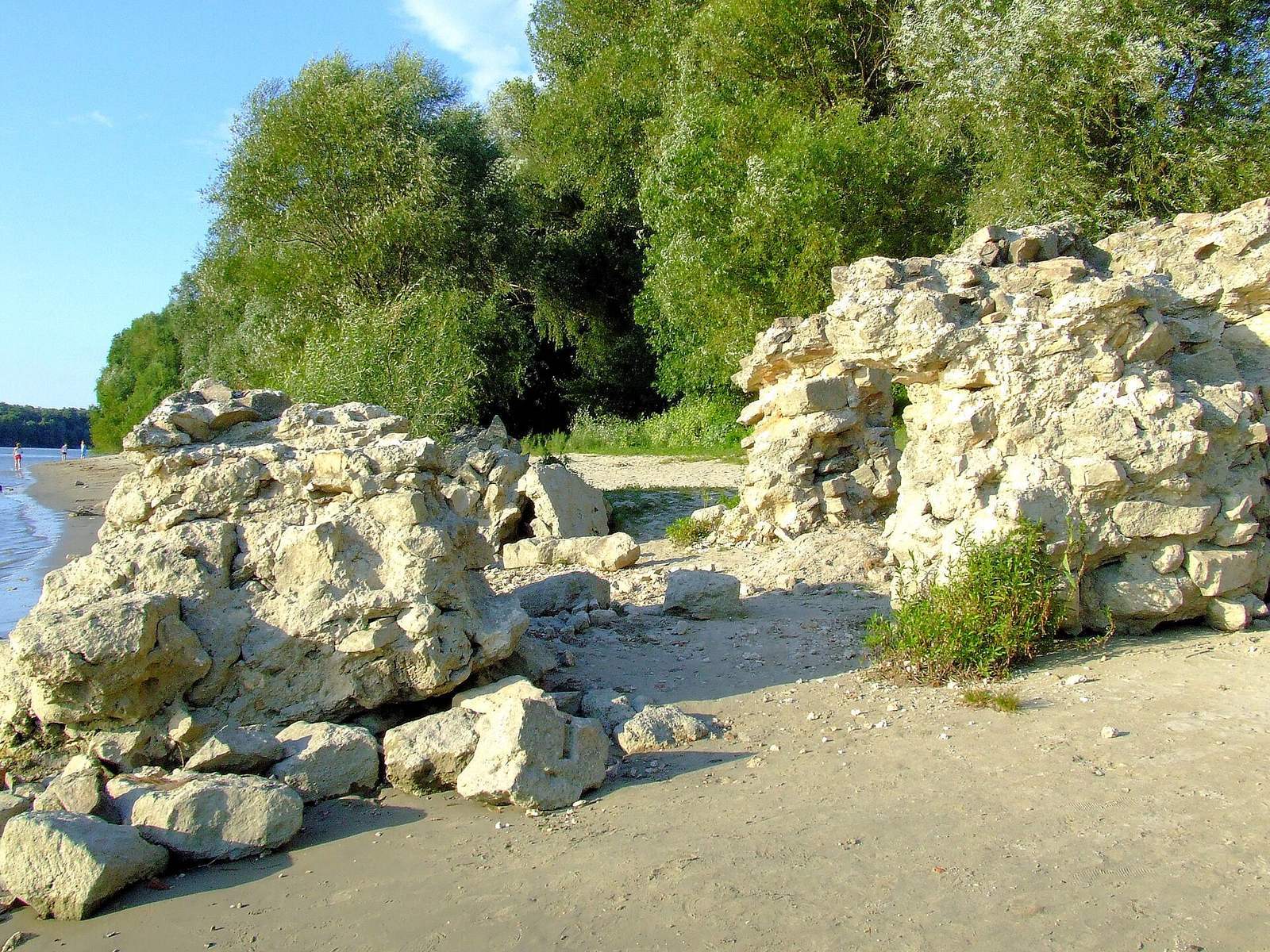
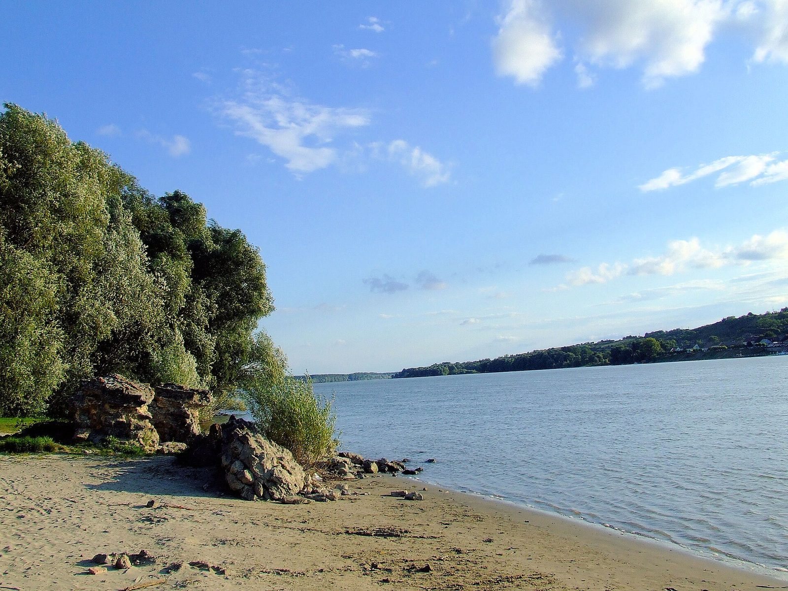
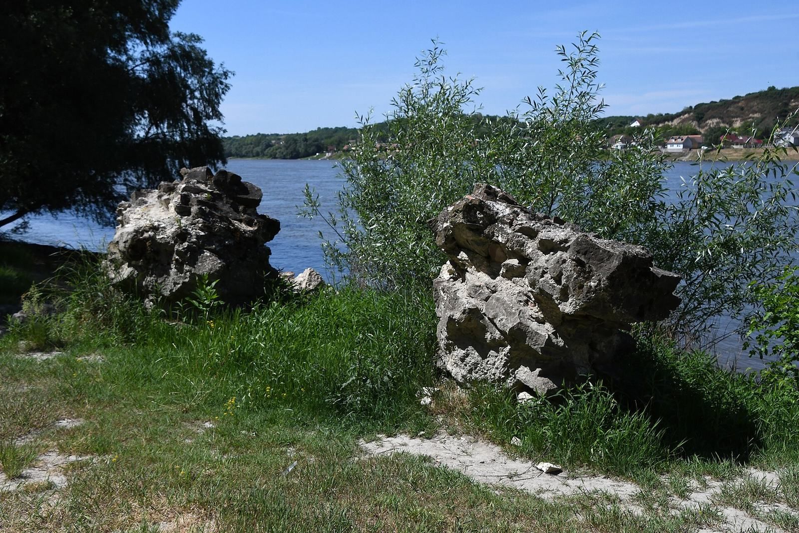
The rear of the fort lies buried in the riverbank. Nearly all masonry from the central residential and watchtower building has disappeared, while the foundations of the two flanking towers were largely recorded. At low water, the foundation of the southern corner tower can still be recognized in shoreline sand; it is the principal visible remnant.
Finds and reused material
Inscribed and sculpted stone
Late Roman pottery and coins have been found at the fort, along with inscribed stone reused in its masonry and a reused relief of Pan, the Greek god associated with the wild and shepherds. Four reused inscriptions were probably brought across the river from Florentia. They include two honorific inscriptions for Septimius Severus, one dated to AD 200–201, a statue base from the reign of Caracalla, and an inscription from the reign of Marcus Aurelius. These dates belong to the reused stones, not to the fort’s construction.
Stamped bricks and tiles
Reused bricks carry a stamp naming the Cohors VII Breucorum civium Romanorum equitata, a Roman auxiliary cohort of the Breuci with a mounted component. The bricks may also have come from Florentia. Tiles stamped with the name of Frigeridus, military commander of Valeria, date to AD 371–373/374. Other examples published by archaeologist János Szilágyi include stamps of the OF ARN group, assigned to the reigns of Constantius II and Valentinian I. Proposed expansions of the abbreviations AR, ARN, and ARAN remain speculative.
A stamp associated with Maxentius has been dated either to AD 351–354 or, in other analyses, to the late 350s or Valentinian I’s final years. Halász’s reading of one stamp is considered probably incorrect; OF ARN MAXENTI A VIN is better supported. The uncertain TERENTIAN VX might name Terentius, a predecessor of Frigeridus as provincial commander, or the nearly contemporary military tribune Terentianus. The fragmentary sequence AEAM…NRKI is not known from other Hungarian frontier buildings.
The name Magister Bonus first appears at the end of Constantius II’s reign or in the following Valentinianic period. Stamps associated with Ursicinus, whose title magister figlinarum means an official overseeing brick or pottery production, are known from a limited number of other forts and river-landing forts, including Dunakeszi and Göd-Bócsaújtelep.