Defensive Walls of Paczków: Medieval Town Fortifications in Poland
Site at a Glance
- Rating
- 4.5
- Popularity
- Low
- Country
- Poland
- Primary era
- Medieval
- Eras represented
- Medieval, Early Modern, Modern
- Civilizations
- German, Holy Roman Empire
- Site type
- Military
- Remains
- Wall
On this page16 sections
History
The Defensive Walls of Paczków are medieval town fortifications in Poland. Their first stone enclosure was built around 1350 under Bishop Przecław of Pogorzela. Paczków’s defenses are regarded as one of Poland’s best-preserved examples of medieval town fortifications, earning the town the nickname “Polish Carcassonne,” a reference to the fortified historic town in southern France.
Early defenses and stone walls
Paczków’s position near the border and its defensive role led to fortification, probably with timber-and-earth works around 1300. A castle stood about 200 metres from the town defenses, but it was not part of their system.
In 1318, an armed force led by Jan Wustehube of Chałupki entered Paczków and attacked people attending a church service, killing several. The attack probably prompted the construction of stone defenses. Under Przecław, the town was enclosed by its first stone walls, perhaps alongside earlier earthworks and a ditch.
Damage and rebuilding
Hussite forces, followers of a religious reform movement associated with the Bohemian preacher Jan Hus, destroyed the wall circuit on 17 March 1428. In 1429, some surviving walls and towers were taken down because of their poor condition, although the extent of the damage and demolition is uncertain. Parts of the defenses were rebuilt in the second half of the 15th century.
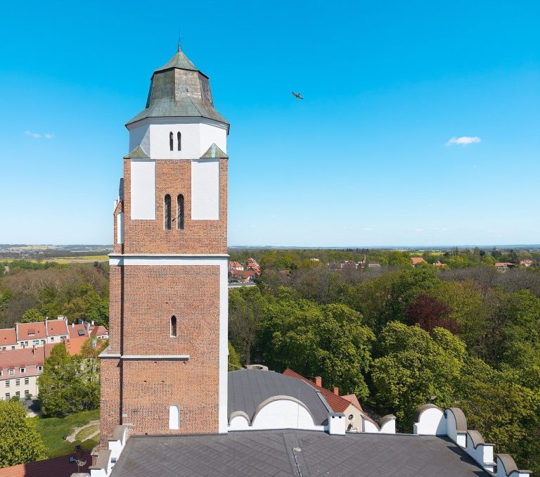
The spread of artillery and firearms made the older defenses less effective. In 1514, Bishop Jan Thurzo began a prolonged rebuilding campaign that continued into the mid-16th century and established the outline of the fortification system that survives today. Concern about Turkish attacks also led to the rebuilding and strengthening of the Church of St John the Evangelist so it could contribute to the town’s defense.
Decline and changes to the town
By the 18th century, the walls no longer served as a fortress, though the gates were shut at night to protect residents from vagabonds. Economic stagnation during the 17th and 18th centuries helped preserve Paczków’s medieval urban structure. The town’s escape from the Napoleonic Wars also spared its street plan and fortifications from demolition.
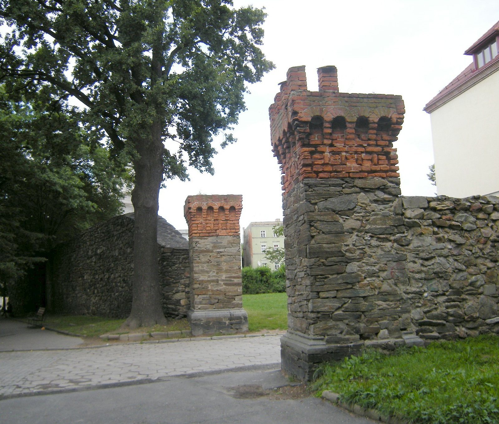
In 1820, the ruined outer wall circuit was dismantled. The Gate of the Dead, which led through the wall toward a cemetery, was removed in 1840 to make room for a school. From 1844 to 1846, gatehouses and foregates were removed and the moat was filled. A park about 1.5 kilometres long was laid out over the moat and outer defenses. Four openings were cut through the walls, three in 1870 near Słowackiego, Piastowska, and E. Plater streets, and another in 1873 near Kołłątaja Street. Demolition for new buildings and a school also removed five towers.
Conservation
Conservation began in the 1840s. Later in the 19th century, parts of wall and tower crowns were rebuilt, and a major restoration campaign in the 1890s repaired damaged sections, particularly along the southern stretch. Buildings around the Ząbkowice Gate tower were cleared between 1896 and 1899. Work in the 1960s focused on the surviving gate towers, followed by revitalization of the historic complex from 2007 to 2013.
Remains
The old town occupies a spur-shaped rise about 240 metres above sea level, with ground rising toward the southeast. The Kamienica, Młynówka, and Gościcki Potok streams bound the rise, which lies near the Nysa Kłodzka River. The old town has an elliptical outline about 300 by 500 metres, enclosed by a stone wall ring roughly 1,200 metres long. Its regular street plan centers on a rectangular market square with proportions of 2:1; ten streets lead toward it from its corners and the middle of its longer sides. Historic plots around the square have changed little since the Middle Ages. Most surviving historic townhouses date from the 18th and 19th centuries, while some 16th-century buildings retain decoration made by scratching through a surface layer to reveal a contrasting one.
Town walls and outer defenses
Inner wall ring
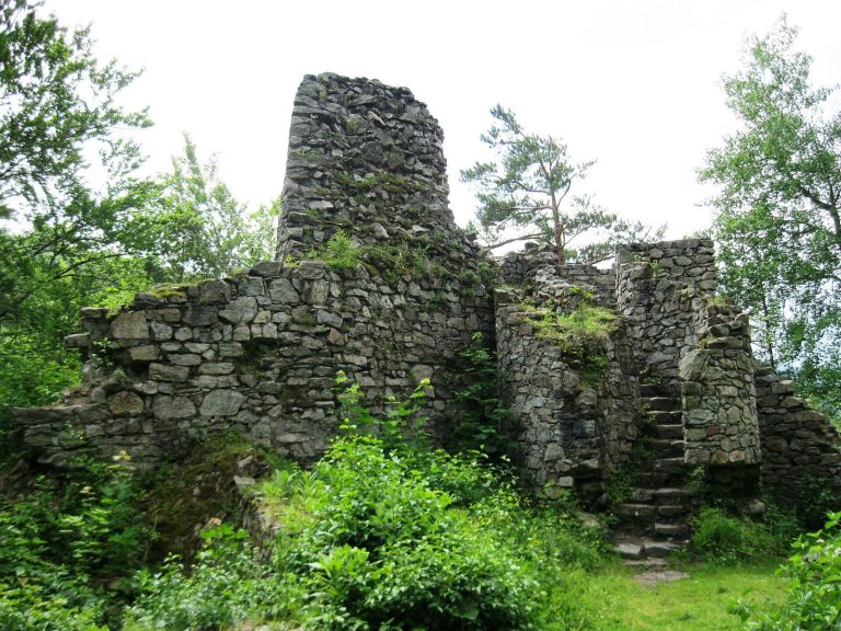
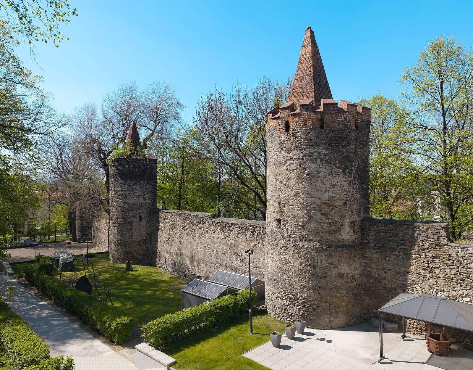
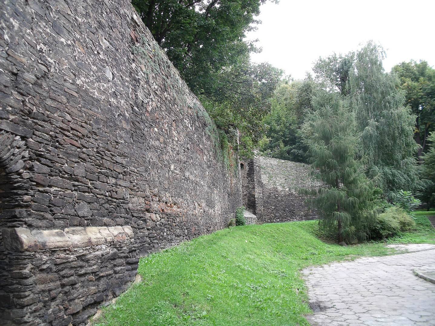
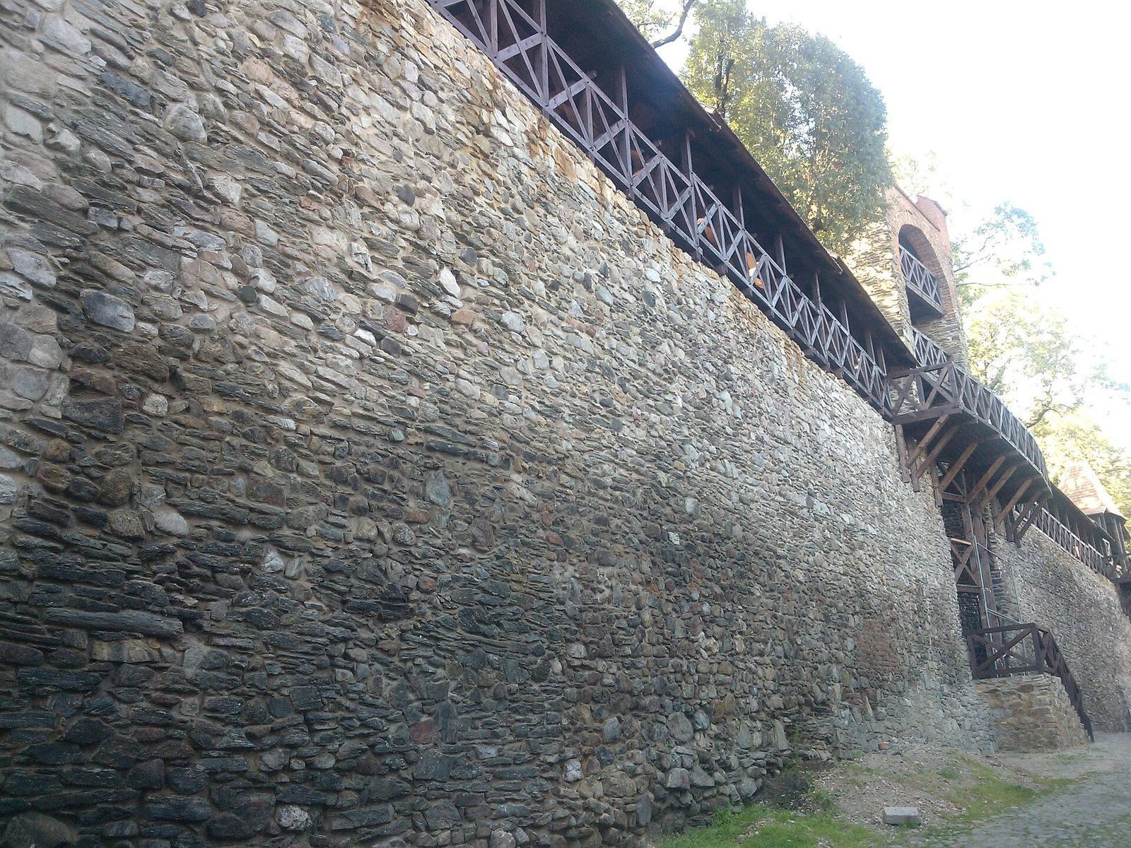
The inner walls were built of fieldstone and later strengthened with roughly dressed stone. The original circuit stood about 7 to 9 metres high and was 1.15 to 1.6 metres thick. The highest surviving sections are about 7 metres tall. The first stone enclosure had three gates and 24 circular shell towers, open-backed towers built into a defensive wall. At the fortifications’ fullest development, the tower count and forms are uncertain: the arrangement may have included 22 shell towers, 24 semicircular and semi-rectangular towers, or 20 semicircular towers and four angular ones. Nineteen shell towers survive.
The southeast side, considered the likeliest direction of attack, followed a break in the slope. Its walls were thicker and it had more towers than the other stretches; initially, it had no gate. The main traffic route ran between the Lower and Upper gates, across the market and toward the opposite gate. This direct line could help attackers cross the town, while also giving defenders quick access to strongpoints at the gate towers, town hall, and fortified parish church. Narrow historic streets could slow an advance, an effect weakened when streets were widened.
Outer defenses
A second, incomplete wall line stood 7 to 8 metres beyond the inner walls, partly following the earlier earthwork. About 4 metres high, it was built of fieldstone and brick and included numerous artillery positions. It probably ran along the northern side, from the Kłodzko Gate tower to a shell tower between the Wrocław Gate tower and the Nysa Gate. A water-filled moat lay between the two lines, either newly dug or refurbished. The rising ground prevented the moat from encircling the entire town.
Wall-top defenses
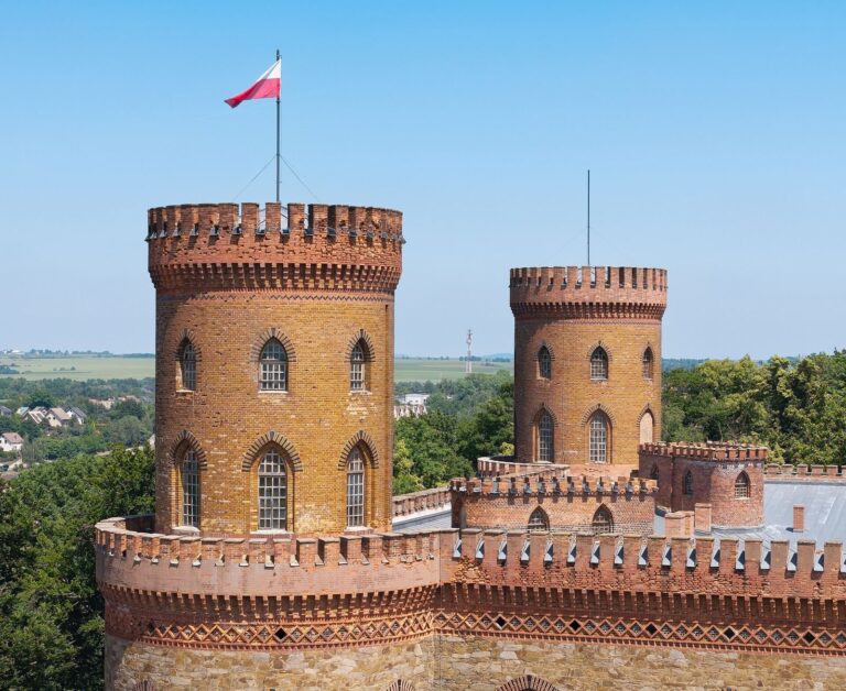
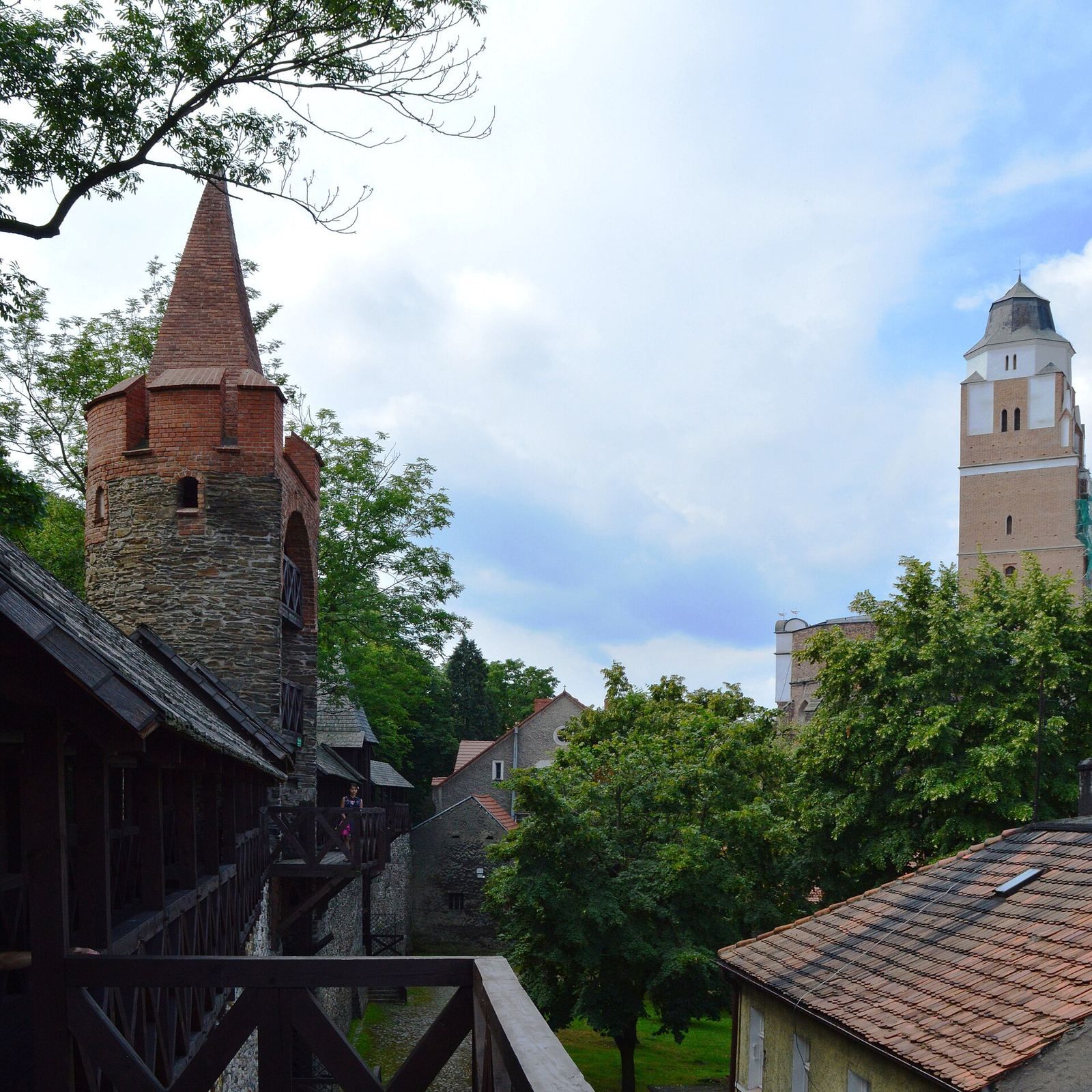
The wall crowns served as patrol walks. Narrower sections had timber fighting platforms, supported by projecting brackets, that gave defenders cover and firing positions. Whether similar platforms also projected from the outer face is uncertain. The walls had crenellations, alternating raised sections and gaps along a battlement, and loopholes, narrow openings for firing. A decorative band of small arches ran along the wall curtain.
Gate towers
The four gate towers were considerably larger than the towers set into the walls. Their entrances were on upper storeys, level with the adjoining wall walks. The towers originally had machicolations, projecting structures with openings for attacking enemies below; remains can be seen on the Kłodzko Gate tower. Over time, the gate approaches gained enclosed passages, drawbridges, and outer defensive structures.
Wrocław Gate
Wrocław Gate, also called the Lower Gate, stood on the road toward Wrocław. Its tower is about 30 metres high, with a square base, seven storeys, a rectangular crenellated crown, and an octagonal brick roof. The moulded doorway is at the third-storey level. Loophole-shaped openings occupy the fourth and fifth storeys, while the top two have blind niches, shallow recesses without openings. Three bands of these niches, added in the second half of the 15th century, were decorative. The tower was part of a larger complex that included a gatehouse, a drawbridge over the moat, and an outer defensive structure that housed the town prison. The medieval tower was partly demolished and rebuilt in 1462; its roof was restored between 1919 and 1924.
Ząbkowice Gate
Ząbkowice Gate, also known as the Łaziebna Gate, stands by a route toward Otmuchów and Kamieniec Ząbkowicki used for local transport. Its circular tower is about 27 metres high, with a cornice, battlements, a decorative parapet (a low protective wall), and a low roof. A walkway runs around the fifth storey. The parapet was added in the first half of the 16th century. The name Łaziebna refers to the former municipal bathhouse nearby. The tower was partly destroyed in 1429 and rebuilt in 1462.
Kłodzko Gate
Kłodzko Gate, also called the Upper Gate, marked the route toward Kłodzko. Its five-storey tower is about 22 metres high. The lower two storeys are square in plan, while the upper storeys are circular; loopholes occur on the third and fifth storeys. The upper part was raised in the first half of the 16th century, when fish-tail-shaped decorative battlements were added. Brackets beneath them supported a former fighting gallery. A semicircular pedestrian opening was cut through the tower in 1901.
Nysa Gate
Built in 1573 on Wojska Polskiego Street, Nysa Gate is a semicircular shell tower with a battlemented crown and a tent-shaped roof. Its upper part was raised in the 16th century. The gate was walled up in 1778 and reopened in 1819.
Church of St John the Evangelist
The Church of St John the Evangelist stands outside the market, close to the town walls, on the site of an earlier wooden church. In the 16th century, its roof was lowered and protective shield walls topped with a parapet were added. They helped guard the roof against fire and provided cover for firing positions. A circular stone well in the south aisle, known as the Tatar Well, was intended to supply defenders with water during a siege. It received an iron superstructure in the 19th century.