Roman Amphitheatre of Tours: A Venue for Public Spectacles
Site at a Glance
- Popularity
- High
- Country
- France
- Primary era
- Classical
- Eras represented
- Classical, Medieval, Early Modern
- Civilizations
- French, Roman
- Site type
- Entertainment
- Remains
- Amphitheatre
On this page19 sections
History
The Roman amphitheatre of Tours, in present-day France, was a Roman venue for public spectacles built in the second half of the first century CE. It stood in Caesarodunum, the Roman city that preceded Tours, and was later incorporated into the city’s defenses.
Caesarodunum and the amphitheatre
Caesarodunum was probably founded under the emperors Augustus or Tiberius, with proposed dates ranging from 10 BCE to 20 or 30 CE. The city covered at least 80 hectares in the Loire and Cher valley and served as the principal town of the Turones, the Gallic people associated with the area. It reached its greatest extent in the second century, when the amphitheatre stood near the edge of the built-up area.
The building’s large footprint and elevated position made it conspicuous beyond the city’s centre. Its audience capacity was large enough to draw spectators from the surrounding region. Caesarodunum’s population has been estimated at about 6,000, a scale that helps explain why the amphitheatre’s size remains striking in relation to the town.
The construction date is now generally placed in the second half of the first century, at least fifty years after the city’s foundation. Comparisons with amphitheatres at Amiens, Autun, and Saintes helped support this dating. Earlier interpretations treated the building as mostly a single project of the early second century and proposed that Hadrian inaugurated it during a visit to Touraine in 122. Later study instead identified several construction phases.
The amphitheatre was probably enlarged in the second half of the second century, bringing its estimated capacity from at least 14,000 to about 34,000. In its final form it was among the largest amphitheatres in the Roman Empire. The reason for building and then enlarging a structure of this scale is unresolved. Civic rivalry has been suggested as a possible motive, but no known event explains the expansion. The performances are also uncertain. Gladiatorial combat or executions of condemned people are possible, while more modest spectacles may have been more common.
From spectacle building to defense
During the second half or toward the end of the third century, worsening insecurity led to the amphitheatre’s conversion into a fortification. The changes made it poorly suited to spectacles and marked a lasting shift in its function. As the city contracted toward its more densely occupied districts beside the Loire, the building became part of the southern side of a fortified enclosure, or castrum, constructed around 350 or shortly before.
Caesarodunum gradually became known as Civitas Turonorum, a later name for the city and its civic community. Around 360, it became the capital of Lugdunensis III, a Roman provincial administrative division. The former amphitheatre was therefore absorbed into the defenses of a city whose role had changed from a major urban centre to a fortified settlement and provincial capital.
Medieval reuse and the cathedral quarter
In 869, Charles the Bald ordered repairs to the walls of Tours and other cities in response to Norman raids. A collapsed stretch of the amphitheatre’s outer face was repaired in the ninth century, probably as part of this work. Towers may also have been built against its southern side. A charter issued by Charles the Simple in 919 is the last clear written reference to the amphitheatre. A 1301 mention of a place called Les Arennes may refer to it, although the identification is uncertain.
From about 1250 until the French Revolution, houses in the cathedral’s canonical quarter were reserved for canons, clergy serving the cathedral chapter. Builders used the amphitheatre’s remaining substructures, turning its former access passages into cellars. Gradually, houses covered the monument and it ceased to be directly visible. Although the houses lost their reserved status after the Revolution, the area’s layout changed little until the twenty-first century, and much of the amphitheatre’s foundation fabric remained in place.
Rediscovery and archaeological study
By the eighteenth century, the amphitheatre had largely faded from local memory. In 1784, Pierre Beaumesnil questioned why Tours had no known arena or local tradition about one. A history of Touraine published in 1828 mentioned the building without locating it, while a plan of the late Roman enclosure made around 1829 represented its southern side as straight.
The Archaeological Society of Touraine, founded in 1840, led efforts to identify the city’s Roman remains. In 1853, a committee formed to catalogue them recognized that vaulted cellars in the cathedral quarter, previously thought to belong to monumental baths, were part of the amphitheatre. Canons serving on the committee helped obtain access to the properties.
Henry Auvray resumed archaeological work in 1938 and published a synthesis of observations the following year, but the Second World War halted further investigation. Jean-Paul Sazerat returned to the remains in 1960. In 1971, Jacques Dubois and a lycée archaeology club continued the work, producing plans from surveys and publishing findings in 1974 and 1977.
Excavations in 1978, prompted by a proposed extension of the departmental archives that was never built, clarified the third-century fortification and early medieval repairs. Jason Wood’s study of the city’s fortified enclosure, completed in 1980 and published in 1983, confirmed the amphitheatre’s place in the fourth-century defenses. Discoveries in cellars in 2000 and 2001, together with the recovery of General de Courtigis’s plans and notes, renewed examination of earlier evidence. Later surveys used systematic mapping, geolocation, and three-dimensional scanning to produce detailed plans. Bastien Lefebvre’s 2008 study also traced the amphitheatre’s influence on the development of the cathedral quarter.
Remains
The buried amphitheatre lies northeast of ancient Caesarodunum and immediately southeast of the present cathedral, partly beneath houses in the cathedral quarter. It was built into a natural sedimentary mound that rose to about 51 metres above the French national datum, while the surrounding ancient plain stood at about 41 metres. Setting part of the structure into the mound reduced the amount of masonry required and helped shield it from flooding.
The original building
Plan and seating area
The first phase had a massive, almost oval but irregular plan, about 112 by 94 metres, with a footprint estimated at 8,270 square metres. Its arena measured about 68 by 50 metres, or 2,670 square metres. Around it, the cavea, the seating area of an amphitheatre, covered roughly 5,600 square metres and could hold at least 14,000 spectators.
The seating area rested chiefly on an earth bank sloping inward toward the arena, rather than on a system of vaulted chambers and radial walls. Some of the fill may have come from soil excavated to form the arena. Spectators may have sat on the grassy slope or on wooden seating. The structure’s orientation appears to have followed the city’s street plan and the ancient left bank of the Loire: its shorter axis extended west toward a road thought to have been the principal east-west street, while its longer axis ran parallel to north-south streets.
Entrances and construction
Eight vomitoria, passages carrying spectators into or out of seating areas, are identified. Four main passages served the arena and an as-yet undetermined level of the seating area. Four narrower passages connected by stairs to its middle section. Eight other entrances, probably formed by pairs of exterior staircases against the outer face, may have provided access to the top of the seating bank.
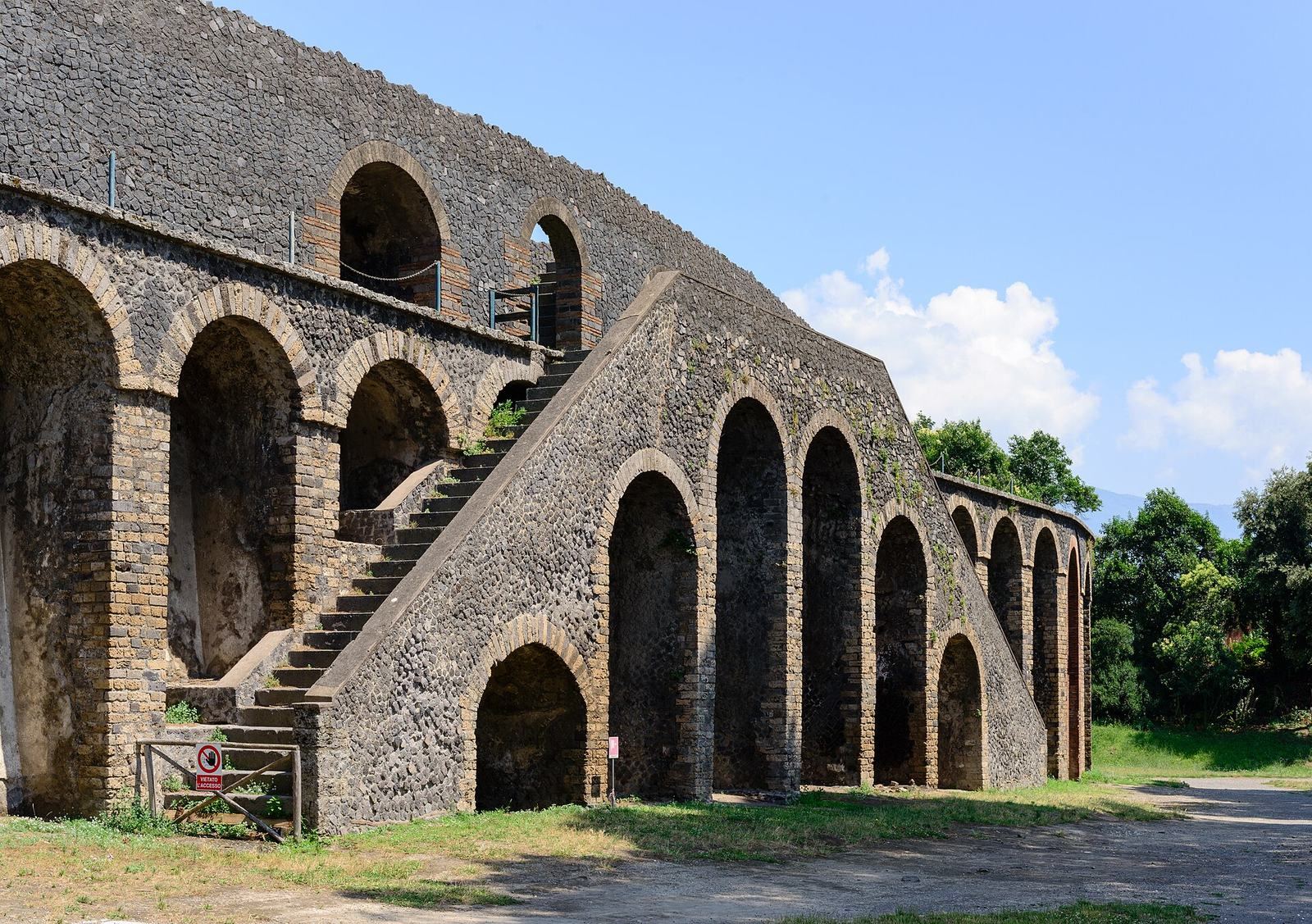
The north and south main passages had vaulted ceilings about 7.5 to 8 metres high and 4.9 metres wide. The east and west passages were smaller, about 6.8 metres high and 2.5 metres wide, while the secondary passages were narrower still. Large, finely dressed stone blocks formed the entrance openings, with closely fitted joints. Moulded capitals above the door jambs supported semicircular arches.
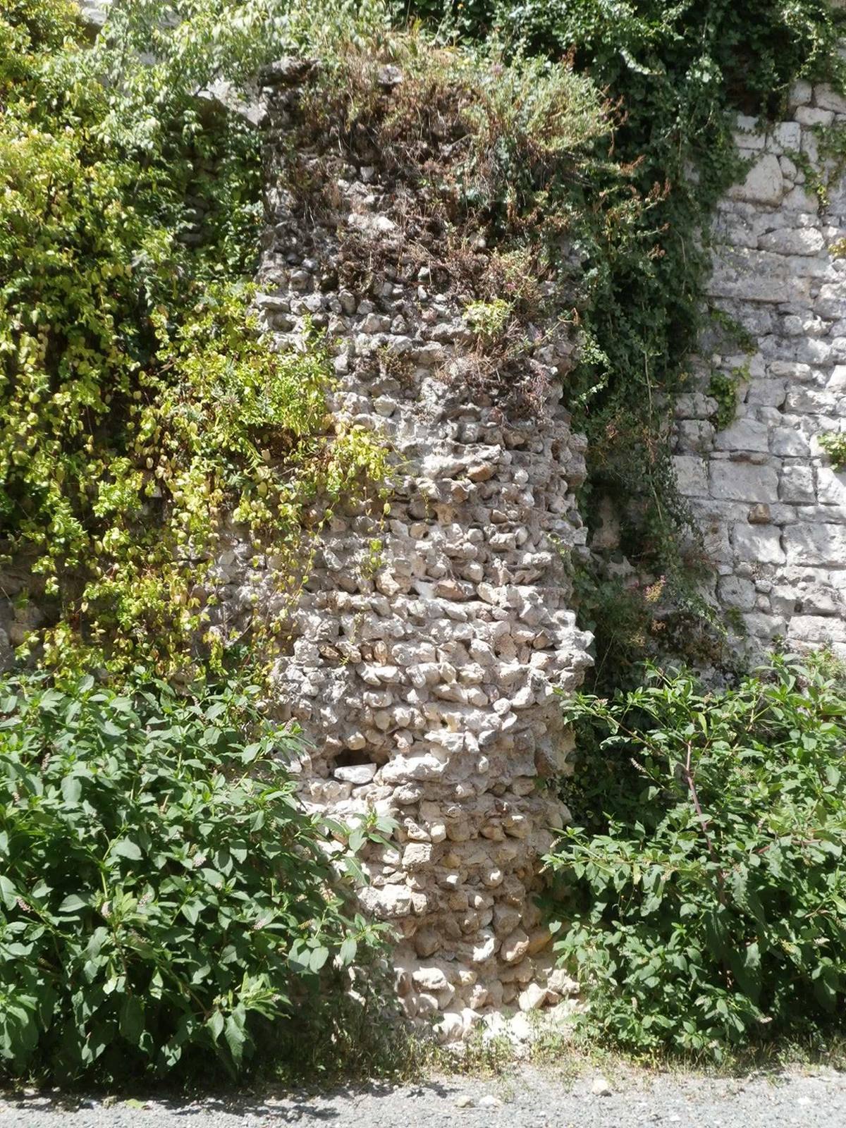
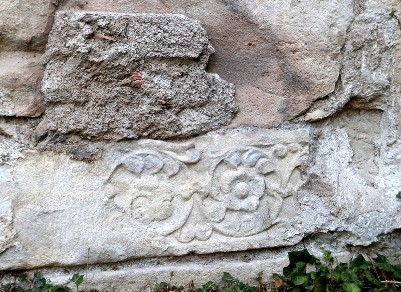
Masonry was concentrated in the outer and arena walls, entrance galleries, staircases, and possibly some retaining walls arranged like spokes through the earth fill. Many surviving wall and vault surfaces consist of small limestone blocks set in a cemented facing around a core of stones embedded in concrete. Some large blocks, probably once part of the amphitheatre’s upper outer edge, were later reused in the late Roman city wall.
Enlargement and arena features
Expanded seating and outer structure
The enlargement, probably carried out in the second half of the second century, extended the outer dimensions to at least 156 by 134 metres. The arena seems to have kept its original size, while the estimated capacity rose to about 34,000. The expanded seating bank rested on fill held by a perimeter wall only about 1.4 metres thick. The enlarged structure probably extended southwest beyond the present retaining wall along Rue du Général-Meusnier.
Pairs of half-towers, each more than five metres across, flanked the four principal entrances and helped support the greater mass of fill. The dimensions of the main passages changed where the two building phases met. The north passage, which has been studied most closely, widened from about 3.3 to 5.2 metres. At examined points, the small-block facing gave way to less regular stonework alternating with courses of architectural terracotta; these observations apply to specific locations rather than necessarily to the whole building.
The original exterior stairs were buried beneath the new fill. They may have continued in use as intermediate stairways, perhaps vaulted and linked to the main passages. The secondary entrances do not appear to have been extended to the new outer face by corridors, although a connection to a circular ground-floor gallery is possible. New exterior stairs may also have been added. Estimates of the amphitheatre’s height range from 25 to 28 metres in calculations made in the late 1970s to more cautious later estimates, including one of 15 metres.
Arena and work area
A wall about 2.8 metres high separated the arena from the seating bank. A paved walkway ran along the wall’s inner side. A smaller wall found beneath a slab in the arena may have belonged to equipment used there, although that interpretation remains uncertain.
Traces at the amphitheatre’s southeastern foot include postholes, hearths, stone chips, brick debris, and lime dust. Together, they indicate a workshop and shelter for workers involved in the enlargement, probably during the second half of the second century. A paved area dating to the late second century lies over these traces and may have served as a circulation surface around the building.
Fortification and late Roman enclosure
Defensive wall and ditch
During the second half or toward the end of the third century, the upper seating bank was levelled to about eight metres above the arena. A ring-shaped defensive wall, about 3.5 metres thick and of unknown height, was set into the fill around the perimeter. It probably rose above the levelled seating area. Its masonry differed from that of the enlargement and covered some earlier construction.
The secondary entrances and interior stairs were blocked during the conversion, leaving the main passages as approaches that could be controlled. A defensive ditch, preceded by an outer slope, was dug at the amphitheatre’s foot in the second half of the third century. Its remains have been found southeast of the building; the ditch probably continued around the site and was maintained until construction of the later fortified enclosure.
Position within the city defenses
The amphitheatre occupied the exact middle of the southern side of the enclosure built around 350 or shortly before. Its longer axis continued within the defenses as a road leading toward a gate that has since disappeared, and to a bridge over the Loire built at about the same time. The west, south, and east entrance passages lay outside the defended area and remained in use. They may have been adapted as a monumental entrance to the fortified city. A road approaching the western passage continued beyond the enclosure, aligned with the southern face of its wall. The arena and seating area may have been partly filled in this period.
Early medieval repairs
In the ninth century, builders repaired a long-collapsed section of the outer face with large blocks taken from an early Roman public building that had survived within the fortified city. Towers may also have stood against the southern half of the amphitheatre’s outer wall.
Buried fabric and traces in the modern city
Cellars beneath the cathedral quarter
Former entrance passages survive beneath houses as cellars, divided by walls running lengthwise and crosswise, and sometimes at different heights. These alterations created several cellar levels. Some passages survive on two levels, one above the other. The houses and cellars occupy the site of the former amphitheatre’s substructures.
Street pattern and changes in level
The amphitheatre’s outline can still be followed in parts of the street plan. Rue Manceau descends from the southeastern edge of the former seating area, crosses the arena, and passes close to its centre. Rue du Général-Meusnier follows part of the perimeter from northwest to southeast. Rue Racine and Rue de la Bazoche meet the perimeter on its northern sides. Radial property boundaries also reflect the building’s plan: the former seating area is largely built over, while larger open spaces remain around the arena. Sections of modern wall along the southern part of the oval provide another trace.
Rue de la Porte-Rouline, laid out in 1642, links land at the amphitheatre’s foot with Rue du Général-Meusnier at the edge of the levelled seating area. The resulting difference in elevation is about five metres and can also be seen in a courtyard on Rue des Ursulines. The slope was originally greater, but levelling and debris accumulated at the foot have reduced it. The amphitheatre’s massive construction also helped preserve masonry embedded in its fill.