Kleinkastell Gunzenhausen Hinterer Schlossberg: A Roman Frontier Fort
Site at a Glance
- Popularity
- Very Low
- Country
- Germany
- Primary era
- Classical
- Eras represented
- Classical
- Civilizations
- Roman
- Site type
- Military
- Remains
- Fort
On this page13 sections
History
Roman frontier and garrison
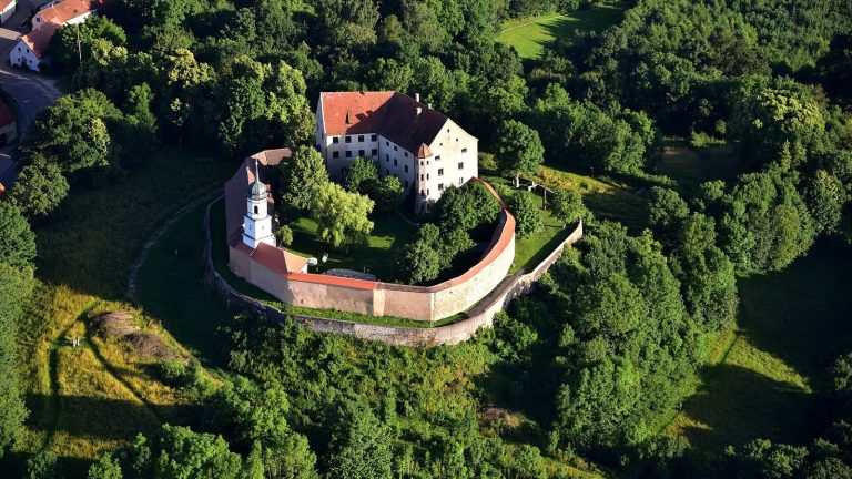
Kleinkastell Gunzenhausen Hinterer Schlossberg was a small Roman fort on the Schlossbuck ridge east of Gunzenhausen, Germany. It stood behind the Rhaetian Limes, Rome’s frontier in the province of Raetia, and served as a garrison until no later than AD 259/260. It may have been destroyed during the Alamannic Wars, conflicts between Rome and the Alamanni, a group of Germanic peoples.
Roman frontier defenses here changed over time, from a wattle fence to an oak palisade erected around AD 161 and later a stone wall. A passage through the palisade may help explain the close group of watchtowers around Schlossbuck. The reason for routing the crossing over the steep ridge instead of level ground near Gunzenhausen remains unknown. Extensive alterations to this stretch of frontier may reflect changing needs.
Investigation and protection
Heinrich Eidam (1849-1934), a section commissioner for the Reich Limes Commission, the German body that investigated and documented the Roman frontier, made a small excavation at the fort’s northeast corner. In late autumn 2009, the Bavarian State Office for Monument Preservation commissioned a magnetometer survey, which uses underground magnetic differences to locate buried features. Geophysicist Jörg Faßbinder led the survey, and its results were published in 2010.
Since 2005, the fort and associated frontier installations have belonged to the UNESCO World Heritage property of the Upper German-Raetian Limes. The fort is also a registered archaeological monument under Bavarian law.
Remains
The fort
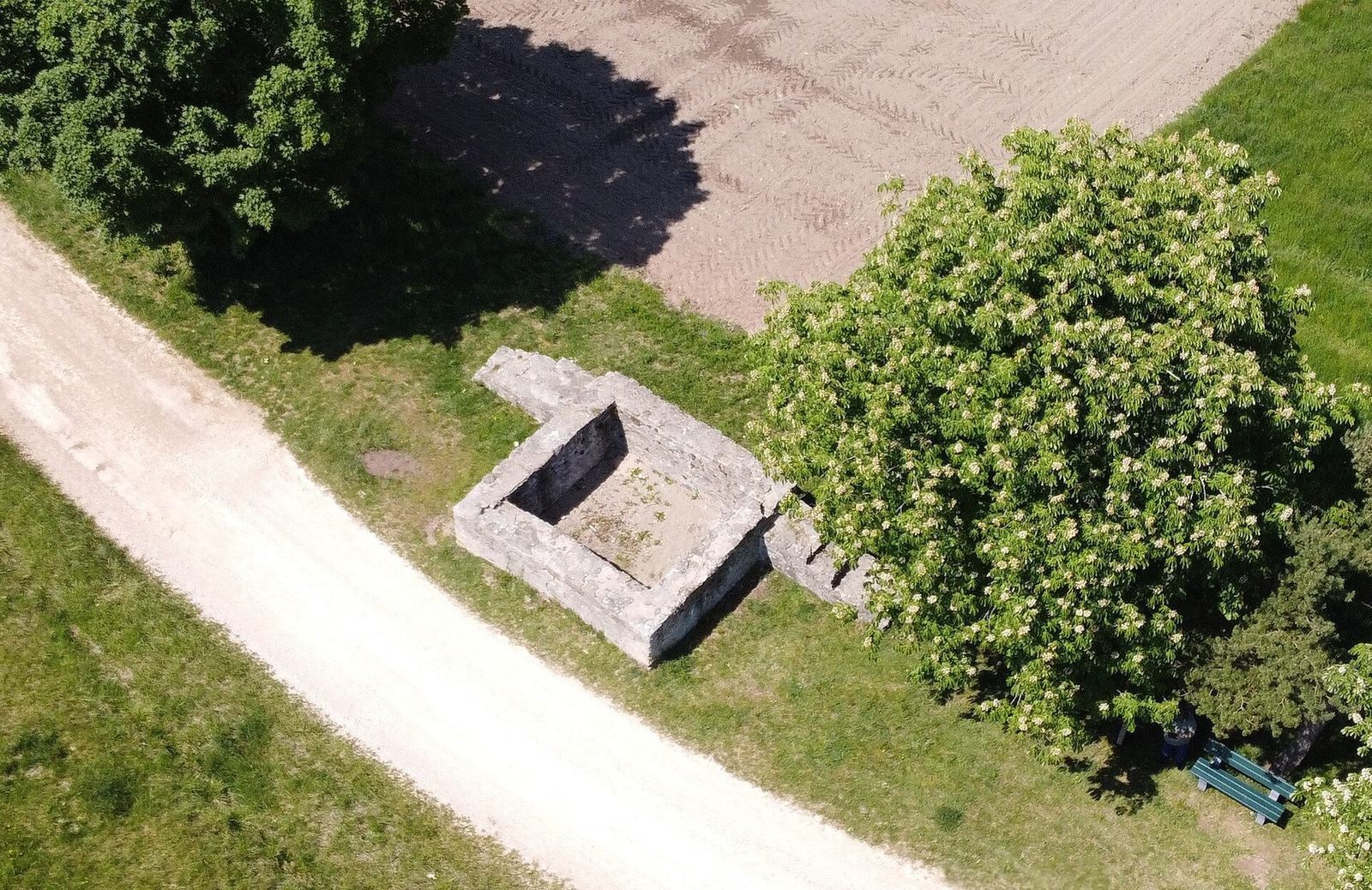
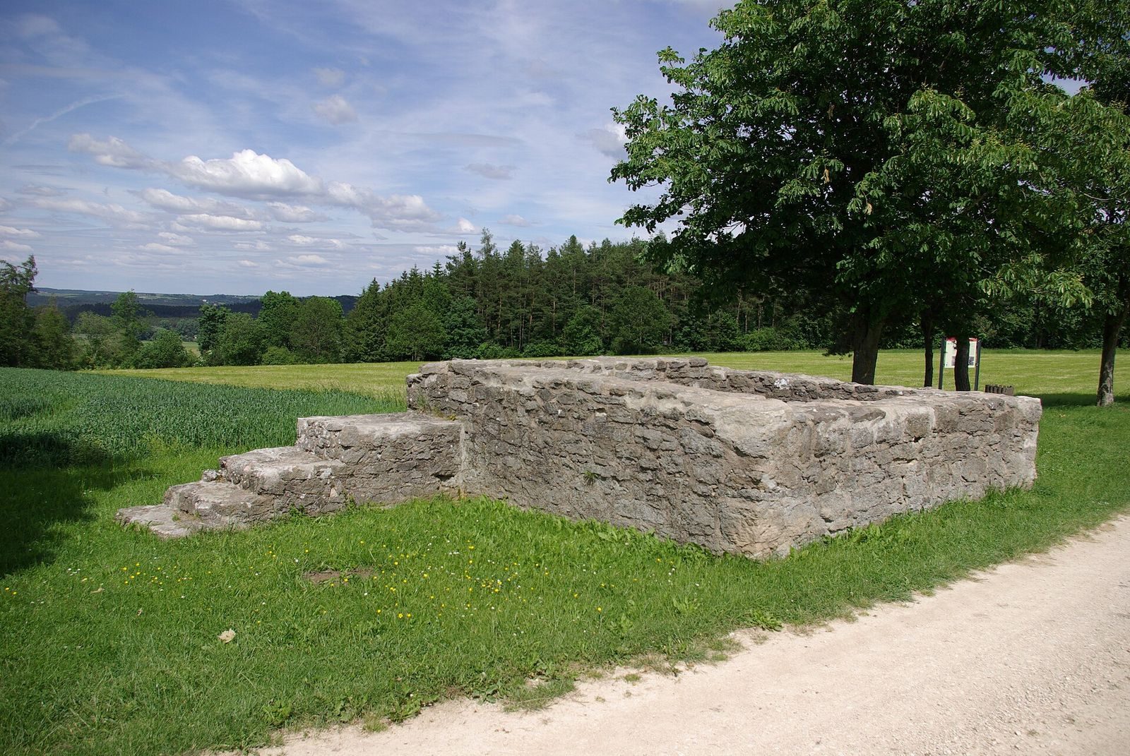
The square stone fort occupied a ridge aligned from west to east, within Burgstallwald at 497 metres above sea level. Set about 18 metres behind the Limes wall, it measured roughly 20 by 20 metres, covering 0.04 hectares, and had right-angled corners.
Perimeter wall and entrance
Eidam recorded the outer wall as 0.70 metres thick. The later geophysical survey indicated foundations between 1 and about 1.20 metres thick. The entrance was on the north side, facing the Limes.
Courtyard and rooms
About three metres inside the perimeter wall, foundation bases roughly one metre thick formed a square around a courtyard. They may have held wooden posts supporting a roof that sloped inward toward the courtyard. Timber living and guard rooms probably stood around it.
Paved strip and walkway
A paved strip three metres wide lay between the outer wall and the interior foundation bases. Soldiers may have climbed a wooden stair to reach a walkway that ran around the fort.
Finds and memorial stone
Fire debris and a soldier’s brooch indicate activity within the first two-thirds of the third century. The fort’s foundation area remains visible as a pronounced rise in lightly wooded beech forest. A memorial stone erected after Eidam’s excavation bears the inscription Castrum Romanum, meaning “Roman fort.”
Frontier installations
The designation Wp means watch post. In Wp 14/5, 14 identifies this Limes section, while 5 gives the post’s sequence within it.
Passage and Wp 14/5
A passage through the palisade lay about 500 metres west of the fort, near the later watchtower Wp 14/5. At this point, the passage did not continue through the stone wall.
Wp 14/4
Wp 14/4 stood 165 metres farther west, near the ridge’s highest point. Built with the stone wall, it probably also watched over a passage through both the palisade and the wall.
Eastern watch posts
Wp 14/6 stood 70 metres from the fort on the slope descending eastward. Wp 14/7 lay another 270 metres farther on, on the valley floor.