Ur: An Ancient Sumerian City and Religious Centre
Site at a Glance
- Popularity
- Very High
- Country
- Iraq
- Primary era
- Bronze Age
- Eras represented
- Bronze Age, Iron Age
- Civilizations
- Assyrian, Babylonian, Sumerian
- Site type
- City
On this page33 sections
History
Ur, also known as Tell al-Muqayyar, is an ancient city in Iraq whose earliest occupation dates to the Ubaid period, about 5000–3750 BCE. It developed into a major Sumerian political centre and a principal place of worship for Nanna, the moon god also called Sîn in Akkadian. Ur later became the capital of the Third Dynasty of Ur.
From early settlement to a Sumerian centre
Ur expanded during the Uruk and Jemdet Nasr periods, about 3900–2900 BCE, as irrigation spread across the surrounding plain. By the early third millennium BCE, the city covered roughly 20 hectares; during Early Dynastic III, about 2600–2340 BCE, its inhabited area approached 50 hectares. A clay layer up to 3.75 metres thick, found between occupation deposits, was interpreted by Leonard Woolley as evidence of a great flood. Ordinary flooding, windblown sediment and rising Gulf waters are other possible explanations. The layer does not establish a link between Ur and flood narratives in Mesopotamian or biblical texts.
Nanna’s sanctuary was also a major economic institution. Its administrators managed farmland, organised workers’ provisions and supervised a workforce that included gardeners, vintners, brewers and smiths. A group of 403 tablets from the late Early Dynastic I or Early Dynastic II period records temple land and employees. Seals, pottery and tablets from near the sacred quarter include some of Ur’s earliest inscriptions, dating to about 2800–2700 BCE. Some seal impressions list Sumerian cities in an order that places Ur first in one group. This may reflect precedence within an association of cities, perhaps one connected to shared religious observances, but the group’s purpose is uncertain.
The Royal Cemetery reflects the city’s wealth and social distinctions in the Early Dynastic period. Its richest graves date to around 2500 BCE. Meskalamdug and Akalamdug are often identified as kings, while Puabi may have been a ruler’s consort or a ruler herself. Their titles remain uncertain, and they may instead have held senior priestly offices. Seventeen exceptionally elaborate graves, conventionally called the royal tombs, held a principal deceased alongside nearly 300 people, including soldiers, servants and court women. Injuries on two examined skeletons suggest that at least some attendants may have been killed by blows to the head before burial. Why people were buried in this way remains open to interpretation: they may have been intended to serve the deceased after death, to express submission to a ruler, or to take part in the moon god’s cult.
Early dynasties and Akkadian rule
Mesannepada is regarded as the founder of Ur’s first historical dynasty, usually placed around the twenty-fifth century BCE. The Sumerian King List associates two dynasties with Ur, but it was written later than the events it describes, and independent evidence for rulers of the second dynasty is lacking. Aanepada, identified as Mesannepada’s son and successor, is associated with a temple to Ninhursag at nearby Obeid, a settlement belonging to Ur’s rulers.
In the later Early Dynastic period, Ur and Uruk seem at times to have been ruled by the same house. Uruk rulers Enshakushana, Lugal-kinishe-dudu and Lugal-kisal-si claimed authority over Ur. Lugalzagesi of Umma briefly dominated lower Mesopotamia before Sargon of Akkad defeated him around 2340 BCE. Under Akkadian rule, Sargon appointed his daughter Enheduanna as high priestess of Nanna, a senior official serving the deity’s cult. Sargon’s grandson Naram-Sin placed his daughter Enmenanna in the same office. These royal appointments tied the ruling family to Ur’s principal sanctuary and helped strengthen Akkadian authority. Ur nevertheless rebelled against Akkadian rulers, including in an uprising led by Kaku against Rimush and a later revolt against Naram-Sin.
The Third Dynasty and the fall of Ur
After the Akkadian period, Ur came under the influence of rulers from Lagash and then Uruk. Utu-hegal of Uruk appointed Ur-Namma as governor; Ur-Namma later took the throne, around 2112 BCE, and founded the Third Dynasty of Ur. Ur became the capital of a state that dominated Mesopotamia. Ur-Namma and his successor Shulgi sponsored extensive construction, especially in Nanna’s sanctuary, although the kings appear to have favoured Nippur or Puzrish-Dagan as their main residences.
The period known as Ur III, the dynasty and the state it ruled, is generally dated to about 2112–2004 BCE. Thousands of administrative and economic texts from the city illuminate the work of its temples, which held farmland and workshops, employed large workforces and conducted commercial activity under royal oversight. Temple workshops produced textiles and luxury goods. Priestly households also trained scribes, from pupils learning basic writing to those copying complex literary and religious works. Religious duties included daily offerings and observances tied to the lunar cycle. The recurring akitu festival, a Mesopotamian religious celebration, took place twice yearly; Nanna’s statue travelled from Ur to another temple for ceremonies.
Under Ibbi-Sin, the kingdom weakened as Isin broke away under Ishbi-Erra. In 2004 BCE, a coalition led by Kindattu of Simashki captured Ur amid incursions by Amorite groups, peoples who had become prominent in Mesopotamia. Ibbi-Sin was deposed and taken to Elam, a neighbouring region to the east, along with Nanna’s cult statue. Destruction in the city’s main sanctuary has been linked to the capture, although the order and extent of the damage are uncertain.
Compositions known as lamentations later described Ur’s fall as a catastrophe brought about by divine punishment. Written decades after the events under Isin’s rulers, they also helped those rulers justify their authority over Sumer. Ishbi-Erra soon expelled the Elamites and recovered Ur. His successor, Shu-ilishu, arranged for Nanna’s statue to be returned from Elam.
Isin, Larsa and Babylonian rule
Ur lost its political independence after the collapse of Ur III but remained a religious and economic centre under the competing kingdoms of Isin and Larsa. Many inhabitants increasingly spoke Akkadian, while Sumerian continued in the clergy. Rulers still appointed royal women as high priestesses of Nanna. Enannatumma, daughter of Ishme-Dagan of Isin, held the office during a period of work at the sanctuary. Temples remained central to the local economy: their land, marshes and herds were worked by staff or leased, while private records show that temple service could be combined with personal business.
Ur’s prosperity also drew on trade. Merchants exchanged silver, textiles or oil for copper brought through the Persian Gulf, travelling to Dilmun and Magan. The temple of Ningal received a share of imported goods, made commercial loans and received silver models of ships from merchants seeking the goddess’s protection at sea. Around 1925 BCE, Gungunum of Larsa took the city without replacing its existing administration. Isin briefly recovered it in the early nineteenth century BCE, but Larsa regained control. The dynasty founded by Kudur-Mabuk sponsored building work through his sons Warad-Sin and Rim-Sin I, while his daughter Enanedu became high priestess of Nanna.
Hammurabi of Babylon took Ur in 1763 BCE after conquering Larsa. Early in the reign of his successor, Samsu-iluna, southern cities rebelled under Rim-Sin II. Samsu-iluna retook Ur and claimed to have destroyed its city wall. Several archives were later burned, and archaeological evidence points to abandonment and the looting of houses. A subsequent record about the temple of Ningal refers to reorganising its guard, apparently in response to pillaging. Agriculture and maritime trade declined under Babylonian rule.
From Kassite restoration to abandonment
Ur was gradually reoccupied during the Kassite period, when Kassite rulers controlled Babylonia. The temple of Sîn was functioning again by the reign of Kurigalzu I, around 1400 BCE. His restoration work probably formed part of an effort to consolidate Kassite rule in the south after the conquest of the Sealand Dynasty. The city’s economy revived, though it did not regain its earlier scale, and Persian Gulf trade had ceased. Later family archives include records of temple work and disputes over brewing prebends, shares in recurring temple duties that could carry income or other rights.
Babylonian kings continued to restore Ur’s buildings after the Kassite period. A later text credits Nebuchadnezzar I with restoring the Dublamah; inscriptions record work by Marduk-nadin-ahhe at the Enunmah and by Adad-apla-iddina at Sîn’s temple. In the following centuries, political instability and the declining importance of a canal linked to the Euphrates may have made the water supply more difficult.
During the Assyrian period, local officials called šakkanakku, meaning governors, administered Ur with varying degrees of autonomy. Sîn-balassu-iqbi governed for Esarhaddon and Ashurbanipal and sponsored construction around the middle of the seventh century BCE. After the Assyrian Empire fell, Ur came under the Neo-Babylonian dynasty, the last native Babylonian dynasty before Persian rule. Nebuchadnezzar II enclosed the sacred quarter. Nabonidus renewed the moon god’s cult and restored major sanctuaries, appointing his daughter Ennigaldi-Nanna as high priestess of Sîn at Ur. The claim that he raised the ziggurat from three levels to seven remains uncertain. Cyrus II of Persia was the last ruler associated with known work in Sîn’s sanctuary.
Ur declined after Babylonia came under Persian rule in 539 BCE. People continued to live there during the Persian and Seleucid periods, but the latest text found at the site dates to the reign of Philip III Arrhidaeus, 323–316 BCE. The city appears to have been abandoned by about the third century BCE, as watercourses diminished and the regional population fell.
Interpretations and archaeological work
The identification of southern Ur with the biblical ‘Ur of the Chaldees’, described in Genesis as Abraham’s homeland, remains disputed. Woolley helped popularise this identification, but other proposed locations include Şanlıurfa, Ura and sites in northern Mesopotamia. The historicity of Abraham, as well as the biblical account’s date and purpose, is also debated.
Pietro della Valle visited the ruins in the seventeenth century and collected inscribed bricks and other objects. John George Taylor carried out the first archaeological investigations in 1853–54 and returned in 1858. Inscriptions he uncovered enabled Henry Rawlinson to identify the site as ancient Ur. Local digging between Taylor’s investigations and 1918 recovered more than 200 tablets, most from Sîn’s temple. R. Campbell Thompson investigated the site in 1918, followed by H. R. Hall’s excavation in 1919.
A joint British Museum and University of Pennsylvania expedition led by Woolley worked at Ur in twelve campaigns from 1922 to 1934. Max Mallowan assisted from 1925 to 1931. The excavations revealed major monuments spanning more than two millennia, including the sacred quarter and Royal Cemetery; fieldwork then paused while the results were published. Iraqi authorities later restored several buildings, including the ziggurat. After the 2003 invasion of Iraq, United States forces temporarily occupied the site, which was returned to Iraqi authorities in 2009. Nearby military activity, fighting and bombardment damaged the archaeological area. Conservation and survey work since 2009 has addressed erosion, neglect, conflict damage and unsuitable restoration, while excavations resumed in 2015 under Elizabeth Stone. Modern construction has also affected parts of the site, including areas levelled for a reconstruction of the fictional House of Abraham and another area paved for a papal visit. Ur forms part of the Ahwar of Southern Iraq UNESCO World Heritage property, inscribed in 2016.
Remains
Ur’s remains extend across a low, roughly oval mound, with a central sacred quarter, residential areas and cemeteries set within a wider landscape of settlements and canals. Large public buildings were chiefly constructed of mudbrick, sun-dried clay brick, while fired brick was used in important facings and foundations. The mound preserves evidence of repeated rebuilding, from early temples beneath later construction to houses from different periods.
Urban form and setting
Mound, canal and city wall
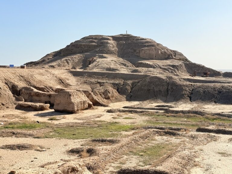
The mound measures about 1,200–1,300 metres from north to south and 800–900 metres from east to west, rising roughly 20 metres above the plain. An ancient canal divides it into northern and southern parts, and sections of the city wall remain visible. Ur stood beside a branch of the Euphrates near the ancient shoreline of the Persian Gulf; changes in the coast have left the ruins inland. Woolley traced the city wall around the central mound and reconstructed the waterways around it. His proposal that the Euphrates ran along the west side, with an artificial canal to the east, and joined two harbour basins remains a reconstruction. Texts nevertheless establish that Ur functioned as a busy river port connected to the Gulf.
City and surrounding settlement
The city extended beyond the central mound. The built area grew from about 10–15 hectares during the Uruk and Jemdet Nasr periods to nearly 50 hectares by Early Dynastic III. For Ur III and Isin-Larsa, estimates distinguish a walled centre of roughly 50–60 hectares from an inhabited area that may have reached 100–140 hectares and spread across as much as 500 hectares. Gardens, orchards and fields lay among buildings, while smaller settlements occupied canal banks leading toward Ur. Residential quarters were dense, and a commercial district is thought to have stood beyond the main mound. The storehouse known as the treasury of Sîn-iddinam was excavated more than a kilometre from the central city. Diqdiqqah, northeast of the sacred quarter, was at times part of the broader inhabited area.
The sacred quarter
Nanna’s sanctuary and the ziggurat court
The sacred quarter developed around the sanctuaries of Nanna and his consort Ningal. Nanna’s complex, called the E-kishnugal, occupied the northern part of the enclosure and was arranged around two courts on an artificial terrace. Earlier monumental buildings lie beneath later construction, indicating that the precinct’s plan changed repeatedly. The western court, known to excavators as the ziggurat court, measured about 140 by 135 metres. Its main monument was a stepped temple platform, or ziggurat, built by Ur-Namma in the twenty-first century BCE, probably replacing or enlarging an earlier temple platform.
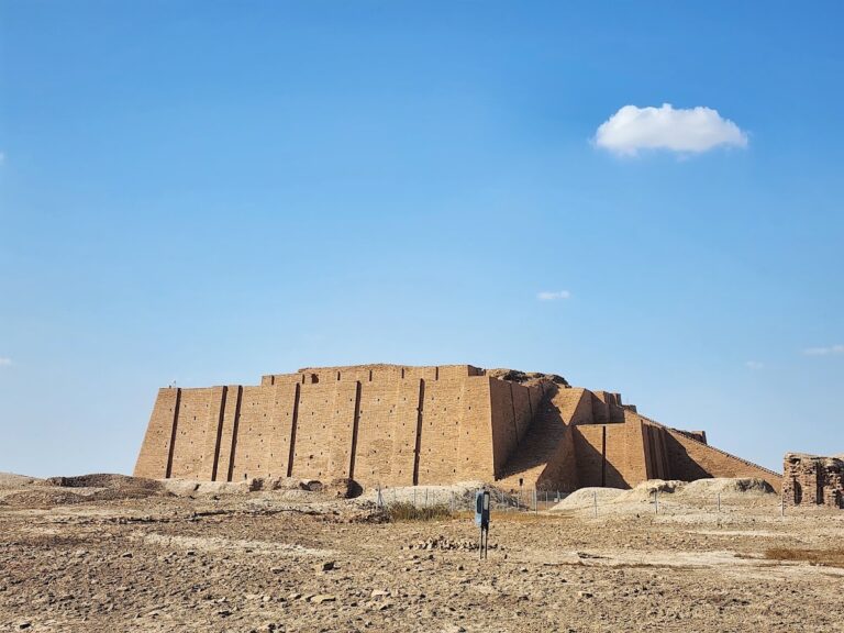
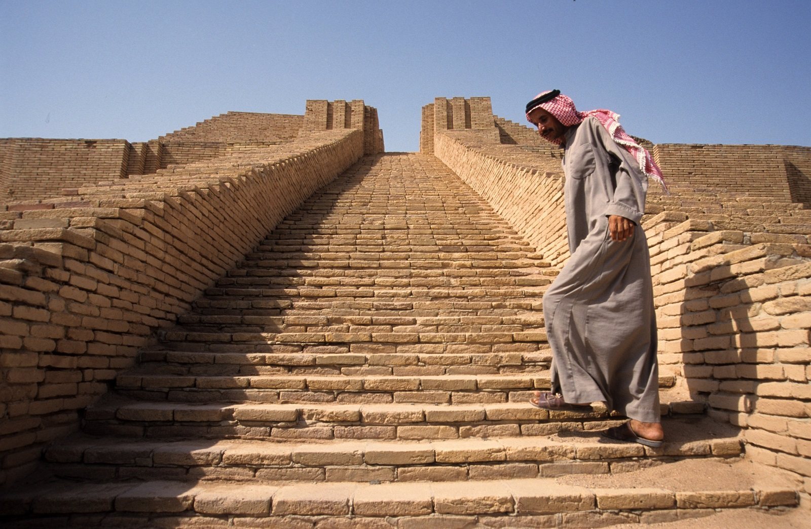
The ziggurat’s rectangular base measures 62.5 by 43 metres. Its core is mudbrick, faced with more durable fired brick. Small channels or openings through the brickwork were intended to drain water or help manage the effects of heat and moisture. The first level, about 11 metres high, survives along with the base of the second, which measured about 36 by 26 metres and may have risen roughly six metres. A perpendicular staircase and two staircases against the façade led to the first level, meeting at a small square structure Woolley called the gate tower. He reconstructed a lost third level with a small shrine; H. Schmid argued instead that the shrine stood on the second terrace and was larger. The ziggurat has been partly restored.
Buildings around the courts
Rooms built into the northwest side of the ziggurat court included storage and spaces for preparing offerings. A kitchen had a large oven, and a brewery prepared drinks. The location of the sanctuary’s cella, its innermost shrine room containing the deity’s statue, remains uncertain. It may have been in a courtyard building or at the top of the ziggurat. Texts also refer to chapels for other deities. At the court’s southeast entrance stood the monumental E-dublamah, which was later remodelled and closed. It retained a place of worship and was also used as a court and archive store. A structure built under Larsa at the court’s northwest corner, once interpreted by Woolley as a defensive bastion, is now thought to have been a new entrance.
The eastern paved court, called the Court of Nanna by excavators, measured about 64 by 42 metres. A double wall enclosed it, with long rooms within the wall. The court was enlarged during the Isin-Larsa period, taking space from the ziggurat terrace. Its purpose is uncertain; it may have served storage or ritual use. Southeast of it, the square Ganunmah had a base about 57 metres on each side and probably functioned as a large storehouse.
Giparu and the temple of Ningal
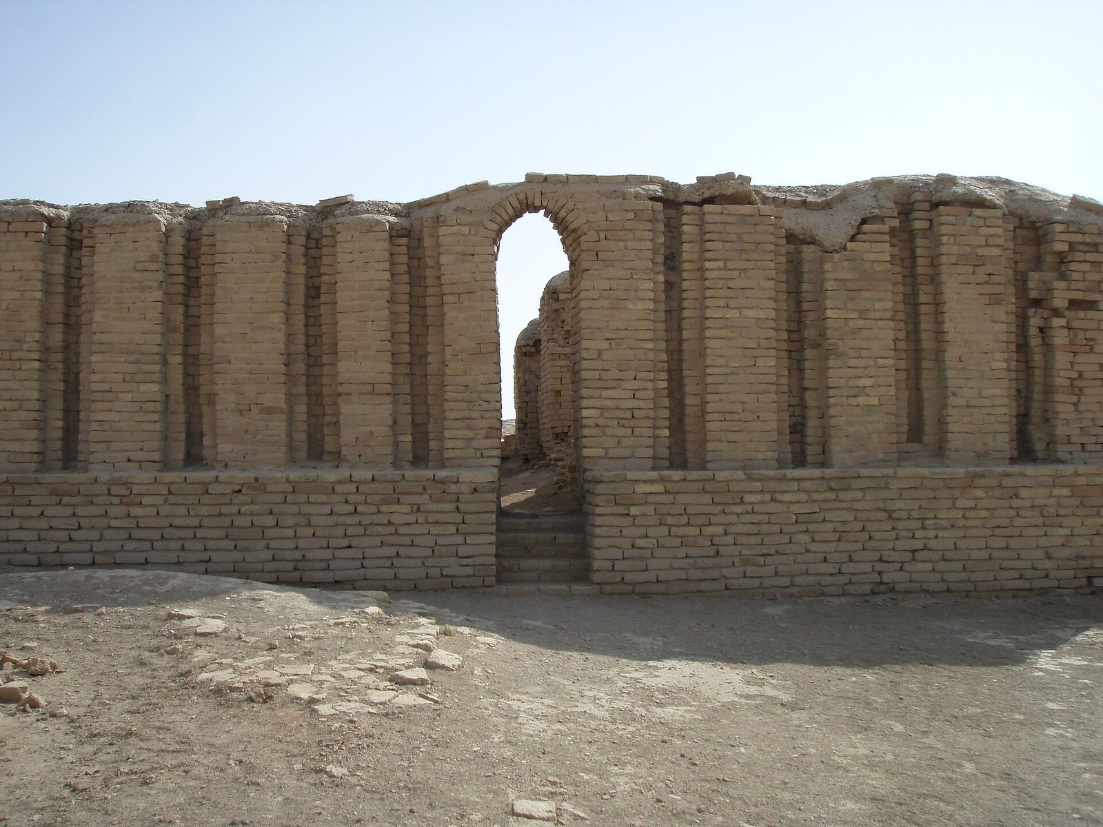
South of the ziggurat court stood the E-gipar, or Giparu, a complex about 79 by 76.5 metres across. Probably first constructed under an earlier dynasty and remodelled during Ur III, it is best understood from its remains dating to Isin-Larsa. A corridor divided the building into two main parts: the E-nun, a temple to Ningal in the southeast, and the high priestess’s residence to the north. Vaulted tombs of earlier high priestesses lay beneath the building.
The E-nun had a monumental entrance, two antechambers and a small court. Its sequence of rooms led to a larger cult court, another antechamber and an elongated sanctuary room with a niche for Ningal’s statue. Kitchens contained hearths and ovens. In the residential section, several courts separated public and private areas, as in a private house; some rooms have been identified as chapels. A carved, two-sided stone monument found in the sacred quarter depicts a ruler making offerings to Nanna and Ningal and taking part in temple rebuilding. The reverse shows a temple inauguration and further offerings. The ruler is probably Ur-Namma, though the identification is not certain.
Royal and funerary buildings
E-hur-sag
Southeast of Nanna’s temple, the square E-hur-sag measured about 55 metres on each side. It is commonly interpreted as a palace, although its precise purpose and any religious function remain uncertain. The building’s northwest portion was destroyed, and the surviving plan does not securely identify the uses of individual rooms. The better-preserved southern part suggests a central court with reception spaces, possibly including a throne room.
Shulgi’s complex
Farther southeast, a group of three adjoining units has been interpreted as a mausoleum built by Shulgi and enlarged by Amar-Sin. The units included underground vaulted chambers. Inscriptions date the central and largest unit to Shulgi’s reign, but it is uncertain whether it was intended for his burial or his father’s. Amar-Sin added the two smaller units. The complex’s relationship to royal funerary worship is debated, and it may not have held royal burials.
Residential districts
Old Babylonian neighbourhoods
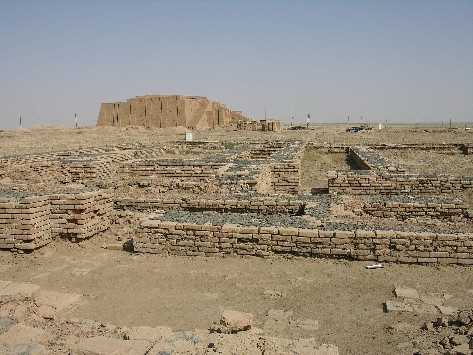
Residential areas excavated from the nineteenth and eighteenth centuries BCE include the EM and EH districts south of Nanna’s sanctuary and the larger AH district farther south. Excavators uncovered fifteen houses across nearly 3,000 square metres in EM, and about fifty buildings over roughly 8,000 square metres in AH. Narrow earthen streets, generally no more than four metres wide, ended in dead ends leading to houses. Chapels and craft spaces also formed part of the neighbourhoods.
Many houses covered about 60–80 square metres and were built of mudbrick, sometimes on fired-brick foundations. Walls were coated with clay, and roofs used timber beams. Plans and sizes varied, and some homes were subdivided over time. A common layout placed rooms around a courtyard or covered central space, with access to a reception room, although plans differ and the function of some rooms is uncertain. Upper floors are possible, but their existence has been disputed. Burials beneath houses included simple pits and brick-built tombs. Bodies were placed in clay coffins or, for children, large jars; graves also contained pottery, and richer burials included jewellery.
Sîn-nada’s house
A large house uncovered in the southern city in 2017 and 2019 dates to the nineteenth century BCE. Covering about 236 square metres, it had sixteen rooms arranged around a central court. An open space to the south, perhaps a garden, lay above a two-chambered burial vault. Identified rooms include a reception hall with a central hearth, a room with a household-worship niche, a paved washroom with a drainage well more than eight metres deep, a kitchen with two large covered ovens and an adjoining pantry. An installation for roasting fish stood in the courtyard. Tablets identify the household as that of Sîn-nada, a priest of Ningal, and his wife Nuttuptum; some school tablets indicate that their children studied there.
Neo-Babylonian houses
Houses excavated south of the AH district belong to the Neo-Babylonian period. Their streets were wider and straighter than those in earlier residential quarters. The houses were larger than their Old Babylonian predecessors and built of mudbrick without fired-brick additions. Rooms continued to be arranged around a central space. Woolley considered them to have had no upper storeys.
The Royal Cemetery
Burials and tombs
The Royal Cemetery lies about 250 metres southeast of the ziggurat, near the city wall. It contains approximately 1,800 burials dating from the twenty-sixth to the twenty-third centuries BCE, with the latest graves belonging to the Akkadian period. Most were simple burials, while others held several people. About twenty graves were exceptionally rich; seventeen are conventionally classed as royal tombs. Woolley excavated roughly 1,850 burials. The graves vary in form and contents, revealing differences in wealth and burial practice.
Two especially large tombs preserve evidence of burial groups. PG-789 contained 63 accompanying people equipped with copper helmets and swords. PG-1237, known as the Great Death Pit, held 74 bodies, 68 identified as women, although the sex of one person is debated. Two large ram figures found there are thought to have belonged to lyres; several lyres were discovered near the entrance. Some bodies showed injuries sustained around the time of death, and skeletons also preserve signs of long-term manual labour.
Objects from the graves
Grave goods include luxury vessels, finely made weapons, gold daggers, a reconstructed draught vehicle, statuettes, cylinder seals and a wooden lyre decorated with a bull’s head. A cylinder seal is an engraved cylinder rolled over clay to make an impression. Puabi’s burial included a headdress of gold leaves and jewellery made with gold, lapis lazuli, carnelian and other precious stones. Her associated lapis lazuli seal bears a banquet scene.
Other notable finds include a 42-centimetre figure of an ibex reaching toward a shrub, made of wood overlaid with gold and set with lapis lazuli, silver, shell and other materials. The Standard of Ur, a shell-and-lapis-lazuli object about 20 by 47 centimetres, has an uncertain function. A shell plaque depicts two rearing ibexes around a shrub. Grave assemblages also included necklaces, rings, chains, a gold fly-shaped amulet, and a gold dagger and sheath. The lyre from the Queen’s Grave is now in the Iraq National Museum; other finds are held by institutions including the British Museum and the Penn Museum.
Later sacred and royal construction
Kassite-period restoration
Kurigalzu I restored or rebuilt the ziggurat and its court, the Dublamah, the Enunmah and the Giparu. Southeast of the ziggurat terrace, he built a small temple to Ningal around a large court with two sanctuary rooms. The Dublamah was raised above the surrounding courts. The Giparu was rebuilt to a different plan and linked to Ningal’s temple by a passage. The surviving evidence is incomplete, but the rearrangement may have expanded the residential part of the Giparu at the expense of its religious space. Kurigalzu also restored other temples and a city gate, raised the city wall and built a fort on it. Kassite-period houses survive poorly.
Assyrian-period rebuilding
Around the middle of the seventh century BCE, Sîn-balassu-iqbi raised the ziggurat terrace and rebuilt the adjoining temple of Ningal with a Babylonian plan of court, entrance hall and sanctuary room. He enlarged the Dublamah and rebuilt the Giparu. Two tombs, possibly belonging to high priestesses, were found in the Giparu. Clay figures placed in building foundations probably served a protective purpose. Poor-quality bricks make the plans of this period difficult to reconstruct.
Neo-Babylonian enclosure and temples
Nebuchadnezzar II enclosed the sacred quarter within a roughly trapezoidal wall about 400 metres long and 200–240 metres wide. It had three gates, two on its eastern side and one to the south. He may also have built two small temples on the ziggurat terrace, but the evidence is inconclusive. Nabonidus restored the temple of Ningal and the Enunmah and may have rebuilt the ziggurat; the claim that he increased it from three levels to seven is disputed.
Nabonidus’s palace and the Harbour Temple
Near the Dublamah area, Nabonidus built a roughly rectangular structure about 100 by 50 metres, with service rooms extending southeast. It may have been a new Giparu intended as the residence of his daughter Ennigaldi-Nanna. Earlier objects, including royal inscriptions, were found there. In Ur’s northeast, beside the northern harbour, he built a palace within a roughly trapezoidal wall up to about 100 by 90 metres. Its main entrance faced southeast, and residential rooms were set around several courts. Inscriptions call the building a Giparu, but it does not appear to have been the high priestess’s residence. A small temple about 33 by 27 metres adjoined it on the south; its deity is unknown, so it is commonly called the Harbour Temple.
Inscriptions and present condition
Inscribed and carved remains
Inscriptions survive on many walls, including stamped marks on mudbricks. Excavated finds also include an alabaster disk carved with an image of Enheduanna, found in the Giparu, where she probably lived as Nanna’s high priestess. Pottery is widespread across the site, including material removed during earlier excavations. A number of objects found in the sacred quarter and cemetery help illustrate the religious and burial practices associated with Ur’s buildings.
The archaeological landscape today
The ziggurat is a prominent surviving feature and has been partly restored. Areas cleared during earlier excavations have in places become covered again. The royal tombs are nearly cleared but empty; some require structural consolidation, and access to most is restricted. Graffiti is present alongside ancient inscriptions. Pottery fragments and human remains are incorporated into parts of the royal-tomb walls.