Bewcastle Roman Fort: A Roman Frontier Outpost in England
Site at a Glance
- Popularity
- Medium
- Country
- United Kingdom
- Primary era
- Classical
- Eras represented
- Classical, Medieval
- Civilizations
- Anglo-Saxon, Roman
- Site type
- Military
- Remains
- Fort
On this page27 sections
History
Bewcastle Roman Fort is a Roman military outpost at Bewcastle in England, United Kingdom, built in the mid-second century, probably between about AD 122 and 142. It stood north of Hadrian’s Wall, the frontier barrier built during Emperor Hadrian’s reign, and may have helped scout the area, warn the Wall of danger, monitor a possible approach and support the Brigantes, a large British tribal group in northern England. Its exposed position suggests that it was intended to house a mobile force, not simply to act as a stronghold. The plateau may have been occupied from the Bronze Age, and a pre-Roman hillfort may have been reused by the Romans. The area may also have had a religious role before their arrival.
The Roman frontier post
The fort’s Roman name is uncertain. One proposed name is Fanum Cocidi, meaning “shrine of Cocidius”; Cocidius was a war god worshipped in Roman Britain. A fifth-century text called the Ravenna Cosmography, a late-antique list of place-names and routes, includes the name Fanocodi. This has been associated with Bewcastle partly because altars dedicated to Cocidius were found nearby, but no inscription definitively establishes the identification.
The First Dacian Cohort, Cohors I Aelia Dacorum, an auxiliary army unit distinct from a legion, is associated with the first fort. Around AD 142 the Romans abandoned the site as the frontier shifted north to the Antonine Wall, a later barrier farther into Scotland. They returned around AD 163 after withdrawing from that frontier. Detachments from three legions, the Second Augusta, Sixth Victrix and Twentieth Valeria Victrix, worked on the fort’s construction or renovation. A Roman legion was a major army unit.
Rebuilding and the end of Roman occupation
Substantial changes in the late second and early third centuries may have prepared the fort for a larger garrison of about 800 to 1,000 soldiers. The identity of that garrison is disputed. Suggested units include the First Cohort of the Nervii, with the First Cohort of Nervana Germans proposed less securely. Soldiers from legions also served at the fort at times, often in specialist building detachments.
A fire led to abandonment around AD 297, followed by reoccupation and rebuilding. Attacks in AD 342–343 caused further damage, after which the fort was rebuilt again. Its final destruction is often associated with the invasion of AD 367, although the date when it stopped functioning as a regular military post is uncertain. One proposal places a troop withdrawal around AD 312, during Constantine I’s campaign in Italy against his rival Maxentius in a civil war for control of the Roman Empire.
After Roman rule
The Maiden Way linked Bewcastle to Birdoswald and the wider Roman road network. It continued to serve as a regional route for travel and trade after Roman rule ended. Anglo-Saxons, Germanic-speaking settlers who established kingdoms in early medieval Britain, probably occupied or reused the Roman site. A loom fragment found in the bathhouse indicates activity there, and use of the site may have continued into the seventh or eighth century.
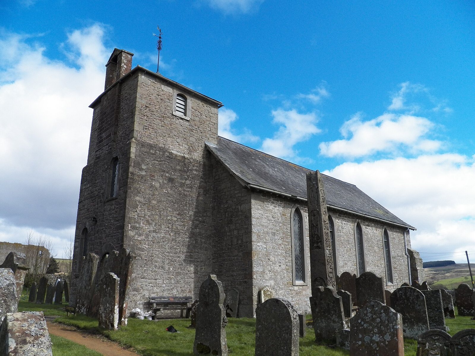
St Cuthbert’s Church may have followed an earlier royal estate, monastery, church, or a combination of these. Bewcastle Cross, an early medieval monument, is traditionally associated with the grave of Alcfrith, a seventh-century king of Deira in northern England. Another interpretation is that it marked the boundary of a Christianized area. Its erection may reflect the adoption by early Christians of a place that already had religious importance.
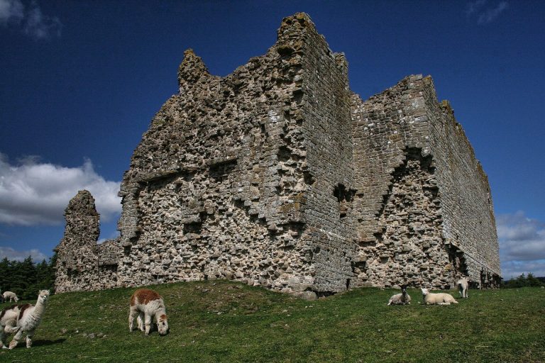
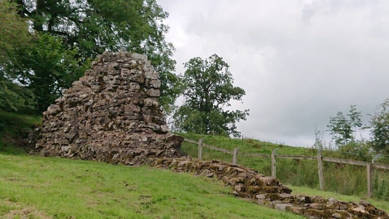
The earliest written evidence for the church is an inscription dated AD 1277, carved on stone taken from the Roman fort. A Norman castle was established at Bewcastle around 1092, probably first as a timber-and-earth structure that reused Roman ditches along its north and east sides. John de Strivelyn built a stone castle between 1361 and 1371, using Roman stone and dismantling the fort’s northeast corner. Roman masonry was also reused in nearby houses. In 1641, Oliver Cromwell’s forces destroyed the castle during the English Civil War, a conflict between supporters of the king and Parliament.
Archaeological investigation
Francis Haverfield excavated the Robin Hood’s Butts signal station in 1901. Investigations at the fort continued between 1922 and 1978. In 1937, Ian Richmond examined parts of the defenses, the northwest gate, the headquarters, the commandant’s house and a barrack block. Excavators partly uncovered the bathhouse between 1949 and 1954, then investigated the northwest corner in 1977–1978. Geophysical surveys followed in 2000, 2002, 2003 and 2008. A Roman marching or construction camp south of Kirk Beck was identified in 2012. English Heritage protects the fort area and Bewcastle Castle.
Remains
Setting and plan
The fort occupied a plateau of glacial sand and gravel above Kirk Beck, within a natural basin. Its area is estimated at about 2.4 hectares. The plateau slopes gently southwest; steep sides about 12 metres high border it to the east, west and south. A bend in Kirk Beck to the south, marshy ground southwest of the site, Hall Sike to the west and Bride Gill to the east all shaped the approaches. A higher, partly wooded ridge lies to the north, east and south. The fort’s roughly hexagonal outline follows the plateau’s edges rather than the rectangular plan usual for Roman forts. Its enclosed area was later reduced. St Cuthbert’s Church and its churchyard occupy the southern part, the castle ruins are northeast, and Demesne Farm buildings from the late seventeenth century stand in the northwest quarter.
Defenses and gates
Ramparts and ditches
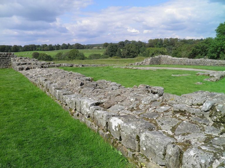
The first defenses, built around AD 122–142, relied mainly on timber and earth. A ditch encircled the fort, and a stone strengthening faced the outer side of its earthen rampart. At least one gate and some buildings inside the fort were made of stone. During a later rebuilding in stone, sections of the inner rampart were removed to make room for a road inside the defenses. In the final major alteration, a new wall was constructed along the southwest side and the northwest gate was removed. The north wall may also have been taken down and realigned. This reduction left the former gate and a barrack block beyond the new boundary.
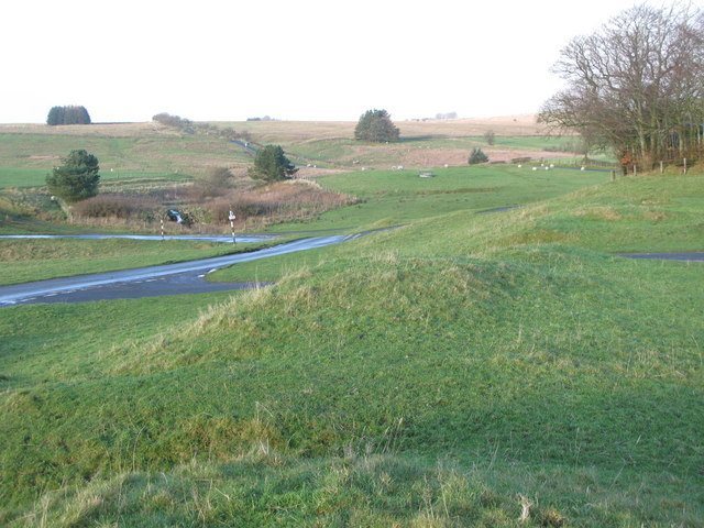
Low earthworks, ditches and an eroded rampart survive around the site. Near the northwest gate, west of Demesne Farm, the rampart stands about four metres high; similar remains may also survive to the southeast. The best-preserved wall section follows a natural ridge on the southwest, where traces of an outer ditch have also been noted. Erosion and stone robbing have affected other sections of the defenses. Earthworks along the north wall, identified in 2008, are thought to be Roman and may have enclosed horses or other military equipment.
Gates
Likely gate positions include the south, east and northwest sides, with the northwest gate regarded as the principal entrance. Set into the fort, it had two passages divided by a central pier. The southern passage was later blocked, perhaps to create a guardroom. The churchyard also contains remains of the fort’s underfloor heating system.
Buildings and circulation
Headquarters
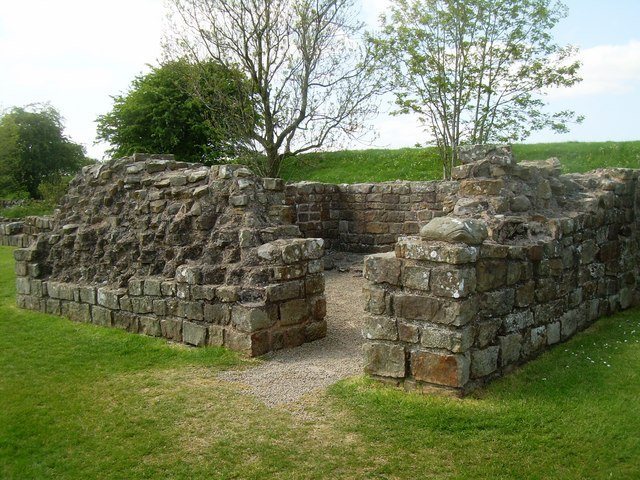
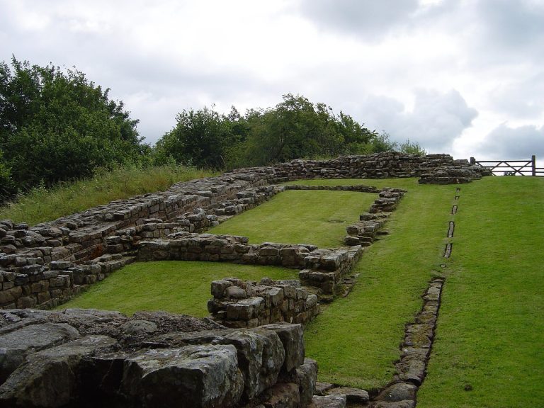
The damaged principia (fort headquarters) measured 21.9 metres from north to south and 30.5 metres from east to west. It formed part of the complex of buildings at the centre of the military site.
Commandant’s residence
The praetorium (commanding officer’s residence) measured at least 26.8 metres north to south by 23.8 metres east to west. It incorporated moulded marble slabs. Traces of buildings to its west may belong to stables or barracks.
Barracks and other buildings
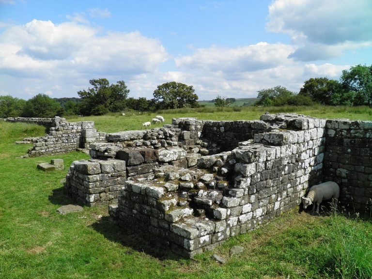
Two barracks have been identified in the northwest corner. Later rebuilding replaced internal structures in stone and added barracks; some buildings were subsequently adapted to other uses. The reduced fort may have left certain buildings outside its defenses, and some structures were altered after the boundary changed.
Bathhouses
A bathhouse stood in the southeast part of the fort during Hadrian’s period. Its rooms followed a linear arrangement, and parts of its reconstructed walls are conjectural. Later changes may have converted it to barrack use. A separate building near the northwest gate, identified by geophysical survey, measures about 15 by 10 metres and contains six rooms. Strong magnetic readings in one room may indicate pottery or other burnt material; the building could have been another bathhouse.
Internal roads and water supply
The main east–west road crossed a north–south road behind the headquarters. Another feature ran east–west south of the first road before turning south; it may have been a channel or aqueduct that supplied the bathhouse.
Roads and frontier communications
The Maiden Way
The Maiden Way was a Roman road about 32 kilometres long, linking the area of Kirkby Thore with Carvoran on Hadrian’s Wall by way of Birdoswald and Bewcastle. It approached the fort directly, crossed Kirk Beck about 46 metres east of Byer Cottage, then climbed to the plateau and the east gate. A possible continuation north toward Liddesdale has an uncertain course. After Roman rule, the road remained a regional route for travel and trade.
Signal towers
Three signal towers are associated with communications between the fort and the frontier. Barron’s Pike, about one kilometre east of Bewcastle, had a direct line of sight to the fort and Gillalees Beacon. Gillalees stood on a low hill between Bewcastle and Birdoswald and could also communicate with Carvoran. Robin Hood’s Butts stood about 3.2 kilometres southeast of Bewcastle beside the Maiden Way, with a direct line of sight to Birdoswald. Its excavated stone tower had a base about six square metres in area, walls about one metre thick and masonry surviving to roughly 1.75 metres. A ditch surrounded it. The towers probably relayed signals using light or smoke.
Marching or construction camp
The rectangular Roman camp identified south of Kirk Beck in 2012 lies 154 metres from the riverbank. It measures 124 metres east to west by 145 metres north to south and covers 2.15 hectares. Gaps in its enclosure may have been made later as entrances. The camp overlooked the Maiden Way crossing of Kirk Beck, and the road can be followed about 100 metres to its east. White Beck flows south and west of the camp before joining Kirk Beck.
Nearby remains and religious finds
Structures beyond the fort
Round huts described as stone circles have been observed near the medieval castle and about 800 metres east of Woodhead. Geophysical surveys east and north of the fort revealed foundations of stone buildings, postholes, roads and a probable lime kiln. Some buildings, especially those near the river crossing, may be Roman; traces of civilian buildings east of the fort are more likely medieval.
Altars and inscriptions
Nine Roman altars were recovered near the fort. Five were dedicated to Cocidius, one to Mars Cocidius, a Romanized form of that deity, one to Mars Belatucadrus, a Romano-British deity identified with Mars, and two to Jupiter Optimus Maximus, the chief god of Roman state religion. An altar to Cocidius found in the marching-camp area between 1863 and 1864 was dedicated by a legionary centurion, an officer in command of soldiers within a legion. Another altar names the centurion Annius Victor, though it does not identify his legion. An inscription also refers to the construction of a temple to Jupiter Dolichenus, a form of Jupiter worshipped in a cult originating at Doliche.
Offerings and other finds
Two third-century silver plaques dedicated to Cocidius were found in 1937 in a cellar beneath the headquarters’ standards shrine, the place where a unit kept its military standards. One shows the god in a shrine, holding a spear and shield; the other depicts him with a spear. Their inscriptions name Cocidius, and one also identifies Aventinus as its maker. They came from a fourth-century layer mixed with third-century objects and are now in Carlisle’s Tullie House Museum.
Other objects recovered with the plaques include a stone base for an imperial statue, fragments of two bronze letters, part of an iron thunderbolt from a statue, seven iron sockets on oak shafts for standards or banners, an iron arrowhead and a piece of a bronze shaft. A well-preserved Samian bowl, fine red-slipped Roman tableware, was found in 1934. Pottery fragments have also been recovered near the fort.
Thirty Roman coins have been recovered: fifteen in 1937, including two that cannot be read, nine in 1977, and six during excavations between 1922 and 1962. Of the 28 coins that can be dated, six were issued under Tetricus I or Tetricus II, rulers of the breakaway Gallic Empire, and four more date to the mid-third century. The latest coin is from the early fourth century and may indicate that Roman occupation continued into that period.
Church, cross and castle
Church and Bewcastle Cross
The church and its churchyard occupy the southern part of the Roman site. A stone taken from the fort bears the church inscription dated AD 1277. Bewcastle Cross stands in the churchyard. It is an early medieval stone monument whose upper portion is missing.
Castle
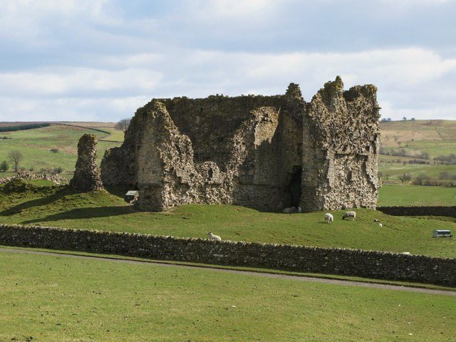
The castle ruins lie northeast of the fort. Its earliest form probably used timber and earth, with Roman ditches incorporated along the north and east sides. The later stone castle reused Roman masonry, and its construction altered the fort’s northeast corner. Roman stone was also built into houses nearby.