Karađoz-beg Bridge: A Historic River Crossing in Blagaj
Site at a Glance
- Popularity
- Very Low
- Country
- Bosnia and Herzegovina
- Primary era
- Early Modern
- Eras represented
- Early Modern, Modern
- Civilizations
- Austria-Hungary, Habsburg, Ottoman
- Site type
- Infrastructure
- Remains
- Bridge
On this page8 sections
History
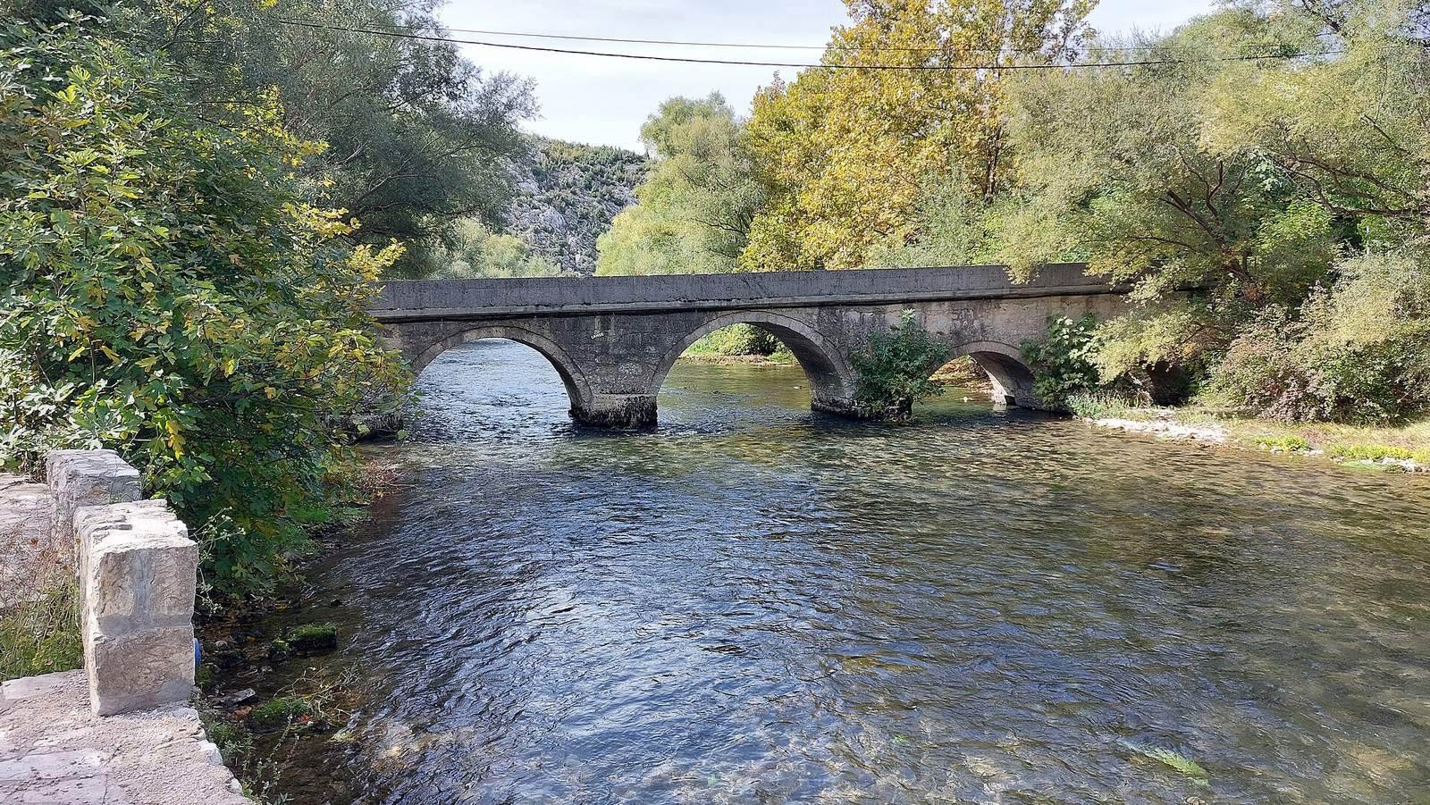
The Karađoz-beg Bridge is a stone crossing over the Buna River in Blagaj, Bosnia and Herzegovina. It was built at the site of an earlier medieval river crossing as an endowment of Hajji Mehmed-beg Karađoz, a sixteenth-century benefactor of Mostar. Its earliest known written reference is an endowment deed dated 8 March 1570, which shows that the bridge was already built by then. Hajji was an honorific for a Muslim who had completed the pilgrimage to Mecca, while beg was an Ottoman-era title of status.
Repair and reconstruction
The bridge suffered major damage in 1849 and may have been left in ruins. Belfe-Kadira, daughter of Ali-beg Velagić, provided money for its repair. A dated repair inscription was set into the bridge, where archaeologist Radimski recorded it in 1891.
During Austro-Hungarian administration of Bosnia and Herzegovina, from 1878 to 1918, construction of a brewery in Blagaj led to alterations to the bridge. It was demolished during World War II and reconstructed after wartime bombing. The repair-inscription tablet is thought to have been saved when the bridge was taken down. A major flood in the 1960s prompted another reconstruction.
The bridge is a National Monument of Bosnia and Herzegovina and is included, as part of the Blagaj Heritage Site, on UNESCO’s Tentative List. This list identifies sites a country may nominate for World Heritage status; inclusion does not mean that a site is on the World Heritage List.
Remains
Structure and setting
Position and overall form
The bridge runs northwest to southeast, about 700 m downstream from the Buna spring, where the old road to Stolac crossed the river. Five stone barrel vaults, continuous tunnel-shaped arches, span the river. The bridge measures 33.40 m across its openings and central piers, and nearly 50 m including the approaches on retaining walls.
Piers and vaults
Four masonry piers in the riverbed and two supports at the banks carry the arches. Their stone blocks are finely dressed, while the vaults are formed from regularly shaped blocks laid in horizontal courses. The building method points to local craftsmen. Each pier has a distinctive form: on the upstream side, a low triangular projection with a horizontal top extends about 1.20 m from the front wall and rises about 1.40 m. On the downstream side, a small rectangular projection about 35 cm deep meets the front wall in a stepped transition.
The semicircular arch faces sit about 3 cm behind the front walls. The bridge is low, with its arches and piers rising together from the foundations; the vaults are 40 cm thick. Their spans increase evenly from the banks toward the center: 3.90 m for each outer arch, 4.90 m for the next pair, and 6.0 m for the central arch.
Roadway and reconstructed fabric
Raising the road level changed the bridge’s original broken, rising profile. Triangular masonry additions appear on the right-bank façade. A raised wall on the left bank, associated with the brewery-related alteration, created a continuous downward slope from left to right. The surviving bank-side vaults provided much of the basis for proportioning the reconstructed vaults. The road level meets the openings along a tangent, leaving only a slight amount of front wall above the arch crowns.
On the preserved bank-side vaults, the outer upper surfaces stand 2.35 m and 3.40 m above the nominal water level. The parapet reaches 4.40 m and 4.25 m above the centers of the openings, with those measurements decreasing toward the middle. A shaped projecting stone course and a parapet of stone slabs mark the roadway. The vaults are about 2.98 m wide, and the path is 2.68 m wide. Its cobbles are set in cement mortar, while the parapet slabs are 15 cm thick.
The reconstructed vaults are made of dressed stone. Their front walls are concrete compacted in place and faced with stone. The stone is tenelija, a local limestone used in the Mostar area and also found in the surviving original portion.
Repair inscription
The tablet bearing the repair inscription measures 65 by 60 cm. It is now kept in the courtyard of the Sultan Sulejman Mosque in Blagaj.