Blagaj Fortress: A Medieval and Ottoman Stronghold in Bosnia and Herzegovina


Site at a Glance
- Rating
- 4.8
- Popularity
- Low
- Country
- Bosnia and Herzegovina
- Primary era
- Medieval
- Eras represented
- Classical, Medieval, Modern
- Civilizations
- Byzantine, Kingdom of Bosnia, Ottoman, Roman
- Site type
- Military
- Remains
- Castle
On this page13 sections
History
Blagaj Fortress, also known as Stjepan-grad, is a fortified hilltop complex in Bosnia and Herzegovina, at Blagaj near the source of the Buna River. Its development spans prehistoric occupation, Roman and late-antique phases, the medieval political history of Hum, and Ottoman rule. The site formed part of the historical settlement of Blagaj, which was also called Stjepan-grad or Stipan-grad, while the wider area was associated with Bona in classical antiquity.
Early fortified settlement
The hill appears to have contained several fortified positions. A prehistoric hillfort occupied the south-eastern summit, while a Roman or late-antique observation post known as Mala gradina stood on the north-eastern summit. The medieval or Ottoman fortress occupied the south-western summit. In the early medieval period, Stjepan-grad and Mala gradina may have formed a twin settlement that continued at least until the middle of the tenth century.
The earliest indirect written reference to the forts of the region, including Blagaj, occurs in Constantine Porphyrogenitus’s Treatise on Peoples, written around 948 to 952. Constantine Porphyrogenitus was a Byzantine emperor and writer whose work describes the political geography and fortified settlements of the Balkans. The text mentions the forts of Bona and Hum, the medieval political region that included the Blagaj area.
After the tenth century, Blagaj gained importance in the development of Hum, also called Zahumlje. Its position near the route through the Neretva valley connected the Adriatic coast with the Bosnian hinterland. This location helped make the settlement a political and strategic centre during the medieval period.
Medieval courts and rulers
Prince Miroslav of Hum held court at Blagaj and built a church dedicated to Saints Cosmas and Damian. A Cyrillic inscription recording the church’s construction was found in 1912 near the ruins of a manor in Bišće and the locality of Vrači. The associated settlement and court complex of Bišće is recorded from 1220, and King Stephen Tvrtko I issued a charter there in 1382.
Blagaj belonged to the political sphere of Hum and later came under the supreme authority of the Kotromanić rulers around 1326, during the rule of Ban Stephen II. The Kotromanić dynasty was the ruling house of medieval Bosnia. During the reign of King Tvrtko, Bosnian rulers issued charters at Blagaj, reflecting the settlement’s position within the kingdom’s political network.
In May 1404, Blagaj became one of the residences of Duke Sandalj Hranić, a leading member of the Hranić-Kosača family. It later became a residence of his successor, Duke Stjepan Vukčić Kosača, who held the title Herceg. The name Stjepan-grad derives from Stjepan Vukčić Kosača, while the title Herceg later gave its name to Herzegovina.
A peace agreement between Sandalj Hranić and Venice, issued on 1 November 1423, contains the first written reference to the fortress or town in the phrase “in our town of Blagaj.” The settlement also appears in fifteenth-century charters issued by Alphonse V of Aragon and Naples. During the conflict between Stjepan Vukčić Kosača and his sons, Vladislav Hercegović captured Blagaj in 1452.
Ottoman rule and abandonment
The Ottomans occupied Blagaj in 1465, and a kadija of Blagaj was recorded by 1473. A kadija was an Ottoman judicial official who administered Islamic law and related legal and administrative affairs. The fortress was associated with an Ottoman siege and remained under Ottoman control until 1835, when the old town was abandoned.
By that time, Mostar had replaced Blagaj as the area’s main strategic centre. The fortress still retained a military connection, but its reduced importance meant that the principal Ottoman garrison was stationed in the settlement below rather than inside the old town. Repairs were carried out in 1699, including work on the western tower, and again around 1827. Ottoman military personnel remained associated with the site until the abandonment of the old town in 1835.
Excavation and protection
Systematic archaeological excavation began in 1965 under the supervision of the National Museum of Bosnia and Herzegovina. The investigation covered approximately 1,000 square metres, more than one-third of the area enclosed by the ramparts, and clarified the sequence of occupation and construction on the hill.
Blagaj Fortress, formally the Old Fortress of Blagaj or Stjepan-grad, was placed under state protection and declared a National Monument of Bosnia and Herzegovina on 6 December 2003. It forms part of the protected historic urban area of Blagaj on the Buna and is classified as a Category I historical monument.
Remains
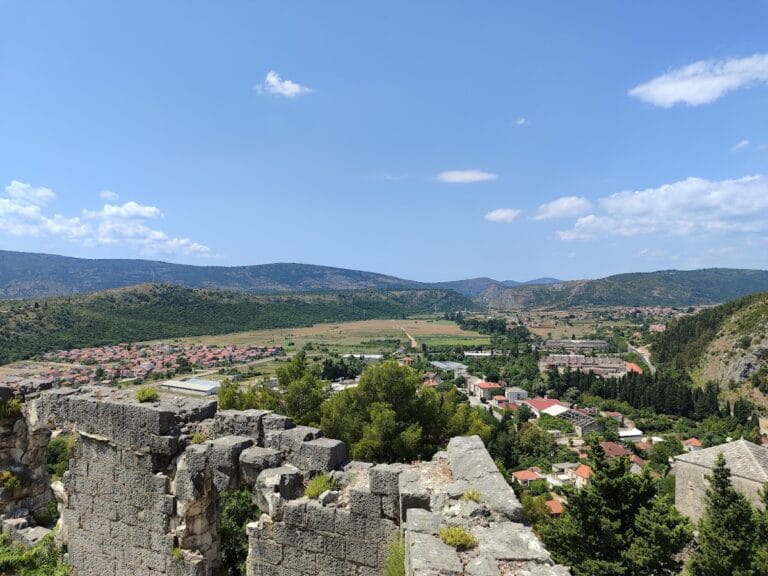
The fortress occupies a high karst hill with a naturally level position above steep cliffs on the south, west, and north. The hill reaches about 310 metres above sea level and stands approximately 266 metres above the source of the Buna River, while the fortress itself is given an elevation of about 275 metres. The wider fortified town covered more than 2 hectares. A gorge, once carrying a river, borders the shorter sides of the triangular summit area, while massive ramparts defend the longer and more accessible side.
Fortifications and entrances
Approach and forecourts
A steep serpentine bridle path, approximately 2 metres wide and 900 metres long, reaches the entrance in the thick eastern wall of the forecourt. The approach was protected by an outer forecourt, a second forecourt measuring about 10 by 11.5 metres, and a gatehouse of approximately 10 by 7 metres. The gatehouse walls are higher and more massive than those of the forecourt. A northern entrance had additional protection from a strong gate tower and a small vestibule.
Walls and towers
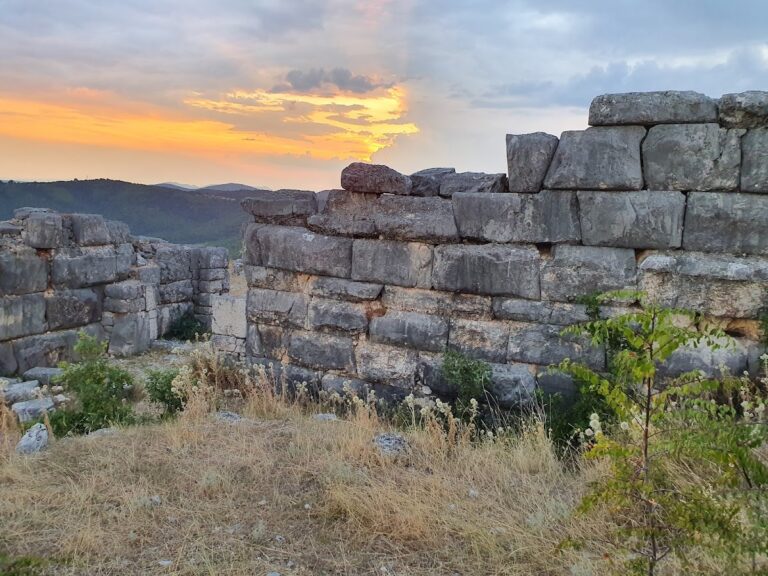
The fortress has an irregular polygonal ground plan adapted to the terrain and is also described as oval-shaped. Its inner defended area covers approximately 1,700 square metres. The walls generally stand about 12 to 14 metres high and are 1.5 to 2 metres thick, although the southern side is no more than about 1.5 metres thick. Four towers, numerous loopholes, and a passage or gallery around the walls formed part of the defensive system.
The gallery was enlarged with a wooden structure, traces of which remain visible, and was reached by five stone steps. The eastern wall is particularly strongly built, while a square tower rises on the western side. The walls were heightened during the sixth century without changing their basic thickness, and medieval additions increased the mass of the fortification. Reinforcement and thickening continued in the late fourteenth and early fifteenth centuries, when an additional wall was built about 10 metres from the fortress. The space between the two walls took on the appearance of a ditch.
The earliest identified construction phase dates to the fourth century. Its walls use quarry stone laid in horizontal courses with opus incertum, a technique employing irregular stones set in mortar. In a second phase, dated approximately 535 to 600, sections were repaired or raised by 1 to 3 metres with diagonally arranged stone known as opus spicatum, a herringbone-like pattern associated with the reign of Emperor Justinian. Repairs to the central tower of the eastern wall also date to the sixth century.
Later interventions are difficult to separate from one another because repairs continued in opus incertum until the nineteenth century. After the sixteenth century, local all-purpose builders known as dunđeri carried out work in both masonry and carpentry. The eastern wall suffered severe damage in the eighteenth or early nineteenth century when a large quantity of gunpowder exploded in its central tower. The subsequent repairs were crude and substantially changed the fortress’s original appearance.
Palace and archaeological layers
Palace XV
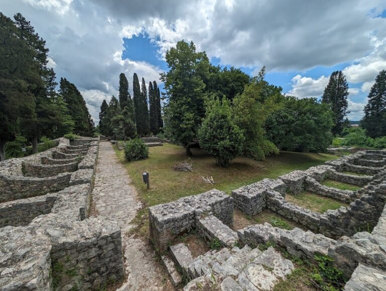
The most important architectural discovery within the fortress is Palace XV, an irregularly rectangular building. Excavation revealed archaeological layers between approximately 0.50 and 3.50 metres thick. Medieval layers contained pottery, small iron objects, glass fragments, and charred grain. About 700 kilograms of lead were found among the ruins of the palace.
Evidence of earlier occupation
A few fragments of Illyrian pottery and small pieces of Roman roof tile indicate activity on the prominent hill before the medieval fortress. Ottoman-period layers contained pottery sherds and small iron construction fittings. The Cyrillic inscription associated with the church of Saints Cosmas and Damian, found near the Bišće manor ruins and the Vrači locality, is now held by the National Museum of Bosnia and Herzegovina.
Šehitluk cemetery
Below the fortress, beside the road and stream, lies the former Muslim burial ground known as Šehitluk. It is probably the oldest cemetery in Blagaj. The outlines of several graves remain discernible, together with eight mostly damaged nišan tombstones positioned on both sides of the stream and road. A nišan is a traditional Muslim grave marker, usually made of stone.