Fulfinum: A Planned Roman Town and Early Christian Complex on Krk
Site at a Glance
- Popularity
- Low
- Country
- Croatia
- Primary era
- Classical
- Eras represented
- Classical, Medieval
- Civilizations
- Roman
- Site type
- City
On this page17 sections
History
Roman foundation and civic purpose
Fulfinum was a planned Roman town on Krk Island near Omišalj, Croatia, probably founded during the second half of the first century AD for retired soldiers of the Flavian emperors. The Flavian dynasty was the Roman imperial family that ruled from AD 69 to 96. Roman settlement in the area followed the Illyrian Wars, campaigns by Rome against Illyrian peoples in the western Balkans.
In the Flavian period, the town was called Municipium Flavium Fulfinum. The name suggests that Fulfinum held the status of a municipium, a Roman town with civic organization and some local self-government. The imperial project aimed to establish a major port and trading centre near routes toward Pannonia and Noricum, Roman provinces in central Europe. Fulfinum was founded within the territory of the Fertinates, a local Liburnian community associated with Omišalj.
The forum, the town’s central public square, served as a focus for political, economic, religious, and social life. Fulfinum’s civic, commercial, and religious facilities supported the functions of a Roman town.
Late antiquity and Mirine
Fulfinum probably began to decline amid the insecurity and disruption of late antiquity, the transition from the Roman imperial world to the early Middle Ages. Its open urban form was vulnerable to pressures on town life, and the settlement had been abandoned by the fifth century.
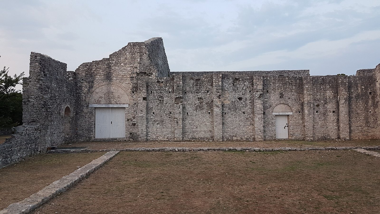
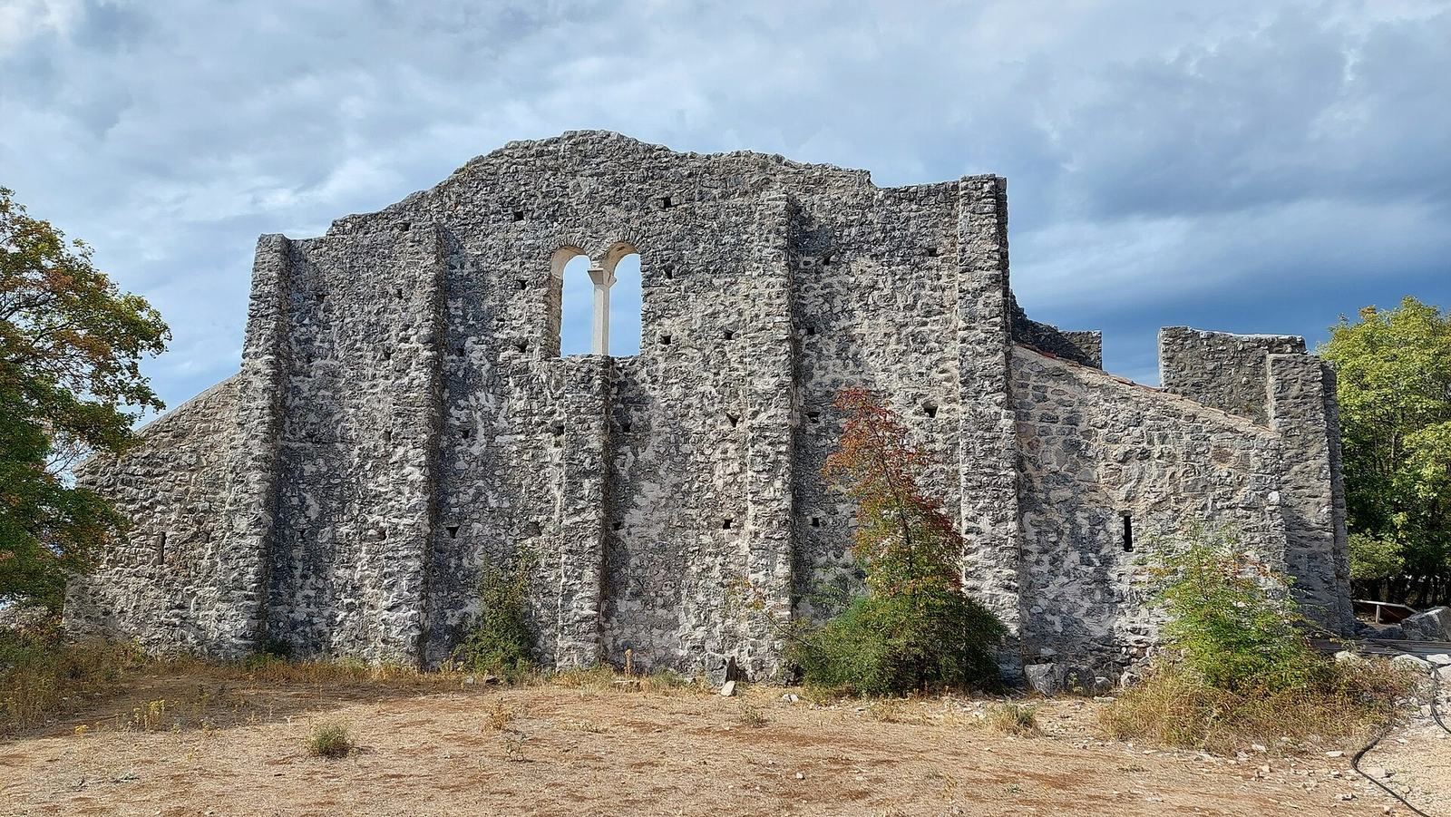
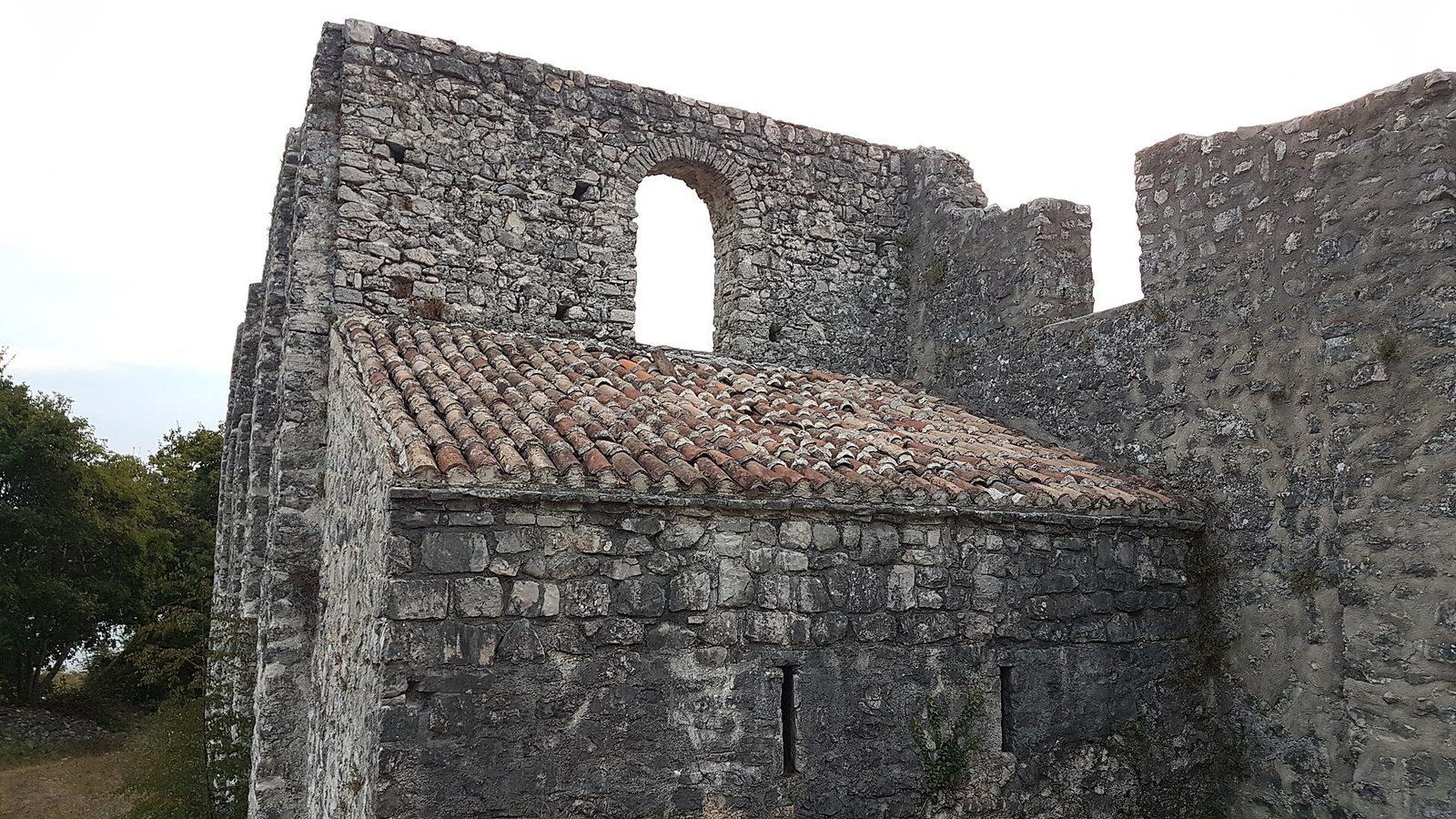
At the edge of Fulfinum, the substantial early Christian complex of Mirine was built in the fifth century, probably around its middle. The complex is associated with the Benedictine Abbey of St Nicholas. Its religious community developed over the following centuries, although when it adopted Benedictine teachings is uncertain. Benedictines follow a monastic tradition shaped by the Rule of St Benedict, associated with the sixth-century monk Benedict of Nursia. Later references place the abbey in the area below Omišalj.
Archaeological investigations uncovered the forum and its facilities, a warehouse district, and part of the former harbor. The excavated harbor remains were later destroyed during construction of the DINA industrial plant.
Remains
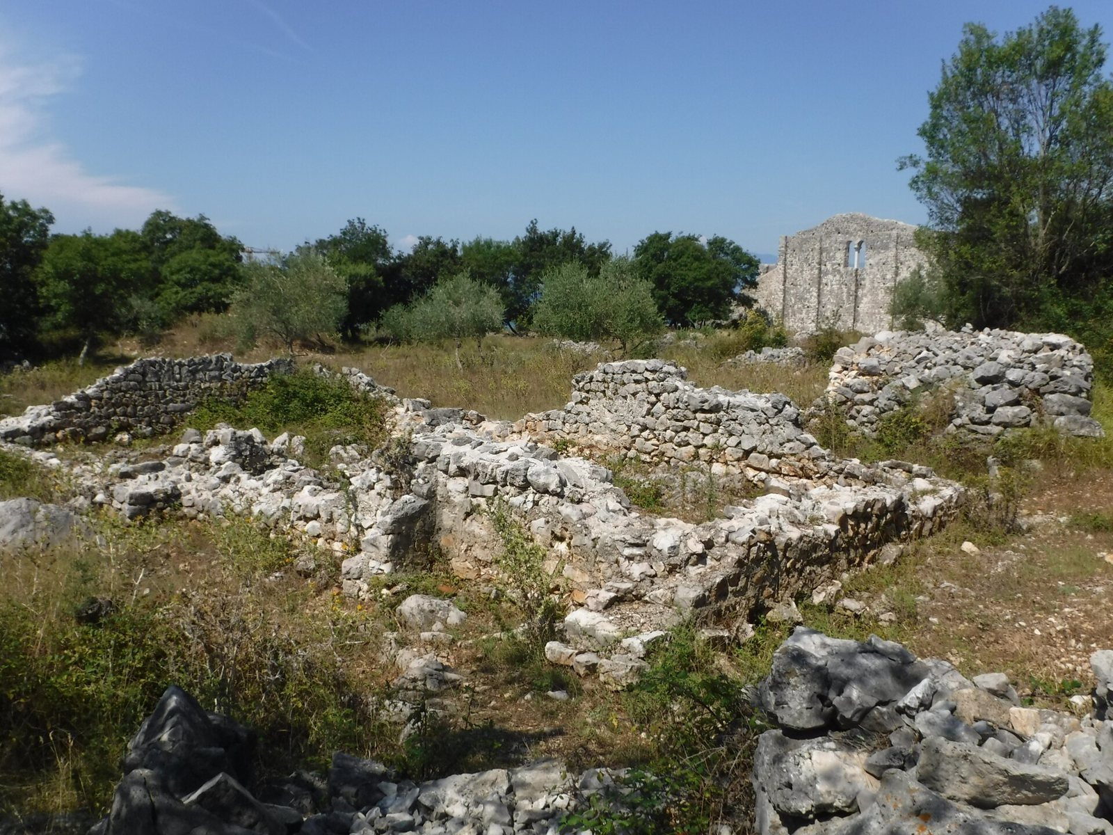
The Fulfinum–Mirine archaeological site lies in Sepen Bay, on the southern side of the Ert peninsula below Omišalj’s old fortress. Fulfinum occupied flat ground, and its streets followed a rectangular grid. A main road probably crossed the town along the coast and may have continued toward the town of Krk. Fertile land and abundant water surrounded the settlement, while the bay provided a sheltered setting for a harbor. The town also had baths and a water supply developed in two phases.
The forum and its buildings
Forum entrance and civic hall
The forum stood at the town’s northwestern edge, probably beside the main road. A portico, a roofed walkway, marked its entrance, with a dedicatory inscription above. The forum included a civic basilica, a public hall used for legal, administrative, or commercial purposes.
Capitoline temple
The principal temple stood along the northwestern side of the forum and occupied an area of about 1,300 square metres. Dedicated to Jupiter, Juno, and Minerva, the three deities of the Capitoline triad in Roman public religion, it had a plain front with four columns. Its simple interior was raised about one metre above the forum pavement. Enclosure walls bordered the temple to the west and north, while the wall of its entrance hall formed the eastern boundary.
Western taverns
A row of taverns occupied the forum’s long western side. Their entrances faced the sea, across from the forum, rather than opening directly onto the square.
Eastern forum building
A very long building stood on the eastern side of the forum. Three small rooms occupied its northern end. In front of them, a large open courtyard was flanked by two porticoes. A doorway through the wall gave access to the courtyard, which shared one boundary with the forum.
Harbor, roads, and services
Harbor and commercial quarter
Harbor installations and a seaside commercial quarter lay near the shore, where the town’s warehouse district was also located. The harbor’s sheltered position within Sepen Bay formed part of Fulfinum’s planned port setting.
Roads and water supply
Beyond the settlement, an ancient road led toward Krk, with a cemetery along its route. The town’s other facilities included suburban roads and a water system built in two phases.
The Mirine complex
Main church and worship spaces
Mirine’s surviving main church is a single-nave building with a simple cross-shaped plan. Its first phase included a narthex, or entrance area, a porch on the south side, and two small rooms beside the sanctuary. These side rooms are considered early forms of sacristies, rooms used to keep church furnishings. An open courtyard, or atrium, was probably built at the same time as the southern porch.
The sanctuary has a plain interior and a straight rear wall. A freestanding bench for offerings stood in front of it. Farther forward, an extension enclosed part of the sanctuary, with a cross-shaped altar stone at its centre.
Cemetery and burials
An early Christian cemetery formed part of the complex, and several privileged graves lay in the porch area. A sarcophagus in the narthex had been placed in a hollow cut into the rock and covered. Beside it was a privileged grave containing two people, dated to the seventh or eighth century.
Eastern service buildings
Smaller buildings used for service or economic activities stood on the eastern side of the monastic complex.
Western church
A smaller church occupied the western part of the complex. It had three apses, curved recesses within the building, and a smaller room attached at the rear with one apse. This church was built no later than the eleventh century.