Krakus Mound: An Ancient Earthwork of Uncertain Origin
Site at a Glance
- Popularity
- Very High
- Country
- Poland
- Primary era
- Unclassified
- Eras represented
- Unclassified
- Civilizations
- Unclassified
- Site type
- Burial
- Remains
- Burial Mound
On this page9 sections
History
Krakus Mound is an ancient earthwork on Lasota Hill in Kraków, Poland, and one of the city’s oldest man-made structures. Its builders, construction date, and original purpose remain uncertain, with archaeological evidence and later traditions supporting several competing interpretations.
Legend and proposed origins
Jan Długosz, a fifteenth-century Polish chronicler, related that Krak, the legendary founder of Kraków, was buried on the hill and that his sons raised the mound according to his wishes. Another tradition says that townspeople carried earth in their sleeves to create a memorial. Krak is also known as Krakus, the name used for the mound.
The hill’s name has been linked to Lassota, a medieval castellan, an official responsible for a castle and its surrounding district. The land originally belonged to the Awdańcy noble family, whose proposed Scandinavian or Anglo-Saxon ancestry remains unconfirmed. Other theories have connected the mound or Krak to Celtic, Scandinavian, Scythian, Hunnic, or Viking origins. During the interwar period, archaeologist Rudolf Jamka advanced some of these interpretations. Arguments for a northern origin for Krak have also drawn on the presence of Vandals in southern Poland through the fourth century.
A Celtic interpretation places construction in the second or first century BCE and considers the mound a tomb, a ritual site, or both. The Celts were ancient peoples of Europe with diverse regional cultures. A funerary purpose has been considered likely, while defensive, signaling, and observation functions have been judged less persuasive in view of the labor such a large earthwork required.
Some interpretations connect the mound to seasonal observances through its alignment with Wanda’s Mound. One proposed alignment corresponds to sunrise on May 1. Sunrise from Krakus Mound falls over Wanda’s Mound around May 2 and August 10, while sunset over Krakus Mound from Wanda’s Mound occurs around February 6 and November 4. These dates have been associated approximately with seasonal festivals in the Celtic calendar. Professor Władysław Góral proposed that Krakus Mound, Wanda’s Mound, Krak II Mound, Esterka’s Mound, and Wawel Hill might have served together as astronomical markers.
Excavations and competing dates
Excavations carried out from 1934 to 1937 under the patronage of the Polish Academy of Arts and Sciences examined the mound’s surroundings and a narrowing shaft reaching toward its base. Archaeologist Józef Żurowski and engineer Franciszek Jakubik led the work. The shaft was first planned to expose about four percent of the base; its enlargement in 1937 brought the excavated area to about 60 percent.
Settlement traces associated with the late phase of the Lusatian culture, an archaeological grouping identified through Central European material remains, were found near the mound and at its base. They were thought likely to have entered the mound during its construction, prompting a proposal that it could not predate about 500 BCE. Work in the 1970s recovered objects associated with the Przeworsk culture inside the mound and identified nearby sites associated with the Lusatian and Pomeranian cultures. These are also archaeological groupings identified from material remains.
Archaeologist Andrzej Żaki proposed a date from the late sixth century to the seventh or eighth century, drawing on a bronze belt fitting and the remains of a large oak. The fitting, probably from the seventh or eighth century, is described as Avar-type, a style that can include Avar-made objects and imitations influenced by Avar culture. Avar military routes passed through southern Poland in 562 and 566/567, and such objects could also have been imported. Botanist Władysław Szafer estimated that the oak was about 300 years old when felled; it may have been a pagan ritual object cut down during the introduction of Christianity in the ninth or tenth century.
Archaeologist Andrzej Buko suggested a later construction date, from the late eighth to the middle of the tenth century, based on a silver coin found in the mound. The coin is a denarius attributed to Boleslaus II, a tenth-century ruler of Bohemia. These different interpretations leave the mound’s date unresolved.
Burial landscape and living tradition
Historian Leszek Paweł Słupecki proposed that the mound marked the grave of an early ruler and belonged to a larger burial ground. Plans from 1702 and 1792 show other earth mounds nearby. Kazimierz Radwański of the Kraków Archaeological Museum estimated that at least 46 stood in the area toward the end of the eighteenth century, and interpreted the cemetery as evidence of Kraków’s importance in the early Middle Ages. Four smaller mounds reportedly once encircled Krakus Mound before their demolition in the nineteenth century to make way for the city wall.
The traditional Rękawka festival was held on the mound’s slopes each year on the first Tuesday after Easter until the mid-nineteenth century. It was revived in the 2000s and continues as an annual custom.
Fortifications and conservation
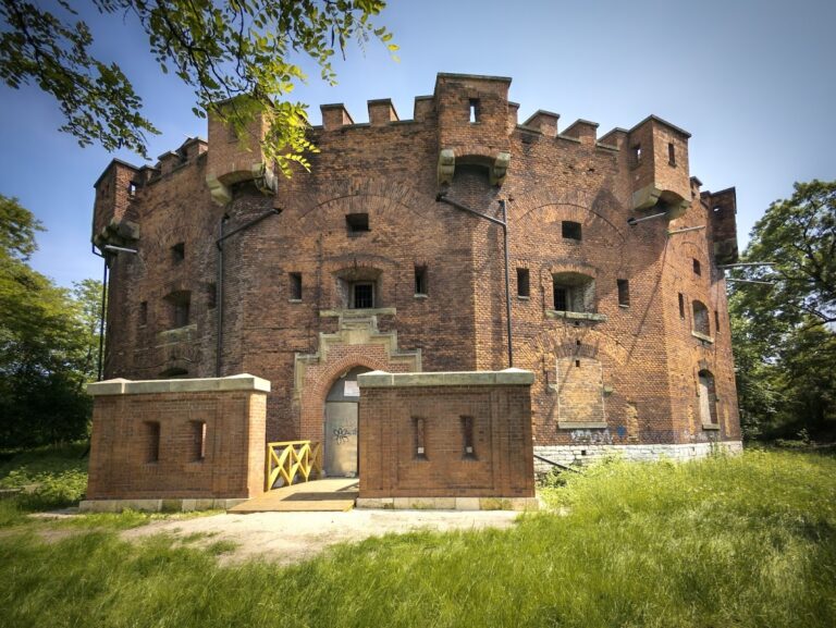
In the nineteenth century, Krakus Mound became part of the Austrian fortification system. Fortification structures were demolished during the interwar archaeological work, while the barracks were cleared after the Second World War. A revitalization project begun in 2012 combined architectural conservation with archaeological, geological, groundwater, structural, landscape, and ecological investigations. The work also uncovered remains of earlier fortifications and Austrian barracks in the surrounding area.
Remains
Mound form and construction
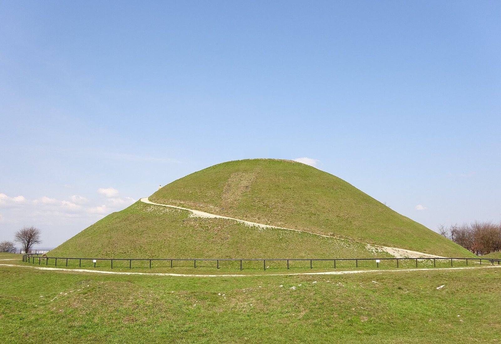
The mound stands on Lasota Hill, on the right bank of the Vistula in Kraków’s Podgórze district. The hill, at an elevation of 271 metres, forms the highest point of the limestone Krzemionki upland. The earthwork is 16 metres high, about 57 metres across at its base, and about 8 metres across its flat summit; its volume is approximately 19,100 cubic metres. Its internal framework was organized around a tall wooden post, with wicker partitions extending outward from it. Earth and stones packed between the partitions formed the body of the mound, which was covered with soil and turf.
Archaeological finds
The excavation shaft narrowed toward the base. Finds from within the mound included a child’s skeleton, a hearth, and other objects, regarded as having been incorporated as the earthwork was raised. The silver coin was found in the upper part, about 50 centimetres below the turf; the bronze belt fitting came from low in the mound, at the base of the shaft. Roots of the large oak were found in the upper part of the mound.
Former defenses
The nineteenth-century defenses around the mound comprised an earth rampart, a wall, and a defensive ditch. Barracks inside the wall formed part of Citadel Fort 33, known as Krakus. The fortification structures were demolished during interwar archaeological work, and the barracks’ remains were removed after the Second World War.