European Archaeological Park of Bliesbruck-Reinheim: A Cross-Border Archaeological Landscape
Site at a Glance
- Popularity
- Medium
- Country
- France
- Primary era
- Classical
- Eras represented
- Iron Age, Classical
- Civilizations
- Celtic, Roman
- Site type
- City
On this page23 sections
History
The European Archaeological Park of Bliesbruck-Reinheim is a cross-border archaeological landscape between Bliesbruck in France and Reinheim in Germany, preserving evidence of human activity from the Stone Age through the Roman and early medieval periods. Its Roman settlement began developing around AD 40–50, during the reign of Emperor Claudius, beside a road linking Lyon and Trier through Metz.
Prehistory and the Iron Age
People were active in the Blies Valley by about 10,000–9,000 BCE. Flint tools and traces of settlement and burial reflect activity through the Mesolithic, the middle period of the Stone Age, and later prehistoric eras. Neolithic finds are known from the wider valley. During the Middle Bronze Age, local metalworking developed, and two burial mounds were built. One covered the grave of a man who was about 80 years old. In the Late Bronze Age, the area was used first for burials and then for habitation.
After the fifth century BCE, the valley became an important settlement and power center. Storage pits, possible grain-storage structures, domestic pottery, and cremations in urns point to settled communities and social distinctions. In the Hallstatt period, an Iron Age culture of central and western Europe, elite graves contained rich furnishings, and their occupants had connections with the Mediterranean. Their residences may have helped control movement through the valley.
During the succeeding La Tène period, Reinheim grew as a center of power while another local settlement declined from the sixth century BCE. Aristocratic burial grounds included the grave of the woman known as the Princess of Reinheim, dating to about 370 BCE. The wider area has 32 known burial mounds, and some graves combined cremation and burial of the body. Reinheim’s importance may have been linked to a salt route from the Seille Valley and to long-distance exchange in goods placed in elite graves. A burial at Furtweg, dated to about 200 BCE, may have belonged to a mercenary who fought for Carthage in Sicily.
Roman settlement and estate
In antiquity, the area belonged to the Mediomatrici, a Celtic people whose territory lay in what is now northeastern France and nearby regions. Under Roman rule, it formed part of the province of Belgica. The Mediomatrici’s principal center was Divodurum, present-day Metz, and the ancient name of the settlement at Bliesbruck is unknown.
The Roman vicus, a small settlement often arranged along a road, developed beside a route connecting Lugdunum, or Lyon, with Augusta Treverorum, or Trier, through Divodurum. Its position on important routes gave it strategic value. The settlement served administrative, commercial, and craft purposes, while a nearby Roman villa, a rural estate with a residence and associated working buildings, supported agricultural production. Trade and craftwork helped the settlement prosper, reaching a peak in the third century. The villa developed most fully in the second century or the first half of the third. A dependent relationship between the settlement and the villa’s owner has been proposed, but remains uncertain.
Religious sites formed part of the wider landscape. A cult building at Horres, about one kilometre from the villa, was used from the end of the Gallic period into the Gallo-Roman period. Coins found in postholes of its polygonal temple have been interpreted as a foundation offering, and a large sanctuary later occupied the site. Another site, about 1.5 kilometres from the villa, may have been a sanctuary dating to the later La Tène period.
Late Roman decline
Invasions and fires in the third century damaged the settlement and reduced its built-up area. The western craft district was probably destroyed around 258, while the eastern district suffered destruction in 273 or 275. Fires also occurred around 260 and 275–276. The public basilica and fountain were destroyed, and the villa was severely disrupted. Repairs or reuse followed at the baths and in the eastern district, but the settlement lost its urban character.
Some buildings were repaired during the first half of the fourth century, as occupation became less dense. The baths were taken out of use between about 250 and 276, although parts of the complex were later used for bronze working. In the fourth century, the central and southern parts of the baths remained in use, and bronze work took place there and in the eastern residential district. That district continued to be occupied into the later fourth and early fifth centuries, with metal recycling and long-distance trade. The ancient settlement’s decline was complete by the middle of the fifth century.
The villa’s precise sequence of destruction and rebuilding is uncertain. A fire and partial rebuilding have been proposed for the third century, followed by a contraction of its residential area after disturbances around the middle of that century. A major fire destroyed the complex around the middle of the fourth century. Later activity was limited, and the estate’s outbuildings went out of use.
Early medieval and later activity
The villa and Roman settlement were unoccupied in the early Middle Ages, although burials took place elsewhere in the area. On Homerich hill, a seventh-century aristocratic funerary monument was later looted. Its grave pit contained four decapitated horses and two dogs, an arrangement associated with a ritual originating in eastern Europe. Four Merovingian-period graves are known near the church at Bliesbruck. One, a richly furnished woman’s burial from the first half of the seventh century, is now in the museum at Sarrebourg.
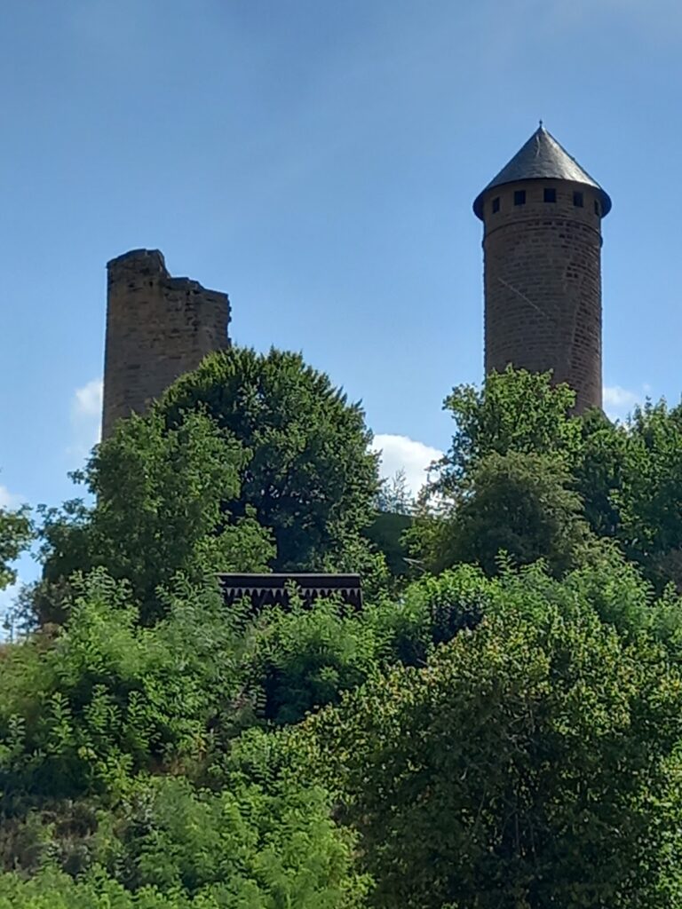
By the end of the Middle Ages, a castle stood on the heights above the village. In 1500, ancient ruins were treated as an economic resource within the territory of the lords of Mauchenheim of Zweibrücken. Rules concerning archaeological discoveries were recorded from the sixteenth century and reaffirmed in the late seventeenth and early eighteenth centuries. In the fifteenth and sixteenth centuries, the bath ruins were reused for habitation or fortification, and a farm occupied the site in the early sixteenth century. Later lime kilns consumed the standing remains, and the land returned to cultivation.
Excavation and creation of the park
Discoveries preceded systematic archaeological work. Urns came to light after a landslide in 1760, and the villa’s main building was excavated in 1806–1809. Later investigations uncovered Roman objects and structures, while railway construction led to the discovery of a cemetery in the late 1880s. Archaeological work resumed in the twentieth century. The Princess of Reinheim’s tomb was discovered in 1954, and excavations of the cemetery continued through 1957. A group of five Roman lime kilns was excavated at Katzenbuckel between 1952 and 1955.
Sand and gravel extraction exposed the Roman settlement in 1971, prompting salvage excavations that became more systematic from 1979. This work established the extent and importance of remains threatened by extraction. Jean Schaub helped develop research on both sides of the border, and the Moselle department acquired part of the site in 1982. Investigations of the western craft district continued through 1987; work in the eastern district began in 1989. The baths were excavated in 1982–1983 and again from 1988 to 1992, while systematic investigation of the villa began in 1987.
The cross-border park was established in 1989 by the Moselle department and Saarland, with assistance from the European Union. The project joined archaeological research and public understanding with local development, and was regarded as an expression of Franco-German cooperation. A 1991 plan divided the park into an equipped area, the villa area, and a natural zone presenting the Blies Valley landscape. A 1999 agreement reaffirmed its European and cross-border character. In France, parts of the Roman settlement received historic-monument protection, extended in 1995, and the park was placed on France’s list of major archaeological sites in 1989.
Research continued into the twenty-first century with landscape archaeology, geophysical surveys, and further excavations. A section of Roman road was excavated between 2004 and 2006, and work on the monumental center took place from 2008 to 2011. Excavations at the former church in Bliesbruck began in 2010 and revealed three successive buildings. By 2013, about one-fifth of the ancient settlement had been excavated. Surveys in 2016 south of the baths identified degraded Roman remains, probably from the late second century, including houses along the main road and a building about 40 metres long.
Remains
The park covers about 70 hectares on both sides of the French-German border. Its archaeological landscape lies on the left bank of the Blies, in a broad valley with alluvial terraces, limestone outcrops, and woodland. Homerich hill overlooks the area. The river offered a water route toward the Saar, while a land road connected the region with Strasbourg and Trier. The remains include Iron Age burial grounds, the Roman settlement and its public center, baths, and a large rural estate.
Iron Age burial landscape
Burial mounds and cemetery
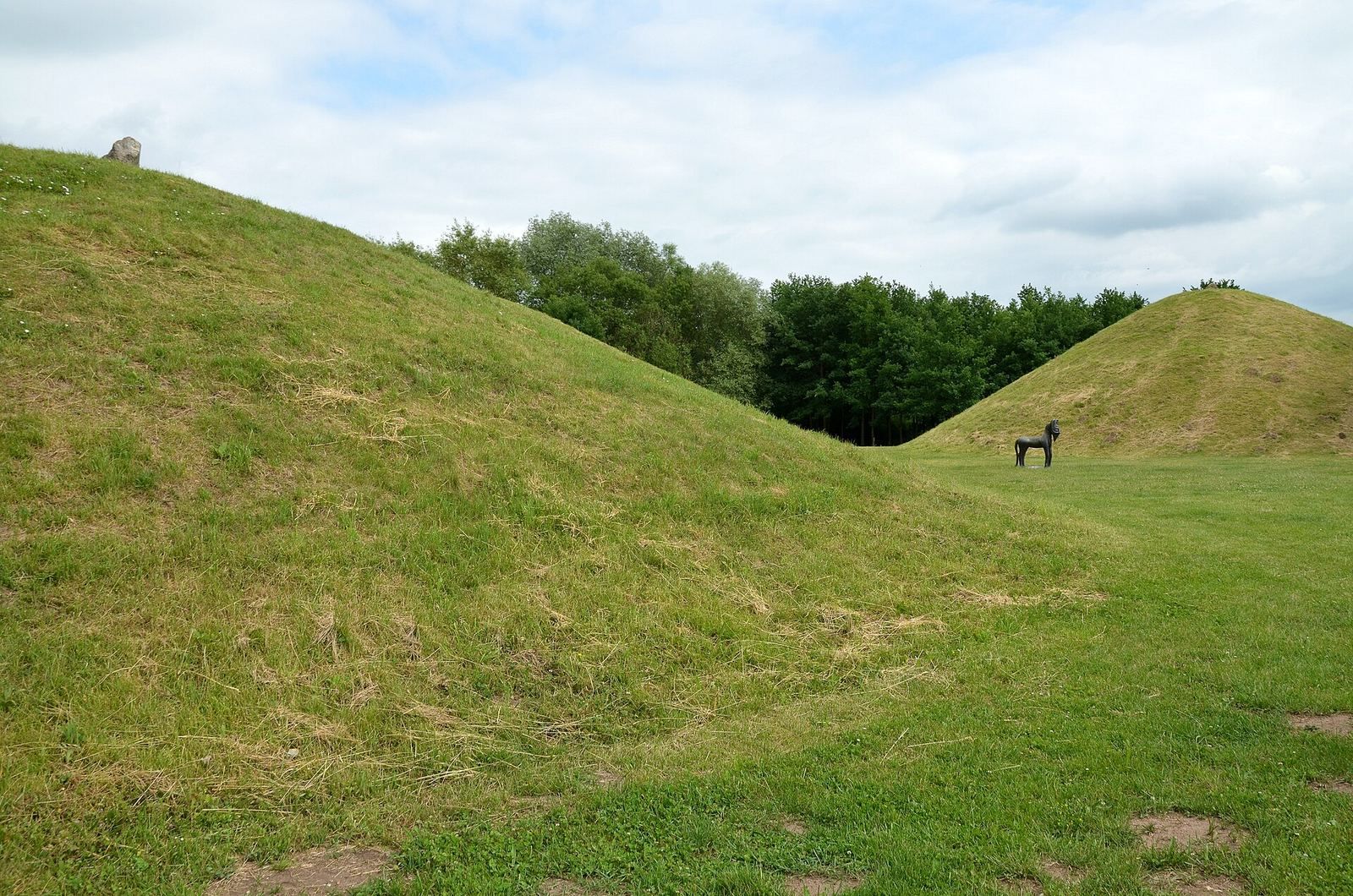
At least three burial mounds, or tumuli, stood in the Reinheim cemetery, with other mounds on nearby heights. The cemetery was levelled during Roman times. In the early 1950s, the enclosure around the mounds measured about 120 metres across and stood about two metres high. The reconstructed mound visible in the park stands close to, but not on, the original location.
The Princess of Reinheim’s burial
The woman’s grave was found at Katzenbuckel, about 130 metres from the Blies, where the excavation location is now a pond. Her mound had a circular ditch and measured about 23 metres across and 4.7 metres high; a stone marker stood on top. The oak burial chamber was oriented north to south and measured about 3.5 by 3 metres, with a height of about one metre. Gravel extraction damaged one side, and the mound had been heavily levelled before excavation. The woman’s estimated height and the arrangement of her body and ornaments were reconstructed from the grave evidence.
The furnishings included a twisted neck ring decorated with opposing human and bird-of-prey figures, gold bracelets and rings, and ornaments made of glass and lignite. Brooches included bronze examples shaped with a mask and a rooster. Two gold-covered brooches fastened a shroud, and a belt with pendants lay beside the woman. Other objects included a bronze mirror with a figure-shaped handle, bronze vessels, and a decorated wine jug whose lid bore a human-headed horse. The jug had held imported wine. Two drinking horns were decorated with gold.
A gold bracelet depicts Artemis and Athena, while two plain bronze cups have been interpreted as having a sacred purpose. The rare mirror lay beside the woman, to her right, a position interpreted as indicating ritual authority. An amber rod may also have served a ritual role. The original objects are now in Saarbrücken; copies are displayed in the reconstructed mound at the park.
Roman settlement
Street plan and housing
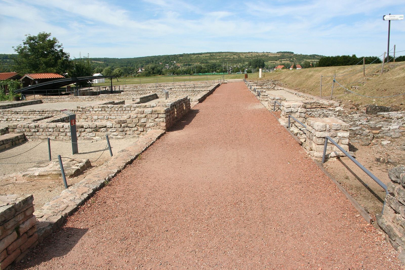
The Roman settlement extended for more than a kilometre along a north-to-south axis between two cemeteries. Its built-up center covered at least 20 hectares, while the settlement reached about 30 hectares at its height. More than 100 houses have been estimated, and the population may have approached 2,000. The main road ran beneath the former departmental road and was repeatedly repaired during the early Roman Empire. The excavated area represents only part of the ancient settlement.
House plots were generally narrow along the street and extended behind the buildings. In the eastern district, plots measured about 9–13.5 metres across and 100–120 metres deep; other plots in the town were about 7–12 metres wide. Houses were commonly 8–16 metres wide and covered about 200–500 square metres. Early buildings used earth and timber beneath tiled roofs. Later construction increasingly employed stone or timber frames, with limestone and lime mortar becoming common in the second century. Rooms and internal walls could still use perishable materials.
Shops and workshops generally faced the street at ground level, with living areas behind or above them. Houses could have upper floors, and rear rooms might include painted plaster, fireplaces, or underfloor heating. This heating system, called a hypocaust, circulated hot air beneath floors and through wall spaces. Small heated rooms, about three metres square, became more common from the late second century. Gardens, wells, orchards, vegetable plots, animal areas, cellars, and storage spaces occupied parts of the plots behind the houses.
Eastern craft district
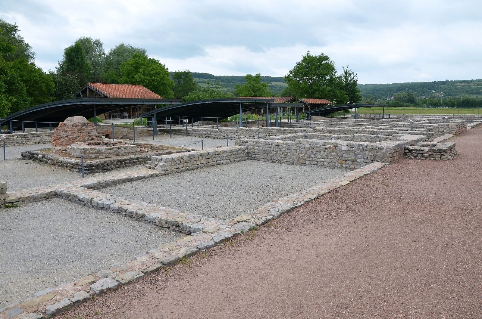
Fourteen buildings have been excavated in the eastern district, which was occupied from the first century and reached its height in the second. A covered walkway about 3.5 metres wide was added to buildings in the late first or early second century. Small masonry supports carried it; in the third century it became a gallery with shops. It served as a sheltered place for movement, work, and trade, with dwellings above. Despite destruction, this district remained occupied into the middle of the fifth century.
Evidence from the district and the western quarter points to iron and bronze working, food preparation and baking, woodworking, stoneworking, weaving, and trade. Ironworking left slag, hearths, furnace-residue pits, and small ingots used to make nails and tools. Bronze casting used the lost-wax method, in which a wax model shaped a mould before being melted away for the metal casting. Bronze products included fittings and brooches. Three food ovens were made from tile, brick, and clay. Finds also included weights and measures, storage vessels, imported-spice labels, and a fragment of an amphora that had held Egyptian wine. Goods brought to the settlement included spices, aromatics, oil, salted products, and wine from North Africa, Egypt, Greece, and Italy.
Western craft district
The western district was investigated along about 140 metres and included between eight and 14 plots in the excavated descriptions. Its earliest northern buildings, dating approximately to AD 30–80, were built from timber and earth with tiled roofs. The district expanded in the third century, when heated and underground rooms and painted plaster appeared. Some timber buildings were replaced by stone or timber-framed structures, and passages between buildings could be only 0.8 to one metre wide.
Workshop and shop rooms opened onto the street, while living areas lay behind or upstairs. Some rooms had heating, cellars, or storage areas. A building with four rooms and a covered walkway has been interpreted as public in function. Another building, with a basin between the western quarter and the river, may have had a ritual purpose; gravel extraction damaged it. A building in the eastern district may have served as the meeting place of a professional or religious association.
Public center
A public market measuring about 140 by 90 metres formed the monumental center. The baths stood to its west, with shops along their western and southern sides, while the main road ran to the east. A basilica, or public hall, stood on the market’s north side, and a monumental fountain occupied the center. The form of this public space in the first century is unknown; its grand arrangement took shape gradually and was substantially established by the early third century.
Civic basilica
The third-century basilica measured about 31.6 by 15.6 metres. Its small-masonry walls were plastered, and eight wooden pillars on sandstone supports divided the interior into three long spaces. A passage about 2.9 metres wide ran through the building. Entrances with lean-to roofs opened on its east and south sides; the side spaces also had lean-to roofs, while a raised central roof lantern brought light into the hall. A room with hearths produced iron and lead weights. It may have been a shop needing weighing equipment or an office supervising weights and measures. A shop was established at the building’s northeast corner in the third century. The building served a public-facing role, though its exact local use is uncertain.
Monumental fountain
The central fountain, a monumental public water display, existed by the early second century and was enlarged in the third. Its semicircular recessed space measured 12 metres across and faced the baths, with a projecting structure on either side. Built from small limestone blocks and finished with painted plaster, it likely had wooden water pipes. Plantings or pillars carrying statues may have stood in front. The remains are heavily levelled. The structure has been interpreted as a recessed space with a central basin and a public display; a plain classical column design and a pitched roof have also been proposed.
Roman baths
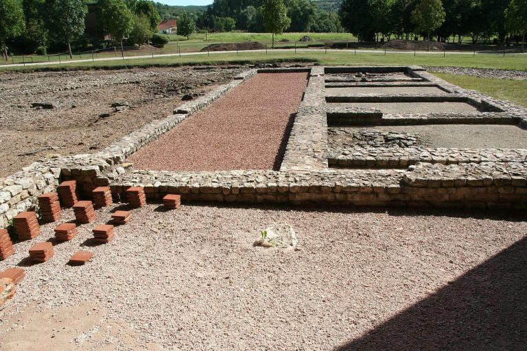
The baths stood near the river, west of the public center. The north-to-south complex measured about 90 by 40 metres and comprised a sequence of bathing rooms. Cold, warm, and hot rooms were arranged on an east-to-west axis, so bathers retraced their route through the building. A paved road, 3.5 metres wide, ran around it, and a separate paved route served fuel deliveries. Bathing-room walls were about 0.9 metres thick, compared with roughly 0.5 metres in the shops. Their pink-red plaster included crushed tile. Tiled roofs covered the complex, and a lime pit found during excavation related to its construction.
The entrance was on the east, where two rows of shops flanked a courtyard about 20 metres square. A basin in the courtyard measured about 7.85 by 4.4 metres. The cold room included a rest area and a basin of about 15 square metres near its curved end; the warm room lay between it and the hot rooms. The hot room had frescoes and marble panels, and its temperature may have exceeded 40 degrees Celsius. A hot bath occupied a curved space near the heating room. Another heated room retained its heating tubes when excavated and had painted decoration. Latrines for 11 or 12 people lay southwest of a courtyard, and wastewater drained into the Blies.
The baths changed over time. At the end of the second century, an outdoor exercise area and swimming pool in a courtyard about 20 metres square were removed, while pools, heated rooms, and reception areas expanded. A room north of the warm room had a heating chamber and painted decoration; it may have been a covered exercise hall. In the north shop wing, a covered walkway was enlarged in the third century, a furnace was installed beneath it, and commercial rooms were added. The south shop wing had an upper floor, and some shops were heated. Shops began as small rooms, about five by 2.8 metres, with timber fronts, shutters, counters, and beaten-earth floors. Some were combined, and some may have served as taverns.
Roman villa
Estate plan and working buildings
The villa stood at Heidenhübel, about 300 metres from the settlement, or about 800 metres northwest of it. Its estate covered nearly 10 hectares, and the excavated area covers about five. The villa followed a plan with a main residence and regularly arranged buildings around a large enclosed court. The wider enclosure measured about 300 by 170 metres, and the working court about 300 by 135 metres. A monumental entrance porch divided the residential and working areas. Six buildings stood along each side of the court, regularly spaced and arranged symmetrically; those at the corners were larger. Their uses are uncertain, with storage, barns, stables, workshops, and housing among the proposed functions. A building measuring 15 by 9.5 metres has been reconstructed as a loading and unloading structure.
A road about four metres wide connected the villa with the settlement and continued toward the Blies. Coins found along the road include one of Crispina dated to AD 185 and another from the fourth century. A high-quality building may have housed the estate manager, while some estate workers lived upstairs or in the courtyard buildings. One 22-by-12-metre utility building was destroyed by a gravel pit in 1964.
Main residence
The central residence measured about 80 metres wide and 62 metres deep in the early second century. A central block and two projecting wings gave it an H-shaped plan, and two covered galleries faced the exterior, one toward the Blies. A large reception room in the central block measured about 33 by 18 metres. Between the wings, an ornamental basin about 40 metres long and three metres wide was filled in at the beginning of the third century. Gardens lay to the south and east; the southern garden may have included a pergola, statues, and fountains. A square masonry block north of the building may have supported a tomb or a column of Jupiter with a giant figure whose legs were serpents.
The eastern wing contained 23 rooms and was separate from the central building. Its northern rooms opened onto a colonnaded gallery. A well in the central area may have been used for storage, and one southern room had heating. The western wing included a large room about 33 by 18 metres, possibly an audience or reception hall. Its northern end contained private baths dating to the second century, with cold, warm, and hot rooms, latrines, and perhaps an exercise area. Painted plaster and marble panels had geometric and floral designs. Seven living rooms lay to the south, three with heating, alongside service areas including a kitchen and cellar. The cellar is accessible by a reconstructed wooden stair.
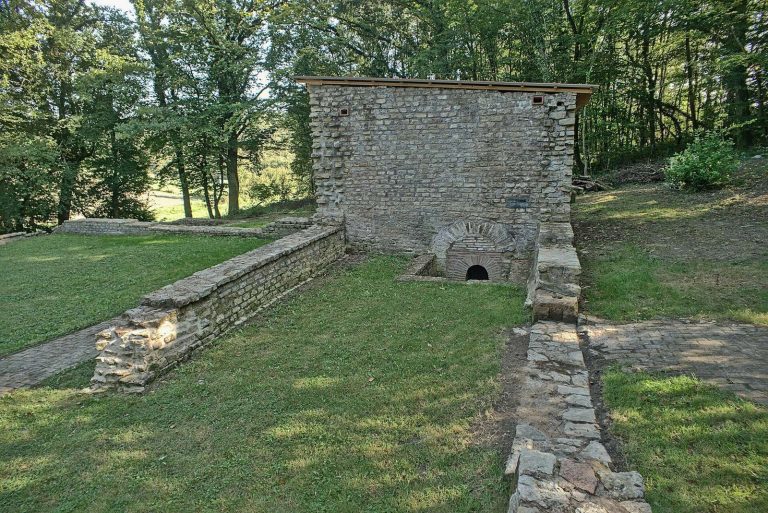
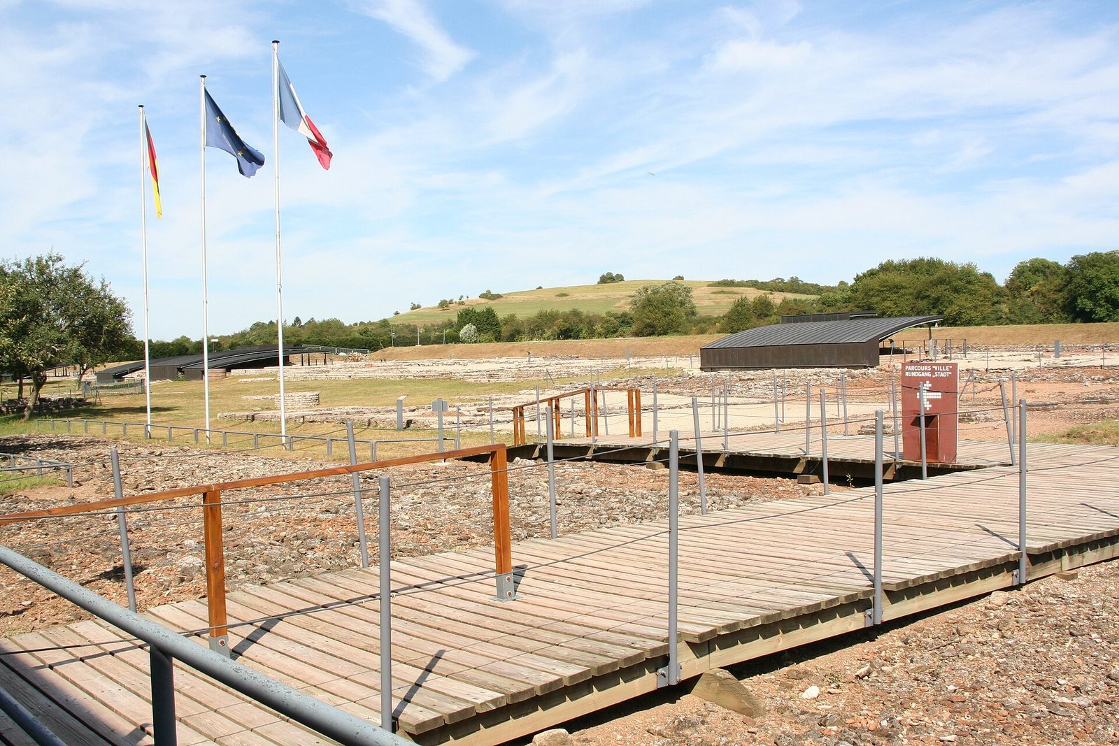
Painted plaster, marble, reception rooms, and architectural fragments including column bases, shafts, and capitals reflect the residence’s decoration. Windows had glass panes, and a sewer carried wastewater to the Blies, about 100 metres away. The original remains are heavily levelled and were further affected by nineteenth-century excavation. Some sections of the enclosure wall, entrance pavilion, main gatehouse, and annexes have been reconstructed to make the plan easier to understand. A reconstructed columned courtyard faces a garden, and gravel fill outlines some interior spaces.
Objects from the villa
Finds from the villa include a fragmentary iron cavalry helmet mask with bronze plating, discovered near an outbuilding in 2000 and dated to the first century. It may have belonged to the villa’s founder. Other objects include third-century bronze furniture fittings decorated with a deity among dolphins and griffins, a fragmentary terracotta theatrical mask, and statuettes representing Fortune, Cupid, Mercury, Mars, and Venus. Late Roman pottery, including Argonne and other fine red-slipped wares, came from a cellar reused as a rubbish pit.
Reconstructed features
The park’s reconstructed features include the Princess of Reinheim’s burial mound and elements of the villa, including its monumental entrance and working buildings. In an activity area in the western quarter, a reconstructed bakery and a timber-and-wattle pottery workshop accompany a garden recreated from plant remains found in wells, including evidence of bottle-gourd cultivation.