Drumanagh: An Iron Age Promontory Fort in County Dublin
Site at a Glance
- Popularity
- High
- Country
- Ireland
- Primary era
- Iron Age
- Eras represented
- Bronze Age, Iron Age, Modern
- Civilizations
- British
- Site type
- Military
- Remains
- Fort
On this page8 sections
History
Drumanagh is a promontory fort, a defensive site on a projecting headland, near Loughshinny in County Dublin, Ireland. It is generally classified as Iron Age, an archaeological period named for its predominant metalworking technology, although its earthworks may date to either the Bronze Age or the Iron Age. Its original purpose remains uncertain, and proposals range from military and commercial uses to an Irish settlement with connections across the Irish Sea.
Proposed Roman connections
Interest in Drumanagh grew in the 1950s, when ploughing exposed fragments of Samian ware, fine red-gloss Roman tableware. The discoveries contributed to competing explanations of the site. Some have proposed a Roman base for military operations in Ireland, a trading settlement, or a place where periodic fairs were held. Another interpretation is that it was an Irish settlement engaged in trade with Roman Britain, the part of Britain under Roman rule.
Barry Raftery and Gabriel Cooney suggested that Gnaeus Julius Agricola, Rome’s governor in Britain during the first century AD, may have used Drumanagh in an attempted invasion in AD 82. The historian Tacitus recounts that Agricola received an exiled Irish prince, apparently considering whether the man might provide grounds for a campaign. Tacitus later describes a sea crossing by Agricola and victories over peoples previously unknown to Rome, but does not specify which waters he crossed. The Clyde and Forth have often been proposed, although the surrounding passage concerns Ireland. Tacitus also says Agricola strengthened the coast facing Ireland and considered the island conquerable with one legion, a large Roman army unit, and supporting troops. No conquest followed, though some historians interpret the crossing as an expedition to Ireland.
Other interpretations emphasize commerce. Vittorio De Martino argued that contact between Ireland and Roman Britain continued, at least through trade. Michael Herity considered the quantity and character of finds, along with structural evidence, indications of a prosperous Irish trading centre with far-reaching Roman connections. More than 40 copper and brass ingots, together with copper mines at Loughshinny, have also prompted the suggestion that Drumanagh was an Iron Age metalworking centre.
Regional discoveries have informed arguments about Roman involvement in Ireland. Burials on nearby Lambay Island contained Roman brooches and decorative metalwork of types found in Roman Britain from the late first century. Roman jewellery and coins from Tara and Clogher have also been cited in support of a possible invasion. Richard Warner proposed that Drumanagh could have supported campaigns by exiled Irish and British adventurers backed by Rome, seeking kingdoms for Irish nobles in exile. He linked this idea to Túathal Techtmar, a figure in Irish tradition said to have been exiled to Britain in the first or second century and to have returned with an army to claim kingship. Whether Túathal was historical, or was the prince mentioned by Tacitus, remains uncertain. The name Drumanagh has likewise been given different explanations: one connects it with a proposed ruman root and Rome, while another derives it from the Celtic Droim Meánach.
Fingal County Council acquired Drumanagh in 2017 and circulated a draft conservation plan the following year, including measures to limit damage from motorcycle scrambling. The site is protected by a Preservation Order dating to 1977 and is a Recorded Monument, an archaeological site entered on Ireland’s statutory record, under Section 12 of the National Monuments (Amendment) Act 1994.
Remains
Headland and earthworks
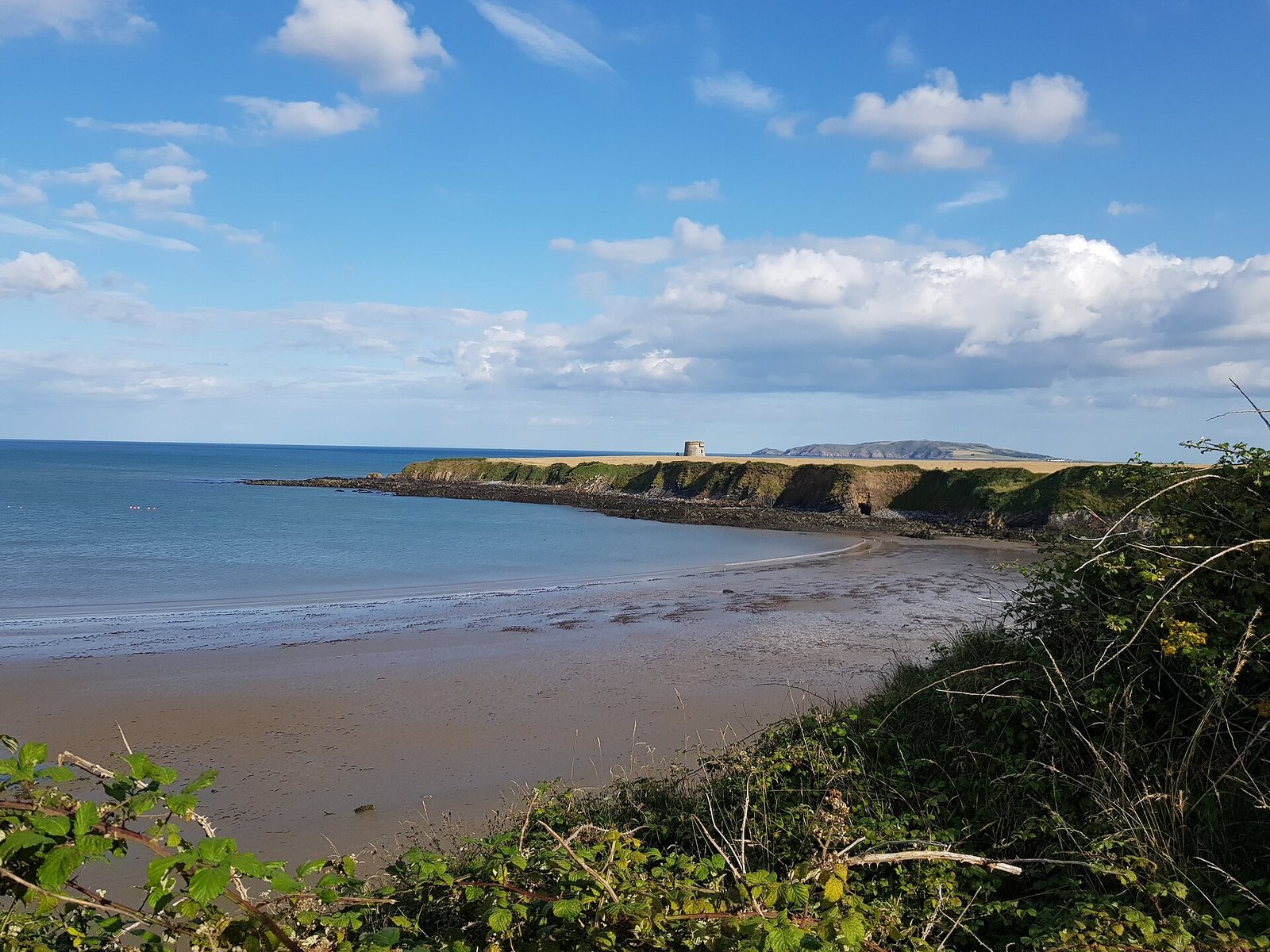
The peninsula measures roughly 320 by 420 metres. The Irish Sea surrounds it on three sides, with cliffs along the seaward edges and three parallel earth banks defending the landward neck. Ditches run in front of the banks, which extend about 350 metres from north to south. Within the ditches, the headland is approximately rectangular and narrows toward the sea; the greatest distance between the ditches and the cliffs is about 400 metres. The banks and natural cliffs together form a defensive position.
Martello tower
An early nineteenth-century Martello tower, a small round tower developed for coastal defence, stands near the headland’s tip, approximately equidistant from its two sides. A short access road leads to it.
Artefacts and excavation
Roman and metal finds
Finds associated with the area include Roman brooches and decorative metalwork resembling objects from Roman Britain. Coins bearing images of the emperors Titus, Trajan, and Hadrian have also been linked to the area. More than 40 copper and brass ingots have been found there. Illegal metal detecting recovered numerous artefacts. In the 1980s, a collector’s attempted sale of Roman coins and ornaments in London was stopped, and the objects were placed in the National Museum of Ireland. A later ownership dispute has restricted public discussion of the objects and their provenance.
Excavated Roman vessel
In May 2025, archaeologists from the Centre for Irish Cultural Heritage at Maynooth University, working with the Irish Archaeology Field School, carried out the site’s first excavation. They uncovered an intact Roman ceramic vessel, approximately 2,000 years old, which was undisturbed and well preserved. It was described as the first intact Roman pot found in Ireland.