Monte d’Accoddi: A Prehistoric Sanctuary Complex in Sardinia
Site at a Glance
- Popularity
- High
- Country
- Italy
- Primary era
- Stone Age
- Eras represented
- Stone Age
- Civilizations
- Unclassified
- Site type
- Religious
- Remains
- Sanctuary
On this page21 sections
History
Monte d’Accoddi is a prehistoric sanctuary and settlement complex near Sassari in Sardinia, Italy. Built by prehistoric communities on the island, its earliest monumental phase belongs to the Ozieri culture, an archaeological culture of prehistoric Sardinia. The oldest parts date to about 4000–3650 BC, and the complex may have served as a major religious center.
Neolithic sanctuary and Copper Age enlargement
People used the area from the Early or Middle Neolithic, and a village occupied it in the Late Neolithic. During the Ozieri period, the community built a raised platform sanctuary, probably in the early fourth millennium BC. Radiocarbon results indicate that the first sanctuary was in use around the transition from the Late Neolithic to the Copper Age, a prehistoric period between the Neolithic and Bronze Age. The settlement around the monument continued to be occupied, and finds from this phase point to the site’s most intensive period of use.
Structural instability led builders to enclose the first sanctuary within a larger platform. This second monument is broadly assigned to the Copper Age, but its precise date is uncertain. The complex may have functioned as a cult center of importance across Sardinia. One interpretation holds that people processed along its ramp toward a sacred high place, where the monument represented a meeting point between people and a deity.
Later prehistoric occupation
In the third millennium BC, new habitation developed east of the monument during the Filigosa and Monte Claro phases, later prehistoric cultural phases in Sardinia. Bell Beaker pottery, part of a wider prehistoric tradition recognized by its vessel shapes and decoration, points to later but apparently infrequent use. From the end of the third millennium BC, the site seems to have been largely abandoned and visited only occasionally.
A child burial with a tripod vessel and a cup dates to the Early Bronze Age. Rare pottery from the Middle and Late Bronze Age also indicates occasional visits. The monument was already in ruins, but seems to have retained some prestige during the Early Bronze Age. The site was abandoned around 1800 BC, at the beginning of the Nuragic age, a later prehistoric period associated with Sardinia’s stone towers and fortified structures.
Ritual interpretations and the site’s name
Animal remains from Copper Age layers include sheep, cattle, and pigs in nearly equal proportions. This pattern has supported an interpretation involving animal sacrifice. Large quantities of bones may also reflect meals at communal gatherings or religious ceremonies, although the settlement and sanctuary shared the site, making ritual and domestic use difficult to distinguish.
Some modern interpretations connect the monument with distant traditions, but remain unconfirmed. In 2017 and 2019, G. and M. Webster proposed that migration, perhaps exile, from Mesopotamia in the first half of the fourth millennium BC contributed to its construction. A direct architectural origin in Mesopotamian ziggurats, tiered monumental buildings, has no scientific confirmation. Archaeologist Ercole Contu also drew an analogy between the sanctuary’s altar and the altar described in the biblical Book of Exodus as commanded by Yahweh to Moses.
Archaeologist Giovanni Lilliu interpreted the fragmentation of marble statuettes as deliberate and connected it with fertility rites. Eugenio Muroni proposed that the monument’s symmetry reflected the Southern Cross and read a nearby Mother Goddess stele as evidence of a change from an earth-focused to a star-focused cult. Physicist Gian Nicola Cabizza considered it possible that the constellation could have been seen from Sardinia about 5,000 years ago. These are interpretations, not established explanations of the site’s purpose. The origin of the name Accoddi is also uncertain; one proposal links it to an archaic Sardinian word for mountain and related terms for stone.
Excavation, damage, and conservation
During the Second World War, trenches for antiaircraft batteries damaged the upper part of the monument. Landowner Antonio Segni brought the site to archaeologists’ attention after it had appeared to be a nuraghe, a prehistoric stone tower. Its archaeological identification dates to 1947. Ercole Contu excavated from 1952 to 1959, identifying remains of the surrounding village. Santo Tinè led a later excavation campaign from 1979 to 1990, followed by restoration informed by surveys of the site’s archaeological layers.
Work in the 1980s partly reconstructed the monument and removed and rebuilt material on the ramp, changes that were criticized as unjustified. Some finds from the surrounding area were also repositioned. In 2025, the archaeological site became part of the UNESCO World Heritage property Funerary Tradition in Prehistoric Sardinia – The Domus de Janas.
Remains
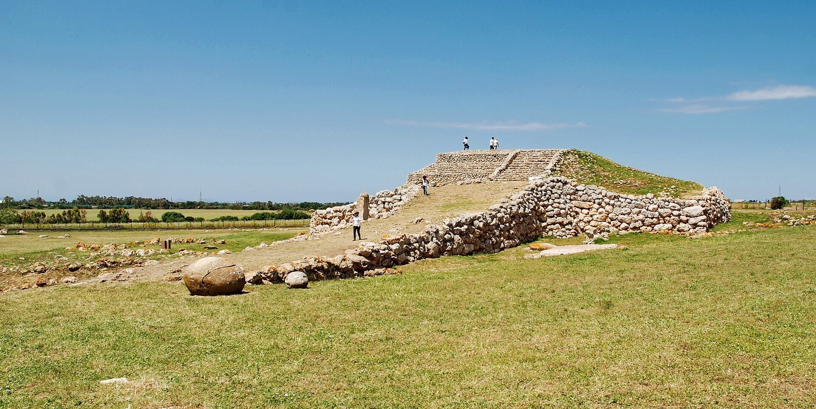
The 17,285-square-metre complex includes the central platform sanctuary, traces of settlement, standing stones, and other stone features. Its layout centers on a ramp approaching from the south and two successive platforms, with the later structure enclosing the earlier one. The square plan has been described as aligned with the cardinal directions, and a possible observational purpose has been proposed, though this remains uncertain.
Platform sanctuary
First sanctuary
The earliest monument consisted of a raised, roughly square platform about 27 metres across and 5–5.5 metres high. A ramp roughly 25 metres long and more than 5 metres wide led up from the south to a smaller rectangular building measuring about 12.5 by 7.2 metres. Its cella, the principal sacred chamber, had walls and a floor coated in red ochre. Traces of yellow and black pigment also survive, giving the building its archaeological nickname, the Red Temple.
The restored and partly reconstructed central building reflects the interpretation of two successive, partly embedded sanctuaries. The earlier internal terrace measured about 23.8 by 27.4 metres and stood roughly 5.5 metres high. Its ramp led to the chamber, which measured about 12.5 by 7.25 metres. The surviving perimeter walls rise about 70 centimetres above the floor, and both retain a red-ochre coating.
Enlarged sanctuary
The later monument expanded around and enclosed the first platform. It formed a stepped structure with a truncated top, measuring about 38 by 30 metres and standing roughly 9–10 metres high. Builders extended the ramp to about 40–42 metres, and stairs connected the two levels. The outer walls were made from large, irregular limestone blocks, set without regular courses and inclined to help carry the structure’s weight.
Behind the surviving walls, the platform’s interior consisted of earth and stone contained in retaining compartments. The fill included alternating layers of earth, stones, and powdered local limestone. The southeastern wall survives intact to a height of 5.4 metres.
Standing stones and other stone features
Limestone and trachyte slabs
A limestone slab lies a few metres east of the ramp, above a natural sinkhole. Measuring about 3 by 3 metres and weighing 8.2 tonnes, it has seven holes passing through its edges. It has been interpreted as either a dolmen, a megalithic tomb made from large stones, or an offering table. The holes may have been used to bind sacrificial victims. A second slab, made of trachyte, a volcanic rock, weighs about 2.7 tonnes and was found immediately beside the ramp on the same side.
Menhirs I and II
Menhirs are upright standing stones. Menhirs I and II stood about 200 and 235 metres south or southeast of the sanctuary. Both were found fallen and have since been re-erected in their original positions. Menhir I is a limestone monolith 2.30 metres high, 1.16 metres wide, and 0.97 metres thick. Its roughly rectangular section has rounded corners. The flat main face points east, and the opposite face is convex. Its top is broken, and the surface is heavily eroded, with major fractures and flaking especially on the south side.
Menhir II is a red sandstone monolith about 2 metres high, 0.97 metres wide, and 0.86 metres thick. Its roughly square section has bevelled corners, with a flat west-facing main surface, a convex reverse, and a rounded top. The north and west faces are relatively well preserved, while the other surfaces are heavily eroded.
Menhir III
Menhir III stands at the foot of the ramp on its left side. This prismatic limestone block is about 4.4 metres high and has numerous cup-shaped hollows. It was found fallen among ash, carbonized remains, and pottery from the Ozieri phase. The trachyte slab beside the ramp and a nearby menhir are considered possibly contemporary with the earlier sanctuary. At least one of the site’s menhirs may predate the monument itself.
Carved and spherical stones
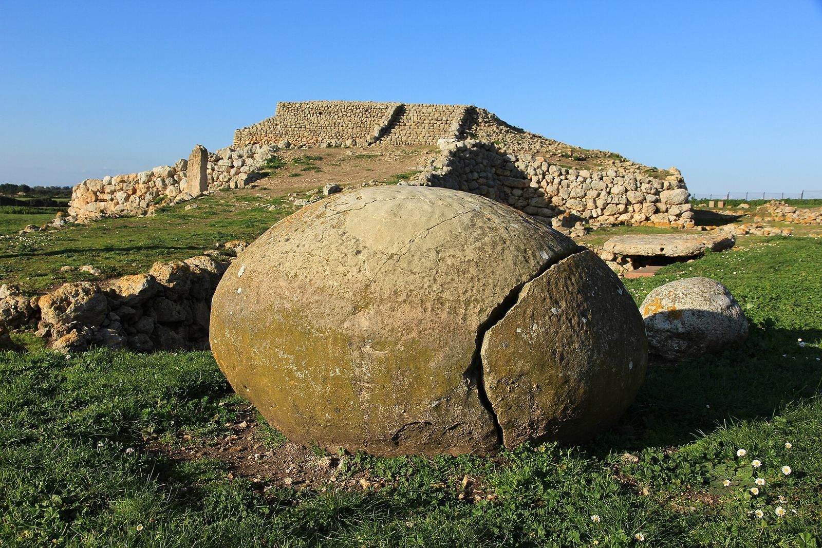
Two spherical limestone stones from east of the complex are now near the larger slab. The larger, worked stone weighs more than a tonne and has a circumference of 4.85 metres; the other is about 60 centimetres in diameter. Their purpose is uncertain. Other finds include a large boulder shaped like an egg and cut along a subtly curved, three-dimensional line.
A red-granite stele, an upright stone slab, stands north of the monument. Known as the Mother Goddess stele, its form has been interpreted as a stylized cross.
Settlement and funerary remains
Settlement structures
Settlement remains surround the sanctuary. They include quadrangular huts with dry-stone walls and elliptical habitation structures west of the ramp. A later settlement developed east of the monument, while foundations in the surrounding area point to additional small, possibly residential buildings.
Tombs and nearby monuments
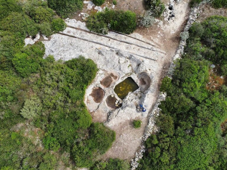
A prehistoric cemetery associated with the early settlement includes underground domus de janas, or rock-cut tombs. Another necropolis lies about 500 metres west of the monument, and a dolmen is located near its southeastern corner.
Pottery and evidence of production
Pottery
Pottery from several occupation phases includes San Ciriaco material, from an archaeological culture of prehistoric Sardinia, recovered in a test trench about 90 metres northeast of the monument, as well as Ozieri ceramics and Bell Beaker vessels. The Bell Beaker finds include hemispherical bowls, cups, tripod and four-legged vessels, and bowls with an angled change in profile. Some carry decoration in the Maritime style, a named variant of Bell Beaker pottery; others have more complex triangular and zigzag patterns.
Food processing, textiles, and metalworking
Numerous grinding stones, mortars, and small basins relate to agricultural processing, including grain preparation. Spindle whorls, most found east of the site, and loom weights provide evidence of textile production across several occupation phases. Possible ochre processing has been linked to coloring the monument and pottery.
Crucibles, hammers, grinders, and possible heaps of slag, waste from metalworking, indicate metalworking activity. It was underway at least by the Filigosa phase. Contu recovered 33 metal objects or fragments, mainly copper, from the oldest archaeological layers beneath the ramp. They include pointed tools, small axes, blades, an awl, a hook, a dagger, and a pendant.
Marble statuettes
Numerous marble statuettes with perforated plaques were found in a highly fragmented condition. Many have clear breaks at the neck, trunk, and arms, along with chips around the head.