Limeskastell Pohl: A Roman Frontier Fort on the Upper Germanic Limes
Site at a Glance
- Popularity
- Medium
- Country
- Germany
- Primary era
- Classical
- Eras represented
- Classical, Modern
- Civilizations
- German, Roman
- Site type
- Military
- Remains
- Fort
On this page13 sections
History
Limeskastell Pohl was a small Roman frontier fort on the northeastern edge of Pohl, Germany, on the Upper Germanic Limes, one section of Rome’s system of frontier boundaries and defenses. Its garrison was an unnamed vexillatio, a detachment from a larger auxiliary unit or legion.
Roman frontier position
The fort stood where the frontier turned about 75 degrees, from east-northeast toward the southeast. A road from the Rhine valley joined an older long-distance route between the lower Lahn valley and the Taunus at this point. The garrison guarded the transport junction, a crossing of the frontier, and the wedge of land formed by the Limes’s change in direction. Military officer and archaeologist Karl August von Cohausen had also recognized the strategic value of the position.
Excavations and modern reconstruction
The Reich Limes Commission investigated the fort from 1897 to 1900 under archaeologist Robert Bodewig, then returned in 1903 under archaeologist and ancient historian Ernst Fabricius, who discovered the site. The excavations yielded limited results. Traces of the suspected timber buildings had disappeared or could not be detected with the methods then available.
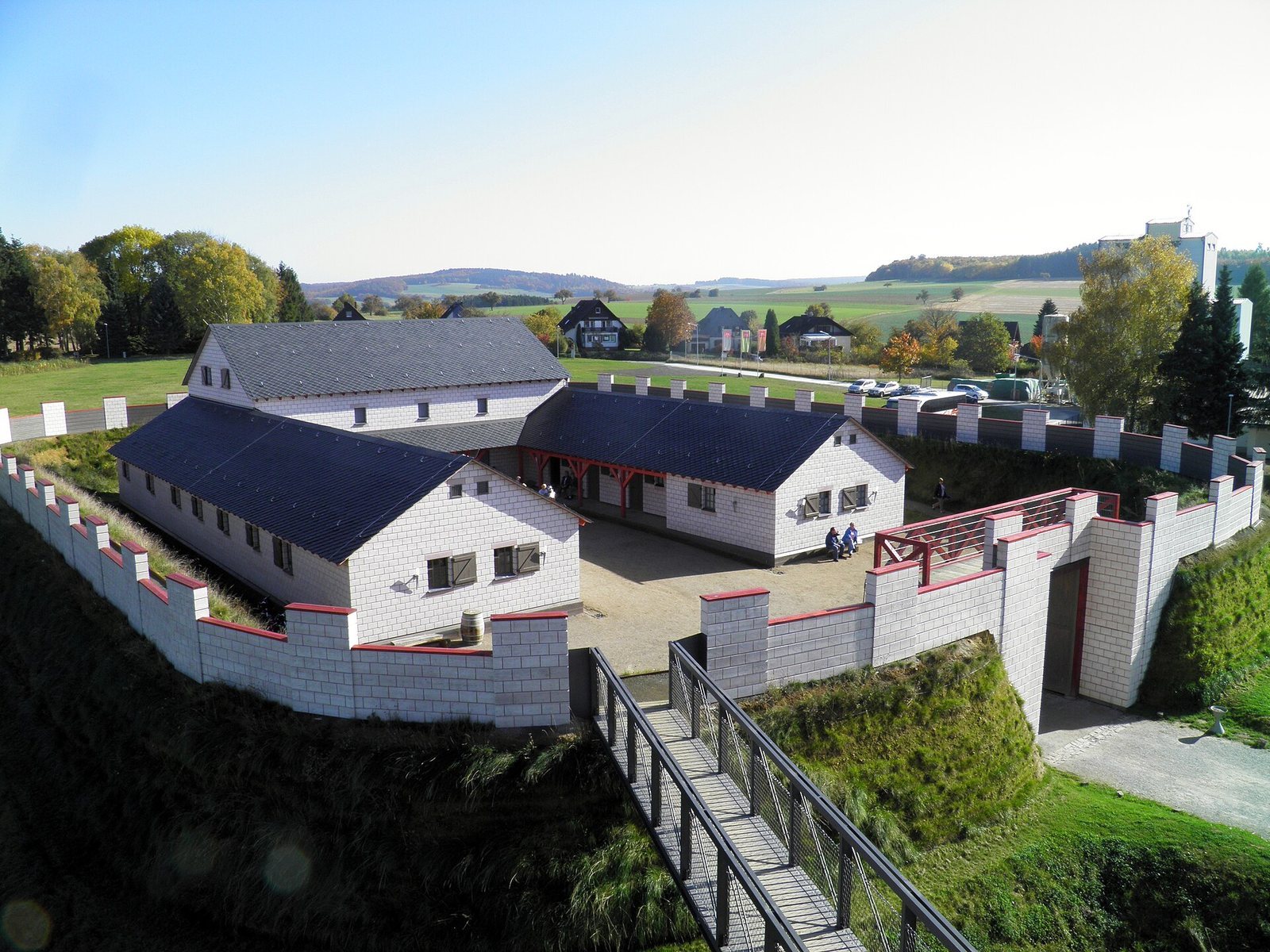
The Limeskastell Pohl Support Association was founded in June 2007 to promote projects and activities concerning the UNESCO World Heritage Limes in the surrounding area. It initiated a speculative reconstruction based on the archaeological plans, at a location slightly displaced from the original fort. Construction took place from September 2009 through May 2011. The fort and associated Limes earthworks form part of the Upper Germanic-Raetian Limes, a UNESCO World Heritage property since 2005, and are protected as cultural monuments under Rhineland-Palatinate law.
Remains
The site includes the buried footprint of a compact timber-and-earth fort and a stretch of the frontier line with several stone and timber watchtower locations. The frontier curves around the former fort and present village before continuing southeast.
Fort enclosure and reconstruction
Original fort
The original fort stood about 337 metres above sea level near the point where School Street leaves Pohl toward Lollschied. Its footprint is partly built over, and the remains survive below ground. The rectangular enclosure measured about 43 by 34 metres. A turf-reinforced earthen rampart carried a palisade, with a narrow walkway along the rampart crest behind it. A single V-shaped defensive ditch, up to 2.35 metres deep, completed the defenses.
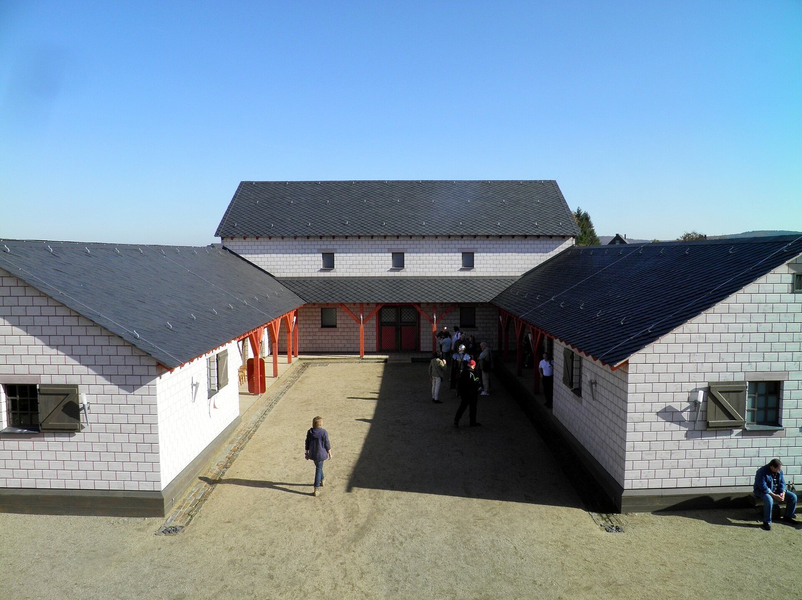
The internal buildings were probably timber structures in a U-shaped arrangement. A main building facing the front gate may have served as headquarters or as the commandant’s quarters, with a barracks on either side. Stone fragments from the fort’s northern corner are now interpreted as remains of a later watchtower associated with a separate tower site.
Reconstructed fort
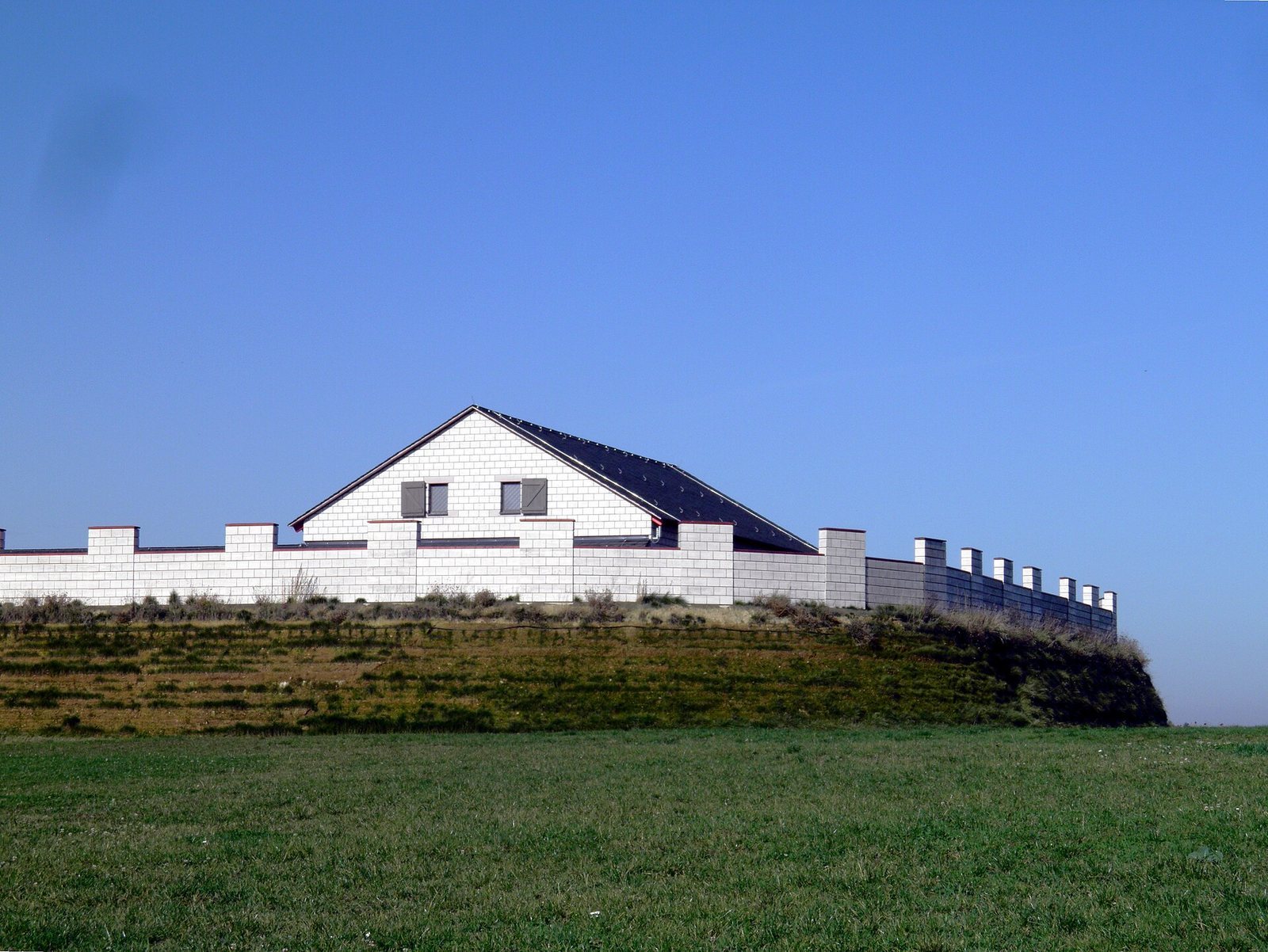
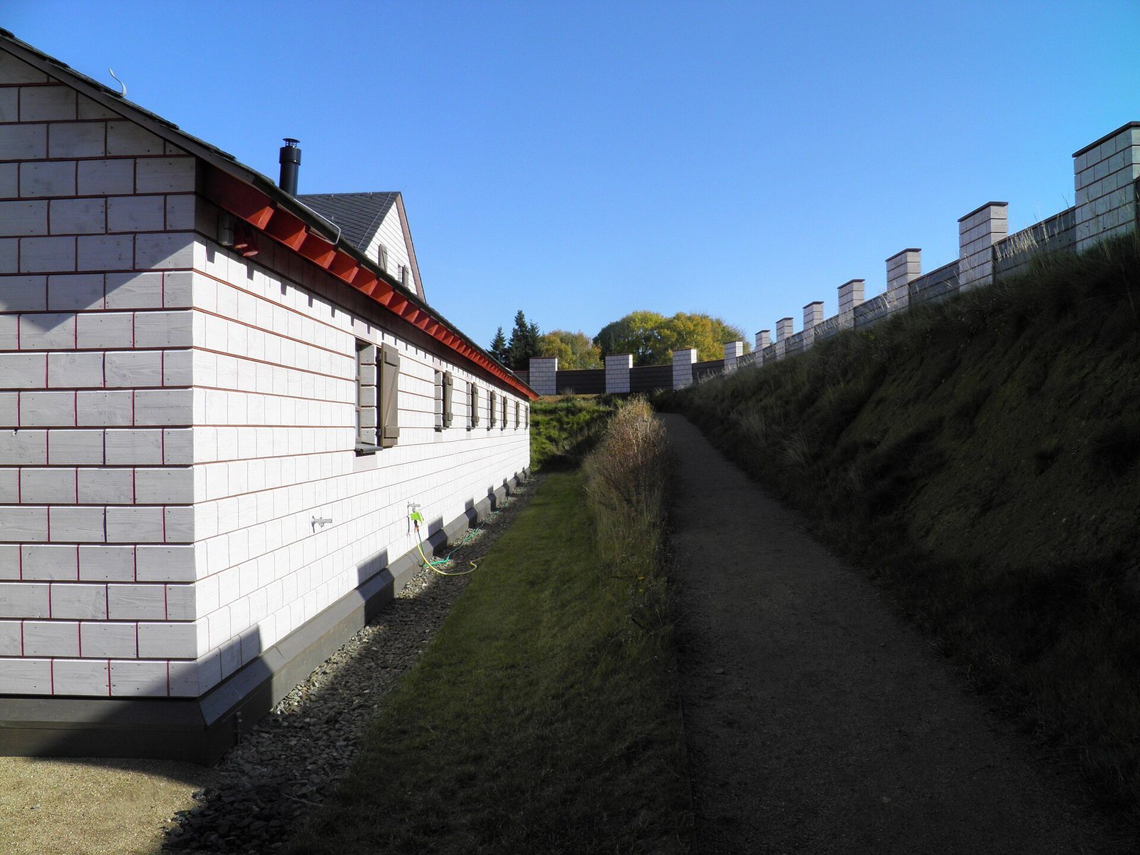
The reconstruction stands slightly away from the historical fort. It includes a rampart and walkway, a speculative gate, a reconstructed barracks, and a watchtower reached by a bridge. These recreated features provide a physical interpretation of the archaeological plans rather than marking the original fort’s exact position.
Frontier route and watchtowers
Between Pohl and the small fort at Pfarrhofen, the Limes bends around the former fort and village, then proceeds southeast. The route rises by nearly 40 metres. Sections in woodland are well preserved, while its course cannot be followed across cultivated fields.
Square stone tower with a shallow ditch
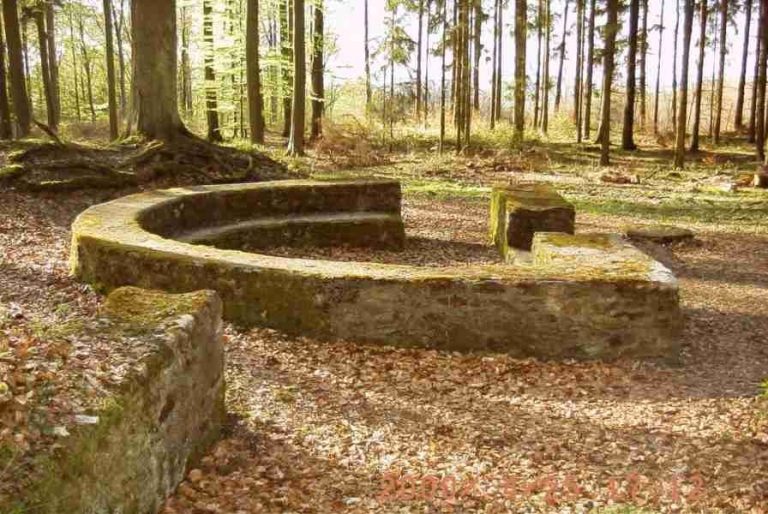
At one tower site, a square stone structure measured about 5.50 metres on each side, with walls 80 centimetres thick. A shallow, nearly square ditch lay about two metres away. Parts of the ditch contained burnt debris, clay-based wall material, and slate. A pit at the tower’s western corner measured 75 centimetres wide, 1.40 metres long, and 2.40 metres deep. It was filled with rubble from the tower, but its purpose is unknown. The Limes rampart and main ditch stopped immediately in front of the tower. Its foundations have been conserved.
Two timber towers on a circular platform
Another site had two timber towers on a circular platform about 8.80 metres across. Postholes indicate that the inner tower was square, measuring 2.30 metres on each side; the outer tower measured about five metres on each side. Ring ditches encircled both structures. Measured from base to base, the inner ditch was about 11.40 metres across and the outer about 19.50 metres. Each ditch had a gap on its northeastern side.
The inner ditch contained burnt debris, pottery fragments, and charcoal, and its floor had reddened and hardened under intense heat. The Limes palisade passed about 15 metres from the tower site and crossed the southwestern slope of a prehistoric burial mound.
Fire-damaged square stone tower
A further square stone tower, about 5.50 metres on each side, was destroyed by fire. The Limes ditch had an interruption at least 13 metres long directly in front of it.
Stone tower and adjacent timber towers
At another location, a rectangular stone tower measured 5.65 by 6.28 metres, with walls 75 centimetres thick. A shallow ditch with rounded corners surrounded it at a distance of 2.65 to 3.20 metres. The ditch was about 60 centimetres wide. In front of the tower, the Limes rampart and main ditch were interrupted, while the palisade ditch continued.
Immediately south of the stone tower was a two-phase timber-tower site on a circular platform about 8.50 metres in diameter. Postholes show that the inner tower measured 2.35 by 2.50 metres and the outer tower about 4.90 metres on each side. Ring ditches surrounded both. The inner ditch was 11.50 to 12 metres in diameter, about three metres wide, and 1.55 to 1.90 metres deep. The outer ditch was wider and shallower, measuring about 19.50 metres across from base to base. Both ditches had gaps on their eastern sides.
Stone tower beside crossing tracks
A further square stone tower measured 5.33 metres on each side, with walls 80 centimetres thick. The base of the Limes ditch lay about 23 metres from the tower, where the ditch was interrupted to let two stone-paved sunken tracks cross the frontier. These tracks were routes worn or cut below the surrounding ground level.