City Walls of Nuremberg: Medieval and Early Modern Fortifications
Site at a Glance
- Country
- Germany
- Primary era
- Medieval
- Eras represented
- Medieval, Early Modern, Modern
- Civilizations
- German, Holy Roman Empire, Kingdom of Bavaria, Swedish
- Site type
- Military
- Remains
- Wall
On this page22 sections
History
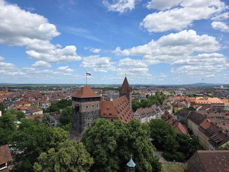
The City Walls of Nuremberg are a medieval and early modern fortification system in Nuremberg, Germany. The earliest defenses are believed to date to the 11th century, while the larger circuit took shape around 1400. Nuremberg itself is first mentioned in 1050 in connection with an imperial castle.
Early defenses and the joined settlements
In the 13th century, Nuremberg was part of a Hohenzollern burgraviate, a territory governed by a burgrave, a medieval official responsible for a castle and its surrounding district. The settlements on either side of the Pegnitz, Sebald to the north and Lorenz to the south, each had their own fortifications. Plans to connect them had been drawn up by the end of the century. One interpretation links those plans to the Rintfleisch massacres, anti-Jewish pogroms in medieval Franconia, since Jewish residents legally occupied land intended to be joined. The relationship between the fortification plans and the violence is an interpretation, not a demonstrated cause.
The two settlements were connected by defenses built between 1320 and 1325. Over the following decades Nuremberg became an important center of the Holy Roman Empire, the changing political entity that included much of central Europe. The Golden Bull of 1356, a constitutional decree that set out procedures for imperial elections, designated Nuremberg as the regular site of the first imperial diet after each newly elected German king’s coronation. An imperial diet was an assembly of the Empire’s estates.
Expansion and artillery
As the population increased, the city built a wider defensive circuit, completed around 1400. It enclosed the old town and brought the castle complex within its northern side. Work on a dry moat began around 1430 in response to the Hussite Wars, conflicts arising from religious and political disputes associated with the Bohemian reform movement. The moat was completed in 1452. Around 800 workers were employed at times during the expansion in 1430, and the supporting moat wall took 26 years to build.
From before 1500, the defenses were altered to meet the threat of artillery. Older towers were modified or taken down, while new towers and projecting gun positions were added. Some defensive spaces between the main wall and outer works, known as Zwinger, were adapted for guns. Work extended from the places where the Pegnitz entered and left the city to the wall north of Frauentor.
Two circular bastions, projecting defensive platforms, were built in 1527: Küblerzwinger in the northeast and Tucherzwinger in the southwest. Nuremberg adopted Protestantism in 1525, increasing concern about possible conflict with Catholic forces. The city made peace with the Schmalkaldic League, an alliance of Protestant rulers and cities in the Holy Roman Empire, in 1532. Three bastions at the castle, Vestnertor, Great, and Lower, followed between 1538 and 1545.
In 1552 Albrecht Alcibiades, Margrave of Brandenburg-Kulmbach and Prince of Bayreuth, attacked Nuremberg without declaring war. The assault exposed weaknesses in the defenses. Between 1556 and 1564, city architect Georg Unger oversaw the reinforcement of the four principal gate towers, giving them their present circular forms. Nuremberg’s arsenal was built in 1588–89 by Hans Dietmair.
War, fortress status, and dismantling
Further work took place from 1611 to 1614, when the defensive wall south of Laufer Tor was renewed and the Wöhrdertor bastion constructed. It was later demolished in 1871. During the Thirty Years’ War, a major European conflict fought from 1618 to 1648, Sweden’s King Gustavus Adolphus ordered new defenses beyond the city in the summer of 1632, before the Battle of Alte Veste. His army was numerically inferior, and the works were intended to protect Nuremberg and its suburbs.
Swedish and Franconian military engineers supervised the construction, including Swedish engineer Frans de Traytorrens, general quartermaster Olao Johanne Gotho, and Nuremberg master of ordnance Johann Carl. The outer defenses included trenches, ramparts made from stone, earth, and sand, and complex star-shaped works. Up to 840 people worked on them at a time. Nuremberg citizens had to provide digging labor, while specialists from the Netherlands and the Bohemian Ore Mountains were paid for their work. Labor, materials, and upkeep placed a heavy burden on the city’s finances. The works were used in later conflicts, including the War of the Austrian Succession and the Seven Years’ War.
After the major changes of the 16th and 17th centuries, the city wall was rarely altered to accommodate later military technology. Defenses increasingly depended on earthworks outside the city. Economic stagnation, which continued until the Industrial Revolution, also helped preserve Nuremberg’s older buildings.
Bavaria took control of Nuremberg in 1806, but the city retained its status as a fortress. Five principal gates were guarded, and three other gates were shut at night. As suburban traffic grew, seven additional gates were built in neo-Gothic style: Max-, Färber-, and Kasemattentor in 1848; Königstor in 1850; Marientor in 1859; Westtor in 1863; and Ludwigstor in 1866.
The Bavarian authorities rejected the city’s 1863 request to remove its fortifications, considering them a stabilizing presence amid fears of unrest. Approval for de-fortification came on 12 July 1866, partly in anticipation of Prussian occupation, although the king initially reserved the final decision on structural changes. Demolition began in 1869. Growing traffic led to the removal of the seven recently built gates between 1877 and 1891. Breaches were made at Sterntor in 1869, Wöhrder Tor in 1871, Hallertor in 1881, and Fürther Tor in 1894, where the opening took the form of a bridge.
War damage and conservation
Allied air raids damaged the fortifications during the Second World War. A daytime raid on 3 October 1944 severely damaged Fronveste, which was partly repaired after the war. In April 1945 the U.S. Seventh Army took Nuremberg by military force, the only such capture in the city’s long history. The medieval defenses had helped prevent its earlier capture in this way.
Parts of Frauentorgraben in the south were filled during the 1960s and uncovered again in 1987 during construction of the U2 underground line. A 1967–68 proposal to redevelop the Königstor–Marientormauer area with commercial, administrative, and civic buildings was not carried out. Conservation work has continued in recent decades. The Kettensteg received substantial supports in 1930 and was renovated in 2010. Work has also taken place at Maxtormauer, Spittlertorgraben, and Neutorgraben. Mohrenturm was adapted for the Museum Turm der Sinne between 1997 and 2003, and Jakobsturm was converted for itinerant journeymen in 2005. Work to rebuild Blaues G, reduced to a masonry stump during the war, began in 2021.
Remains
The surviving fortifications extend around almost all of Nuremberg’s old town. Their overall form combines stretches of wall with substantial corner towers, rather than a single continuous walkable battlement. About four of the original five kilometers remain. The system’s principal elements include the older settlement walls, river crossings, the later circuit and dry moat, and defensive works built for artillery.
Early walls and river crossings
Sebald settlement
The northern fortification ran from the castle toward Maxtor, then past Sieben Zeilen, Webersplatz, the Landauer Twelve Brothers House, the inner Laufer Gate, and Laufer Schlagturm. Its line continued toward Sand and followed the Pegnitz past Neue Gasse, Hans-Sachs-Gasse, Plobenhofstraße, and An den Fleischbänken. From Wasserturm it passed western Maxplatz and the inner Neutor before returning to the castle by Tiergärtnertor. Surviving portions include the castle and Tiergärtnertor area, Laufer Schlagturm in the east, and Wasserturm in the west.
Lorenz settlement
The southern wall is thought to have followed Unterer Bergauerplatz, the former Katharinentürlein, Peter-Vischer-Straße, the site of today’s city savings bank, the inner Frauentor, now Mauthalle, Kornmarkt, Frauengasse, Spittlertor, Weißer Turm, Karl-Grillenberger-Straße, and Unschlitthaus. Weißer Turm and its gate structure remain west of the old Lorenz town center. Old moat sections survive at Grübelstraße, known as Herrenschießgraben, Peter-Vischer-Straße, known as Katharinen- and Tiergraben, and Mühlgasse, known as Klettengraben.
Walls across the Pegnitz
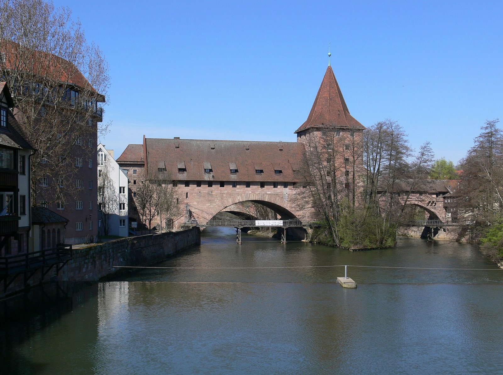
The defenses completed between 1320 and 1325 connected the two settlements at two points across the river. In the west, a wall ran from Unschlitthaus to Weinstadel, crossed the Pegnitz, and joined the older Sebald defenses. Henkerturm, Wasserturm, and the connecting wall-walk survive in this area. In the east, the wall crossed Neue Gasse and Vordere Insel Schütt toward Unterer Bergauerplatz, near today’s Heubrücke. A wall-walk crossed the river’s southern arm. Schuldturm and the smaller Fraueneisen, also called Weiberschuldturm, survive on the eastern side.
The later circuit
Wall, defensive space, and moat
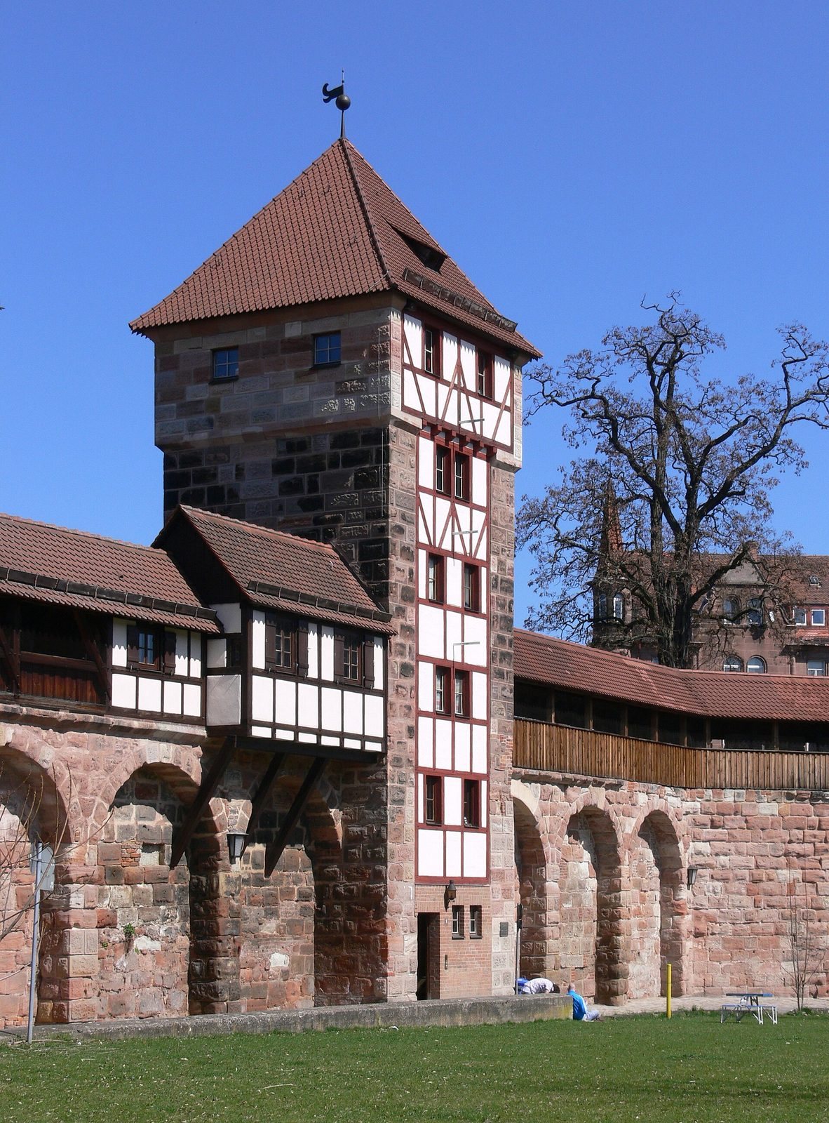
The later circuit formed a skewed parallelogram about five kilometers long, with a substantial gate tower at each corner. Its defenses comprised the principal wall, a ground-level Zwinger about 15 meters wide, a second wall rising from the moat, and the dry moat itself. About 130 wall and moat towers can be identified, and the castle was fully incorporated at the circuit’s northern end.
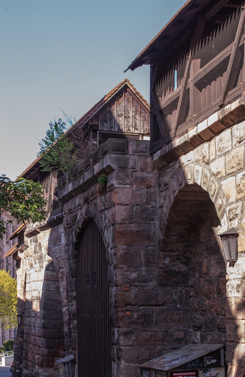
The principal wall was built as two stone layers with limestone filling between them and measured about one meter thick. Its wall-walk faced inward toward the town and was wide enough for two soldiers to walk side by side. Stairs connected positions along the defenses, and a clay-tile roof helped reduce the danger of fire from incendiary attacks. Across the full defensive system, the width was about 30 to 35 meters.
The moat, excavated from around 1430, averaged about 12 meters deep and reached up to 20 meters across. Sandstone for the works came from nearby quarries. The moat is partly preserved; broad surviving stretches and the bastions west and north of the castle have been arranged as parks and gardens.
Gates and river defenses
Seven entrances served the town. Five were principal gates: the older Tiergärtnertor and the later Laufer Tor, Frauentor, Spittlertor, and Neutor. Hallertürlein, on the north bank of the Pegnitz in the west, and Wöhrder Türlein in the east were pedestrian passages. Vestnertor provided a separate entrance to the castle.
Fronveste, built between 1489 and 1494, spans the Pegnitz where the river leaves the city. At the eastern point where the river enters, Tratzenzwinger and its three towers formed part of the defenses. The Kettensteg, a footbridge, was built in front of Fronveste in 1824. A timber bridge also carried the Fischbach over Frauentorgraben and into the city. Near Sterntor, the Blausternwerk used the stream’s water power for Nuremberg’s water supply. A marker at the foundation of a moat tower lost during the Second World War identifies the former point where the Fischbach entered the old town.
Towers and artillery positions
From 1540, towers carried a system of colors and letters. The black sequence began with Luginsland, Black A, by the castle and ended with Black Z on Insel Schütt. Blue began there and continued to Blue X at the Frauentor wall; Red A followed, ending at Red Z on the Spittlertor wall. The green series ran from Green A to Green O, returning to the castle. These markings remain visible on the towers.
The circular bastions built in 1527 were Küblerzwinger, also known as Dürerbastei, in the northeast and Tucherzwinger in the southwest. The castle’s Vestnertor, Great, and Lower bastions stood to its north and west. Between 1556 and 1564 the four principal gate towers, Laufertorturm, Frauentorturm, Spittlertorturm, and Neutorturm, were encased in rounded masonry. Their reinforced forms reach up to 17 meters in diameter, presenting a smaller target for cannon shot. A gun platform beneath each roof could hold 16 cannons, positioned to fire over the surrounding countryside from a height equivalent to eight stories. Unger may have taken inspiration from the round towers at Milan’s Castello Sforzesco, built by Bartolomeo Gadio around 1450.
Outer defenses and associated buildings
The 1632 works
The defenses added beyond the city in 1632 included Bärenschanze at Gostenhof and Schwedenschanzen at Wöhrd. Trenches ran from Lichtenhof toward Gostenhof and the Pegnitz at St. Johannis, then behind the castle by Vestnertor bastion toward Maxfeld and Wöhrd. They connected with works extending from St. Peter and Lichtenhof. Three substantial bastions stood between Spittlertor and Frauentor, with two more farther toward Frauentor.
Other works guarded the roads near Steinbühl, St. Wolfgang, and Gleishammer. A trench from Wöhrd toward Rechenberg had four bastions. A ravelin, an outwork set in front of a fortification, and a hornwork, a defensive work with projecting arms, lay between Frauentor and Spittlertor. Bastions also protected the Pegnitz’s entrance and exit points. More than 300 guns were distributed among the redoubts, ramparts, walls, round towers, and bastions.
Arsenal
Nuremberg’s arsenal stood at Pfannenschmiedsgasse 24 near Kornmarkt as an extension of the defensive installations. After its destruction, the building was reconstructed in 1954–55.
Surviving sections and adapted towers
Western wall and Fronveste
A two-story sandstone-ashlar building with a hipped roof and attached buildings stands beside the western wall near Fronveste. Towers Green C, Green D, and Green E are incorporated into this group. Wall sections around the circuit have been heavily restored or rebuilt, and conservation has continued at several points.
Insel Schütt and eastern wall
On Insel Schütt, the eastern wall includes Tratzenzwinger, behind which stand Blue A and Black Z. Blue A has been used by the district youth council since 1980, while Black Z has housed the Krakow House since 1996. Another tower in the wall houses the Neutor youth center.
Mohrenturm, Jakobsturm, and Blaues G
Mohrenturm, marked Green B, stands beside Westtor and houses the Museum Turm der Sinne. Jakobsturm, marked Red L, dates to around 1480 and stands at Jakobstor. Its accommodation for itinerant journeymen includes five sleeping places, a kitchenette, and a bathroom. At Marientorzwinger, Blaues G retains its masonry stump from the Second World War; work to rebuild the tower began in 2021.
Other surviving areas
Seventy-one wall towers remain from the 88 present at the end of the Second World War. Named wall sections include Vestnertormauer and Maxtormauer in the north; Laufertormauer, Marientormauer, and Königstormauer in the east; and Spittlertormauer, Westtormauer, and Neutormauer in the west. Marientormauer and Westtormauer lie beside the Pegnitz, Königstormauer is near the main railway station, and Neutormauer stands west of the castle. A sculpture garden was laid out in 2004 in the Zwinger at Frauentorgraben, between Sterntor and Frauentor, as part of a museum. Underground tunnels beneath the walls formed part of the defenses and enabled the movement of personnel and supplies, as well as surprise attacks.