Fort Regent: A Napoleonic-Era Coastal Fortress in Jersey
Site at a Glance
- Country
- Jersey
- Primary era
- Modern
- Eras represented
- Modern
- Civilizations
- British, German
- Site type
- Military
- Remains
- Fort
On this page18 sections
History
Before the fort
During the Middle Ages, Mont de la Ville and nearby Petit Mont de la Ville were common land. The Chapel of Notre Dame des Pas stood at the hill’s foot until the Board of Ordnance ordered its demolition in 1814. In 1550, Edward VI called for Saint Helier to move onto the hill, which was considered easier to defend, but the town stayed where it was. In 1591, local officials in the Vingtaine de la Ville, a Jersey administrative district, agreed to seek residents’ consent to acquire the common land for fortifications. They cited Elizabeth I’s promise to strengthen the hill’s defences, but no sixteenth-century construction followed.
The hill saw military action before Fort Regent existed. In October 1651, during the Third English Civil War, the final phase of the English civil conflicts, Parliamentarian Colonel James Heane’s forces fired explosive shells from mortars on high ground between Town Hill and South Hill. The bombardment contributed to the surrender of Royalist leader George Carteret at Elizabeth Castle in December. During the 1781 Battle of Jersey, the 78th Regiment of Foot used Town Hill to prevent the invading French army from retreating.
Evidence for earlier fortifications remains uncertain. Lines in a 1757 illustration by J. Heath may represent earthworks rather than stone walls, an interpretation supported by a map derived from a 1787 survey. A 1799 map placed the principal citadel on South Hill, not Town Hill. From the late eighteenth century, Town Hill also operated as a commercial signal station. In 1785, workers levelling it for a parade ground uncovered a dolmen, a prehistoric monument made from large stones. Field Marshal Henry Seymour Conway had the structure moved in 1788 to his home, Park Place, near Henley-on-Thames.
Construction and military service
Jersey’s Lieutenant Governor, George Don, laid Fort Regent’s foundation stone on 7 November 1806. Local workers and the Royal Engineers built the fort, with an average workforce of about 800, and work was complete in 1814. The Napoleonic Wars, a series of conflicts between France and Britain and its allies from 1803 to 1815, shaped the project. Mont-Orgueil and Elizabeth Castle were thought inadequate to protect Jersey from a possible French invasion. The fort opened on 24 April 1814, after that danger had passed. It was named for the Prince Regent, George, Prince of Wales, who governed for his father, George III, before becoming George IV. Lieutenant-General John Humfrey is credited with the design; Lieutenant-Colonel John Evelegh may have helped develop the final plans.
The regular army used Fort Regent until 1932. The Royal Militia of the Island of Jersey was its last British garrison, leaving on 20 June 1940 to serve in the United Kingdom as part of the Hampshire Regiment. The militia was re-formed in 1987 as the Jersey Field Squadron, based at the Engineers’ Barracks at nearby La Collette.
Occupation and later use
German forces occupied the Channel Islands during the Second World War and added military installations at the fort. After the occupation, it stored potatoes, wine and coal; the nearby power station then burned coal. The States of Jersey bought Fort Regent in 1958 and decided in December 1967 to turn it into a leisure centre. The conversion took place during the 1970s, with the project team consulting construction records, including the commanding officer’s diary, held at the National Archives in Kew.
Remains
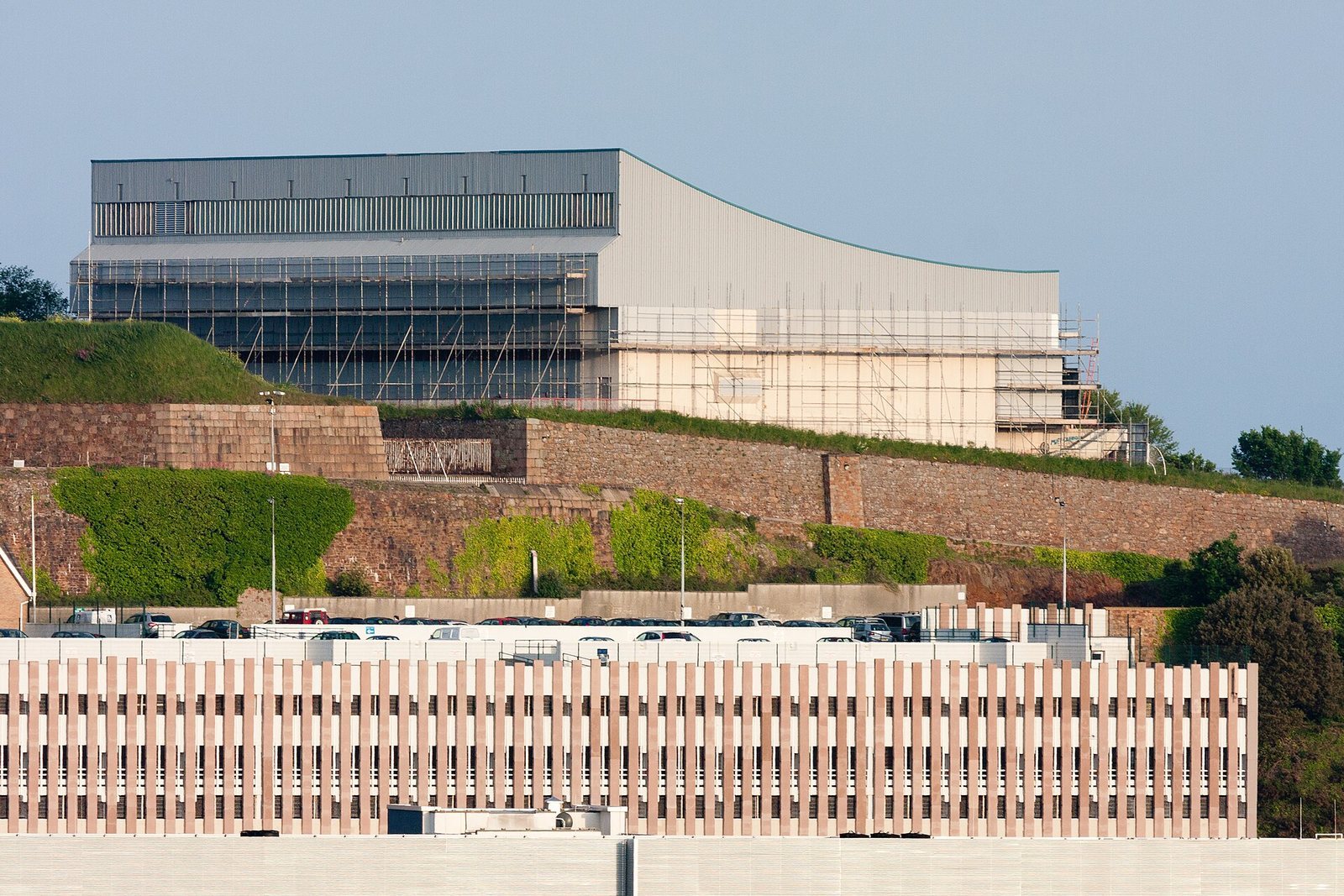
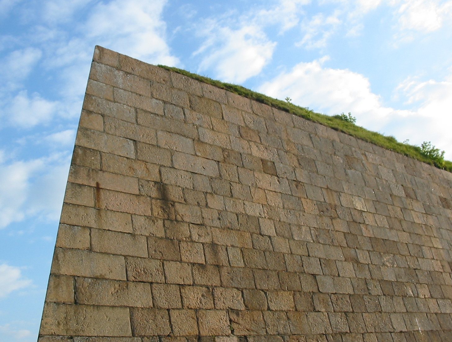
Fort Regent occupies the steep-sided Mont de la Ville above Saint Helier, overlooking the town, Saint Aubin’s Bay, Elizabeth Castle and the harbour to the west. Its defences combine walls, ditches and open ground, built in dressed stone, meaning stone cut into regular blocks, including granite and Carboniferous limestone. The parade ground was at the centre of the fort and is now built over.
Defensive walls and positions
Walls and bastions
A curtain wall, the defensive wall between fortified positions, runs along the western cliff top from the West Bastion to the Northwest Redan. It is 5.5 metres thick, and quarrying steepened the cliffs alongside it. A second curtain wall protects the eastern side from bombardment. The East Bastion and the southern redans lie behind this wall. One bastion faces west and the other east; a bastion is a projecting fortification that allows defenders to fire along a wall. From the eastern rampart, the southeast coast, including Icho Tower, a coastal defence tower built around 1811, is in view.
Redans and cannon positions
Four redans, outward-pointing defensive works, form part of the fort: two lie to the south and two at its northern end. They have several sides rather than the simpler two-sided shape, allowing their gun positions to cover approaches from different directions. Across the fort, positions and openings were made for 100 cannon. A report dated 8 March 1810 counted 55 cannon and six mortars in place.
Approach and ditches
Glacis Field
On the southern side, the Glacis Field is a flat, sloping grass area 210 metres long. A glacis is an open, sloping area outside a fortification. It forms the fort’s sole road and pedestrian approach; the other sides are steep or bordered by vertical cliffs.
East Ditch
The East Ditch has stone-faced inner and outer slopes, with an additional ditch cut into the rock beyond it. In 1873, the Jersey Eastern Railway enlarged the cutting for use as a station.
Well and pumping machinery
Well shaft and spring
Sunk between December 1806 and October 1808, the well shaft was blasted through hard Jersey granite using gunpowder. It is about 71 metres deep and averages roughly 2.4 metres across. Workers drilled the rock with iron tools struck by sledgehammers. They unexpectedly reached a spring 221 feet below the well curb, the rim around the opening, in the underground well-head chamber. Water rose quickly. The miners were suspended in a basket halfway up the shaft, and the engineer in charge described the difficulty of bringing them to the surface before the rising water could drown them.
Pumps and underground chambers
At first, a horse-powered lifting drum at parade-ground level brought water up the shaft. The slow, unpopular arrangement lasted only about a year after the fort opened. In 1815, Henry Maudeslay and Son supplied pumps driven by moving beams and arranged in sequence down the well. A long pump rod, a manually turned capstan, a rotating drum for hauling loads, and connecting gears powered them.
The equipment occupied two circular chambers excavated beneath the parade ground. One held the capstan and linked to an adjoining chamber containing the well-head machinery and shaft opening. The capstan was later adapted for donkey power, but taking the animals through the long, sloping tunnel from the East Bastion proved difficult. A small steam engine replaced them, followed later by a gas engine. The gas engine and original 1815 well-head machinery remain in place, preserving examples of late-Victorian technology and early nineteenth-century engineering.
During the 1970s conversion, concern about contamination of water for the leisure complex led to the removal and scrapping of the shaft’s ladders, cast-iron floor gratings, pump rods and valves. The contractor salvaged the machinery and handed it to the development committee, but the parts were scrapped two years after the contract ended. A small number of people protested the loss; the wider public learned about it later.
Heated rock face
While the shaft was being cleaned in 1979, a contractor found a flat granite face about 12 metres high, formed along a natural fracture roughly 30 metres below the surface. Water dripping onto the hot rock turned to steam, and contact could blister a hand. It may be Jersey’s only example of geothermal heat, heat generated underground.
Occupation remains and later structures
German installations
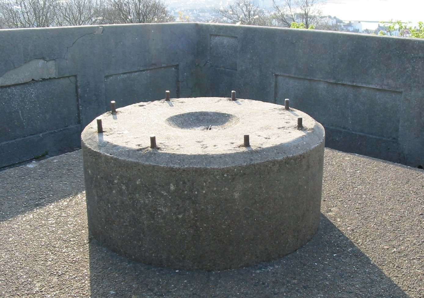
Some concrete works from the German occupation survive, including remains linked to anti-aircraft gun installations.
Leisure complex and Glacis Field pool
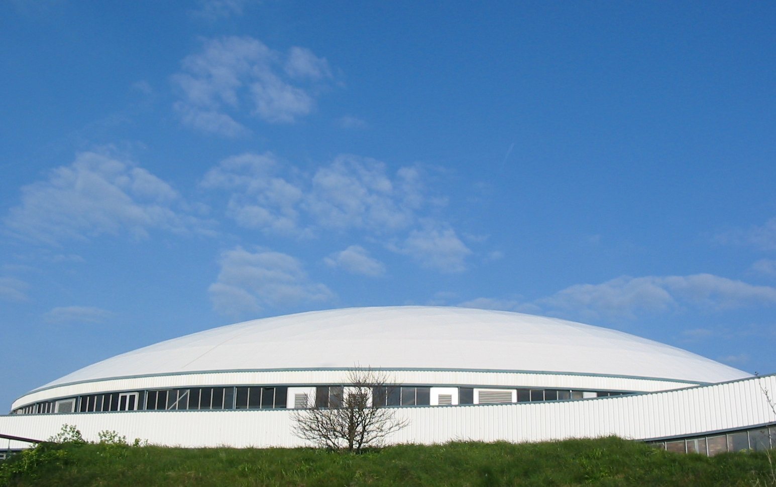
A large white glazed roof now spans the fort’s old walls and covers its sports and leisure centre. Promenades have also been laid out within the enclosure. A swimming pool built on the Glacis Field opened in 1971 and closed in 2009. Its roof was removed and the ground levelled by early 2021.