Khertvisi: A Medieval Fortress in Georgia
Site at a Glance
- Country
- Georgia
- Primary era
- Medieval
- Eras represented
- Medieval, Early Modern, Modern
- Civilizations
- Georgian, Ottoman
- Site type
- Military
- Remains
- Fort
On this page16 sections
History
Khertvisi is a fortress in Georgia that was rebuilt and enlarged in the tenth and eleventh centuries. It occupied a strategic position on routes linking Georgia with Turkey and Armenia and on the road between Akhalkalaki and Akhaltsikhe. From its position above the Paravani and Mtkvari river region, it also commanded nearby settlements.
Early traditions and medieval growth
The medieval Georgian chronicler Leonti Mroveli traced Khertvisi’s beginnings to the fourth century BC and described it as one of Georgia’s earliest cities. Local tradition says Alexander the Great destroyed an early fortification there. The fortress’s original foundation date remains unknown, and modern scholarship does not accept that Alexander campaigned in Georgia. Khertvisi first appears in historical records in the tenth or eleventh century.
After declining in the early medieval period, the fortress was rebuilt and extended in the tenth and eleventh centuries. It became a regional center of Meskheti, a historic region in southern Georgia, and developed into a town. Khertvisi was recognized as a town in the twelfth century and remained an active stronghold throughout the Georgian feudal period, when authority and landholding were organized partly through ties between monarchs and regional nobles.
Destruction and rebuilding
An earthquake in 1283 destroyed the old fortress walls. Mongol forces also devastated the town during the thirteenth century, destroying churches, monasteries, and homes. Khertvisi fell into ruin; its main tower appears to have been the only building left standing, and local feudal lords did not initially rebuild the fortress.
After Georgia was reunified under George V the Brilliant in 1334, fortresses across the country, including Khertvisi, were restored and enlarged. An inscription credits Zakaria Kamkamishvili, the king’s chief treasurer, with beginning work on a tower and enclosure, or their rebuilding, in 1354 and completing it in 1356.
Ottoman rule and changing control
In the later medieval period, Khertvisi came under the Jaqelis, a Georgian princely house that ruled Samtskhe-Saatabago, a medieval principality centered in Samtskhe. The fortress passed to Ottoman control during the empire’s sixteenth-century expansion into southern Georgia and later became the center of an Ottoman administrative district.
Georgian commander and political figure Giorgi Saakadze captured Khertvisi in 1624, but Ottoman control soon resumed. In 1771, Heraclius II, king of Kartli-Kakheti, and Georgian-Russian forces briefly retook the fortress. Ottoman rule followed again. Many valuables were taken away during the evacuation, suggesting that in the second half of the eighteenth century Khertvisi had again become a small town as well as a stronghold.
Russian rule and modern study
Russian and Georgian forces captured the fortress in 1828 during the Russo-Ottoman War of 1828–1829. Under the Treaty of Adrianople, it passed to the Russian Empire. Khertvisi then ceased to serve as a defensive stronghold and became a monument of fortification; Russian troops also used it as a military base in the late nineteenth century.
In 1832, Swiss geographer and traveler Frédéric Dubois de Montpéreux found a large inscription in Asomtavruli, an early Georgian script used for monumental writing, above the entrance. Marie Brosset first read the inscription, and Georgian historian and archaeologist Ekvtime Takaishvili published a corrected reading in 1909. Khertvisi and the Vardzia medieval cave-monastery complex were added to UNESCO’s Tentative List for World Heritage in 2007. Improvement work in 2017–2018 included restoration of the entrance gate.
Remains
Setting and layout
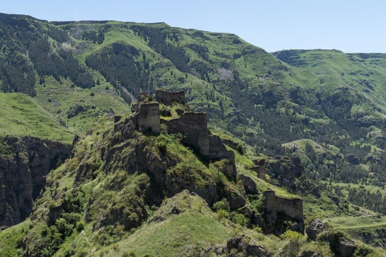
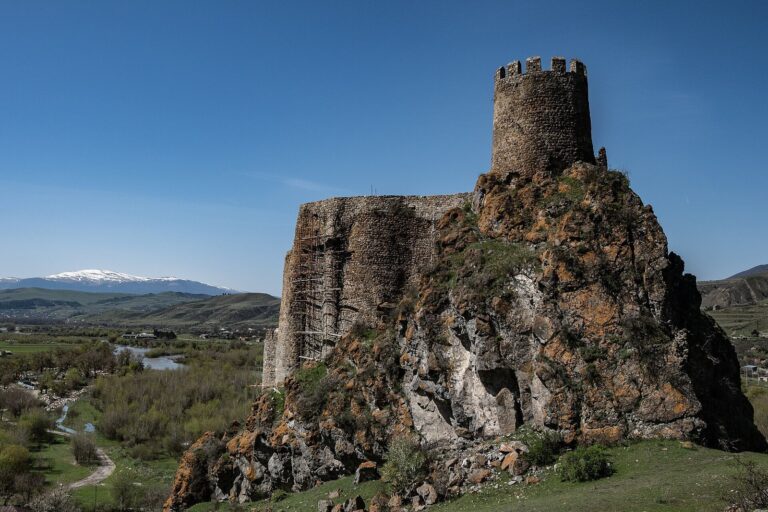
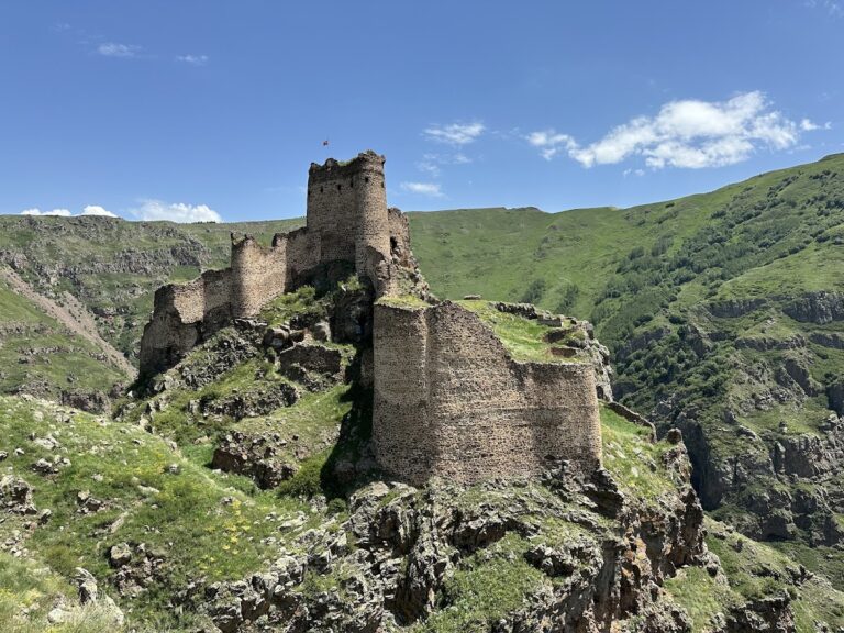
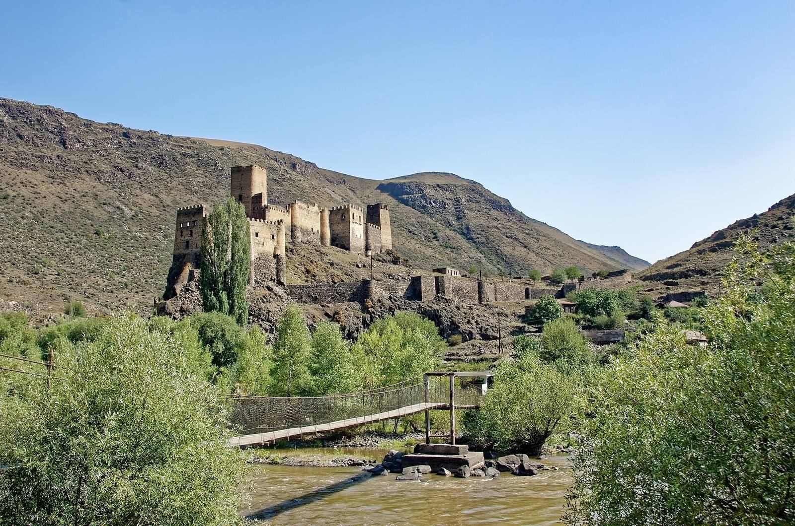
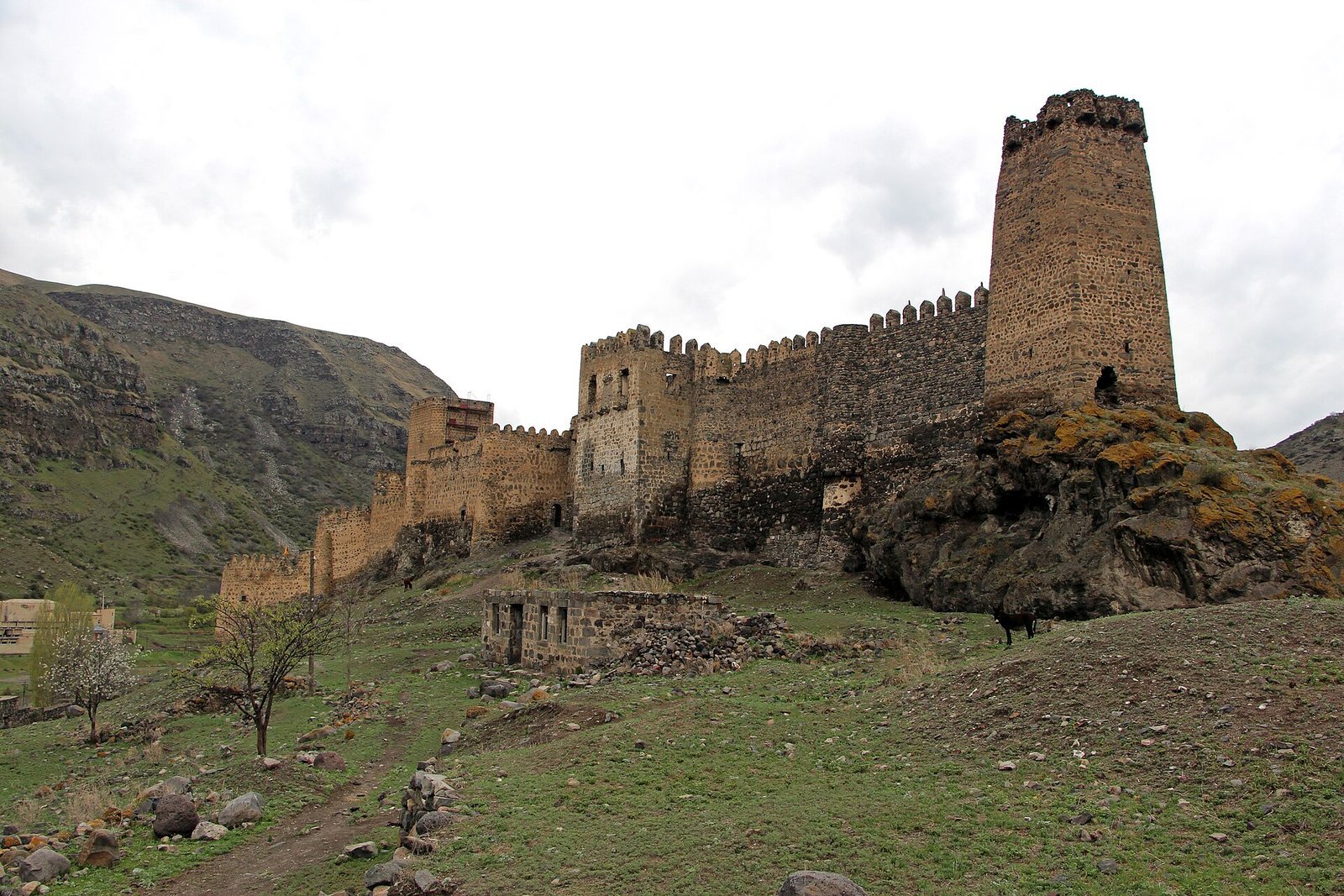
The fortress stands on a high, rocky promontory where the Paravani River meets the Mtkvari, also called the Kura. Its irregular plan follows the shape of the rock and its steep slopes, overlooking two valleys. The upper fortress, or citadel, follows the ridge, while a larger lower yard adjoins it to the south and east. A second defensive line extended south toward the Mtkvari valley, and part of it has been restored. The nearby village occupies steep canyon slopes, where artificial agricultural terraces and orchards form part of the surrounding landscape.
Walls and towers
Wall lines
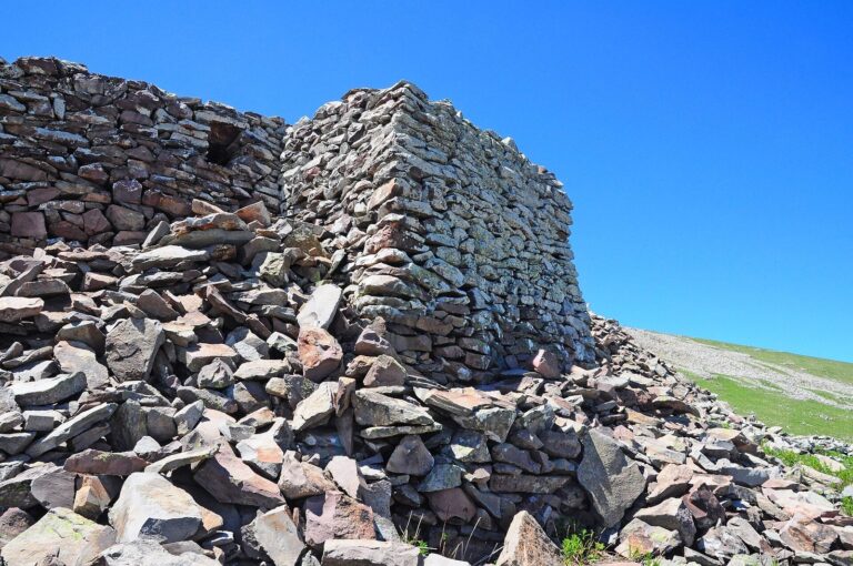
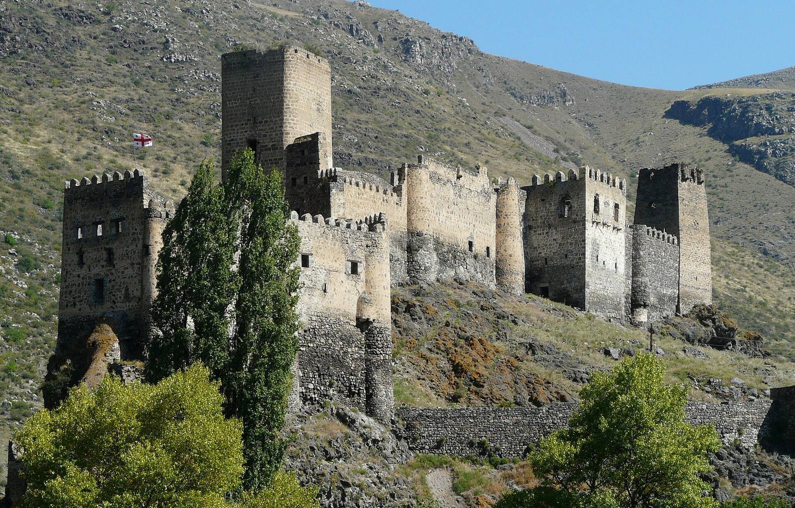
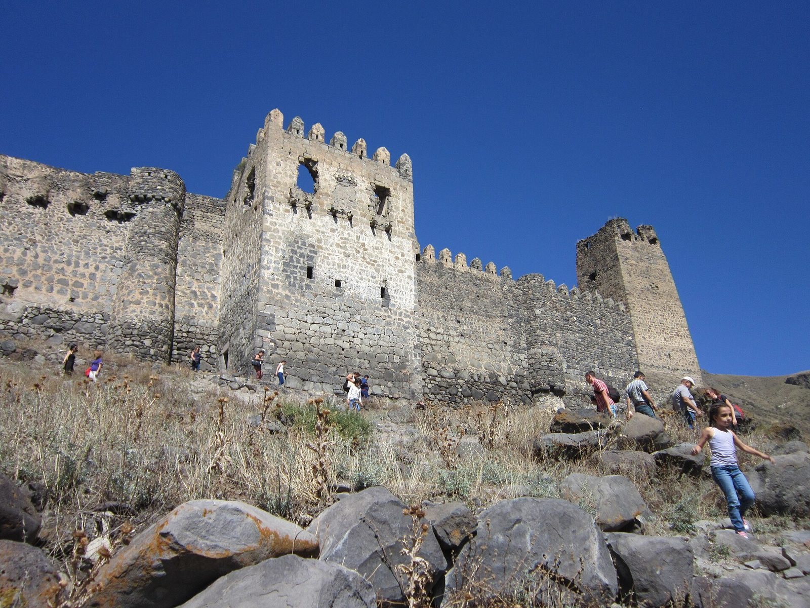
Rough, irregular stonework forms a complex with building layers spanning early periods through the nineteenth century. Most structures date from the tenth to fourteenth centuries; principal buildings are associated with the tenth to twelfth centuries, with later additions from the sixteenth to eighteenth centuries and sections of the north wall from the nineteenth. Following the mid-fourteenth-century expansion, the fortress measured more than 120 m in length. Its walls reach up to 18 m, while other sections are about 15, 10, or 7 m high.
Semicircular supports project from the walls. Those on the south and west taper slightly, while another was rebuilt with a sharper taper and one was substantially changed into a half-tower. The north wall was renewed without additional supports. Parts of the western wall retain loopholes, narrow openings for observation or firing, with triangular tops. The wall was lowered when these openings were made and later raised, with wider firearm openings added above them.
Gate and defensive towers
At the easternmost rise, a five-sided tower joins the eastern front wall across a pronounced setback, leaving the entrance gate outside the tower. Three sides at the summit are arranged for defense and have later machicolations, projecting structures with openings for dropping objects on attackers, and loopholes. A large inscription in Asomtavruli is set above the fortress entrance.
A tower on the western wall stands 13 m high and narrows from 3.6 m across at its base to 2.85 m higher up. It has two loopholes and a machicolation. A similar tower on the eastern side is 8 m high. Both date to the seventeenth or eighteenth century, during Ottoman rule. Between them, a semicircular half-tower was later converted into a dwelling with a second-floor balcony. Three towers show evidence of later feudal-era construction. The fortress’s southern side was extensively altered in the seventeenth and eighteenth centuries, making earlier and later masonry difficult to distinguish.
Citadel and water features
Divisions and passages
Strong interior walls divide the citadel into sections. These walls contain loopholes and narrow entrances, and the citadel includes towers of different shapes and sizes. Two passages cut into its northern side descend toward the river. The northwest passage supplied water and the passages also offered an exit during a siege. How water reached the citadel in its earliest phases remains uncertain.
Oldest tower and courts
The oldest part of the fortress includes a square tower with rounded outside corners. Its interior sides measure 5 m, while its exterior sides measure 8.3 m. A nearly rectangular upper court lies to its east and a lower court to its west. One doorway links the upper court to the tower’s first floor; a second, set above and offset from it, leads to the second floor, while a third opens to the west. A reservoir, partly cut into the rock, adjoins the tower on its northeast side.
Churches
Fortress church
The fortress church is associated with a construction date of 985 and was restored in 2000. It stands on a high platform cut into the rock, and small surviving fragments include parts of the apse, the curved end of a church sanctuary. The building had doorways to the south and west, with a cave-like space beneath it opening southward. An inscription associated with the church may have concerned its construction or another important event and appears to have referred to King Bagrat III of Georgia.
Church-chapel of Saint George
In the fortress’s western part, a small square contains a church-chapel dedicated to Saint George, a Christian martyr venerated as a saint. It occupies the site of an older church and measures 2.7 by 4.3 m externally. Dressed blocks of tuff, rock formed from compacted volcanic ash, make up the building. Its west doorway is the sole entrance, and its apse is a flattened semicircle. The lower apse and sanctuary floor are cut into the rock, with the floor raised by one step.
The chapel’s plain facades use finely dressed stone and finish in a stepped, shelf-like molding; the roof is tiled. On the east, the rock forms the lower part of the facade, where a fragment of the earlier church’s masonry remains.