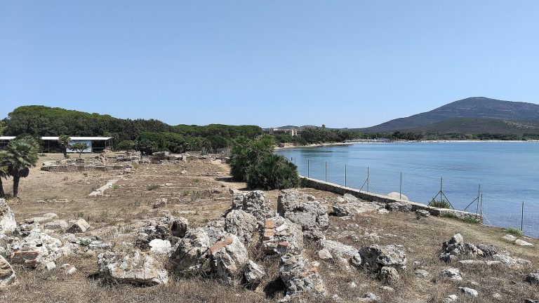
Monte Baranta: A Pre-Nuragic Complex in Sardinia
Site at a Glance
- Country
- Italy
- Primary era
- Bronze Age
- Eras represented
- Bronze Age
- Civilizations
- Unclassified
- Site type
- Military
- Remains
- Fortified Town
On this page21 sections
History
Monte Baranta is a prehistoric complex near Olmedo in Sardinia, Italy, chiefly associated with the Monte Claro culture of the third millennium BCE. Its large-stone defenses and substantial sacred area suggest that it may have served as a regional center for surrounding communities.
Monte Claro occupation
The settlement was probably occupied for a relatively short time before being abandoned. Its unfinished sacred area and the limited archaeological material support this interpretation. Nearby settlement nuclei at Tanca Baranca and Padru Salari may have been connected to Monte Baranta through defensive or ritual activity, although the nature of those links is uncertain.
The fortified position has been interpreted as a response to insecurity among Monte Claro communities and an effort to defend elevated ground and control territory. The strategic use of the terrain has also been seen as anticipating protonuraghi, early forms of the stone towers associated with Sardinia’s later Nuragic culture.
Later use and archaeological interpretation
The site saw later use during the Bonnanaro cultural phase, associated with the early Bronze Age. The fortified enclosure was reused in Nuragic and later historical periods, and finds indicate occasional activity during Roman times.
Local scholar Filippo Nissardi surveyed the Olmedo area in the early twentieth century. On maps produced by Italy’s Military Geographic Institute in 1958, Monte Baranta appeared as Nuraghe Su Casteddu. In 1962, archaeologist Ercole Contu described the enclosure and wall, initially assigning the complex to the Nuragic period because he interpreted the enclosure as a pseudo-tower.
Archaeologist Alberto Moravetti identified the settlement and sacred area. A fragment of Monte Claro pottery helped establish the site’s cultural attribution. Excavations beginning in 1979 and continuing into the early 1980s examined the enclosure, two huts, and part of the sacred area. Their structures and finds were attributed to the Monte Claro culture, an interpretation supported by excavations in the settlement area in 2012.
In 2025, Monte Baranta became part of the UNESCO World Heritage property Funerary Tradition in the Prehistory of Sardinia – The domus de janas. Domus de janas are prehistoric rock-cut tombs in Sardinia.
Remains
The complex occupies about 7,000 square metres on the edge of a plateau of trachyte, a volcanic rock, roughly 120 metres above sea level in northwestern Sardinia. The position overlooks valleys to the southeast and a broad plain extending southwest toward the Gulf of Alghero. The site includes a fortified enclosure, a large-stone boundary wall, a settlement, and a sacred area.
Fortified enclosure
Walls and construction
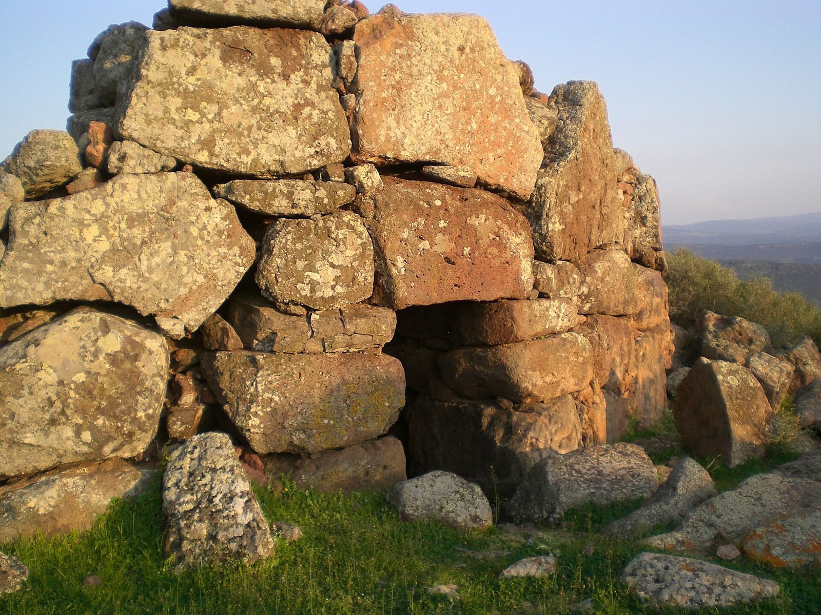
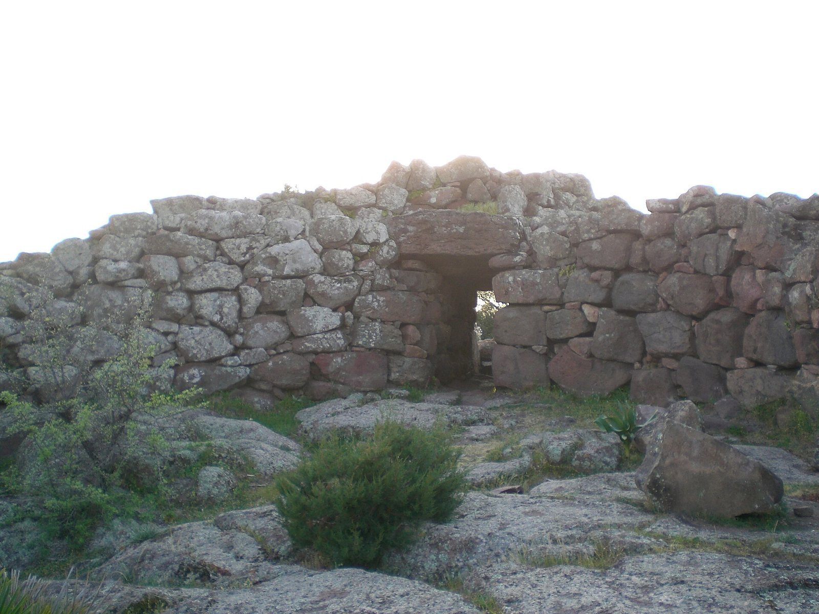
At the edge of an escarpment, the enclosure has a horseshoe or U-shaped plan, measuring about 20.65 by 15.30 metres and surrounding a space of approximately 380 to 390 square metres. Its walls are 4.15 to 6.50 metres thick and survive to an average height of about 3.45 metres. The outer face uses large, irregularly placed trachyte blocks secured by heavy blocking stones. Smaller, more carefully shaped blocks form relatively even horizontal rows on the inner face, with small stones packed between the two sides. Along the east, the precipice itself provides a natural defense.
Entrances and corridors
Northern and western entrances lead through roofed corridors into the enclosure. The western opening is about 2.10 metres high and 1.20 metres wide. Its horizontal stone lintel, which spans the opening, measures 1.08 by 0.72 metres and is covered by a larger stone about 1.07 metres thick. The corridor extends 5.80 metres and is roofed by four large slabs; a doorway beneath another lintel opens from it into the courtyard. The northern entrance is about 1.73 metres high and 1.20 metres wide. Its corridor is 4.80 metres long and covered by four slabs, one of which was reset during restoration in 1992.
During the pre-Nuragic occupation, the outer doorway of the northern corridor was blocked, forming a rectangular chamber accessible from the courtyard. A metal blade found in the courtyard may be bronze or copper. It is 13 centimetres long, has a rounded tip, and is pierced for a rivet.
Courtyard and wall-top access
The semi-elliptical courtyard follows uneven natural rock, which was partly levelled; stones were added where the slope was steepest. A simple stair in the southwest wall reaches a walkway along its top. The walkway runs for about six metres, is generally 1.50 metres wide, and broadens to 1.90 metres near the roof slab of the western corridor. At that point it ends at a barrier about 1.20 metres high and 3.90 metres thick. Because the walkway covers only part of the perimeter and the barrier is too thick for a clear view of the wall’s base, the stair and walkway probably supported wooden structures built on the wall.
Large-stone boundary wall
Course and construction
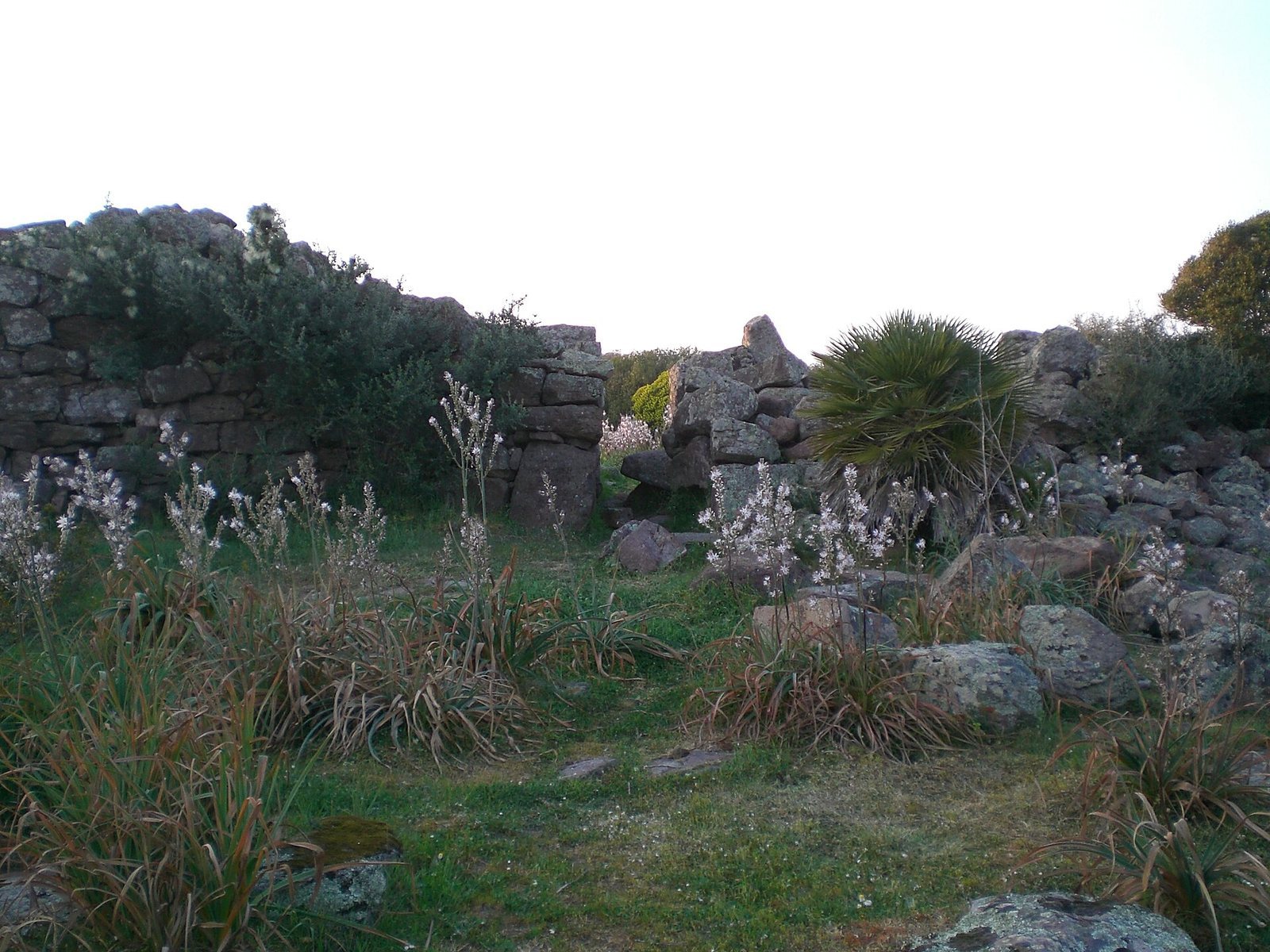
Northwest of the enclosure, at slightly higher ground, a large-stone wall closes the accessible part of the plateau. Steep slopes naturally protect the area on three sides. The wall runs about 97 metres, mainly from north to south, then turns inward at its southern end to follow the terrain. Large blocks form its outer face, while smaller stones set in rows make up the inner face; small stones fill the space between them. Some blocks appear to have been reused. The surviving height ranges from 1.48 to 3.00 metres. Its average thickness is about 3.75 metres, reaching roughly five metres at the thickest point.
Entrance and stair
A single entrance passes through one end of the wall and leads into a rectangular corridor 5.10 metres long, 0.90 metres wide, and 1.60 metres high. Its lintels and roof slabs have fallen to the ground. Just beyond the corridor, a stair is visible on the right-hand wall. The collapse of the wall’s upper portion leaves uncertain whether the stair reached a walkway or the top of the wall.
Settlement and huts
Six huts have been identified within the walled area, which covers 3,124 square metres; a seventh was found beneath the left side of the enclosure entrance. The structures are low, simple remains, with some perimeter walls surviving to 0.80 metres. Further hut traces are visible at ground level beyond the sacred area. Excavations recovered Monte Claro pottery, including large vessels, some supported by several feet, and pitchers, as well as a small number of stone tools. Grindstones are uncommon, a pattern interpreted as evidence of limited agricultural activity.
Hut 1
Near the centre of the plateau, Hut 1 has a roughly quadrangular plan measuring 5.82 by 6.40 metres. An opening lies on its eastern side, and traces of an internal partition remain. Its outer wall is up to 0.80 metres high and 1.14 metres thick. Flat floor slabs rest on a bed of small pebbles 0.20 to 0.30 metres deep. A recess extending 1.70 metres from the south side defines a roughly semicircular space of uncertain purpose. Near the north wall, four edge-set slabs form a sunken rectangular feature interpreted as a hearth; pottery fragments were found there.
Hut 2
At the northern end of the settlement, Hut 2 is roughly quadrangular and measures 3.62 by 2.68 metres. A single row of blocks survives to 0.62 metres high. Wide gaps between the blocks were intended to hold timbers supporting the roof. Small and medium-sized flat stones pave the floor.
Hut 3
About six metres from the boundary wall and ten metres northeast of Hut 1, Hut 3 is the largest excavated structure. Its rectangular plan measures 10 by 8 metres, with traces of a partition dividing it into two spaces. A hearth like the one in Hut 1 lay in the smaller space, markedly toward its eastern wall. The main space contained a small pit, 0.65 by 0.40 metres and 0.27 metres deep, which may have served as a hearth or posthole, and an elliptical cist, a small stone-built, box-like chamber, measuring 1.80 by 1.10 metres and 0.45 to 0.55 metres deep. A copper dagger fragment was found among the floor stones beside the cist’s perimeter slabs.
Hut 4
Hut 4 measures about 6.20 by 5.80 metres. Three walls survive; damage to the fourth leaves a plan that would have enclosed a trapezoidal space. A rectangular hearth pit near the southeastern and western walls measures 0.56 by 0.68 metres and is bounded by slabs to a depth of 0.50 metres. Its floor combines flat stones with levelled natural rock.
Hut 5
Adjoining Hut 6, Hut 5 has a trapezoidal plan measuring 6.50 by 5 metres and a pebble floor. A rectangular hearth in its southern part measures 0.60 by 0.40 metres and is 0.30 metres deep.
Hut 6
Hut 6 measures 9 by 5.40 metres. Its quadrangular plan has rounded corners and a rounded northeastern end, while an internal partition divides it into two areas. The northern area has a carefully laid floor of flat stones and a probable posthole near its centre.
Sacred area
Stone circle
A few metres outside the boundary wall, a roughly circular stone feature measures about 9 to 12 metres across. It contains at least 30 large slabs, within a total of about 80 slabs, along with many smaller stones. Many of the large stones are broken, and all now lie fallen. Some have the form of menhirs, large stones intended to stand upright. Excavations within the circle yielded few finds, all belonging to the Monte Claro culture.
Fallen stones
Two fallen trachyte stones identified as menhirs lie around the circle’s northern edge. One, broken into two pieces, measures 2.05 metres long. Another, about ten metres northwest, measures 3.95 metres. It has a polygonal cross-section, narrows and bevels toward its upper end, and carries a lengthwise ridge. Clearing around it revealed levelled bedrock and a rectangular setting hole that had only begun to be cut. The roughly shaped stone was unfinished and had never been raised.