Fortified City of Bergamo: Venetian Defenses of the Upper City
Site at a Glance
- Country
- Italy
- Primary era
- Early Modern
- Eras represented
- Classical, Medieval, Early Modern, Modern
- Civilizations
- Holy Roman Empire, Roman, Venetian
- Site type
- Military
- Remains
- Wall
On this page16 sections
History
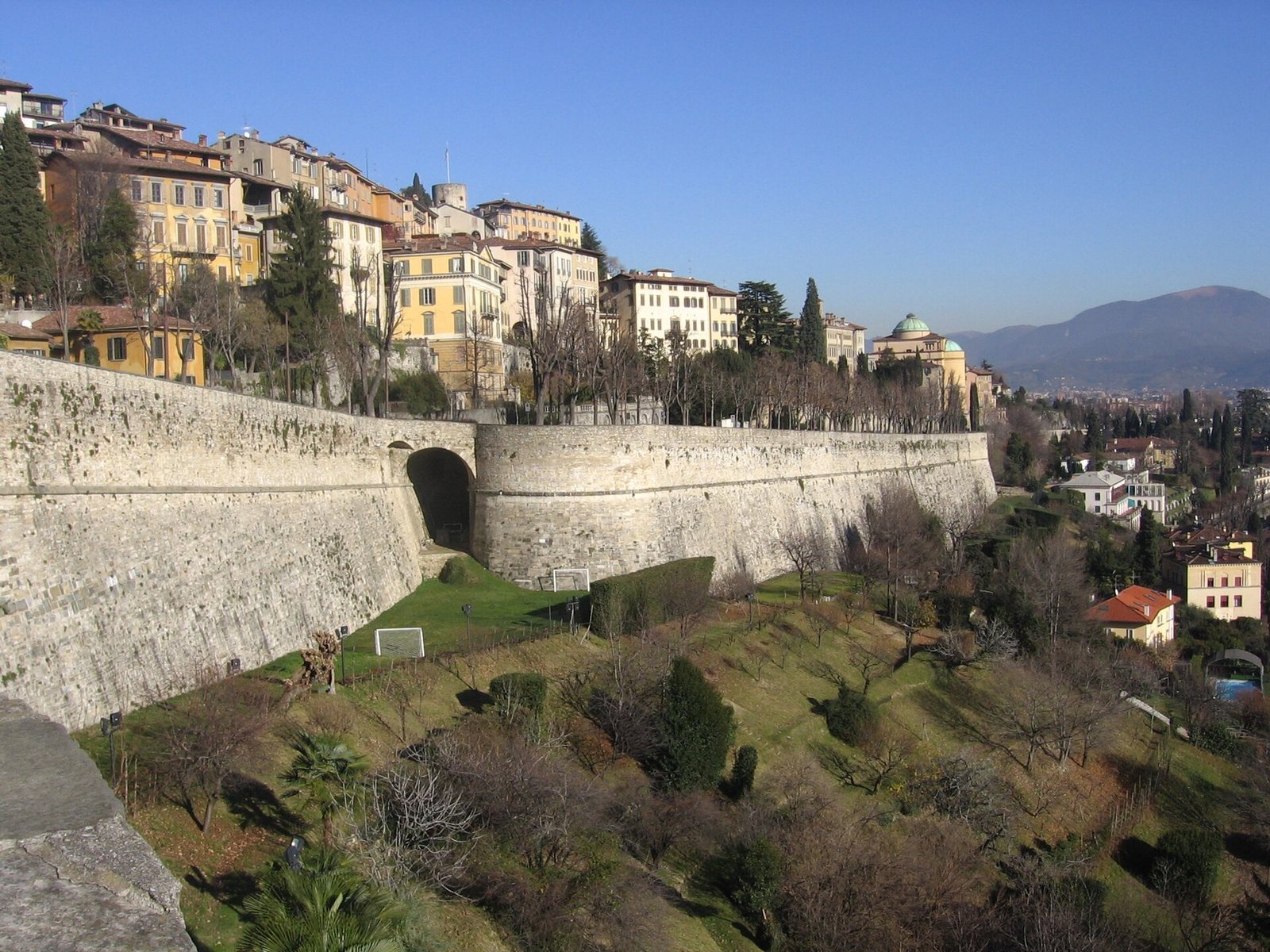
The Fortified City of Bergamo is the hilltop Upper City in Bergamo, Italy, enclosed by Venetian walls built in the sixteenth century and completed in 1588. Its elevated position mattered from antiquity because routes connected the eastern Po plain and Friuli with central Europe.
Ancient and Lombard Bergamo
Bergamo was a center of the Cenomani, a Celtic people of northern Italy who were allied with Rome. Under Roman rule, it became a military stronghold on a road linking Friuli with Raetia, a Roman province in the central Alps, and other parts of Europe. Roman-era fortifications formed an early stage in the city’s defenses.
From the sixth century, Bergamo was the center of an important Lombard duchy. The Lombards were a Germanic people who established kingdoms in Italy. Wallari, the first Lombard duke of Bergamo, ceded the duchy’s western territory, including Lemine, to King Autari after Autari became king in 584.
Frankish and medieval fortifications
Following the Frankish conquest under Charlemagne in 774, Bergamo became the center of a county. Its first Frankish count was Auteramo, whose death is placed around 816. During this period, a castle was built on San Vigilio hill, a position with military importance.
Medieval defenses dating to the tenth century were built over Roman walls. In 1331, during conflict between the Guelphs and Ghibellines, rival factions broadly associated with papal and imperial interests, Bergamo submitted to John of Bohemia. Work on the Rocca fortress on Sant’Eufemia hill began under his representative, Guglielmo da Castelbarco, and was completed under the Visconti, including Azzone Visconti. The Visconti, the ruling dynasty of Milan, strengthened the Rocca during their conflict with Venice.
The Visconti also established the Cittadella on San Giovanni hill, joining it with the Rocca in a defensive system around the old city. A second circuit, locally called the Muraine, protected growing suburbs and marked a customs boundary. It followed much of the Roggia Serio Grande, which served as a moat along parts of its course. The circuit was completed around 1350 and enlarged by 1375; Venice extended it around the San Lorenzo suburb in 1460–1461.
Venetian rule and the sixteenth-century walls
Venice took control of Bergamo from the Visconti in 1428 and expanded its defenses. The city faced attacks from Visconti, French and Spanish forces. In the seven years before 1516, it was invaded twelve times.
The planned walls also served Venetian commercial and political interests. As maritime trade declined after the discovery of the Americas, the Venetian Republic, a maritime state with mainland and overseas territories, placed greater value on routes to central Europe. The proposed Via Priula was intended to connect Bergamo and Venetian territory through the Brembana Valley to the Grisons, a canton in eastern Switzerland, avoiding routes through Spanish-controlled territory and its high customs charges. Venice’s position in the region was contested by the Duchy of Milan, then ruled by the Spanish branch of the Habsburgs, and by French forces.
After the Peace of Cateau-Cambrésis, which ended the Italian Wars and helped establish Spanish predominance in Italy, Venice decided to fortify Bergamo. The plan was political as well as defensive. The walls enclosed the hilltop city, not the lower town, and the enclosed area was too small to serve as a base for an attack on Milan. The project reflected Venice’s retreat from ambitions to expand in Lombardy and its military commitments against the Ottoman Empire.
The Venetian Senate approved the final plan in 1561. On 31 July, the commander Sforza Pallavicino arrived to begin the work with 550 soldiers under Gerolamo Martinengo, Agostino Clusone and Giulio Savergnano, as well as military engineers. Francesco Horologi had taken part in early planning but left when the scale of the work became clear. Francesco Malacreda and Genesio Bersani directed its design and execution. After Pallavicino died in 1585, Giulio Savorgnan took charge. The project lasted 27 years and was completed in 1588.
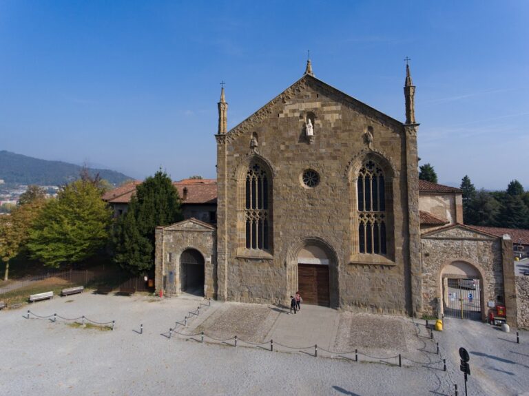
Construction transformed parts of the city. About 250 buildings, including eight places of worship, were demolished. These included the cathedral of Sant’Alessandro, which held relics of the city’s patron saint, and the Dominican convent of Santo Stefano, associated with the remains of Pinamonte da Brembate. The work damaged built-up areas and weakened slopes. In 1627, Giovanni Antonio Guarnieri described severe damage to the terrain. Local clergy excommunicated Pallavicino over the destruction; he later worked to have the excommunications revoked, including through a substantial payment.
The project brought work to large numbers of people and stimulated the local economy through demand for labor and services. At its peak, the workforce included 3,760 sappers, workers who dug and prepared fortifications, as well as stonecutters, masons, carpenters, supervisors and nine friars. One projecting section of the defenses, the San Pietro bastion, was altered in 1907–1908 when its western end was opened to create a road connection to Castagneta and the surrounding hills.
Changing uses and modern history
The walls were not used in military action. By the seventeenth century, sections had taken on civilian uses: earthworks were removed, many gun positions were dismantled, and areas beneath the walls became gardens and vegetable plots. The four gates were used to check goods and collect customs payments. New artillery, including guns able to fire at a high angle, also made this type of defense less effective. A calmer regional situation, Venice’s conflicts elsewhere and the shift of European trade toward the Atlantic further reduced the walls’ military importance.
In 1797, French forces entered Bergamo without firing artillery after the Venetian Republic collapsed, a change formalized by the Treaty of Campo Formio between France and Austria. Neither the French-backed Cisalpine Republic nor the later Austrian Empire put the fortifications to military use. On 8 June 1859, Giuseppe Garibaldi and his Alpine Hunters entered through the San Lorenzo gate. Prepared by Bergamasque organizer Gabriele Camozzi, the entry marked the city’s annexation to the Kingdom of Sardinia. The gate later became known as Porta Garibaldi.
The Muraine were demolished in 1901 after internal customs duties were abolished. The walls were surveyed and photographed in 1974–1975, and cleaned and restored between 1976 and 1984; the work also removed earth fill, repaired wall features and cleared some tunnels. In 2017, the walls became part of a UNESCO World Heritage property recognizing Venetian defensive works across the Republic’s mainland and western maritime territories. In 2024, the Sant’Agostino gate became the location of a museum devoted to the history of Bergamo’s walls.
Remains
The Venetian circuit encloses the hilltop Upper City rather than the lower town and extends for 6,200 metres. Its walls reach up to 50 metres in places, with dry ditches below and a protected patrol path outside. The defenses included 14 bastions, projecting structures designed to let defenders fire along adjoining walls, two platforms, 32 sentry boxes, 100 gun openings and four principal gates. One sentry box survives. Two small powder magazines, secure stores for gunpowder, had pyramidal roofs.
Fortresses and military positions
The Rocca and Cittadella
The Rocca’s existing keep was supplemented by a circular tower. Inside the tower was the so-called School of the Bombardiers, used as barracks for artillerymen. The Rocca also held an arsenal where weapons were repaired and gunpowder was made. Arms and food were stored in the Cittadella near Colle Aperto, the seat of the Venetian captaincy, a local military and administrative command.
Fort of San Marco
The Fort of San Marco occupied the northern part of the Upper City between the Sant’Alessandro and San Lorenzo gates. Its defenses included the Porta del Soccorso, a protected opening for escape, and a concealed underground passage leading to the castle of San Vigilio on the hill above the Sant’Alessandro gate.
Gates and related features
Principal gates
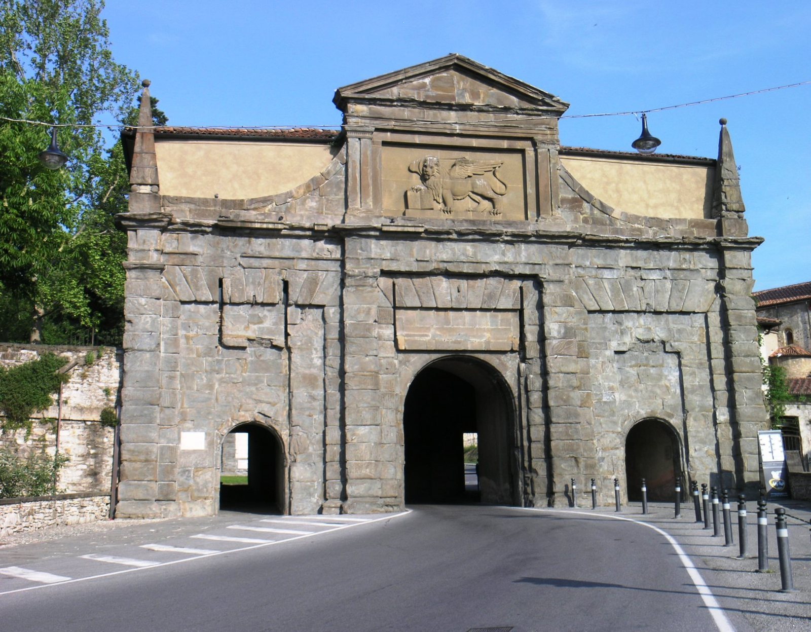
The four main entrances are Sant’Agostino, San Giacomo, Sant’Alessandro and San Lorenzo, also known as Porta Garibaldi. In 1958, sculpted lions of St Mark were placed in the pediments of the Sant’Agostino, San Giacomo and Sant’Alessandro gates. Piero Brolis made the sculptures at the first two gates, and Antonio Milani made the one at Sant’Alessandro. The lower Pantano gate, dating to the thirteenth century, connected the defenses with Borgo Canale.
Underground defenses
The fortifications included protected openings through which troops could emerge, underground rooms and military passages. The system also incorporated tunnels connecting parts of the defenses. Small military quarters formed another part of the complex.
Sant’Alessandro memorial column
A granite column erected in 1621 near the Sant’Alessandro gate commemorates the church of the same name, which was demolished during construction of the walls.
Earlier defenses and the lower-city circuit
Roman fortifications
Traces attributed to the Roman defenses can be seen on Via Vàgine, beneath the convent of Santa Grata, and west of the present funicular route near the former Via degli Anditi.
The Muraine
A surviving stretch of the lower-city circuit on Via Lapacano retains its original battlements and arrow slits. The circular Galgario tower also survives. The upper-city circuit as a whole remains well preserved and retains much of its sixteenth-century form.