Marinid Walls of Algeciras: Medieval City Fortifications
Site at a Glance
- Country
- Spain
- Primary era
- Medieval
- Eras represented
- Medieval
- Civilizations
- Crown of Castile
- Site type
- Military
- Remains
- Wall
On this page12 sections
History
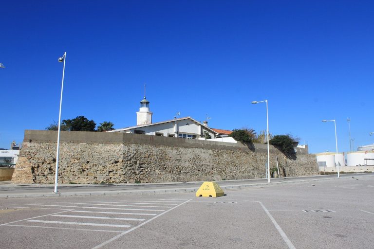
The Marinid Walls of Algeciras are the remains of a medieval defensive system in Spain. Once attributed to the late 13th-century Marinid period, the surviving complex includes Islamic structures built before 1342 and major Castilian rebuilding around 1344–1350. The Marinids were a Muslim dynasty that ruled Morocco and parts of North Africa. The walls stand within the former Old Town of Al-Yazirat Al-Hadra, the medieval Arabic name for Algeciras, also known as the Northern Enclosure.
Islamic and Castilian Fortifications
Evidence from inscriptions published in 2012 prompted a revised understanding of the walls’ chronology. It indicates that Islamic fortifications preceded the Castilian work, although their precise date remains uncertain. After Castile, a Christian kingdom in medieval Iberia, conquered Algeciras, its forces rebuilt and remodeled the defenses around 1344–1350. Damage from the Castilian siege of 1344 prompted this work.
Nasrid Capture and Abandonment
In 1369, the Nasrids, the dynasty that ruled the Emirate of Granada, captured Algeciras. They demolished the walls and covered inscriptions that had marked the Castilian occupation. In 1379, the city was destroyed and abandoned, leaving little archaeological heritage.
Excavation and Protection
In 1985, the walls received Spain’s protected cultural heritage designation. The site later housed infantry barracks beside the former Fort of Santiago. After military use ended, the barracks were demolished in 1996 for redevelopment. A proposed extension of Blas Infante Avenue toward the seafront raised concerns that construction would destroy the remains.
Initial test excavations revealed the site’s archaeological potential. In 1997, excavation findings were presented at an international conference on fortifications in al-Andalus, the Muslim-ruled territories of the Iberian Peninsula, with a recommendation to preserve the remains. The city redirected the proposed road extension, and systematic excavation proceeded. Testing was also required before work in the area designated for archaeological caution.
In 2000, the city council and Andalusian regional government agreed on plans to prepare the remains for public interpretation. The site then remained abandoned for nine years while subsidies were awaited. A conservation project was prepared in 2006, and agreements between the regional government and city enabled the remains to be conserved and interpreted.
Remains
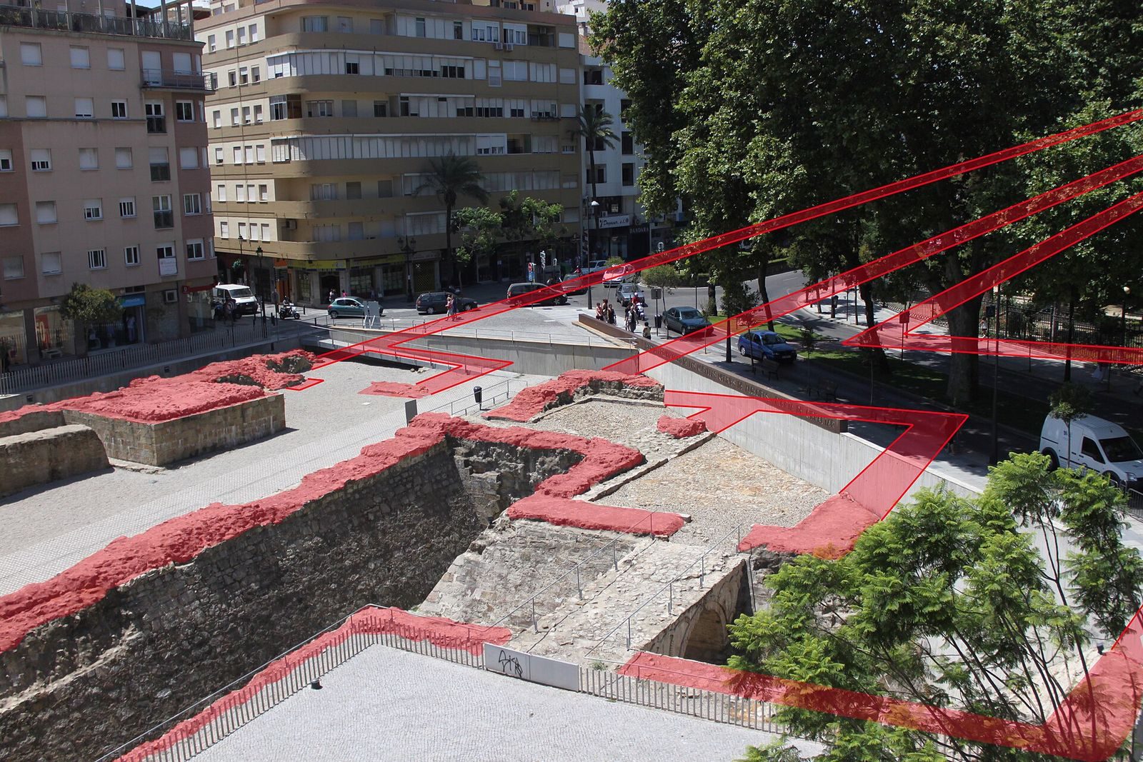
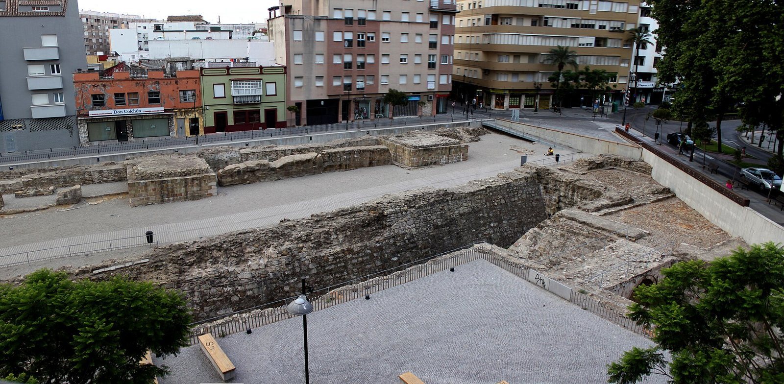
The archaeological park covers about 6,000 square metres at the northern edge of Algeciras’s New Town. Its excavated defenses include roughly 200 metres of wall, four towers, a moat, part of an outer defensive structure called a barbican, and the Gibraltar Gate. Together, these remains show a defensive line with an entrance complex set apart from the wall.
Defensive Walls and Outer Works
Wall and Towers
Towers were spaced along the wall’s northern side, while dwellings were built into its southern side. The area around the gate was open. At its base, the wall is 1.5–2 metres thick, with a mortar core faced in courses of rubble masonry. The four towers stand about 20 metres apart. Their surviving remains are roughly seven metres across and about two metres high, with solid cores. Carefully cut stone blocks, known as ashlar, face the towers; the blocks are shaped with sloping sides and fitted around the core.
Mason’s marks on the ashlar indicate work by several crews from Castile and Aragon. Courses removed about a metre above the base remain visible; the stone was taken out to make the towers collapse. Between some towers, a rough mortar wall may represent either repairs after the 1344 siege or a reinforcing addition. Parts of the wall and towers have been raised to just over two metres using architectural stone recovered at the site. The easternmost, Tower 4, remains at its excavated height, displaying four rows of removed ashlar.
Moat and Barbican
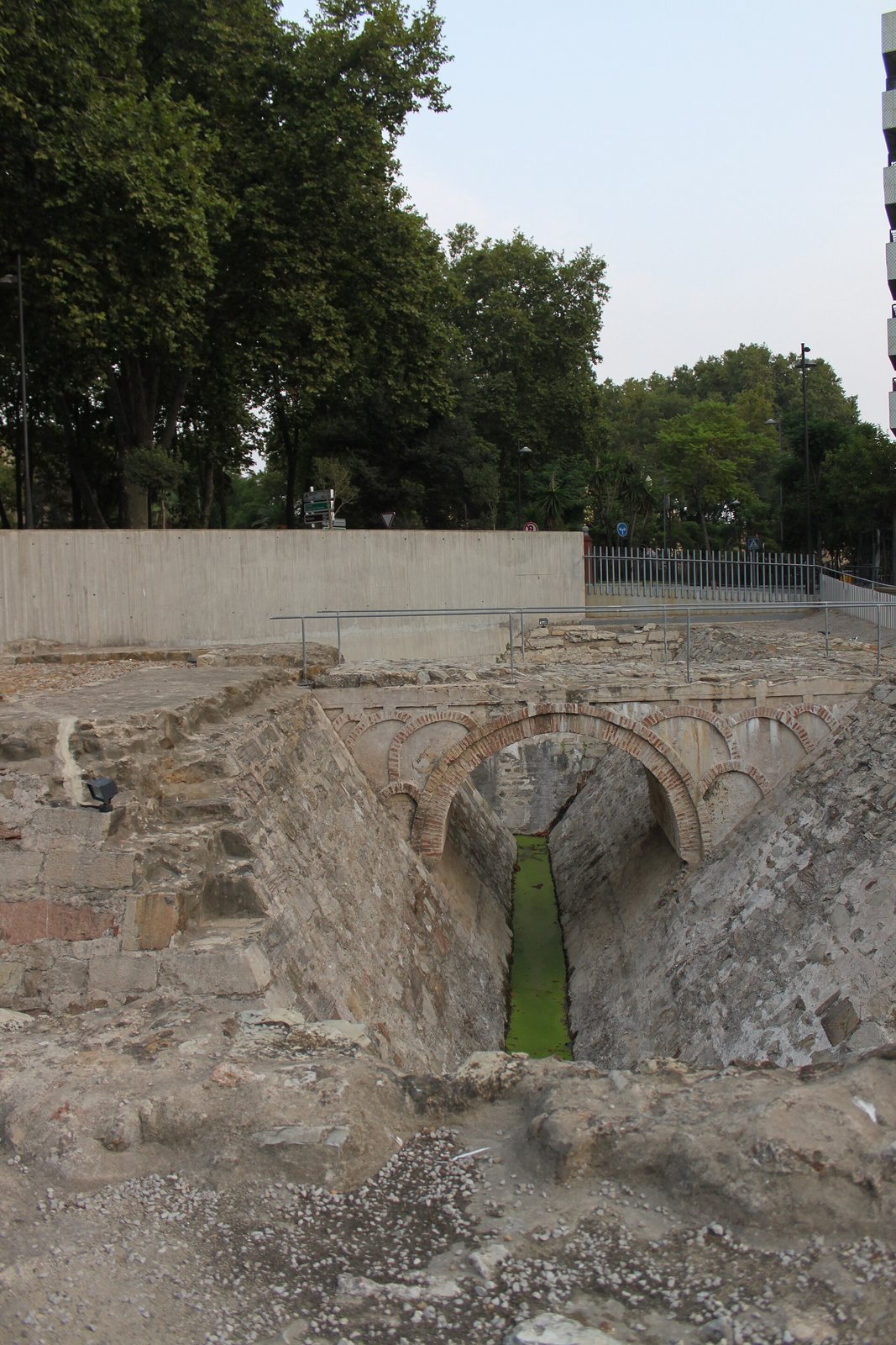
The moat’s inner and outer slopes survive along most of its course. It is 4.4–8.2 metres wide and about three metres deep, built from rubble bonded with lime mortar and faced with ashlar smaller than the tower blocks. The slopes formed the bases for the barbican and the parapet, a protective wall along the top of a fortification. The parapet is thought to have been no more than 1.5 metres high and made from rubble bonded with lime.
The barbican stood 12.5–18 metres from the main wall and rose about two metres above the liza, the open defensive space between wall and barbican. Its core consists of rubble bonded with lime, faced with ashlar less finely worked than that on the towers. Sections of the barbican and moat have been partly reconstructed and stabilized. Waterproof material covers the liza and adjoining areas to limit weed growth.
Gibraltar Gate and Bridges
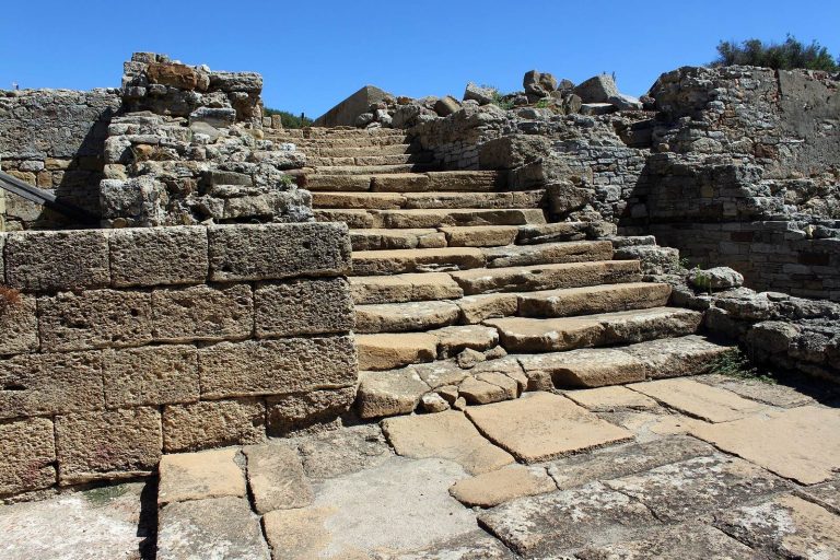
The Gibraltar Gate, also called the Fonsario Gate and possibly identified with Bab Tarafa, formed a substantial defensive entrance. Set apart from the wall, it provided a passage into the city. Its defenses included a projecting tower to guard a vulnerable approach and an entrance route with offset turns. The walls, built of rubble bonded with lime and faced with ashlar, survive to heights of 35 centimetres to 1.1 metres. They enclose three paved rooms linked by doorways. The surviving beginnings of stairways indicate access to an upper level.
Castilian rebuilding appears to have largely followed the gate’s Islamic-period layout and included square towers. The moat runs around the gate and branches at a right angle. A nearly intact, single-arch bridge crosses from the moat to the gate; it is 3.5 metres wide and seven metres long. A second single-arch bridge, with a smaller span, linked the gate to the liza near the wall and remains partly unexcavated. Interlaced circles in the brickwork along the first bridge resemble Mudéjar decoration, an artistic tradition in Christian-ruled Iberia that adapted Islamic forms. A similar pattern appears in the 14th-century Courtyard of the Maidens at Seville’s Alcázar, a royal palace complex. The gate and its associated remains have also been partly reconstructed and stabilized.
Cemetery and Excavated Finds
Burial Ground
Excavations in the park’s northern area uncovered a cemetery with four phases of use, extending from the 10th century until the city’s abandonment in 1379. It contained 137 burials. About 70 percent were simple pit graves; others had tile covers or small funerary structures, probably linked to important local families. The cemetery was probably the most important in the Islamic city. Green-glazed stone markers may have identified individual graves or sections of the burial ground, and have become symbols associated with the Arab city.
Projectiles and Architectural Fragments
Stone projectiles excavated at the site include ammunition used by the Christian forces of King Alfonso XI of Castile during the 1344 siege. Some of the many projectiles are displayed in three metal containers. Architectural fragments, including mouldings whose original positions are difficult to determine, are also displayed at the site.