Morro de São Paulo Fortified System: A Coastal Defense Network in Brazil
Site at a Glance
- Country
- Brazil
- Primary era
- Early Modern
- Eras represented
- Early Modern, Modern
- Civilizations
- Portuguese
- Site type
- Military
- Remains
- Fort
On this page22 sections
History
Settlement and strategic value
The Morro de São Paulo Fortified System, locally known as the Fortaleza do Morro de São Paulo, is a network of forts and batteries on Tinharé Island in Bahia, Brazil. Its defenses developed over several centuries to protect an approach to Salvador across All Saints Bay. The island lies about 64 kilometres south of the city, whose sailing ships depended on local winds and currents to navigate the bay’s so-called false entrance.
In 1536, Francisco Romero selected Morro de São Paulo for an establishment on behalf of Jorge de Figueiredo Correia, grantee of the Captaincy of Ilhéus, a Portuguese colonial territory. Because the area lay within the lands of the Indigenous Aimoré people, strategic concerns prompted the captaincy to move its headquarters to São Jorge de Ilhéus. Later settlement at Vila Velha and Salvador further reduced Morro de São Paulo’s social and economic importance.
The region nonetheless supplied Salvador with food and timber. During the seventeenth century, Cairu and old Boipeba produced manioc flour, reportedly reaching 1,200 alqueires a year. An alqueire was a regional measure of dry volume whose size varied. These supplies helped sustain Salvador during the Dutch siege of 1638, led by the military commander Maurice of Nassau. Sawmills and timber depots also sent valuable hardwood to the Portuguese Crown through the Morro de São Paulo channel. The regional economy declined from the mid-eighteenth century as natural resources were depleted.
Seventeenth-century defenses and the Forte Novo
A fortification may have stood at Morro de São Paulo during the Dutch invasion of Salvador in 1624–25. In 1631, on the orders of Diogo Luiz de Oliveira, governor and captain-general of the State of Brazil, two defenses were built on Tinharé: the Reduto de São Luís, a small enclosed defensive work, and the Forte de Nossa Senhora da Conceição, also called the Forte Velho. Their garrison was intended to suppress Indigenous communities and support the shipment of hardwood to the Crown. It comprised about 100 to 200 men recruited around Cairu and Boipeba. In return for helping maintain the forts, those settlements were exempted from military service.
Repairs at Morro de São Paulo took place from 1699 to 1704. A later fortification, known as the Forte Novo, was undertaken under Viceroy Vasco Fernandes César de Meneses, who governed the State of Brazil from 1720 to 1735. Military engineer Miguel Pereira da Costa submitted a plan in 1725. The Council of Overseas Affairs endorsed the project, and royal approval followed in 1727.
Construction began in 1728. An administrative record gives 4 April as the start date, while mason Domingos Gonçalves da Silva stated that he began on 15 May and had worked for 63 months by the time he petitioned. Forty enslaved people worked on the construction. The dates and the inscription over the main gate, which attributes the fortress’s foundation to 1730, mark distinct stages in its building.
During construction, the fort’s commander, infantry captain Carlos de Sepúlveda, retired and assistant lieutenant Dom José Mirales temporarily took his place. A royal order in 1731 authorized a regularly stationed company of local men, most of them married and supporting their families through smallholdings and other work. The soldiers lived outside the walls. Within the fort, quarters were provided for the captain and chaplain.
In 1732, the viceroy sought artillery, arguing that masonry defenses without guns were ineffective. The Council considered 24 bronze guns and proposed transferring 20 iron guns from existing stocks, along with 1,000 muskets for the State of Brazil. Engineer João Teixeira, who oversaw the work, died that year. The requested artillery arrived in June 1733, and a plan from 1759 counted 51 iron and bronze guns at Morro de São Paulo.
Damage, military use, and rebuilding
Sea erosion had severely damaged the walls by 1796. Powerful waves had opened breaches from 1774 onward, despite temporary repairs, and buildings were repaired again between 1800 and 1802. In 1809, Prince Regent João reduced the garrison to 30 of its oldest soldiers, who were to spend their final days at the fort under a junior officer. During repairs in 1815, dressed stone from ruined walls on the beach was reused in the construction of Salvador’s Commercial Association building.
During the Brazilian War of Independence, Admiral Thomas Cochrane’s fleet anchored below the fort in 1823. Pedro II later noted that the Brazilian fleet remained in the cove from after the battle of 4 May until 2 July, when Portuguese forces evacuated Bahia. The dismantled fort then had four guns and 27 cannonballs. Ship carpenters repaired the gun carriages, and the fort received 400 rounds. When Pedro II visited in 1859, seven invalid soldiers formed the garrison, and their barracks were in very poor condition.
Nineteenth-century repairs and heritage protection
A lighthouse was built during the provincial presidency of Francisco Gonçalves Martins, whose term ran from 1848 to 1852. The fortification underwent repairs and reconstruction in 1863 under Emperor Pedro II and provincial president Antônio Coelho de Sá e Albuquerque. Further repairs followed in 1876 and 1881–83. In 1885, the site was described as having 40 artillery pieces, and its lighthouse was operating.
By 1915 the fortification was again in ruins, with 52 abandoned iron guns. The Reduto de São Luís, abandoned since 1838, held three guns. The 2,335-square-metre property had belonged to Brazil’s Ministry of Finance since 1937. In 1938, the federal heritage service registered it in the Historical and Fine Arts register.
Remains
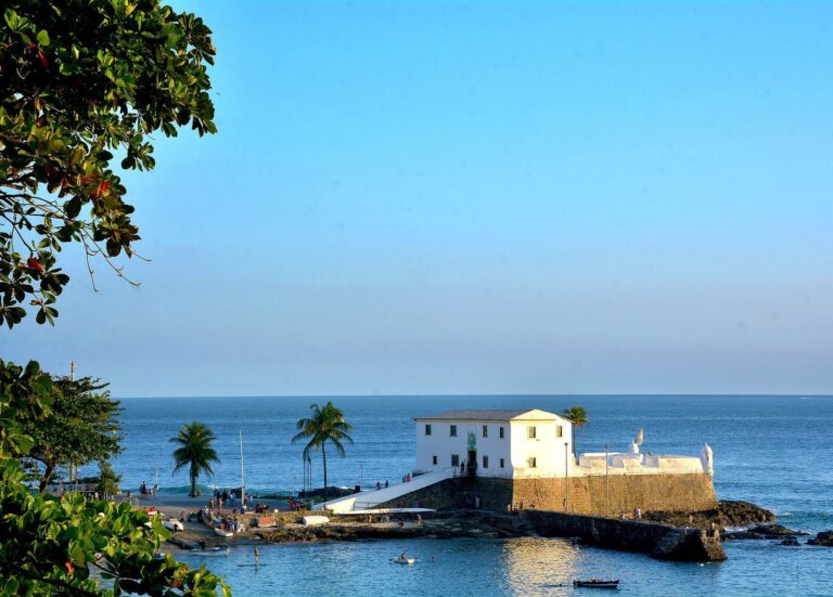
The fortification occupies the northwestern tip of Tinharé Island and consists of works distributed around the coast rather than a single enclosed fortress. Its bastioned design uses projecting sections to protect neighboring walls. An 1863 description measured the system’s firing fronts at 3,020 palmos, historical length units whose values varied by place and period. The measured defenses included the forts of São Luís, Zimbeiro, São Paulo, and Conceição, along with the batteries linking the last two.
Early forts and linked defenses
Reduto de São Luís
A plan from 1631 depicts the Reduto de São Luís as a four-sided fortification armed with three guns. The name also appears in later descriptions of the wider system, which identify a Forte de São Luís on the island’s southeastern point.
Forte Velho and the hilltop chapel
The 1631 plan places the Forte de Nossa Senhora da Conceição, or Forte Velho, on the hill and shows it armed with six guns. At the summit stood the Chapel of Nossa Senhora da Luz, whose name means Our Lady of Light and refers to a title of the Virgin Mary in Catholic devotion.
Forte da Ponta and its wall
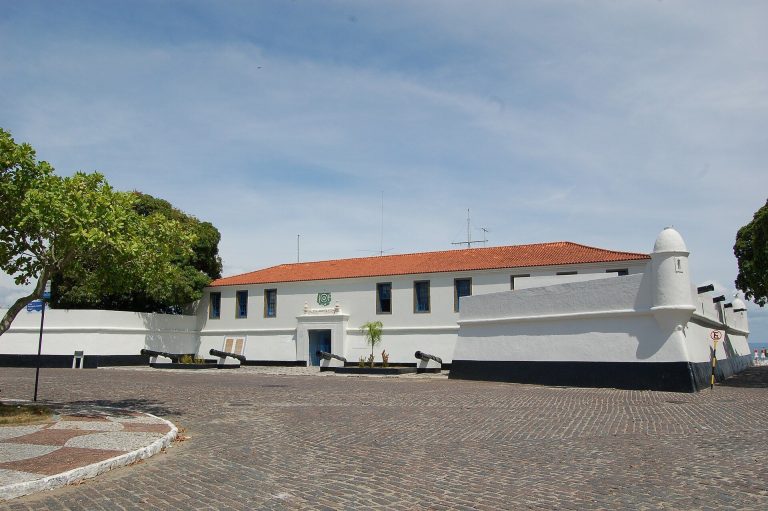
The later Forte da Ponta supplemented the Forte Velho. Its open, four-sided plan had bastions facing the sea at the corners, with circular sentry boxes set on piers. A polygonal curtain wall, a defensive wall joining separate works, connected the forts along the island channel. The wall’s southwestern end contained the entrance portal.
Eastern coastal works
Forte de São Luís
The Forte de São Luís stood at the island’s southeastern point, 50 palmos above high-water level. It had a trapezoidal plan, gun batteries firing over a parapet, and a length of 212 palmos. In 1863, repairs had been carried out, while the platform, paving, guardhouse railing, and locks still required work.
Zimbeiro
Zimbeiro stood north of São Luís, between 80 and 100 braças away, on an eastern hill that projects toward the sea. A braça, like a palmo, was a historical length measure with a locally variable value. The position was 270 palmos above high water. Its five-sided battery, with guns firing over the parapet, extended for 200 palmos. In 1863, small cracks marked its walls, and plans called for repairs, a platform, and a guardhouse.
Northern and western defenses
Forte de São Paulo
At the island’s northern point, 15 palmos above high-water level, the Forte de São Paulo had an irregular six-sided plan extending for 582 palmos. Its corners included four outward-projecting angles and one inward-facing angle. Three sides allowed guns to fire over parapets; the other three had embrasures, openings in a wall for firing. The embrasured section held eight guns of calibre 30. Repairs and new construction had taken place by 1863, but further work was still needed on the platform, older walls, drains, plaster, stonework, paving, hooks, and doors.
Western curtain wall
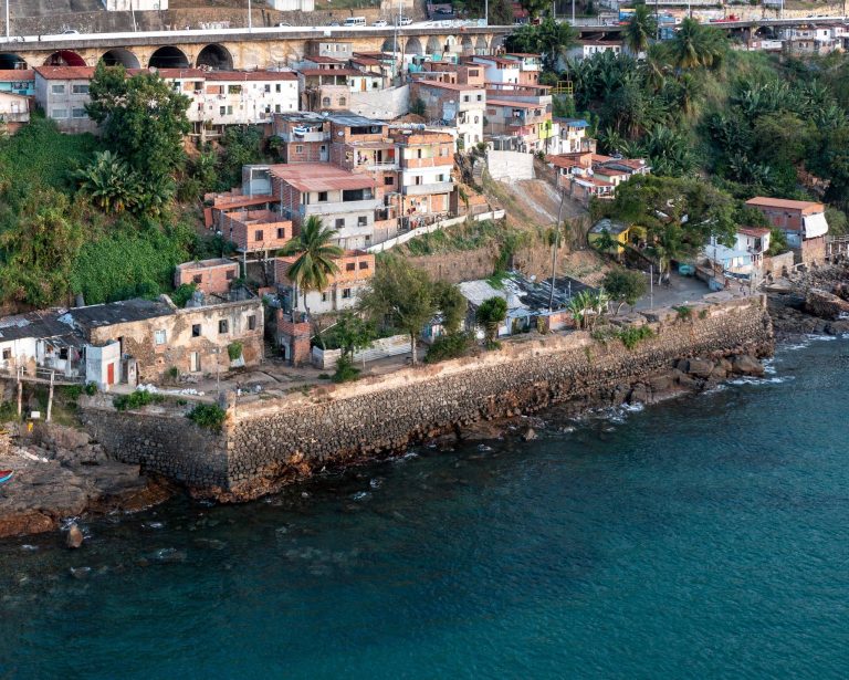
The curtain wall between São Paulo and Conceição ran along the western shore at the water’s edge. Its six sections included four inward-facing and two outward-projecting angles, two gun positions, and other positions for firing over parapets. It measured 1,211 palmos. By 1863, 480 palmos had collapsed and required rebuilding.
Conceição Battery
The arrow-shaped Conceição Battery extended for 174 palmos and had four gun positions, each associated with a gun of calibre 18. Two guns on its northern face covered the left side of the Forte de São Paulo; the other two could fire northwest. The battery was repaired and ready in 1863.
Battery beside the entrance ramp
A further battery connected the left side of the Conceição Battery to the entrance ramp. Its four wall sections extended for 642 palmos and contained eight corner gun positions, four at a central outward-projecting angle and four beside the left side of the entrance. In 1863, 179 palmos of wall had collapsed.
Surviving structures and hilltop features
Entrance portal and inscriptions
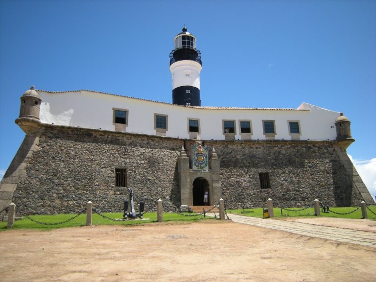
The old stone entrance portal survives with carved ornament and a curved pediment bearing inscriptions that refer to the Empire. One inscription credits Vasco Fernandes César de Meneses, Count of Sabugosa, with founding the fortress in 1730. Another marks its reconstruction in 1863 under Pedro II and provincial president Antônio Coelho de Sá e Albuquerque.
Barracks and arcaded wing
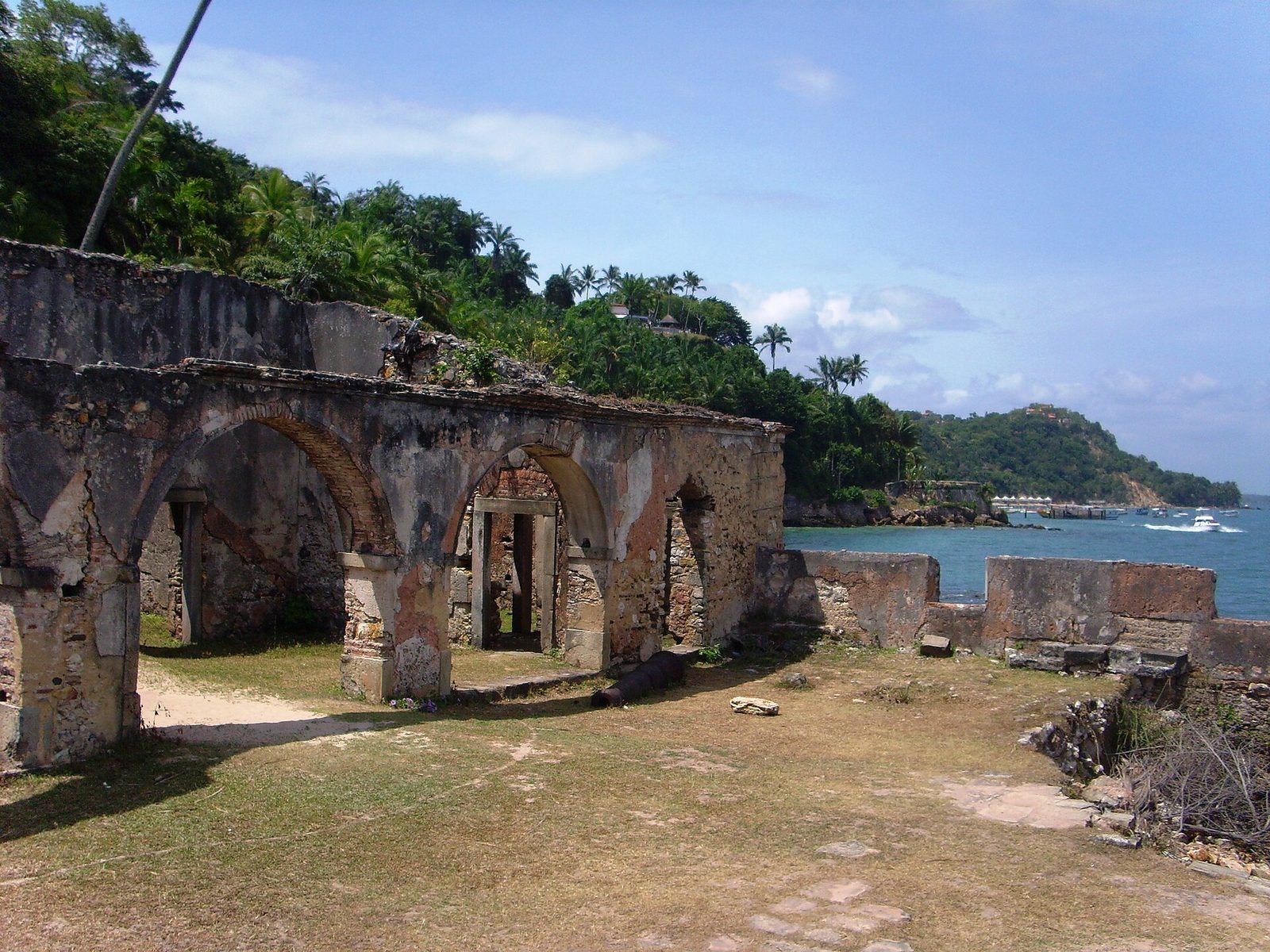
A surviving section is thought to have served as troop barracks. An arcaded wing, supported by columns of an original design, also remains.
Lighthouse and former hilltop buildings
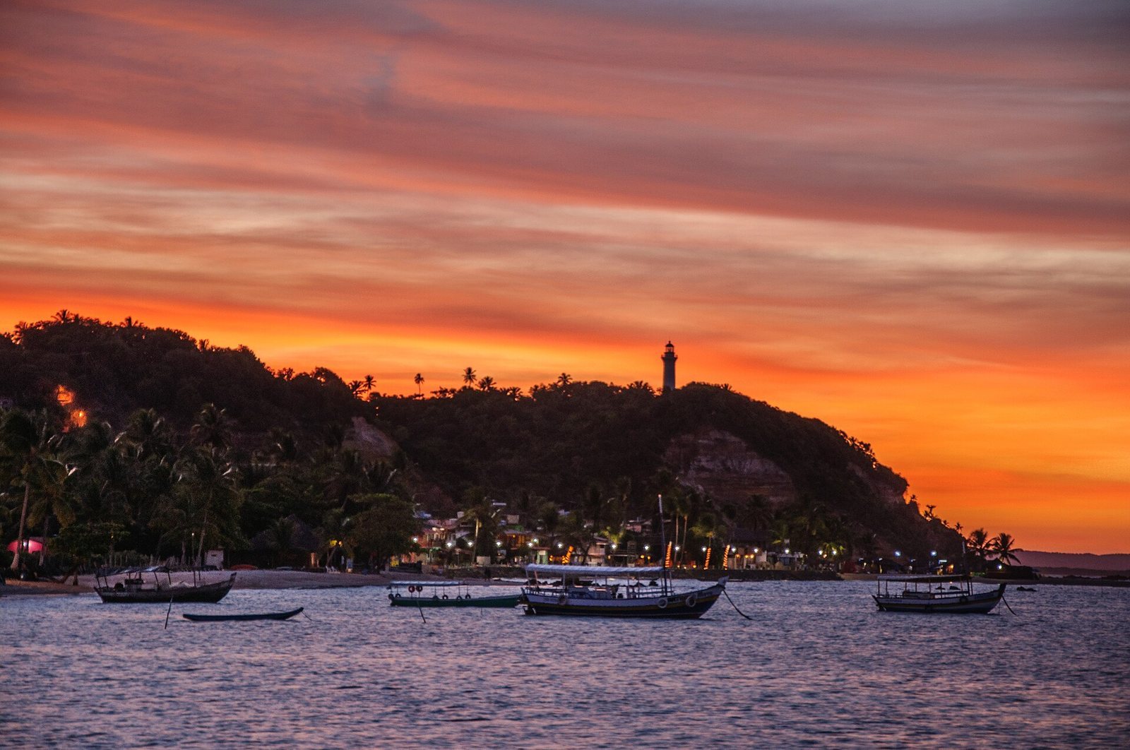
The hilltop, where the lighthouse now stands, formerly held the chapel, the chaplain’s house, the powder magazine, and a section of wall. A 1859 description says the lighthouse needed only one lantern. It also notes a dungeon used to store lighthouse oil and other items, as well as a furnace for heating shot and its associated tools. At that time, the fort was dismantled; the sea had brought down part of a wall and undermined another.