Derinkuyu Underground City: A Multilevel Refuge in Turkey
Site at a Glance
- Country
- Turkey
- Primary era
- Medieval
- Eras represented
- Iron Age, Classical, Medieval
- Civilizations
- Byzantine, Phrygian, Roman
- Site type
- Military
- Remains
- Fortified Town
On this page12 sections
History
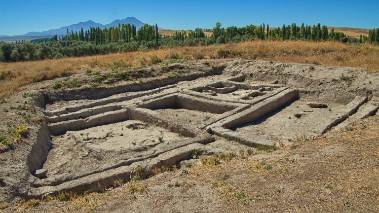
The Derinkuyu underground city is a multilevel refuge beneath the settlement in Turkey, with passages that may first have been cut by the ancient Phrygians in the eighth or seventh century BC. The complex was enlarged over time and became a place where local communities could shelter during periods of danger.
Early use and Christian expansion
The Phrygians, an ancient people of Anatolia, may have begun carving the earliest chambers. During Persian rule, from the sixth to the fourth centuries BC, the underground settlement served as a refuge. Christians later enlarged its caves and rooms, probably during the Late Roman Empire, adding chapels and Greek inscriptions. It reached full development in the Byzantine era, the eastern continuation of the Roman Empire.
Conflict and refuge
Derinkuyu was greatly expanded during the Arab-Byzantine wars, approximately 780 to 1180. The conflict brought raids by the Umayyads and Abbasids, successive Muslim caliphates, and the underground city sheltered local Christians. Its defenses allowed residents to hide, seal off sections, move through the complex, and potentially resist attackers who entered. The population probably came closest to the site’s estimated capacity of about 20,000 during this period.
Communities in Cappadocia also used underground cities during Seljuk incursions in the eleventh century and Mongol incursions under Timur, a Central Asian ruler and conqueror, in the fourteenth century. In quieter periods, residents returned to the surface and built above ground, retreating below when danger threatened. Under Ottoman rule, local Christians continued to use underground chambers as refuges.
Persecution, abandonment, and rediscovery
Cappadocian Greeks and Armenians used underground chambers to escape periodic persecution in the twentieth century. In 1909, after news of the Adana massacres reached Axo, many residents took shelter underground and for several nights did not sleep above ground. Cambridge linguist Richard MacGillivray Dawkins recorded the episode.
The 1923 population exchange between Greece and Turkey expelled the region’s Christian inhabitants, who were relocated to Greece; migrants from Greece settled in their place. Derinkuyu was abandoned after the exchange, by 1924. Cappadocian Greek speakers knew the town as Malakopi. The name Derinkuyu means “deep well,” referring to shafts that supplied water to the underground settlement and the town above.
The complex came to light again in 1963, when a resident renovating a house broke through a basement wall and found a room. Further digging revealed access to the tunnel network. More than 600 entrances have since been identified, while only an estimated 10 to 15 percent of the city has been explored. Derinkuyu forms part of Göreme National Park and the Rock Sites of Cappadocia, added to UNESCO’s World Heritage List in 1985 as a mixed cultural and natural property.
Remains
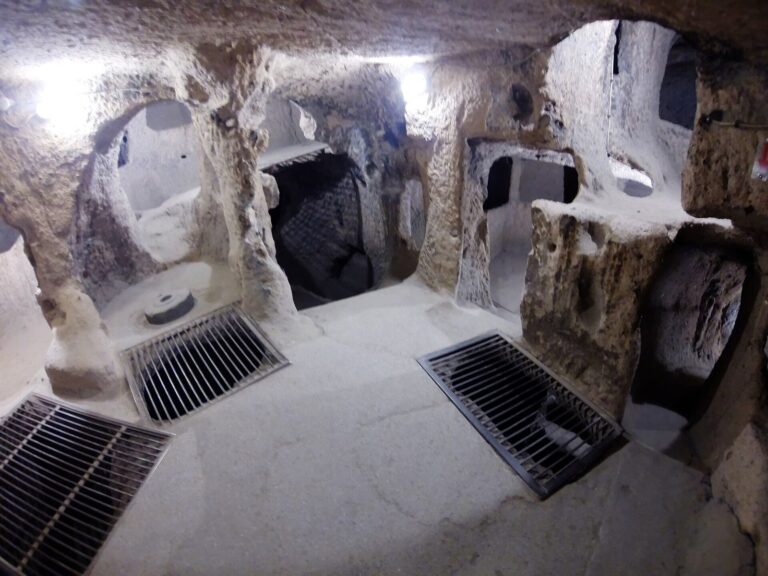
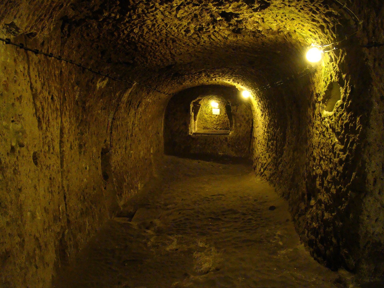
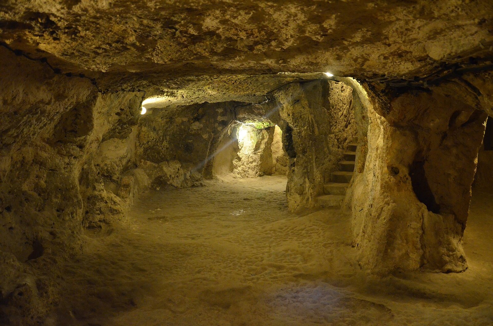
The underground city is cut mainly into soft volcanic tuff, rock formed from volcanic ash, beneath a plateau about 1,355 m above sea level. Its branching rooms, halls, tunnels, and shafts extend in several directions and descend to approximately 85 m. The area is estimated at 1.5 to 2.5 km². The total number of levels is uncertain: twelve have been proposed, while other estimates allow for as many as twenty more unopened levels. Some levels connect through small openings in the floors, and passages and ceilings become lower and narrower deeper underground. A tunnel links Derinkuyu with Kaymakli over approximately 8 to 9 km.
Rooms and shared spaces
First and second levels
The first level contains stables, a grape press, and a large vaulted structure. A spacious room on the second level has a barrel-vaulted ceiling, a continuous tunnel-shaped ceiling, and was probably used as a religious school. Rooms to its left served as studies.
Church and lower passages
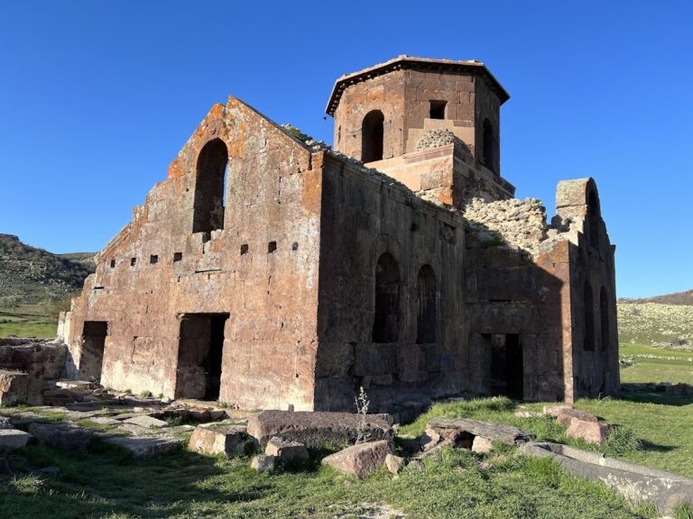
Staircases between the third and fourth levels lead to a lower-level church measuring 20 by 9 m, with a cross-shaped plan. Dedicated to the Holy Unmercenary Saints, Christian saints associated with healing without payment, it was once famed for miracles. A narrow tunnel below the church is 160 to 170 cm high, with empty chambers on either side.
Living, work, and meeting areas
Deeper levels included living quarters and kitchens, while armories occupied the third and fourth levels. The underground settlement also had storage rooms, bakeries, wine and oil presses, cellars, granaries, dining halls, and workshops. Kitchens used deep ovens called tandoors for baking and cooking. A spacious hall on the eighth level may have served as a meeting place, and the complex may also have included a cemetery.
Entrances, barriers, and services
Entrances and rolling stone doors
One entrance lies inside a one-storey house, and other access points are concealed beneath private homes. Large circular stone doors could be rolled into place from within to seal rooms or entire floors. Each measured 1 to 1.5 m high and 30 to 35 cm thick, and weighed between 200 and 500 kg. Openings in the stones allowed at least two people to move them from the inner side and may also have served as peepholes.
Water and ventilation shafts
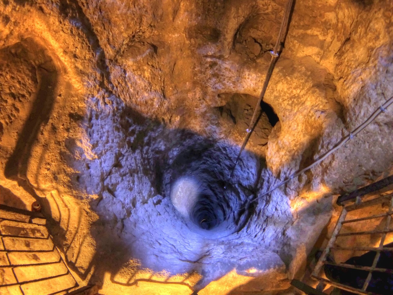
Fifty-two vertical shafts served the complex. A central shaft, about 3 by 2.8 m and roughly 55 m long, connected several levels and appears to have functioned as a well. It supplied water to the town above and to people sheltering underground when the surface could not be reached; village wells remained in use until 1962. Some well openings could be covered and concealed to protect the water during an attack. Smaller vents linked rooms to wider shafts. Openings between levels in the main shaft do not align directly, a layout that appears intended to improve airflow. Rooms and tunnels were well ventilated and lit, with interior temperatures of about 13 to 15°C.