Fort de Chartres: A French Colonial Administrative Fort in Illinois
Site at a Glance
- Country
- United States
- Primary era
- Early Modern
- Eras represented
- Early Modern, Modern
- Civilizations
- French
- Site type
- Military
- Remains
- Fort
On this page11 sections
History
Fort de Chartres is a French colonial fort on the east bank of the Mississippi River in present-day Illinois, United States. Its stone fort was built between 1753 and 1756 and became the administrative center of the Illinois Country, a French colonial region within New France, France’s colonial presence in North America.
French Forts and Administration
On January 1, 1718, the French government granted John Law and the Company of the West, a French commercial company with colonial trade privileges, a trade monopoly. The company wanted to protect its interests, including plans to mine precious metals. The fort was also intended to extend French control over Indigenous peoples in the region, particularly the Meskwaki, also called the Fox. As administration shifted from Quebec to New Orleans, responsibility in the region passed to the Company of the Indies.
A French contingent from New Orleans, led by military officer Pierre Dugué de Boisbriant, built the first fort from logs between 1718 and 1720. Mississippi flooding severely damaged it within about five years. A second log fort, farther from the river but still on the floodplain, followed in 1725. Repairs were made in 1742, when the second fort was in poor condition. Five years later, its garrison moved to Kaskaskia, about 18 miles (29 km) south, while officials considered whether to rebuild there or near the earlier forts.
After Louisiana returned to the French Crown in the 1730s, officials considered replacing the wooden fort with one of stone. In August 1751, Governor Vaudreuil summoned François Saucier from Mobile to New Orleans to plan a fort for additional troops. The proposed work was meant to impress the Chickasaw, an Indigenous people, and counter British expansion. Saucier surveyed the land and prepared plans and cost estimates. After delays and discussions about expense, officials approved a reduced design. Land clearing and tree felling began while approval was still pending. The French selected a site a little over half a mile north of the earlier forts rather than Kaskaskia, and Vaudreuil approved rebuilding near the original location.
British Rule and Abandonment
The Treaty of Paris in 1763 transferred the Illinois Country east of the Mississippi to Great Britain after the Seven Years’ War, a mid-eighteenth-century conflict between Britain and France and their allies. British forces took control of the fort on October 10, 1765. A detachment of the 42nd Regiment of Foot, a British infantry unit, arrived under Captain Thomas Stirling; the 34th Regiment replaced it soon afterward. In 1766, the British appointed Philippe-François de Rastel de Rocheblave, who had served at the fort as a French lieutenant, to command it.
The British renamed the post Fort Cavendish, after the colonel of the 34th Regiment. When the 18th Regiment took over in 1768 under Lieutenant Colonel Wilkins, the fort again became known as Fort Chartres. The name referred to Louis, Duke of Chartres, son of Philippe, Duke of Orléans, who served as France’s regent. The British left the fort in the early 1770s, although a small British party remained at Kaskaskia until 1776. Under British rule, French Canadian settlers had to leave or obtain special permission to stay. Many moved to St. Louis, whose culture they found more congenial.
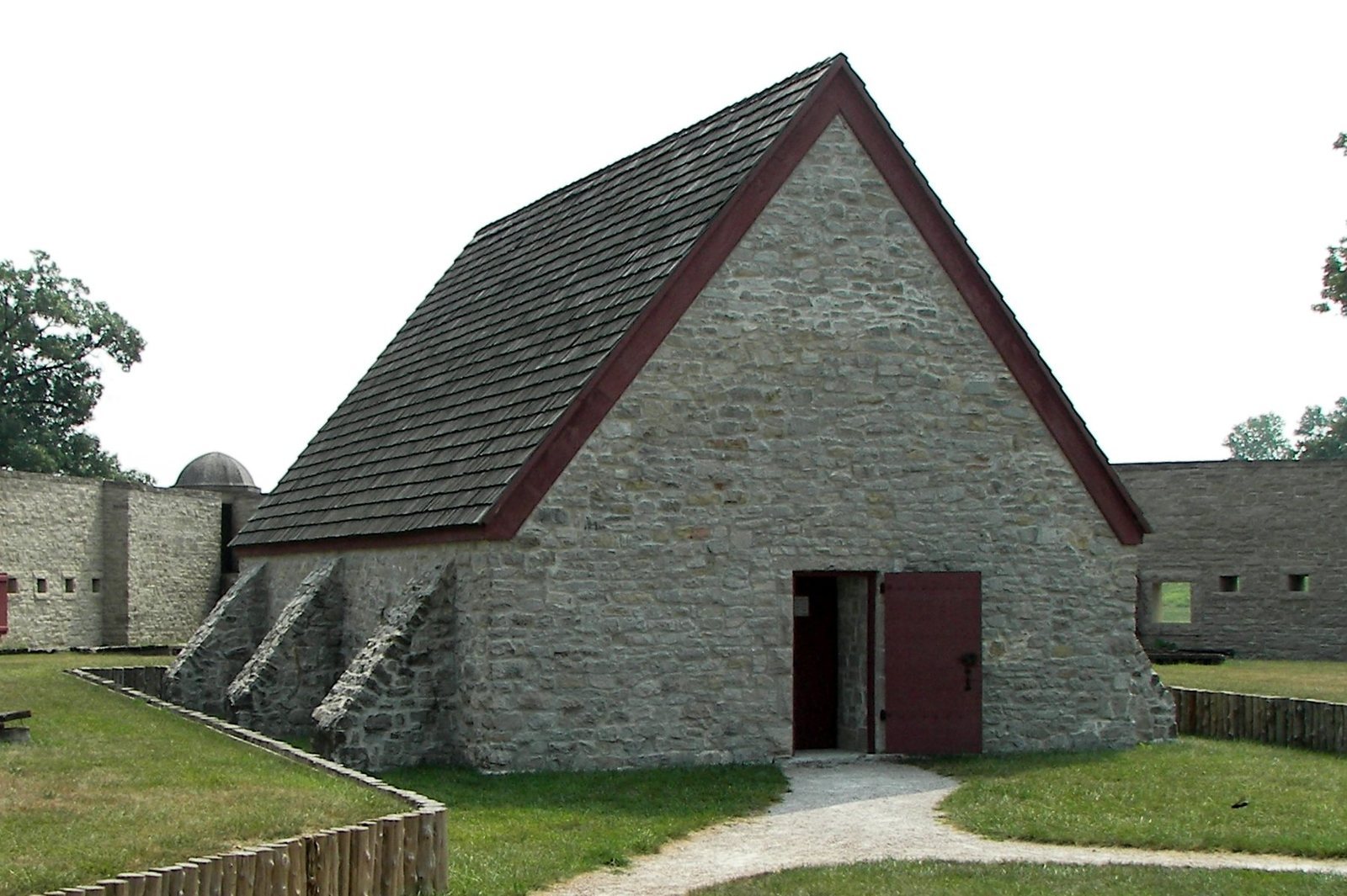
Mississippi erosion continued after the fort’s abandonment. In 1772, the south wall and a bastion, a projecting fortification for defensive fire along the walls, fell into the river. The remaining walls deteriorated, and local residents reused stone for construction. By about 1900, the powder magazine, a secure store for gunpowder and ammunition, was the only original building still standing.
Preservation and Recognition
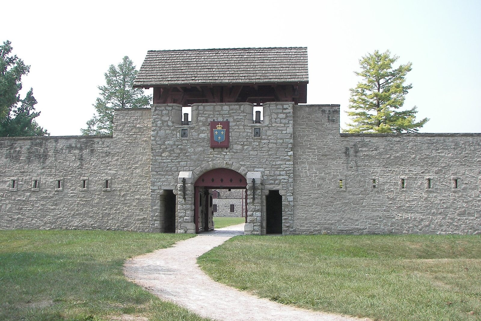
Illinois acquired the ruins as a historic site in 1913 and restored the powder magazine in 1917. Work in the 1920s exposed the foundations of the fort’s buildings and walls. In the late 1920s and 1930s, the Works Progress Administration, a US public-works agency created during the Great Depression, rebuilt the gateway and two stone buildings. In 1989, sections of the walls were reconstructed on their original foundations, and additional foundations and cellars were exposed. The site is an Illinois state historic site and was designated a National Historic Landmark, recognizing its national historical importance, in 1960. It was added to the National Register of Historic Places in 1966 and included in the French Colonial Historic District in 1974.
Remains
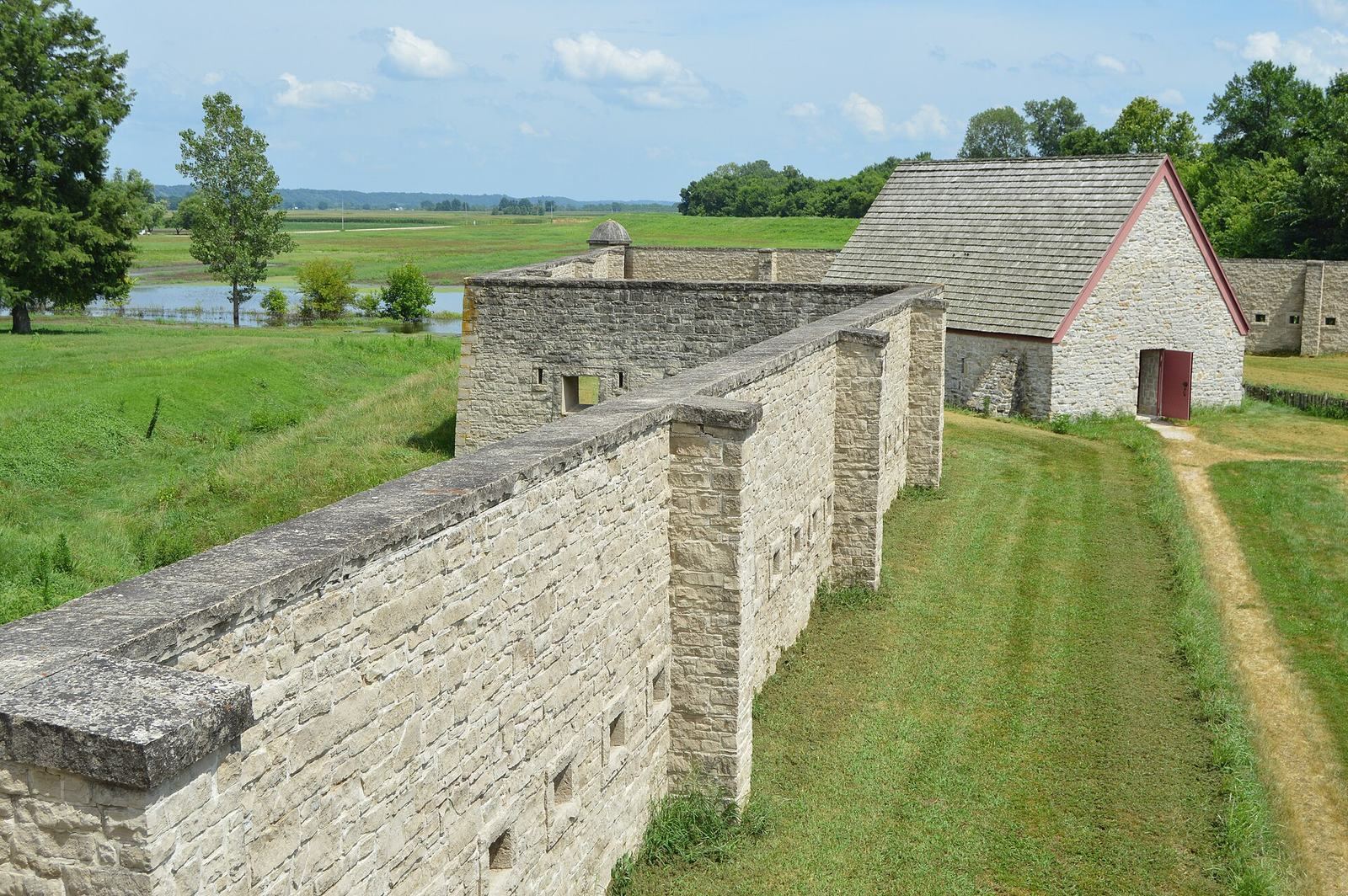
The site lies on the Mississippi’s east-bank floodplain, known as the American Bottom, south of modern St. Louis and about four miles west of Prairie du Rocher. The stone fort enclosed about four acres (16,000 square metres). Its limestone walls were about three metres high and one metre thick. Builders quarried the stone in nearby bluffs two or three miles away and ferried it across a small lake.
Enclosure and Gateway
Partial reconstructions of the fort walls follow their original foundations, and the gateway has also been rebuilt. Together with the exposed foundations and cellars, these features show parts of the fort’s layout. Frames on the grounds illustrate post-and-beam construction (a frame of vertical posts and horizontal beams).
Surviving Original Building
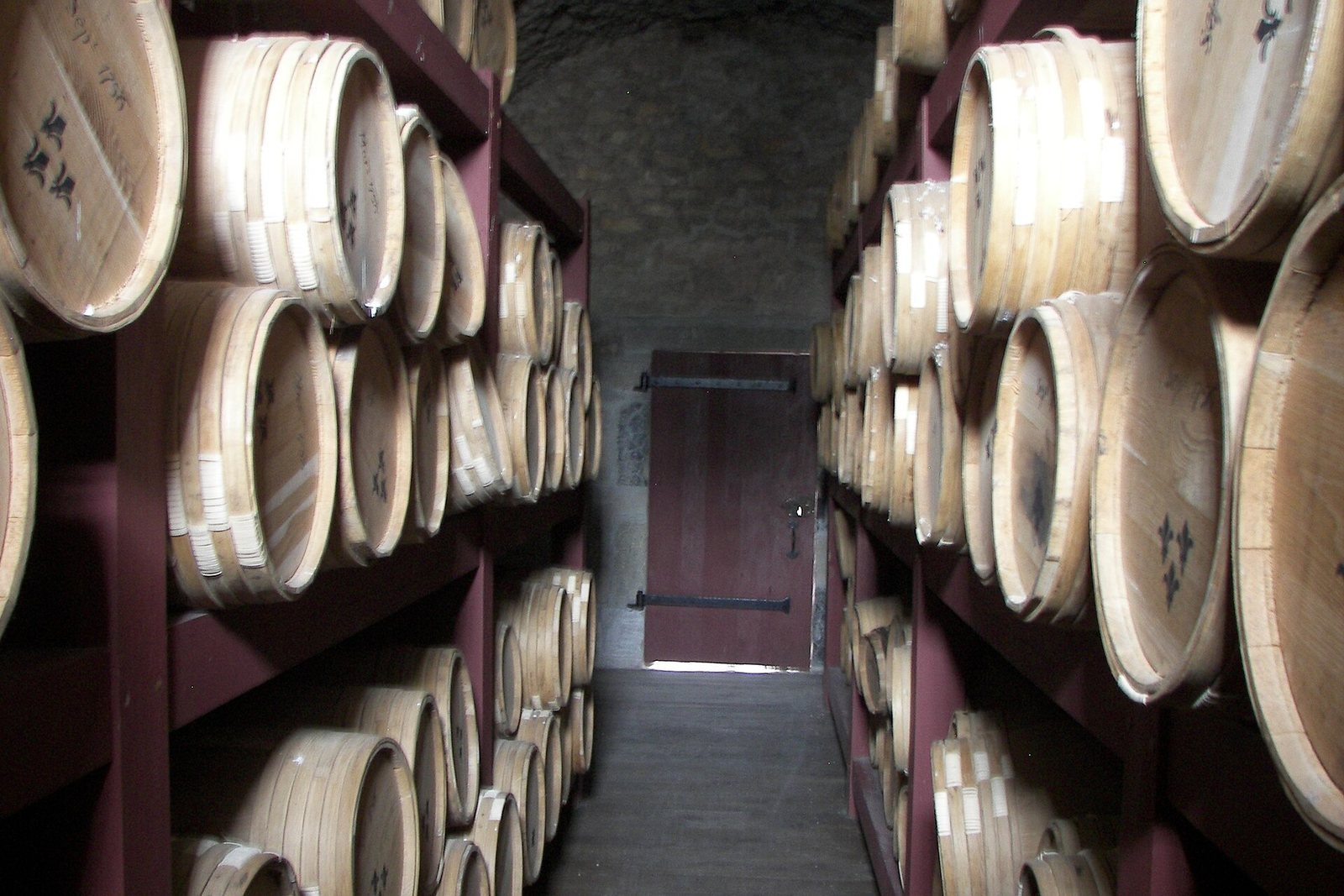
The stone powder magazine is the only original building still standing at the site. It is believed to be the oldest surviving building in Illinois.
Reconstructed Buildings and Grounds
Museum and Office Building
Built in 1928 on the foundation of an original fort building, the museum and office building contains exhibits about French life at the fort.
Guards House
The reconstructed stone Guards House was completed in 1936. It contains a Catholic chapel furnished in a style representing the 1750s, as well as a priest’s room, a gunner’s room, an officer-of-the-day room, and a guard’s room.
Grounds and Building Demonstrations
The grounds include an operating bake oven and a kitchen garden with raised beds of produce typical of eighteenth-century French Illinois. A garden shed made from upright logs uses post-on-sill construction, in which upright posts rest on a horizontal sill. Modern levees protect the site, but flooding remains a threat. In 1993, floodwaters breached a levee and rose to the top of the fort walls.