Cahokia: A Mississippian Urban and Ceremonial Center in Illinois
Site at a Glance
- Rating
- 4.7
- Popularity
- Medium
- Country
- United States
- Primary era
- Medieval
- External website
- Open
- Eras represented
- Medieval
- Civilizations
- Unclassified
- Site type
- City
On this page17 sections
History
Cahokia was a Native American urban and ceremonial center of the Mississippian culture in Collinsville, Illinois, United States, across the Mississippi River from present-day St. Louis. The city flourished especially between approximately AD 1050 and 1350, when its planned plazas, monumental earthworks, religious structures, and regional connections made it the largest and most influential urban center of the Mississippian world.
Early occupation and urban growth
People occupied the area during the Late Archaic period, around 1200 BC. The settlement archaeologically identified as Cahokia developed around AD 600 during the Late Woodland period, while mound construction began around the ninth century as the Mississippian culture emerged. By the late tenth century, a concentrated community covered approximately 35 to 70 hectares.
Rapid urban growth began around AD 1050. Cahokia’s urban precincts included Cahokia proper, East St. Louis, and the mounded area of present-day St. Louis. At its height around AD 1100, the city extended across about 6 square miles, or 16 square kilometres, and contained roughly 120 earthworks. Population estimates vary widely, from 6,000 to 40,000 people, although estimates for the densely occupied central area place its population between about 10,200 and 15,300 from AD 1050 to 1100.
The city stood near the confluence of the Mississippi, Missouri, and Illinois Rivers, a position that supported extensive regional connections. Exchange networks reached the Great Lakes, Pennsylvania, the Gulf Coast, and the Upper Midwest. Copper, Mill Creek chert, shark teeth, lightning-whelk shells, and other materials moved through these networks. Cahokia controlled the distribution of Mill Creek chert hoes and other agricultural tools, although it did not necessarily produce them.
Society, religion, and political organization
Immigration appears to have contributed substantially to Cahokia’s rapid expansion. Connections with communities in the lower Ohio drainage, the Lower Mississippi Valley, the Upper Midwest, and the south-central Plains brought people and practices to the city. Mound-and-plaza planning traditions from these communities helped shape Cahokia’s urban character.
Cahokia served as a major religious and ceremonial center. Its planned plazas, monumental earthworks, ritual structures, pilgrimage connections, and mortuary complexes indicate a highly organized society. Political centralization was especially pronounced during the Stirling phase, an archaeological period dating approximately from AD 1100 to 1200.
Agriculture included maize and plants of the Eastern Agricultural Complex. Maize became important in the region around AD 900, but diets at Cahokia, particularly in its earlier period, remained varied. People in outlying areas appear to have depended more heavily on maize than residents of the urban center. Food supply, waste disposal, polluted waterways, drought, flooding, and the health effects of dense settlement placed continuing pressure on the population. Maize was initially processed through nixtamalization, a treatment with an alkaline substance that improves its nutritional value, but this practice may have declined around AD 1200. Burial remains show iron-deficiency anemia and defects in tooth enamel, although nutritional deficiencies have not been conclusively connected to Cahokia’s wider collapse.
Conflict, contraction, and abandonment
A large residential compound in the East St. Louis precinct was burned around AD 1160 to 1170. The destruction affected ritual structures containing unusually large quantities of stone tools, exotic materials, and vessels filled with shelled maize. The event may have reflected social unrest connected with inequality. The area was later rebuilt for a nonresidential purpose.
People began leaving Cahokia in increasing numbers during the late twelfth century. By the middle of the thirteenth century, the population had fallen by half or more, and the city was abandoned by approximately AD 1350. The causes remain uncertain. Proposed factors include environmental degradation, deforestation, overhunting, pollution, drought, flooding, disease, nutritional stress, political fragmentation, social tensions, weak integration among immigrant communities, and external conflict.
Flooding affected the wider region, although recent research has found no evidence of human-caused erosion or flooding. Sediment from Horseshoe Lake indicates major floods approximately between AD 1100 and 1260 and again between AD 1340 and 1460. Cahokians responded with channels, dikes, levees, and agricultural fields distributed between lowland and upland areas. These measures apparently reduced the risk that a single flood would destroy the entire food supply. During the thirteenth century, palisades with watchtowers enclosed parts of the central ceremonial precinct. They may have served defensive, ritual, or separation purposes, and were rebuilt several times as the city contracted.
After the city was abandoned, the surrounding region entered a major population decline known as the Vacant Quarter. Population in the wider Horseshoe Lake area later rebounded after reaching a minimum around AD 1400, peaked around 1650, and declined again around 1700. Cahokia’s original name is unknown. Its modern name comes from the historic Cahokia, an Illiniwek people living in the area when French explorers arrived in the seventeenth century. That community lived there centuries after the Mississippian city had been abandoned and is not necessarily descended from its original inhabitants.
Later occupations and preservation
French settler-colonial families claimed parts of the abandoned city during the eighteenth century. Trappist monks lived on the grounds briefly in the early nineteenth century, after which the Ramey family farmed the land. These later occupations contributed to the name Monks Mound and to sustained archaeological interest.
Illinois protected Cahokia in 1923 by authorizing the purchase of a state park. Federal highway construction in the 1950s damaged the site’s integrity but also funded emergency archaeological investigations. Intensive research has continued since then. Cahokia became a National Historic Landmark on July 19, 1964, and entered the National Register of Historic Places on October 15, 1966. UNESCO designated Cahokia Mounds a World Heritage Site in 1982, recognizing its exceptional evidence of a cultural tradition and its importance to the history of human architecture and technology.
The site’s heritage remains important to contemporary Native American communities. The Osage Nation, a Native American nation with historical ties to the central United States, works with archaeologists and site managers. Native people continue to regard the grounds as sacred and use them for ceremony and dance.
Remains
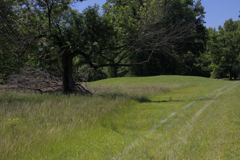
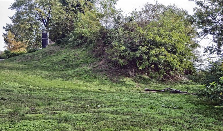
The archaeological park covers approximately 2,200 acres, or 890 hectares. About 80 manmade mounds or earthworks survive within the archaeological site, while 109 mounds have been located and 68 lie inside the park. The ancient city originally contained about 120 earthworks across roughly 6 square miles. These monuments were built by excavating, carrying, and placing more than 55 million cubic feet of soil by hand, using woven baskets. They were arranged with ceremonial plazas, residential areas, courtyards, and laid-out paths.
The early urban plan followed a symbolic four-part arrangement oriented toward the cardinal directions. Monks Mound stood close to the intersection of the main east-west and north-south axes, with large plazas to its east, west, north, and south. The central district formed an approximate diamond about 1 mile across, while the wider city extended roughly 5 miles from east to west. Platform mounds, conical mounds, and ridge-top mounds formed the principal earthwork types and appear to have had different meanings or functions.
Central ceremonial precinct
Monks Mound
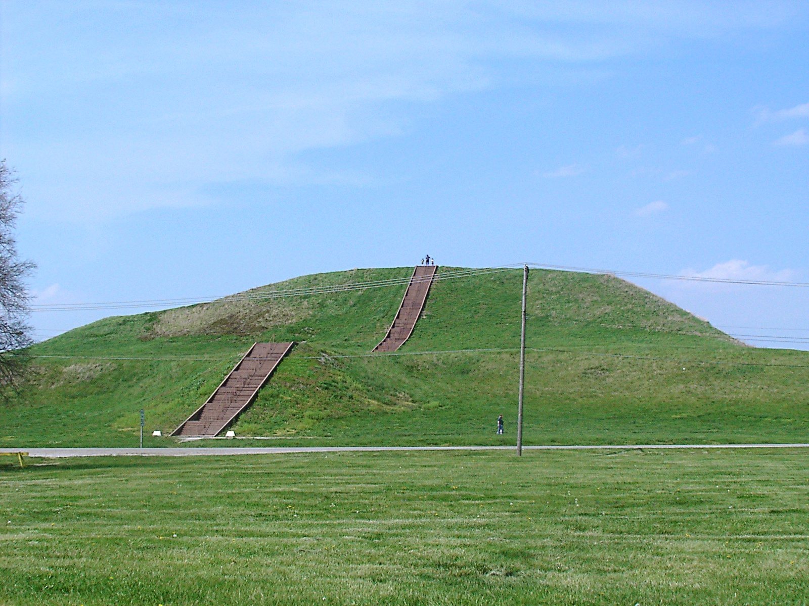
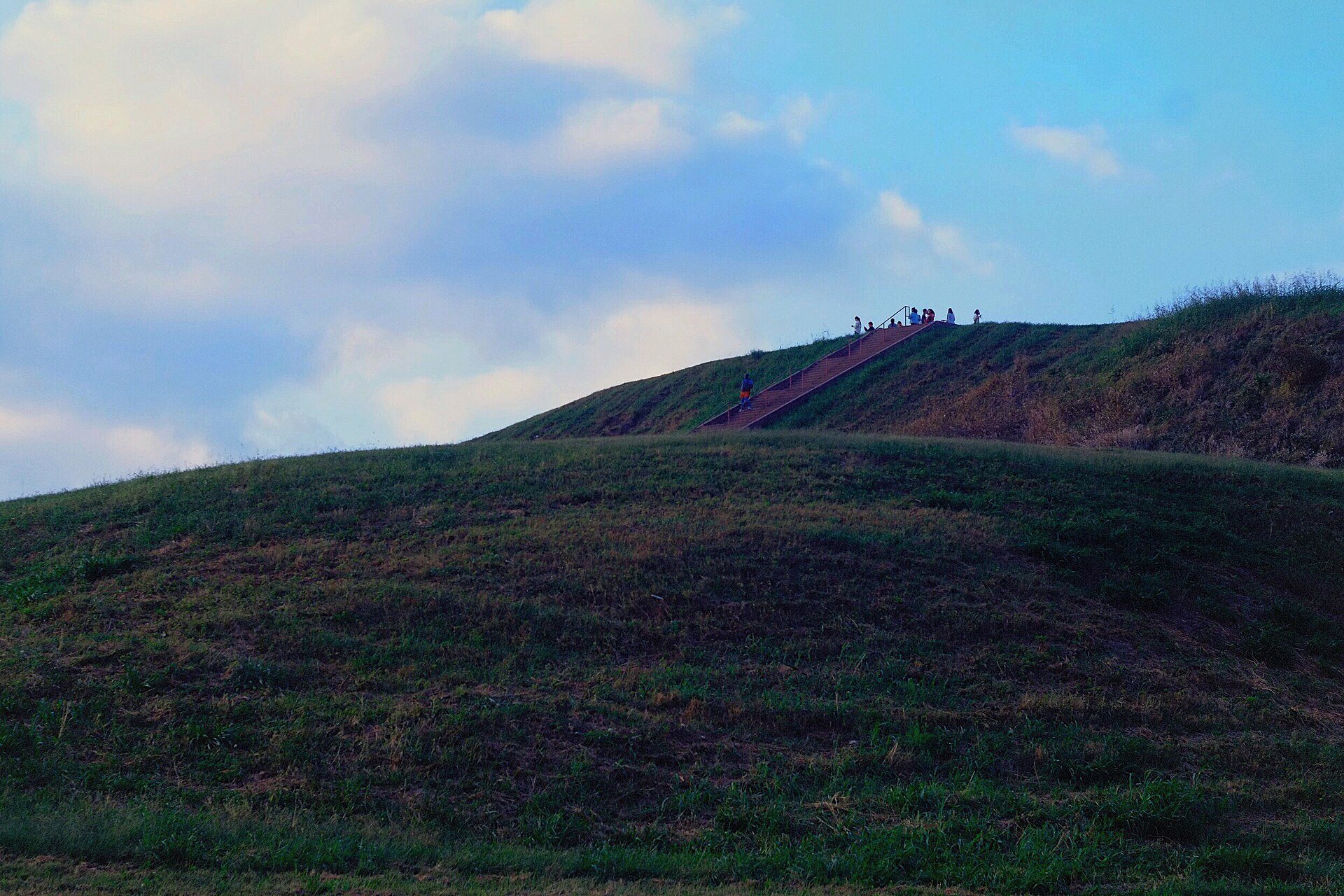
Monks Mound is a south-facing platform mound, an earthen monument with a level or terraced summit, and the central focus of Cahokia. It rises approximately ten stories and has four terraces. The mound measures about 951 feet long, 836 feet wide, and 100 feet high. It covers approximately 13.8 acres and contains about 814,000 cubic yards of earth.
Workers enlarged Monks Mound over several centuries in as many as ten construction episodes. These additions increased its height and width and created terraces and an apron. Excavation on the summit revealed evidence of a large building, probably a temple or the residence of a paramount chief. The structure measured about 105 feet long and 48 feet wide, may have reached 50 feet in height, and covered approximately 5,000 square feet. Excavations on the east and northwest sides in 2007 addressed erosion caused by slumping, and those areas were subsequently repaired.
Grand Plaza
The Grand Plaza lies south of Monks Mound and covers approximately 50 acres. It measures more than 1,600 feet long and more than 900 feet wide. Soil studies show that the original ridge-and-swale ground was deliberately levelled and filled to create the broad open space.
The plaza hosted large ceremonies, gatherings, and ritual games, including chunkey. In this game, players rolled a disk-shaped stone across the field and threw spears toward the place where they expected the stone to stop.
Rattlesnake Causeway
The Rattlesnake Causeway formed a major ceremonial north-south route between the central precinct and the ridge-top mortuary mound now called Rattlesnake Mound or Mound 66. The raised embankment was approximately 18 metres wide and 800 metres long. Its height ranged from about 0.5 metres to nearly 1.3 metres as it crossed a low, swampy area south of the Grand Plaza.
The causeway is aligned approximately 5 degrees east of north. Its position near Mound 72, its passage across a low water-filled area, and its connection with a mortuary complex have been interpreted as having lunar and underworld associations. It may have represented a Path of Souls.
Residential and specialized areas
Residential zones formed planned clusters around plazas and mounds. Their exact social and functional divisions remain uncertain, although some clusters may have supported religious or ethnic separation. Standardized building types included steam baths, council houses, and temples. Domestic buildings generally had rectangular plans and pole-and-thatch construction. Builders often used wall trenches rather than setting individual posts. More than 20 percent of neighborhood structures may have served non-domestic, possibly spiritual purposes.
Mound 72
Mound 72 is a ridge-top mortuary mound south of the main urban precinct. Excavations revealed approximately 270 individuals, including paired male and female burials and a central burial placed on about 10,000 marine-shell disk beads arranged in the shape of a falcon.
The central burial, known as the Beaded Burial or Birdman Burial, contained a man whose head, arms, and legs were framed by the shell-bead falcon. A nearby cache held finely worked arrowheads in four styles and materials associated with different geographic regions, illustrating Cahokia’s long-distance connections.
More than 250 additional skeletons were recovered from the mound. Scholars estimate that nearly 62 percent may have been sacrificial victims, based on evidence of ritual execution, burial arrangement, and other factors. The remains include four young men missing their hands and skulls, a mass burial of more than 50 women arranged in two layers separated by matting, and a burial of approximately 40 men and women who appear to have died violently. The chronology and relationships among the burials remain uncertain. Wood from several parts of the mound produced radiocarbon dates between approximately AD 950 and 1000. Excavations show that the final ridge-top mound developed from several smaller mounds that were reshaped and covered.
Copper-working workshop
Excavations near Mound 34 between 2002 and 2010 located a copper-working workshop first identified in the 1950s by archaeologist Gregory Perino. Its precise position had then been lost for approximately sixty years. The workshop is the only known copper workshop at a Mississippian culture site.
Three tree stumps in the workshop probably supported anvil stones. The recovered copper had been annealed through repeated heating and cooling. Artisans made religious objects such as long-nosed god maskettes and ceremonially shaped earrings, which may have been used in fictive-kinship rituals.
Timber circles and artistic evidence
Cahokia Woodhenge
Cahokia Woodhenge was a series of large timber circles approximately 850 metres west of Monks Mound. Woodhenge is an archaeological term for a circular arrangement of timber posts. The circles are generally dated to approximately AD 900 to 1100, with later circles becoming larger and containing twelve more posts than their predecessors.
The posts decayed, but dark soil marks preserved the positions of their holes. Archaeologist Warren Wittry recognized arcs of regularly spaced holes during salvage archaeology in the early 1960s. Excavations from the 1960s through the 1980s confirmed five circles, designated Woodhenges I through V, and allowed researchers to investigate possible astronomical alignments. A reconstruction of Woodhenge III, built in 1985 from the excavated post positions, contains 48 posts in the circle and a forty-ninth central post.
Art and ritual objects
A clay statuette excavated at Cahokia and an incised sandstone Birdman tablet discovered in 1971 during excavations east of Monks Mound form part of the site’s artistic and ritual record. The Birdman motif and other Cahokian objects also connect the city with the wider Mississippian world.
Greater Cahokia
The wider regional complex known as Greater Cahokia included interconnected sites such as East St. Louis, the St. Louis mounds, Janey B. Goode, and the Mitchell site. Similar mounds once stood in what is now St. Louis, approximately 8 miles west of Cahokia. Most were levelled during nineteenth-century urban development and their soil was reused for construction. Sugarloaf Mound survives on the western bank of the Mississippi River as a related mound.