City Wall of Nanjing: The Ming Capital’s Defensive Enclosure
Site at a Glance
- Popularity
- Very High
- Country
- China
- Primary era
- Medieval
- Eras represented
- Medieval, Early Modern, Modern
- Civilizations
- Ming, Qing
- Site type
- Military
- Remains
- Wall
On this page29 sections
History
The City Wall of Nanjing is the inner defensive wall of the former Ming capital in Nanjing, China. Zhu Yuanzhang, founder and first emperor of the Ming dynasty, which ruled China from 1368 to 1644, made Nanjing his capital in 1368 and ordered the wall to strengthen his authority and defend the city against coastal raiders. Acting on advice from his adviser Zhu Sheng, he commissioned a high wall. Construction took 21 years, involved about 200,000 workers, and required the movement of roughly 7 million cubic metres of earth.
The Ming capital and its walls
Ming Nanjing had four successive enclosures: the outer wall, the inner city wall, the imperial city wall, and the palace city wall. The inner wall followed the terrain rather than forming the regular square associated with earlier capitals. Its unusual outline has inspired competing explanations. A popular tradition compares it to a gourd; other interpretations describe it as a fan or as a zongzi, a leaf-wrapped rice dumpling. Another proposal connects its plan with the Northern and Southern Dipper constellations. The wall’s layout was also associated with the celestial equator, the ecliptic, and the 28 lunar mansions, divisions of the sky in traditional Chinese astronomy. These interpretations linked the city’s design with harmony between people and nature and with the emperor’s divinely sanctioned authority.
The northern line has also been debated. One widely accepted explanation is that it was extended north during construction for military or geographical reasons, bringing Lion Hill, a useful position for defending the Yangtze, within the city. Historian Yang Guoqing proposed instead that the line was shifted east, using Xuanwu Lake rather than the Jinchuan River as a defensive moat and creating an additional wall section. The section west of Jiefang Gate, sometimes confused with the much earlier Taicheng, is a remnant of the Ming wall.
Changes after the capital moved
When the Yongle emperor transferred the dynasty’s primary capital from Nanjing to Beijing, Nanjing retained its standing as a secondary capital. The northern part of the inner city became quieter and more sparsely inhabited. Several northern gates were closed over time: Yifeng, Zhongfu, and Jinchuan by the late Ming, and Shence and Qingliang early in the Qing. In 1659, Qing commander Liang Huafeng reopened Yifeng and Shence to launch a surprise attack against forces besieging the city under Zheng Chenggong, a Ming loyalist military leader.
Other gates were affected by changes in military control and urban use. Zhengyang and Chaoyang were closed to ordinary residents after the former Ming imperial city was adapted as a walled Manchu garrison town. By the end of the Qing, only eight gates remained open to public passage. Jinchuan was reopened in 1909 to admit a railway, after the Shanghai–Nanjing line had passed through the gate toward Xiaguan in 1907. New openings followed as the city’s transport needs changed. The outer wall’s Yaofang Gate was demolished in 1903 during railway construction; British engineers rendered its name as Yaohua, which became the name of the railway junction.
Conflict and gate histories
Jinchuan Gate became associated with the Jingnan campaign, a civil war over the Ming throne. In 1402, officials Li Jinglong and Zhu Hui opened the gate to admit Zhu Di’s forces, an event remembered as the Jinchuan Gate incident. At Tongji Gate, the Hongguang emperor, Zhu Yousong, fled Nanjing on the night of 3 June 1645 as Qing forces approached. He was captured 15 days later and brought back through the same gate. A proposal to call Tongji Republican Gate was used for a time after 1928, but never became its official name.
Yifeng Gate was breached in 1853 after Taiping general Lin Fengxiang tunnelled toward it and used mines against the wall, enabling Taiping forces to capture Nanjing. The Taiping Heavenly Kingdom was a nineteenth-century rebellion and state that fought Qing rule. Defenders at Taiping Gate had built an underground fortified position at the foot of Zhongshan and the Tianbao Fort on the hill. After these positions fell, Qing forces used a tunnel at Longbozi to break through the wall. In 1911, allied forces from Jiangsu and Zhejiang captured Tianbao Fort and then entered Nanjing.
Shence Gate saw fighting in both the seventeenth and nineteenth centuries. Zheng Chenggong was defeated there in 1658; the following year, Liang Huafeng reopened the gate as part of his surprise attack on Zheng’s besieging forces. Taiping troops entered Nanjing through Shence in 1853. The Shunzhi emperor, an early Qing ruler, renamed it Desheng, or Victory Gate. Chaoyang, the city’s eastern gate, was ordinarily closed and linked the imperial city with the Xiaoling Mausoleum. In 1928 it became part of the route built for Sun Yat-sen’s funeral procession to his mausoleum.
Republican rule and urban change
On 12 November 1911, forces allied from Jiangsu and Zhejiang captured Nanjing after the Wuchang uprising. The Republic of China’s provisional government was established in the city the following year. Of the four enclosures, the inner wall was then generally the best preserved. The Manchu garrison town was dismantled first, and its bricks were sold; bricks found in Nantong may have originated in Nanjing. Demolition reached Wu Gate at the former imperial palace before local pressure persuaded officials to halt the work.
After Nanjing became the Republic’s capital in 1927, debate continued over whether to preserve or demolish the inner wall, while urban development brought further damage and removals. Zhengyang, the capital’s principal entrance, had been attacked repeatedly during late Qing, early Republican, and anti-Japanese wartime fighting. Renamed Guanghua Gate in 1931, it and adjoining wall sections were dismantled between 1955 and 1962, and bricks were taken for construction. Tongji Gate and the wall east of it were demolished between 1957 and 1963. The gate called Jubao was renamed Zhonghua during the Republican period. Its name was popularly linked to a magical treasure basin belonging to the merchant Shen Wansan, but is instead explained by the gate’s position facing Jubao Mountain, now called Yuhuatai.
Chaoyang and Wencheng gates were demolished in 1929, and a new three-arch gate was built nearby to replace Chaoyang as the eastern entrance. Named Zhongshan Gate before its dedication, it received a plaque written by politician and calligrapher Tan Yankai. The plaque was replaced in 1943 with calligraphy by Wang Jingwei, who later headed a Japanese-aligned government during the Second Sino-Japanese War. His signature was removed in 1946, although the gate name written in his hand remained in use for about 50 years. The gate was adapted in 1996 as an entrance for the Shanghai–Nanjing expressway, with two vehicle tunnels built beneath it.
New gates and openings multiplied during the twentieth century. By the 1930s, the inner wall had 24 gates, including Caochang, Fengrun (later Xuanwu), Hailing (later Yijiang), Wuding, Hanzhong, Zhongyang, Xiaobei, Xinmin, Yuhua, and the eastern and western Zhonghua gates. Xuanwu Gate was built in 1909–1910 to provide access to Xuanwu Lake during the Nanyang Industrial Exposition. It was first called Fengrun, after the home region of governor Zhang Renjun, and was renamed Xuanwu in 1928. Hailing Gate opened in 1914 and was completed the following year to connect Xiaguan railway station and wharf with the city. It was later renamed Yijiang Gate. Yuhua Gate was opened in the 1930s to connect a local railway with the Jiangnan railway and the capital with the Beijing–Guangzhou railway; the local line was gradually abandoned after the war against Japan.
Damage, investigation, and protection
From 1949 through the 1950s, the wall deteriorated severely. In the mid-1950s, the municipal government planned to demolish it for economic reasons. Excavation of air-raid shelters during the 1960s and 1970s caused further damage. A disused section west of Jiefang Gate was repaired in 1973. At Zhengyang’s former site, construction in 2006 exposed ancient tombs from different periods and a Ming wall foundation, which was left in place.
Local authorities gave greater attention to investigation and protection from the late 1970s. A management office for Zhonghuamen was established in March 1979. In 1982, the Jiefang Gate section known as Taicheng was included in Nanjing’s first group of protected cultural heritage sites. The inner wall received national-level cultural relic protection status in January 1988. A city-wall management office was established that March and transferred from the municipal landscaping authority to the cultural heritage authority in 1993. A city-wall history museum opened in May 1998. In 2014, the management bodies and several gate offices were consolidated into the Nanjing City Wall Management Center, responsible for protecting and managing remains associated with all four enclosures.
Remains
City plan and wall fabric
Inner and outer enclosures
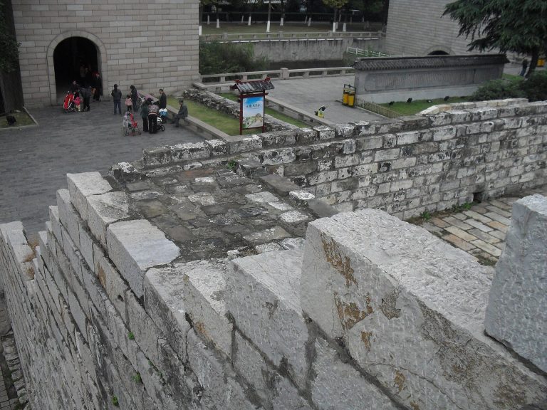
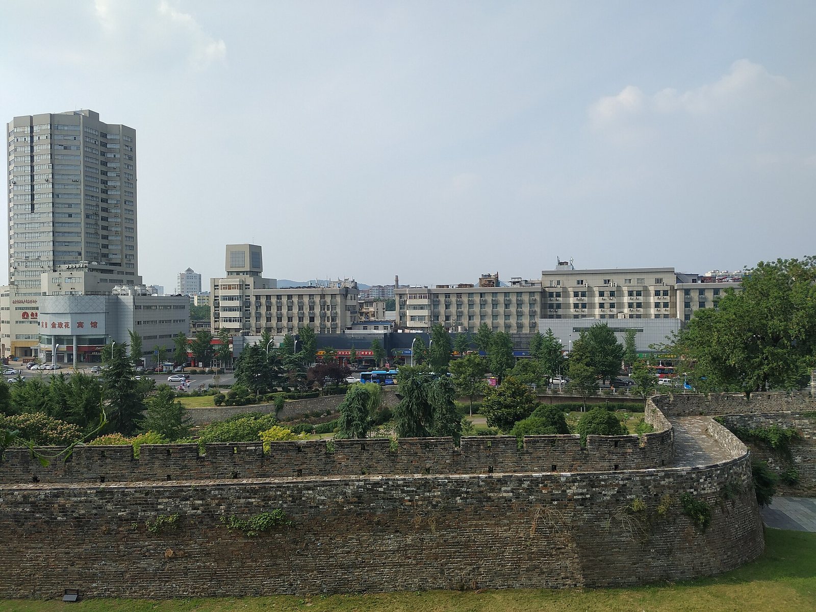
The inner wall’s irregular route follows the surrounding terrain, with Zhongshan to the east, Shitou to the west, the Qinhuai River to the south, and Xuanwu Lake, also called Houhu, to the north. The enclosed city covered about 55 square kilometres. When complete, the inner wall measured 35.267 kilometres; about 25 kilometres survive in disconnected sections, roughly two-thirds of its original length. A Ming imperial archive gave a circumference of 34.349 kilometres in 1373, while a 2005 survey using newer methods measured the completed wall at 35.267 kilometres. The wall has a rammed-earth core faced with brick or dressed stone. It is the longest surviving ancient city wall and is among China’s better-preserved ancient walls.
The outer enclosure followed the mountainous landscape around Nanjing and measured about 60 kilometres in circumference. It had 18 gates and was built mainly of rammed earth, with roughly 20 kilometres faced in brick. Its gates included the riverside palisade gate, Jiangdong, the Great and Small Xunxiang gates, the Great and Small Andemen gates, Fengtai, Jiagang, Shangfang, Gaoqiao, Cangbo, Qilin, Xianhe, Yaofang, Guanyin, Fengning, Shangyuan, and Outer Jinchuan. Gate names survive in local place names.
Imperial and palace enclosures
The imperial and palace walls formed a central north–south sequence extending from Zhengyang Gate. Seven gates served the imperial enclosure: Hongwu, Chang’an Left, Chang’an Right, Chengtian, Dong’an, Xi’an, and Bei’an. The palace enclosure had four: Wumen, Donghua, Xihua, and Xuanwu. Along the axis, the route of structures ran from Hongwu Gate and the Outer Five-Dragon Bridge over the outer imperial canal to Chengtian Gate, Duan Gate, and Wumen. Farther north stood the Inner Five-Dragon Bridge over the inner imperial canal, Fengtian Gate, Fengtian Hall, Huagai Hall, Jinshen Hall, Qianqing Gate, Qianqing Palace, Shengong Hall, Kunning Palace, the palace’s northern Xuanwu Gate, the imperial city’s northern Bei’an Gate, and Taiping Gate.
Southern gates
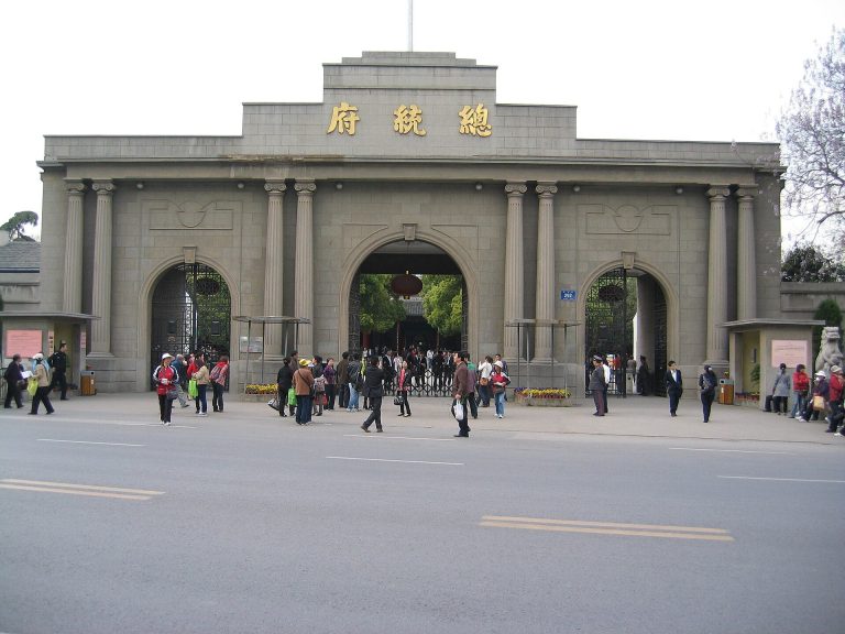
Zhengyang Gate
Zhengyang stood southeast of the city centre, as the easternmost of the three southern gates and the principal entrance to the capital. Its position formed the southern end of an axis with the main gates of the imperial and palace cities. It lay 1,450 metres east of Tongji Gate and 2,590 metres southwest of Chaoyang Gate. The entrance had a tall gate tower, one outer barbican and two inner barbicans. A barbican is a fortified enclosure that controls passage through a gate. The moat between the former gate site and Zhongshan Gate is now called Moon Lake, and Kuijiao Bridge stood outside Zhengyang. A Ming wall foundation exposed near the former site in 2006 remains in place.
Tongji Gate
Tongji stood on the southern wall facing the Qinhuai River, between Zhengyang to the east and Jubao to the west. By area, it was the largest of the inner-city gates. Three boat-shaped barbicans and four gates formed a straight line; the stonework was blue. The barbicans measured about 690 metres around and about 90 metres across the front. Towers stood over the main gate and barbicans, with horse ramps and walking paths beside the main entrance. A road passed through the gate, and a sluice stood where the Qinhuai and Minzhenhao rivers met. The Qinhuai formed the outer moat and was crossed by Jiulong Bridge. A commercial district lay inside to the southwest and the imperial palace to the southeast.
Zhonghua Gate
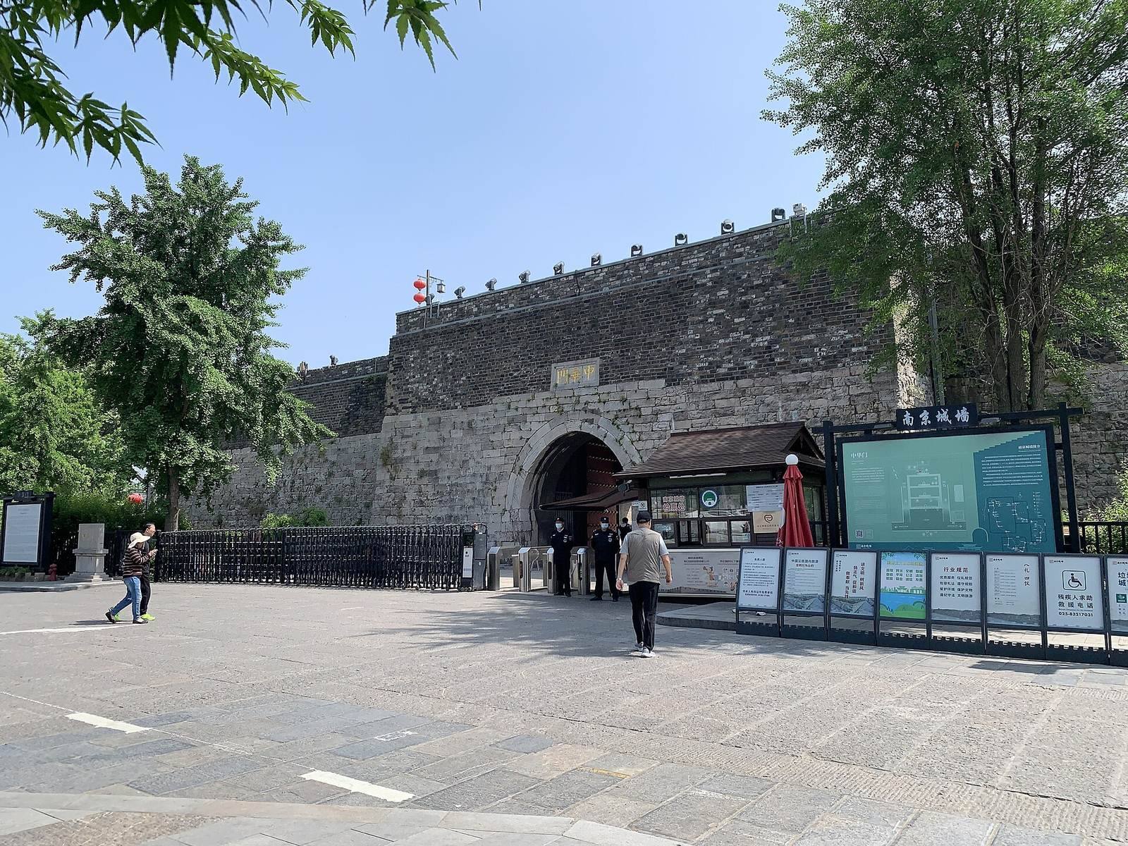
Zhonghua Gate, originally Jubao Gate, is the southern entrance of the inner city between the inner and outer Qinhuai rivers. Its fortress measures 118.5 metres from east to west and 128 metres from north to south, covering about 15,168 square metres. Three rectangular barbicans connect through four arched gates; the first gate is 21.45 metres high. Movable iron portcullises, heavy gates raised or lowered vertically, and double-leaf wooden doors controlled the entrances. Their slots and the door positions survive. The fortress contains 27 chambers for soldiers or military supplies, with a capacity estimated at several thousand people. Ramps and paths beside the main gate enabled the movement of troops and supplies, and horse ramps led to the wall. A stone threshold was traditionally said to grow between midnight and noon and shrink between noon and midnight; centuries of wear nearly erased it. Road reconstruction in 1995 created a gate plaza with about 10,000 square metres of green space.
Sanshan Gate
Sanshan, also called Shuixi Gate, stood on the western side of the city beside the Qinhuai River and served as an important water route. Rebuilt in the early Ming at the site of the Southern Tang city’s western Longguang Gate, it had three boat-shaped barbicans and four arched entrances. A western water gate carried the Inner Qinhuai River out of the city. The barbicans were demolished in 1955, and their remains were rediscovered in 2010.
Western and northern gates
Shicheng Gate
Shicheng Gate, also called Hanxi Gate or Hanxi West Gate, stood between Sanshan to the south and Qingliang to the north. Formerly the Southern Tang capital’s Great West Gate, it was incorporated and enlarged in 1366 on Zhu Yuanzhang’s orders. Two barbicans and three gates were aligned in a straight line, with two arched passages and a specially paved stone roadway beside a commercial thoroughfare. The name referred to its position near Shitou, or Stone City. During the Qing period, carts carrying firewood from Baguazhou wore down the paving. Some barbican sections survived the 1958 demolition and were repaired in 1997.
Qingliang Gate
Qingliang Gate, also called Qingjiang Gate, consisted of a gate and barbican on uneven rocky ground southwest of Qingliang Mountain. It had a single arch and faced the Qinhuai River in a sparsely populated outer area. The surviving structures are generally well preserved.
Yifeng Gate
Yifeng stood at the northwestern corner, opposite Lion Hill, with Dinghuai to the south and Zhongfu to the east. Its passage included two water tunnels and an arched opening. In the Ming and Qing periods, it was Nanjing’s passage to the Yangtze. Its Qing-period form had a two-storey archery tower. The gate was rebuilt in 2006 as a three-arch structure.
Shence, or Heping, Gate
Shence Gate, now called Heping, stands in the north near the northwest side of Xuanwu Lake. Its plan turns with the uneven ground. The Qing added an outer barbican, and the tower was rebuilt during the Guangxu reign at a lower provincial grade than the earlier capital-level structure. The gate originally had two arched openings; one arched gate and one barbican remain.
Taiping Gate and Longbozi
Taiping Gate stood where Zhongshan meets Xuanwu Lake, between Fugui and Fuzhou hills, commanding the northern approaches and nearby mountain terrain. The adjoining wall section, called Longbozi, was the inner wall’s sole stretch without water as a natural defence. During the Taiping Heavenly Kingdom, defenders built an underground fortified position at the foot of Zhongshan and Tianbao Fort on the hill to protect the approach.
Chaoyang and Zhongshan gates
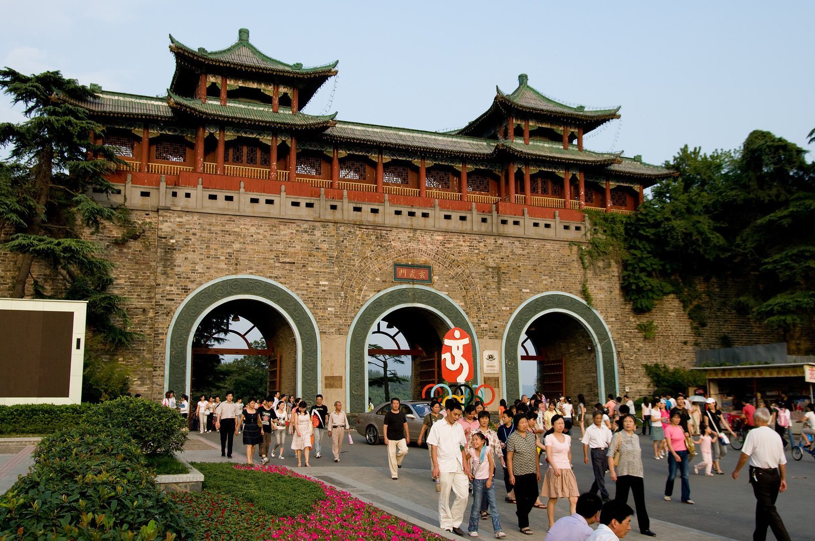
Chaoyang was the Ming city’s eastern gate, set slightly south of the present Zhongshan Gate on an east–west line with Donghua Gate, Xihua Gate, and Xuanjin Bridge. It had a single arch and a water gate beneath the wall; an outer barbican was added in 1865. The nearby three-arch Zhongshan Gate replaced it as the eastern entrance. Its central arch is 10 metres wide and 10.5 metres high, while each side arch is 8 metres wide and 9.5 metres high. The arch supports are 3 metres thick, and the gate is 15 metres deep.
Later openings and rebuilt gates
Xuanwu and Yijiang gates
Xuanwu Gate lies on the northern wall between Heping and Taiping gates. First built as a single-arch opening, it was rebuilt with three arches in 1931. Yijiang Gate, opened as Hailing Gate in 1914, began as a single-arch passage and was enlarged into a three-arch gate in 1928–1929. The People’s Liberation Army entered Nanjing through Yijiang on 23 April 1949.
Other twentieth-century openings
The inner wall’s original 13 gates expanded with new openings between older entrances. These included Caochang between Dinghuai and Qingliang, Xiaobei between Shence and Jinchuan, and Wuding, Hanzhong, Zhongyang, Xinmin, Yuhua, and the eastern and western Zhonghua gates. Jiefang Gate opened in 1952. Jiqing Gate was built in the early 1990s; Huayangang followed in 2007, Changgan in 2008, and Biaoying in 2009. Changgan Gate’s central arch accommodates a metro line. The Jiqing Gate wall section includes the Yuyuanquan Museum.
Yuhua Gate
Yuhua Gate was reconstructed in 2009 as a three-arch gate using old bricks. Its main arch is about 14 metres wide and 9.9 metres high; each side arch is about 5.5 metres wide and 6.35 metres high. A slow-traffic lane and footpath pass through the structure. It stands opposite Yuhua Bridge on Jiangning Road.
Jiefang Gate and the Xuanwu Lake wall
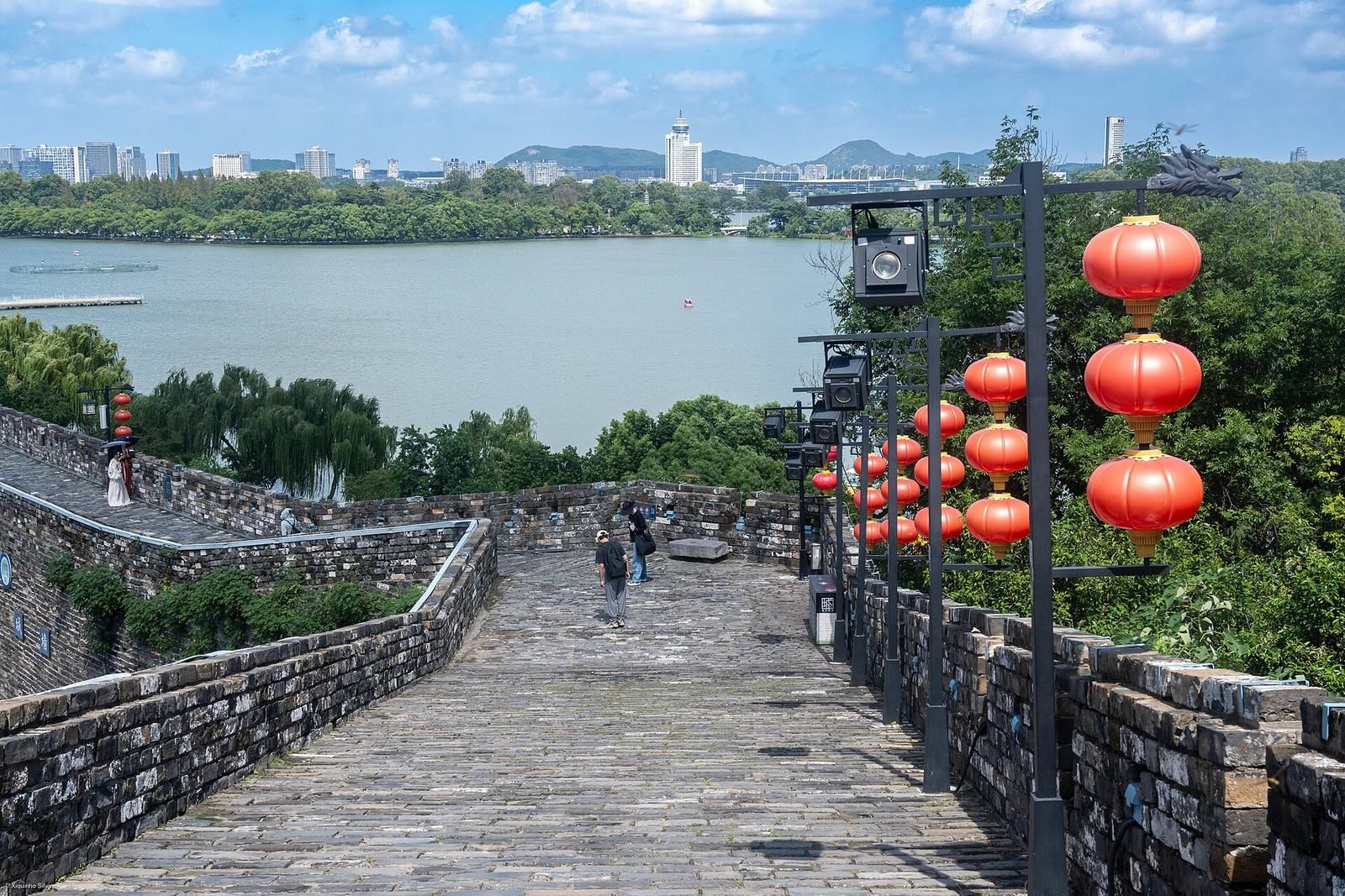
Jiefang Gate is a single-arch opening on the southern shore of Xuanwu Lake, south of Xuanwu Gate and west of Taiping Gate. The wall from Xuanwu through Jiefang to Taiping forms the longest, best-preserved, and highest surviving stretch; it generally rises about 20 to 25 metres above ground. A museum of Nanjing’s city wall occupies the gate section. A nearby small Ming-period opening toward the lake was also enlarged.
Water management and drainage
Lake sluice and wall drains
The Xuanwu Lake Great Sluice carries lake water through a buried conduit beneath the wall into the city’s Zhenzhu River, and its flow can be adjusted to regulate the river’s level. The sluice measures 25 metres by 25 metres, with a square shaft 85 metres deep. Its conduit is 143.9 metres long and 0.95 metres in diameter, comprising 103 copper-pipe sections and 37 cast-iron sections, with two intakes and two pairs of double copper gates. The wall’s drainage system includes stone outlets at the top and additional drains near the foundations. During heavy rain on 1 July 2016, water that had seeped into the Ming wall flowed through these outlets in a display described as “dragon spitting water.”